Category:Winterborne Stickland
Jump to navigation
Jump to search
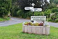
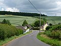
English: Winterborne Stickland is a village in north Dorset, England, situated in a winterbourne valley on the Dorset Downs four miles west of Blandford Forum. The village has a population of 576 .
village and civil parish in Dorset, UK  | |||||
| Upload media | |||||
| Instance of | |||||
|---|---|---|---|---|---|
| Location | Dorset, South West England, England | ||||
| Population |
| ||||
| Said to be the same as | Winterborne Stickland (Wikimedia duplicated page, civil parish) | ||||
| official website | |||||
 | |||||
Subcategories
This category has the following 3 subcategories, out of 3 total.
C
S
W
Media in category "Winterborne Stickland"
The following 161 files are in this category, out of 161 total.
-
 A hidden Stickland Farm Triangulation Pillar - geograph.org.uk - 3918506.jpg 4,000 × 3,000; 5.05 MB
-

-
 Barley near Hedge End - geograph.org.uk - 1950710.jpg 640 × 448; 80 KB
-
 Cottages, Winterborne Stickland.jpg 6,000 × 4,000; 2.63 MB
-
 Crossroads at Winterborne Stickland - geograph.org.uk - 4864820.jpg 640 × 427; 49 KB
-

-
 Electricity flowing north - geograph.org.uk - 425154.jpg 640 × 430; 198 KB
-
 Entering Winterborne Stickland - geograph.org.uk - 408734.jpg 430 × 640; 121 KB
-
 Entrance to Winterborne Stickland - geograph.org.uk - 3087549.jpg 640 × 480; 63 KB
-
 Fairmead, Winterborne Stickland - geograph.org.uk - 3087559.jpg 640 × 480; 90 KB
-
 Field Grove - geograph.org.uk - 1950735.jpg 640 × 436; 92 KB
-
 Fingerpost, Winterborne Stickland - geograph.org.uk - 459783.jpg 640 × 480; 142 KB
-
 Fish Tanks, Winterborne Houghton - geograph.org.uk - 4526965.jpg 640 × 480; 94 KB
-
 Frank Moss Bennett Winterbourne Stickland, Dorset 1919.jpg 3,189 × 2,219; 1.37 MB
-
 Horses at sunset Okeford Hill - geograph.org.uk - 373239.jpg 640 × 427; 54 KB
-
 Houghton Springs Fish Farm - geograph.org.uk - 3352613.jpg 1,024 × 731; 115 KB
-
 Lime tree, Winterborne Stickland - geograph.org.uk - 1944160.jpg 480 × 640; 203 KB
-
 Lime tree, Winterborne Stickland - geograph.org.uk - 1944172.jpg 640 × 480; 197 KB
-
 Mast, Winterborne Stickland - geograph.org.uk - 1950783.jpg 640 × 480; 84 KB
-
 Memorial - geograph.org.uk - 376535.jpg 640 × 427; 142 KB
-
 Noticeboard at Winterborne Stickland - geograph.org.uk - 3123095.jpg 640 × 480; 68 KB
-

-
 Path to Winterborne Stickland - geograph.org.uk - 1950760.jpg 524 × 640; 135 KB
-
 Pleck - geograph.org.uk - 3341338.jpg 640 × 480; 82 KB
-
 Pond Down Buildings, Hedge End - geograph.org.uk - 2769913.jpg 640 × 480; 77 KB
-

-
 Power Line at Hedge End - geograph.org.uk - 2765930.jpg 640 × 480; 85 KB
-
 Quarleston Farm - geograph.org.uk - 163356.jpg 600 × 450; 96 KB
-

-
 Ringmoor and Turnworth Down - geograph.org.uk - 372597.jpg 640 × 427; 160 KB
-
 Road junction, Winterborne Stickland - geograph.org.uk - 3087564.jpg 640 × 480; 63 KB
-
 Road near Hedge End - geograph.org.uk - 1950693.jpg 640 × 480; 89 KB
-
 Saxon Rise, Winterborne Stickland - geograph.org.uk - 3087554.jpg 640 × 480; 92 KB
-
 Sheep grazing on South Down - geograph.org.uk - 444569.jpg 640 × 430; 373 KB
-
 Sunny morning on the Inside Park campsite - geograph.org.uk - 440056.jpg 640 × 480; 101 KB
-
 Thatched cottages at Winterborne Stickland - geograph.org.uk - 6239884.jpg 1,024 × 683; 167 KB
-

-

-
 Track up eastern end of South Down - geograph.org.uk - 439421.jpg 430 × 640; 335 KB
-
-
 Weather vane, Pamela Hambro Hall - geograph.org.uk - 1948670.jpg 640 × 480; 52 KB
-
 Winterborne Houghton, cows and lane - geograph.org.uk - 973141.jpg 640 × 480; 62 KB
-
 Winterborne Houghton, lane and stream - geograph.org.uk - 533635.jpg 640 × 419; 70 KB
-
 Winterborne Stickland - geograph.org.uk - 1950813.jpg 640 × 463; 117 KB
-
 Winterborne Stickland - geograph.org.uk - 1950825.jpg 640 × 451; 88 KB
-
 Winterborne Stickland Cricket Club - geograph.org.uk - 408727.jpg 640 × 430; 92 KB
-
 Winterborne Stickland Post Office - geograph.org.uk - 459847.jpg 640 × 480; 98 KB
-
 Winterborne Stickland tennis courts - geograph.org.uk - 408728.jpg 640 × 430; 104 KB
-

-

-
 Winterborne Stickland, Dorset, 2015.JPG 5,184 × 3,456; 6.77 MB
-

-
-
 Winterborne Stickland, Hedge End - geograph.org.uk - 1374879.jpg 640 × 480; 75 KB
-

-
 Winterborne Stickland, PO ^ store - geograph.org.uk - 3343607.jpg 1,024 × 768; 148 KB
-
-

-

-

-
 Winterborne Stickland, River Winterborne - geograph.org.uk - 3343631.jpg 768 × 1,024; 178 KB
-
 Winterborne Stickland, River Winterborne - geograph.org.uk - 3352587.jpg 1,024 × 768; 207 KB
-
 Winterborne Stickland, sheep grazing - geograph.org.uk - 3343600.jpg 1,024 × 768; 126 KB
-

-
 Winterborne Stickland, The Dunbury School - geograph.org.uk - 3343620.jpg 1,024 × 768; 133 KB
-
 Winterborne Stickland, The Old Chapel - geograph.org.uk - 3343650.jpg 753 × 1,024; 141 KB
-

-
 Winterborne Stickland, Village Cross Roads - geograph.org.uk - 2325355.jpg 1,600 × 1,071; 1.6 MB
-
 Winterborne Stickland, village sign - geograph.org.uk - 533650.jpg 640 × 436; 63 KB
-
 Winterborne Stickland, war memorial - geograph.org.uk - 3343643.jpg 768 × 1,024; 106 KB
-

-

-
 Winterborne Stickland- church path - geograph.org.uk - 3123138.jpg 640 × 480; 86 KB
-
 Winterborne Stickland- gravestones - geograph.org.uk - 3123140.jpg 480 × 640; 85 KB
-
 Winterborne Stickland- war memorial - geograph.org.uk - 3123106.jpg 480 × 640; 82 KB
-
 Wintreborne Stickland - geograph.org.uk - 1531077.jpg 640 × 480; 59 KB
-
 Bank near Canada Farm - geograph.org.uk - 425108.jpg 640 × 430; 245 KB
-
 Barns at Field Barn - geograph.org.uk - 425126.jpg 640 × 430; 240 KB
-
 Bridleway Junction - geograph.org.uk - 439408.jpg 640 × 430; 336 KB
-
 Bridleway signpost - geograph.org.uk - 368597.jpg 640 × 427; 186 KB
-
 Bridleway to Brockham (woods) - geograph.org.uk - 439414.jpg 430 × 640; 393 KB
-
 Bridleway to Morgans Wood - geograph.org.uk - 459943.jpg 640 × 480; 147 KB
-
 Bridleway towards Houghton Spring Farm - geograph.org.uk - 408714.jpg 430 × 640; 132 KB
-
 Broadley Cottage - geograph.org.uk - 397689.jpg 640 × 427; 103 KB
-
 Brockham - geograph.org.uk - 439431.jpg 640 × 430; 310 KB
-
 Canada Farm - geograph.org.uk - 425068.jpg 640 × 430; 225 KB
-
 Contours of Canada Farm - geograph.org.uk - 425065.jpg 640 × 430; 213 KB
-
 Cows near Field Barn - geograph.org.uk - 425130.jpg 640 × 430; 271 KB
-
 Curves in the track - geograph.org.uk - 425097.jpg 640 × 430; 250 KB
-
 Downland north of Dunbury Lane - geograph.org.uk - 408055.jpg 640 × 430; 96 KB
-

-
 East of South Down - geograph.org.uk - 439057.jpg 640 × 430; 250 KB
-
 Eastern end of South Down - geograph.org.uk - 439061.jpg 640 × 430; 227 KB
-
 Edge of Field Grove - geograph.org.uk - 376342.jpg 640 × 427; 108 KB
-
 Farm building by Wessex Ridgeway - geograph.org.uk - 295656.jpg 600 × 400; 33 KB
-
 Farm building near Manor House - geograph.org.uk - 425103.jpg 640 × 430; 249 KB
-
 Farm buildings near Hedge End - geograph.org.uk - 295602.jpg 600 × 393; 44 KB
-
 Farmland near Normandy farm - geograph.org.uk - 32688.jpg 640 × 480; 71 KB
-
 Farmyard, Turnworth Farm - geograph.org.uk - 295607.jpg 600 × 400; 58 KB
-
 Field Barn - geograph.org.uk - 425119.jpg 640 × 430; 290 KB
-
 Field Barn from the side - geograph.org.uk - 425137.jpg 640 × 430; 330 KB
-
 Field Grove - geograph.org.uk - 376338.jpg 640 × 427; 87 KB
-
 Field Grove - geograph.org.uk - 382079.jpg 640 × 427; 144 KB
-
 Field of rape on Thornicombe Farm - geograph.org.uk - 423573.jpg 640 × 430; 131 KB
-
 Field of yellow rape - geograph.org.uk - 425159.jpg 640 × 430; 363 KB
-
 Fields at Knife Hill Farm - geograph.org.uk - 295603.jpg 600 × 399; 56 KB
-
 Fields of Thornicombe Farm - geograph.org.uk - 423568.jpg 640 × 430; 85 KB
-
 Footpath across Little Down - geograph.org.uk - 425161.jpg 430 × 640; 304 KB
-
 Footpath in The Plantation - geograph.org.uk - 425013.jpg 430 × 640; 493 KB
-
 Footpath to Higher Barn Cottages - geograph.org.uk - 459951.jpg 640 × 480; 129 KB
-
 Footpath towards Milton Park Wood - geograph.org.uk - 408713.jpg 430 × 640; 156 KB
-
 Green fields of Thornicombe Farm - geograph.org.uk - 423599.jpg 640 × 430; 117 KB
-
 Green side of the hedge - geograph.org.uk - 425142.jpg 640 × 430; 257 KB
-
 Heathy Field Coppice - geograph.org.uk - 425115.jpg 640 × 430; 207 KB
-
 Hedge End - geograph.org.uk - 295151.jpg 600 × 399; 48 KB
-
 Hill north of Winterborne Stickland - geograph.org.uk - 408049.jpg 640 × 430; 90 KB
-
 Horses at dusk Okeford Hill - geograph.org.uk - 373236.jpg 640 × 427; 92 KB
-
 Houghton North Down - east end - geograph.org.uk - 437938.jpg 640 × 430; 185 KB
-

-
 Houses at foot of Stickland Hill - geograph.org.uk - 408730.jpg 640 × 430; 94 KB
-
 Junction at Houghton North Down - geograph.org.uk - 437935.jpg 430 × 640; 104 KB
-
 Lady Caroline's Drive - geograph.org.uk - 408120.jpg 430 × 640; 119 KB
-
 Lady Caroline's Drive - geograph.org.uk - 425047.jpg 430 × 640; 342 KB
-
 Laundry of former Turnworth House - geograph.org.uk - 295616.jpg 600 × 399; 87 KB
-
 Little Down beside Little Wood - geograph.org.uk - 425160.jpg 640 × 430; 292 KB
-
 Little Wood - geograph.org.uk - 371785.jpg 640 × 480; 113 KB
-
 Little Wood - geograph.org.uk - 425158.jpg 640 × 430; 240 KB
-
 Middle Farm, Winterborne Houghton - geograph.org.uk - 295612.jpg 600 × 399; 55 KB
-
 Morgan's Wood - geograph.org.uk - 376347.jpg 640 × 427; 148 KB
-
 Near Broadley cottage - geograph.org.uk - 397709.jpg 640 × 427; 107 KB
-
 Normandy Farm - geograph.org.uk - 376517.jpg 640 × 427; 53 KB
-
 Northern edge of The Plantation - geograph.org.uk - 425017.jpg 640 × 430; 306 KB
-
 Norton Coppice - geograph.org.uk - 408113.jpg 640 × 430; 94 KB
-
 Norton Limekiln Coppice - geograph.org.uk - 408114.jpg 640 × 430; 98 KB
-
 Okeford Hill - geograph.org.uk - 372589.jpg 640 × 427; 93 KB
-
 Pit (dis) on Canada Farm - geograph.org.uk - 425076.jpg 640 × 430; 279 KB
-
 River Winterborne - geograph.org.uk - 459696.jpg 480 × 640; 158 KB
-

-
 Road near North Barn Farm - geograph.org.uk - 295653.jpg 600 × 399; 44 KB
-
 Road to Canada Farm - geograph.org.uk - 425049.jpg 640 × 430; 244 KB
-
 Small clump of trees in corner of field - geograph.org.uk - 425148.jpg 640 × 430; 224 KB
-
 Small scale logging - geograph.org.uk - 371795.jpg 640 × 480; 102 KB
-
 Small unnamed clump of wood - geograph.org.uk - 425162.jpg 640 × 430; 298 KB
-
 Southern edge of The Plantation - geograph.org.uk - 425032.jpg 640 × 430; 263 KB
-
 Stickland Hill - geograph.org.uk - 408731.jpg 430 × 640; 95 KB
-
 Television Mast - geograph.org.uk - 376345.jpg 640 × 427; 43 KB
-
 Track and Bridleway merge - geograph.org.uk - 371779.jpg 640 × 480; 104 KB
-
 Track curving into Coombe Bottom - geograph.org.uk - 439435.jpg 430 × 640; 307 KB
-
 Track from Winterborne Clenston - geograph.org.uk - 425109.jpg 430 × 640; 276 KB
-
 Track to Field Barn - geograph.org.uk - 425141.jpg 430 × 640; 269 KB
-
 Track towards Heath Bottom - geograph.org.uk - 437932.jpg 430 × 640; 170 KB
-
 Track towards Pleck - geograph.org.uk - 439425.jpg 640 × 430; 369 KB
-
 Upended tree roots in The Plantation - geograph.org.uk - 425028.jpg 430 × 640; 513 KB
-
 View across Houghton North Down - geograph.org.uk - 437940.jpg 640 × 430; 211 KB
-
 View of Brockham - geograph.org.uk - 439457.jpg 640 × 430; 263 KB
-
 View of Milton Park Wood - geograph.org.uk - 408718.jpg 640 × 430; 116 KB
-

-
 View towards The Plantation - geograph.org.uk - 425050.jpg 640 × 430; 245 KB
-
 Walled garden, Turnworth House - geograph.org.uk - 295622.jpg 600 × 399; 86 KB
-
 Winding Bridleways of South Down - geograph.org.uk - 444568.jpg 640 × 430; 270 KB
-
 Yellow side of the hedge - geograph.org.uk - 425144.jpg 640 × 430; 295 KB


_-_geograph.org.uk_-_439414.jpg)


_on_Canada_Farm_-_geograph.org.uk_-_425076.jpg)


