Category:Winterborne Monkton
Jump to navigation
Jump to search
English: Winterborne Monkton is a hamlet and civil parish in the south-west of the English county of Dorset.
village and civil parish in Dorset, UK  | |||||
| Upload media | |||||
| Instance of | |||||
|---|---|---|---|---|---|
| Location | Dorset, South West England, England | ||||
| Population |
| ||||
 | |||||
Subcategories
This category has only the following subcategory.
W
Media in category "Winterborne Monkton"
The following 136 files are in this category, out of 136 total.
-

-
 A35 and footpath near Poundbury - geograph.org.uk - 6599883.jpg 1,024 × 768; 218 KB
-
 A35 heading west - geograph.org.uk - 6218442.jpg 1,024 × 684; 249 KB
-
 A35 heading west - geograph.org.uk - 6218445.jpg 1,024 × 684; 225 KB
-
 A35 round Dorchester - geograph.org.uk - 6022609.jpg 1,024 × 768; 126 KB
-
 A35, Dorchester bypass - geograph.org.uk - 1945254.jpg 640 × 480; 257 KB
-
 A35, Dorchester bypass - geograph.org.uk - 6524152.jpg 1,024 × 681; 155 KB
-
 A35, Winterborne Herringston - geograph.org.uk - 6220312.jpg 2,536 × 1,489; 735 KB
-
 A354 - geograph.org.uk - 3666109.jpg 640 × 430; 73 KB
-
 A354 Monkton Hill - geograph.org.uk - 5439057.jpg 640 × 480; 379 KB
-
 A354 northbound lay-by - geograph.org.uk - 4417265.jpg 640 × 455; 34 KB
-
 A354 northbound lay-by - geograph.org.uk - 4417284.jpg 640 × 480; 43 KB
-
 A354 towards Weymouth - geograph.org.uk - 5964832.jpg 1,024 × 684; 166 KB
-
 A354, Monkton Hill - geograph.org.uk - 3666106.jpg 640 × 430; 52 KB
-
 Across the fields to Dorchester - geograph.org.uk - 402005.jpg 640 × 480; 79 KB
-
 Allotments on Maiden Castle Road, Dorchester - geograph.org.uk - 3452348.jpg 4,608 × 3,072; 5.84 MB
-
 An unlikely McDonald's - geograph.org.uk - 3452204.jpg 4,608 × 3,072; 7.08 MB
-

-
 Beets by Maiden Castle Rd - geograph.org.uk - 6524127.jpg 1,024 × 681; 164 KB
-
 Boundary stone by Maiden Castle Road - geograph.org.uk - 6591853.jpg 1,200 × 1,600; 1.06 MB
-
 Boundary Stone, Maiden Castle Road - geograph.org.uk - 803862.jpg 426 × 640; 122 KB
-
 Bridge over the A35, Dorchester bypass - geograph.org.uk - 1945274.jpg 640 × 480; 211 KB
-
 Bridleway and farm track north-west of Maiden Castle - geograph.org.uk - 6591852.jpg 1,600 × 1,200; 1.01 MB
-
 Bridleway off Maiden Castle Rd - geograph.org.uk - 6524128.jpg 1,024 × 681; 121 KB
-
 Bridport Road - geograph.org.uk - 6219373.jpg 3,263 × 1,692; 1.2 MB
-
 Bush Cottage - geograph.org.uk - 6524145.jpg 1,024 × 681; 119 KB
-
 Car park and tumulus from Maiden Castle - geograph.org.uk - 1989769.jpg 2,000 × 1,500; 1.06 MB
-
 Car park at Maiden Castle - geograph.org.uk - 6591850.jpg 1,600 × 800; 553 KB
-
 Cattle eating fodder - geograph.org.uk - 6524135.jpg 1,024 × 681; 146 KB
-
 Crops by Maiden Head Rd - geograph.org.uk - 6524120.jpg 1,024 × 681; 131 KB
-
 Cycle route sign - geograph.org.uk - 1366391.jpg 640 × 480; 314 KB
-
 Dawn over The South Winterborne - geograph.org.uk - 3336063.jpg 640 × 479; 120 KB
-
 Dorchester , Weymouth Road - geograph.org.uk - 1263501.jpg 640 × 466; 81 KB
-
 Dorchester bypass in the distance - geograph.org.uk - 6524142.jpg 1,024 × 681; 137 KB
-
 Dorchester Bypass looking North West - geograph.org.uk - 803798.jpg 426 × 640; 76 KB
-
 Dorchester Bypass looking South East - geograph.org.uk - 803796.jpg 426 × 640; 75 KB
-
 Dorchester bypass, Dorchester, Dorset - geograph.org.uk - 336944.jpg 640 × 480; 105 KB
-
 Dorchester Town Football Stadium Main Entrance - geograph.org.uk - 2196007.jpg 1,799 × 1,199; 452 KB
-
 Earthwork near to Maiden Castle - geograph.org.uk - 4921029.jpg 5,520 × 3,680; 7.07 MB
-
 Farm track - geograph.org.uk - 6524136.jpg 1,024 × 681; 101 KB
-
 Farm track off Maiden Castle Rd - geograph.org.uk - 6524139.jpg 1,024 × 681; 102 KB
-
 Fence by Maiden Rd - geograph.org.uk - 6524121.jpg 1,024 × 681; 193 KB
-
 Field by Maiden Castle Rd - geograph.org.uk - 6524132.jpg 1,024 × 681; 147 KB
-
 Fields near Maiden Castle Farm - geograph.org.uk - 1989775.jpg 2,000 × 1,500; 1.16 MB
-
 Fields to west of Winterborne Monkton - geograph.org.uk - 1945216.jpg 640 × 480; 221 KB
-
 Footpath to Maiden Castle - geograph.org.uk - 4417294.jpg 640 × 480; 62 KB
-
 Footpath Towards Maiden Castle - geograph.org.uk - 4414286.jpg 3,072 × 2,304; 2.55 MB
-
 Houses at Winterborne Monkton - geograph.org.uk - 3943324.jpg 1,024 × 680; 354 KB
-
 Joining the A35 at Poundbury - geograph.org.uk - 1871020.jpg 640 × 480; 55 KB
-
 Lady in red on Maiden Castle - geograph.org.uk - 3448477.jpg 4,600 × 2,088; 5.33 MB
-
 Layby on the A354, Monkton Hill - geograph.org.uk - 5439058.jpg 640 × 480; 354 KB
-
 Maiden Castle - geograph.org.uk - 5042809.jpg 1,024 × 683; 241 KB
-
 Maiden Castle - geograph.org.uk - 6524096.jpg 1,024 × 681; 106 KB
-
 Maiden Castle - geograph.org.uk - 6524097.jpg 1,024 × 681; 121 KB
-
 Maiden Castle - geograph.org.uk - 6524098.jpg 1,024 × 681; 111 KB
-
 Maiden Castle - geograph.org.uk - 6524100.jpg 1,024 × 681; 125 KB
-
 Maiden Castle - geograph.org.uk - 6524103.jpg 1,024 × 681; 110 KB
-
 Maiden Castle - geograph.org.uk - 6524105.jpg 1,024 × 681; 111 KB
-
 Maiden Castle - geograph.org.uk - 6524109.jpg 1,024 × 681; 105 KB
-
 Maiden Castle car park - geograph.org.uk - 6524099.jpg 1,024 × 681; 104 KB
-
 Maiden Castle car park - geograph.org.uk - 6524110.jpg 1,024 × 681; 116 KB
-
 Maiden Castle car park - geograph.org.uk - 6524113.jpg 1,024 × 681; 110 KB
-
 Maiden Castle Ramparts - geograph.org.uk - 6022607.jpg 1,024 × 768; 109 KB
-
 Maiden Castle Rd - geograph.org.uk - 6524114.jpg 1,024 × 681; 97 KB
-
 Maiden Castle Rd - geograph.org.uk - 6524115.jpg 1,024 × 681; 100 KB
-
 Maiden Castle Rd - geograph.org.uk - 6524122.jpg 1,024 × 681; 161 KB
-
 Maiden Castle Rd - geograph.org.uk - 6524124.jpg 1,024 × 681; 119 KB
-
 Maiden Castle Rd - geograph.org.uk - 6524143.jpg 1,024 × 681; 140 KB
-
 Maiden Castle Rd crossing A35 - geograph.org.uk - 6524147.jpg 1,024 × 681; 146 KB
-
 Maiden Castle Road - geograph.org.uk - 3943545.jpg 800 × 531; 128 KB
-
 Maiden Castle Road - geograph.org.uk - 5750589.jpg 640 × 427; 53 KB
-
 Maiden Castle Road Bridge, A35 - geograph.org.uk - 2851343.jpg 640 × 400; 42 KB
-
 Maiden Castle Road goes over the A35 - geograph.org.uk - 4981468.jpg 1,600 × 1,071; 583 KB
-
 Maiden Castle Road, Dorchester - geograph.org.uk - 1945262.jpg 640 × 480; 253 KB
-
 Maiden Castle, Dorchester - geograph.org.uk - 1929871.jpg 3,008 × 2,000; 1.69 MB
-
 Maiden Castle, evening - geograph.org.uk - 1989750.jpg 2,000 × 1,500; 1.16 MB
-
 Maiden Castle, gates - geograph.org.uk - 4878151.jpg 1,024 × 750; 203 KB
-
 Maiden Castle, It's a steep walk up from the car park - geograph.org.uk - 4935396.jpg 4,745 × 2,837; 7.64 MB
-
 Maiden Castle, path on north side - geograph.org.uk - 1989753.jpg 2,000 × 1,500; 1.16 MB
-
 Maiden Castle, Scene from the entrance - geograph.org.uk - 4921002.jpg 3,678 × 2,455; 4.71 MB
-
 Maiden Castle, sheep grazing - geograph.org.uk - 4878074.jpg 1,024 × 769; 149 KB
-
 Maiden Castle, track - geograph.org.uk - 4878137.jpg 1,024 × 769; 173 KB
-
 Manor House, Winterborne Monkton - geograph.org.uk - 5750590.jpg 640 × 427; 93 KB
-
 Monkton Hill - geograph.org.uk - 6219852.jpg 3,146 × 1,745; 412 KB
-
 Monkton Hill - geograph.org.uk - 6219854.jpg 3,172 × 1,552; 606 KB
-
 New Lay By - geograph.org.uk - 2885489.jpg 640 × 480; 71 KB
-
 Northern ramparts of Maiden Castle - geograph.org.uk - 1868524.jpg 640 × 480; 52 KB
-
 Oil seed rape field, near Poundbury - geograph.org.uk - 3452212.jpg 4,608 × 3,072; 7.65 MB
-

-
 Path on the north side of Maiden Castle - geograph.org.uk - 1989765.jpg 2,000 × 1,500; 1.28 MB
-

-
 Poplars and the South Winterborne - geograph.org.uk - 3337725.jpg 494 × 640; 144 KB
-
 Poundbury - geograph.org.uk - 4921023.jpg 3,678 × 2,455; 3.86 MB
-
 Poundbury, McDonald's - geograph.org.uk - 1986216.jpg 1,024 × 768; 107 KB
-
 Public footpath near Poundbury - geograph.org.uk - 6599887.jpg 1,024 × 768; 172 KB
-
 Road junction - geograph.org.uk - 4417288.jpg 640 × 480; 105 KB
-
 Roundabout on A35 - geograph.org.uk - 6215558.jpg 3,264 × 1,836; 330 KB
-

-
 Slopes of Hog Hill - geograph.org.uk - 1989762.jpg 2,000 × 1,500; 1.15 MB
-
 Spring lambs near Maiden Castle - geograph.org.uk - 760450.jpg 640 × 426; 97 KB
-
 Steep pasture - geograph.org.uk - 4934753.jpg 1,024 × 768; 208 KB
-
 Sugar beets - geograph.org.uk - 6524125.jpg 1,024 × 681; 158 KB
-
 The A35 Dorchester Bypass - geograph.org.uk - 4981414.jpg 1,600 × 1,081; 790 KB
-
 The A35 Dorchester Bypass - geograph.org.uk - 4981683.jpg 1,600 × 1,104; 892 KB
-
 The A354 at the A35, Dorchester - geograph.org.uk - 4981412.jpg 1,600 × 1,139; 395 KB
-
 The A354 Monkton Hill towards Dorchester - geograph.org.uk - 4981411.jpg 1,600 × 1,133; 423 KB
-
 The Black Sheep of the Family - geograph.org.uk - 808721.jpg 640 × 385; 100 KB
-
 The north-eastern side of Maiden Castle - geograph.org.uk - 6591851.jpg 1,600 × 1,200; 942 KB
-
 Toyota Sheepdog - geograph.org.uk - 808722.jpg 640 × 404; 79 KB
-

-
 Tumulus - geograph.org.uk - 5042463.jpg 1,024 × 683; 118 KB
-
 Tumulus - geograph.org.uk - 6524101.jpg 1,024 × 681; 105 KB
-
 Tumulus - geograph.org.uk - 6524108.jpg 1,024 × 681; 128 KB
-
 Tumulus - geograph.org.uk - 6524117.jpg 1,024 × 681; 149 KB
-
 Tumulus near Maiden Castle - geograph.org.uk - 3943543.jpg 800 × 531; 164 KB
-
 Tumulus near Poundbury - geograph.org.uk - 6599893.jpg 1,024 × 768; 202 KB
-
 Tumulus north of Maiden Castle - geograph.org.uk - 6591849.jpg 1,600 × 800; 519 KB
-
 View from A354 - geograph.org.uk - 4417269.jpg 640 × 480; 50 KB
-
 View from Maiden Castle Road - geograph.org.uk - 3452343.jpg 3,549 × 2,666; 3.13 MB
-
 View of Maiden Castle - geograph.org.uk - 5906796.jpg 2,048 × 1,536; 1.16 MB
-
 View towards Dorchester - geograph.org.uk - 6524133.jpg 1,024 × 681; 137 KB
-
 West Dorset , The A35 Roadside - geograph.org.uk - 1538076.jpg 640 × 480; 127 KB
-
 Weymouth Road - geograph.org.uk - 6219851.jpg 3,118 × 1,728; 1.24 MB
-
 Winterborne Herringston, sheep grazing - geograph.org.uk - 5632413.jpg 1,024 × 768; 232 KB
-
 Winterborne Monkton from Maiden Castle - geograph.org.uk - 1945221.jpg 640 × 480; 274 KB
-
 Winterborne Monkton School - geograph.org.uk - 2697371.jpg 640 × 480; 125 KB
-
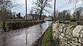 Winterborne Monkton, 17 January 2023 flooding - 1.jpg 4,032 × 2,268; 3.98 MB
-
 Winterborne Monkton, 17 January 2023 flooding - 2.jpg 4,032 × 2,268; 4.75 MB
-
 Winterborne Monkton, lay-by - geograph.org.uk - 2359928.jpg 1,024 × 768; 151 KB
-
 Winterborne Monkton, Monkton Hill - geograph.org.uk - 2359904.jpg 768 × 1,024; 135 KB
-
 Winterborne Monkton, pond - geograph.org.uk - 2359883.jpg 1,024 × 768; 328 KB
-
 Winterborne Monkton, postbox No. DT2 34 - geograph.org.uk - 1354267.jpg 640 × 480; 100 KB
-
 Winterborne Monkton, Roman road - geograph.org.uk - 2359876.jpg 768 × 1,024; 117 KB
-
 Winterborne Monkton, South Winterborne - geograph.org.uk - 3383815.jpg 1,024 × 768; 228 KB
-
 Winterborne Monkton.jpg 640 × 480; 162 KB
-
 Winterbourne watergate - geograph.org.uk - 676536.jpg 640 × 480; 75 KB


