Category:Winkburn
Jump to navigation
Jump to search
English: Winkburn is a small village and civil parish in the Newark and Sherwood district, in Nottinghamshire, England. The population is included in the civil parish of Caunton. It is located north-east of Southwell and north-west of Newark.
village in United Kingdom | |||||
| Upload media | |||||
| Instance of | |||||
|---|---|---|---|---|---|
| Location | Newark and Sherwood, Nottinghamshire, East Midlands, England | ||||
 | |||||
Subcategories
This category has the following 2 subcategories, out of 2 total.
W
- Winkburn Hall (14 F)
Media in category "Winkburn"
The following 103 files are in this category, out of 103 total.
-
 'Change and decay in all around I see' - geograph.org.uk - 2935660.jpg 1,024 × 768; 228 KB
-
 Approaching Holywell Farm - geograph.org.uk - 3691182.jpg 3,648 × 2,736; 4.77 MB
-
 Approaching Mather Wood - geograph.org.uk - 5500872.jpg 1,024 × 768; 212 KB
-
 Arable field near Park Spring Farm - geograph.org.uk - 3305428.jpg 3,648 × 2,736; 4.76 MB
-
 Arable land near Roe Wood - geograph.org.uk - 2155134.jpg 1,024 × 768; 299 KB
-
 Arable land south of Dilliner Wood - geograph.org.uk - 2155042.jpg 1,024 × 768; 374 KB
-
 Barn at Holywell Farm - geograph.org.uk - 2155104.jpg 1,024 × 766; 253 KB
-
 Beside Mather Wood - geograph.org.uk - 5067912.jpg 3,072 × 1,728; 4.31 MB
-
 Bonfire and Holywell Farm - geograph.org.uk - 2933703.jpg 1,024 × 768; 129 KB
-
 Bridge over The Wink - geograph.org.uk - 3338262.jpg 2,256 × 1,504; 2.26 MB
-
 Burnell Arms - geograph.org.uk - 5066158.jpg 800 × 600; 110 KB
-
 Byway across a field of wheat - geograph.org.uk - 5066161.jpg 800 × 600; 146 KB
-
 Byway from Winkburn village - geograph.org.uk - 1537404.jpg 640 × 480; 127 KB
-
 Byway to the north west of Winkburn - geograph.org.uk - 5066160.jpg 800 × 600; 151 KB
-
 Caunton Road - geograph.org.uk - 3642059.jpg 640 × 480; 88 KB
-
 Caunton Road - geograph.org.uk - 3642064.jpg 640 × 480; 62 KB
-
 Country road heading south - geograph.org.uk - 3642153.jpg 640 × 480; 63 KB
-
 Country road towards Winkburn - geograph.org.uk - 3642149.jpg 640 × 480; 104 KB
-
 Cracking up - geograph.org.uk - 5067977.jpg 1,728 × 3,072; 5.09 MB
-
 Crop field, Winkburn Park - geograph.org.uk - 3642175.jpg 640 × 480; 92 KB
-
 Cutting the corner - geograph.org.uk - 5500887.jpg 1,024 × 768; 226 KB
-
 Dilliner Wood - geograph.org.uk - 3691167.jpg 3,648 × 2,736; 5.16 MB
-
 Drive to Park Spring Farm - geograph.org.uk - 450267.jpg 640 × 480; 89 KB
-

-
 Entrance track to Orchard Wood Farm - geograph.org.uk - 2155070.jpg 1,024 × 772; 280 KB
-
 Farm track off Caunton Road - geograph.org.uk - 3642057.jpg 640 × 480; 104 KB
-
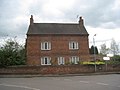 Farmhouse in Winkburn - geograph.org.uk - 2935669.jpg 1,024 × 768; 139 KB
-
 Farmland north of Winkburn - geograph.org.uk - 3642161.jpg 640 × 480; 80 KB
-
 Farmland south off Maplebeck - geograph.org.uk - 3642148.jpg 640 × 480; 79 KB
-
 Farmland, North Lodge Farm - geograph.org.uk - 3642155.jpg 640 × 480; 68 KB
-
 Footbridge over the Wink - geograph.org.uk - 2945865.jpg 1,024 × 768; 315 KB
-
 Footpath across a field of wheat - geograph.org.uk - 5066162.jpg 800 × 600; 134 KB
-
 Footpath Entrance off Winkburn Lane - geograph.org.uk - 3338390.jpg 1,504 × 2,256; 2.44 MB
-
 Footpath to Maplebeck - geograph.org.uk - 2933809.jpg 1,024 × 768; 161 KB
-
 Footpath to Readyfield Farm - geograph.org.uk - 5500878.jpg 1,024 × 768; 182 KB
-
 Footpath to Readyfield Farm - geograph.org.uk - 5500919.jpg 1,024 × 768; 195 KB
-
 Footpath to Roe Wood - geograph.org.uk - 2524778.jpg 640 × 427; 113 KB
-
 Footpath to Winkburn - geograph.org.uk - 5500892.jpg 1,024 × 768; 195 KB
-
 Gap between Mather Wood and Coppice Wood - geograph.org.uk - 5500926.jpg 1,024 × 768; 210 KB
-
 Grazing, Newfields Farm - geograph.org.uk - 3642061.jpg 640 × 480; 84 KB
-
 Holy Well by the Wink - geograph.org.uk - 2933840.jpg 1,024 × 768; 315 KB
-
 Holywell Farm - geograph.org.uk - 2945881.jpg 1,024 × 768; 156 KB
-
 Isolated tree - geograph.org.uk - 5500937.jpg 1,024 × 768; 172 KB
-
 Lane near Winkburn - geograph.org.uk - 1537054.jpg 640 × 480; 53 KB
-
 Lay-by on Caunton Road - geograph.org.uk - 2715223.jpg 3,648 × 2,736; 3.15 MB
-

-
 Maize crop - geograph.org.uk - 3642058.jpg 640 × 480; 125 KB
-
 Meadow near Dilliner Wood Farm - geograph.org.uk - 2155055.jpg 1,024 × 768; 260 KB
-
 Minor road near Hockerton - geograph.org.uk - 4139601.jpg 1,024 × 768; 140 KB
-
 New bridge near Holywell Farm - geograph.org.uk - 2155119.jpg 1,024 × 752; 298 KB
-
 Newfield Farm - geograph.org.uk - 450235.jpg 640 × 480; 100 KB
-
 Newfields Farm - geograph.org.uk - 3056163.jpg 640 × 427; 85 KB
-
 Newlands Farm - geograph.org.uk - 2715215.jpg 3,648 × 2,736; 3.07 MB
-
 North Lodge Farm - geograph.org.uk - 3338394.jpg 2,256 × 1,504; 2.13 MB
-
 North Lodge Farm - geograph.org.uk - 3642150.jpg 640 × 480; 71 KB
-
 Not the footpath - geograph.org.uk - 5500865.jpg 1,024 × 768; 169 KB
-
 Obstructed footbridge - geograph.org.uk - 5066163.jpg 800 × 600; 201 KB
-
 On foot through Nottinghamshire - geograph.org.uk - 3691205.jpg 3,648 × 2,736; 4.43 MB
-
 Orchard Wood Farm - geograph.org.uk - 2155083.jpg 1,024 × 768; 210 KB
-
 Orchard Wood Farm - geograph.org.uk - 3691177.jpg 3,648 × 2,736; 5.2 MB
-
 Overgrown field edge near Mather Wood - geograph.org.uk - 5500931.jpg 1,024 × 768; 212 KB
-
 Park Spring farmland - geograph.org.uk - 3056145.jpg 640 × 427; 93 KB
-
 Parkland, Winkburn - geograph.org.uk - 3642170.jpg 640 × 480; 81 KB
-
 Pasture land - geograph.org.uk - 3691169.jpg 3,648 × 2,736; 4.95 MB
-
 Path through Dilliner Wood - geograph.org.uk - 2155017.jpg 1,024 × 768; 319 KB
-
 Pathway to Duke's Wood - geograph.org.uk - 2155005.jpg 800 × 600; 232 KB
-
 Plank bridge on Robin Hood's Way - geograph.org.uk - 2933721.jpg 1,024 × 768; 216 KB
-
 Ploughed field - geograph.org.uk - 5067926.jpg 3,072 × 1,728; 3.97 MB
-
 Power lines east of Nut Wood - geograph.org.uk - 2155226.jpg 1,024 × 744; 202 KB
-
 Private road, Winkburn - geograph.org.uk - 3642169.jpg 640 × 480; 101 KB
-
 Robin Hood Lane alongside Roe Wood - geograph.org.uk - 2933691.jpg 1,024 × 768; 192 KB
-
 Robin Hood Lane, Winkburn - geograph.org.uk - 2933681.jpg 1,024 × 768; 151 KB
-
 Robin Hood Way through Nut Wood - geograph.org.uk - 4870470.jpg 2,479 × 1,728; 1.58 MB
-
 Rubbish dumped behind Holywell Farm - geograph.org.uk - 3691190.jpg 3,648 × 2,736; 4.79 MB
-
 Sheep near Dilliner Wood Farm - geograph.org.uk - 2945892.jpg 1,024 × 768; 138 KB
-
 Straw bales near Roe Wood - geograph.org.uk - 2155158.jpg 1,024 × 754; 230 KB
-
 Stubble, straw bale and maize - geograph.org.uk - 5500915.jpg 1,024 × 768; 180 KB
-
 Sunshine and clouds - geograph.org.uk - 3691211.jpg 3,648 × 2,736; 3.95 MB
-
 The former Burnell Arms - geograph.org.uk - 2935664.jpg 1,024 × 768; 157 KB
-
 The landscape around Newlands Farm - geograph.org.uk - 6265619.jpg 19,157 × 4,285; 6.6 MB
-
 The Old School, Winkburn - geograph.org.uk - 5500857.jpg 1,024 × 768; 180 KB
-
 Track through Nut Wood - geograph.org.uk - 2155260.jpg 1,024 × 768; 419 KB
-
 Track to Newfields Farm - geograph.org.uk - 3642062.jpg 640 × 480; 86 KB
-
 Track to Park Springs Farm - geograph.org.uk - 3642067.jpg 640 × 480; 81 KB
-
 Track towards Roewood Farm - geograph.org.uk - 5067962.jpg 3,070 × 1,724; 3.74 MB
-
 Tracks not as shown on our map^ - geograph.org.uk - 5067972.jpg 3,072 × 1,728; 4.68 MB
-
 Tractor lines in a wheat field - geograph.org.uk - 5066164.jpg 800 × 600; 144 KB
-
 View towards Newfields Farm - geograph.org.uk - 5293734.jpg 1,024 × 768; 142 KB
-
 View towards Roe Wood - geograph.org.uk - 4870471.jpg 3,072 × 1,728; 1.83 MB
-
 View towards The Wink - geograph.org.uk - 3432205.jpg 1,280 × 960; 204 KB
-
 Walking towards Winkburn - geograph.org.uk - 5067936.jpg 3,072 × 1,728; 4.4 MB
-
 Where's the path^ - geograph.org.uk - 5066143.jpg 600 × 800; 172 KB
-
 Where's the path^ - geograph.org.uk - 5066146.jpg 800 × 600; 208 KB
-
 Winkburn - geograph.org.uk - 3642165.jpg 640 × 480; 61 KB
-
 Winkburn House and Horse Trials 2011 - geograph.org.uk - 3054509.jpg 640 × 427; 70 KB
-
 Winkburn Lane - geograph.org.uk - 3642174.jpg 640 × 480; 69 KB
-
 Winkburn Lane - geograph.org.uk - 3642177.jpg 640 × 480; 72 KB
-
 Winkburn Old School 1.jpg 4,032 × 3,024; 4.67 MB
-
 Winkburn Old School 2.jpg 4,032 × 3,024; 5.94 MB
-
 Field edge eastwards - geograph.org.uk - 458152.jpg 640 × 480; 80 KB
-
 Field edge westwards - geograph.org.uk - 458151.jpg 640 × 480; 79 KB
-
 Footpath this way - geograph.org.uk - 458148.jpg 640 × 480; 102 KB
-
 West entrance Winkburn Park - geograph.org.uk - 61773.jpg 640 × 480; 156 KB


