Category:Windy Gyle
Jump to navigation
Jump to search

mountain on the border of England and Scotland, in the United Kingdom  | |||||
| Upload media | |||||
| Instance of | |||||
|---|---|---|---|---|---|
| Location |
| ||||
| Mountain range | |||||
| Topographic prominence |
| ||||
| Elevation above sea level |
| ||||
 | |||||
Subcategories
This category has the following 3 subcategories, out of 3 total.
Media in category "Windy Gyle"
The following 10 files are in this category, out of 10 total.
-
 A path on Windy Gyle - geograph.org.uk - 3243885.jpg 640 × 360; 220 KB
-
 Bridleway, Windy Gyle - geograph.org.uk - 48610.jpg 640 × 480; 124 KB
-
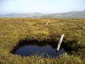 Cheviot peat bog - geograph.org.uk - 239590.jpg 640 × 479; 271 KB
-
 Hard to read sign - geograph.org.uk - 1158699.jpg 640 × 480; 33 KB
-
 Path on Windy Gyle - geograph.org.uk - 3243894.jpg 640 × 360; 231 KB
-
 Path up to Windy Gyle - geograph.org.uk - 3487947.jpg 3,872 × 2,592; 4.54 MB
-
 Pennine Way on Windy Gyle - geograph.org.uk - 539004.jpg 640 × 475; 123 KB
-
 The Pennine Way west of Windy Gyle - geograph.org.uk - 3490068.jpg 3,872 × 2,592; 4.89 MB
-
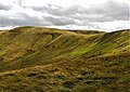
 Windy Gyle - geograph.org.uk - 3239545.jpg 640 × 360; 203 KB
-
 WindyGyle.jpg 2,200 × 1,554; 1.09 MB


