Category:Windlust, Wateringen
Jump to navigation
Jump to search
| Object location | | View all coordinates using: OpenStreetMap |
|---|
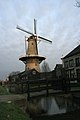
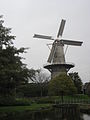
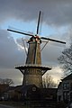
windmill in Wateringen, Netherlands  | |||||
| Upload media | |||||
| Instance of | |||||
|---|---|---|---|---|---|
| Location | Wateringen, Westland, South Holland, Netherlands | ||||
| Street address |
| ||||
| Located on street |
| ||||
| Has use | |||||
| Heritage designation |
| ||||
| Source of energy | |||||
 | |||||
|
This is a category about rijksmonument number 38408
|
| Address |
|
Media in category "Windlust, Wateringen"
The following 28 files are in this category, out of 28 total.
-
 Antoon Versteegde Waterringen 2.jpg 1,299 × 1,299; 675 KB
-
 Felix Karel Langemeijer — 146298.jpg 3,102 × 3,066; 1.84 MB
-
 Hofpark Wateringen 2010.JPG 3,648 × 2,736; 2.46 MB
-
 Korenmolen "Windlust" - Wateringen - 20251338 - RCE.jpg 1,200 × 1,193; 242 KB
-
 Korenmolen "Windlust" - Wateringen - 20251340 - RCE.jpg 1,200 × 1,186; 176 KB
-
 Korenmolen "Windlust" - Wateringen - 20251341 - RCE.jpg 1,200 × 1,179; 221 KB
-
 Korenmolen "Windlust" - Wateringen - 20251346 - RCE.jpg 1,200 × 1,186; 243 KB
-
 Korenmolen "Windlust" - Wateringen - 20251347 - RCE.jpg 1,200 × 1,181; 298 KB
-
 Korenmolen "Windlust", details - Wateringen - 20251342 - RCE.jpg 778 × 1,200; 150 KB
-
 Korenmolen "Windlust", details - Wateringen - 20251343 - RCE.jpg 788 × 1,200; 154 KB
-
 Korenmolen "Windlust", Heulweg, aanzicht - Wateringen - 20251335 - RCE.jpg 813 × 1,200; 159 KB
-
 Korenmolen Windlust, aanbrengen van balie - Wateringen - 20251336 - RCE.jpg 788 × 1,200; 168 KB
-
 Korenmolen Windlust, aanbrengen van balie - Wateringen - 20251337 - RCE.jpg 1,200 × 795; 59 KB
-
 Korennolen "Windlust" onttakeld - Kwintsheul - 20128320 - RCE.jpg 1,200 × 1,170; 310 KB
-
 Overzicht van de molenromp - Wateringen - 20369817 - RCE.jpg 1,200 × 1,200; 228 KB
-
 Wateringen - Heulweg Molen.jpg 1,536 × 2,048; 1.39 MB
-
 Wateringen molen Windlust bij nacht.jpg 1,314 × 1,752; 1.05 MB
-
 Wateringen molen Windlust foto 2.jpg 1,606 × 1,606; 1.56 MB
-
 Wateringen molen Windlust tegenlicht.jpg 1,245 × 1,884; 1.08 MB
-
 Wateringen molen Windlust.jpg 1,322 × 1,983; 1.46 MB
-
 Wateringen molen.jpg 1,704 × 2,272; 1.88 MB
-
 Wateringen, molen de Windlust foto2 2009-09-27 12.43.JPG 2,592 × 3,456; 554 KB
-
 Wateringen1.JPG 2,112 × 2,816; 2.04 MB
-
 Wateringen16.JPG 2,112 × 2,816; 2.56 MB
-
 Windlust mill Wateringen 2.jpg 3,264 × 4,928; 6.08 MB
-
 Windlust mill Wateringen.jpg 3,264 × 4,928; 5.97 MB
-
 Windlust, Wateringen.JPG 2,736 × 3,648; 3.49 MB
-
 WindlustWateringen2017.jpg 3,648 × 5,472; 4.48 MB


