Category:Wind power maps
Jump to navigation
Jump to search
Subcategories
This category has the following 3 subcategories, out of 3 total.
Media in category "Wind power maps"
The following 17 files are in this category, out of 17 total.
-
 2012 11 17 V4 Original.JPG 2,980 × 2,488; 403 KB
-
 Fig-5-Map-of-the-wind-power-density-to-the-west-of-Cerro-Paranal.gif 567 × 426; 215 KB
-
 FusionMaps-canadawind-jan12.png 978 × 830; 113 KB
-
 FusionMaps-ontariowind-jan12.png 978 × 954; 47 KB
-
 Karte Offshore-Windkraftanlagen in der Deutschen Bucht.png 4,342 × 3,483; 2.61 MB
-
 Map of the offshore wind power farms in the German Bight.png 4,342 × 3,483; 2.6 MB
-
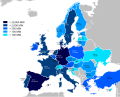
 New Wind installations in the European Union.jpg 1,414 × 1,602; 313 KB
-
 Share of wind power in demand 2017.svg 680 × 520; 822 KB
-
 Wind Power Capacity 2010.svg 570 × 460; 387 KB
-
 Wind Power Installed Capacity Map of Brazilian States (2016).png 561 × 299; 44 KB
-
 Wind power installed in Europe by end of 2007.svg 645 × 690; 363 KB
-
 Wind power installed in Europe in 2010.png 2,000 × 2,140; 523 KB
-
 Wind power installed in Europe in 2012.png 2,000 × 2,140; 524 KB
-
 Wind power installed in Europe in 2013.png 2,000 × 2,140; 447 KB
-
 Wind power potential map.jpeg 5,424 × 4,068; 1.98 MB
-
 Windkraftanlagen in Deutschland 2007.png 1,750 × 2,235; 692 KB
-
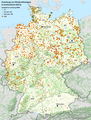 Windkraftanlagen in Deutschland.png 1,421 × 1,871; 2.54 MB


.png)


