Category:Willington, Bedfordshire
Jump to navigation
Jump to search
village and civil parish in Bedfordshire, UK  | |||||
| Upload media | |||||
| Instance of | |||||
|---|---|---|---|---|---|
| Location | Bedford, Bedfordshire, East of England, England | ||||
| Population |
| ||||
 | |||||

Subcategories
This category has the following 5 subcategories, out of 5 total.
Media in category "Willington, Bedfordshire"
The following 83 files are in this category, out of 83 total.
-
 A drain flowing down to the Ouse - geograph.org.uk - 4602705.jpg 1,066 × 1,600; 559 KB
-
 A series - geograph.org.uk - 2361860.jpg 768 × 1,024; 155 KB
-
 Barford Road, Willington - geograph.org.uk - 4543183.jpg 3,264 × 2,448; 4.27 MB
-
 Barley field at Willington - geograph.org.uk - 4543193.jpg 3,264 × 2,448; 3.68 MB
-
 Boat on the Great Ouse river - geograph.org.uk - 6603823.jpg 1,024 × 768; 313 KB
-
 Brick box by the Ouse Valley Way - geograph.org.uk - 4602745.jpg 1,600 × 1,066; 623 KB
-
 Bridleway by Sheerhatch Wood - geograph.org.uk - 5096031.jpg 1,600 × 1,066; 394 KB
-
 Bridleway crossing Wood Lane - geograph.org.uk - 4602724.jpg 1,600 × 1,066; 495 KB
-
 Bridleway to Hoo Farm - geograph.org.uk - 5096079.jpg 1,600 × 1,066; 382 KB
-
 Bridleway to Hoo Farm - geograph.org.uk - 5096108.jpg 1,600 × 1,066; 554 KB
-
 Car park at Frosts garden centre - geograph.org.uk - 6377156.jpg 1,024 × 768; 281 KB
-
 Church at Willington - geograph.org.uk - 5711028.jpg 640 × 480; 187 KB
-
 Church road and St Lawrence's church, Willington - geograph.org.uk - 4510637.jpg 4,320 × 3,240; 4.85 MB
-
 Clear as Day - geograph.org.uk - 2399302.jpg 768 × 1,024; 295 KB
-
 Corrugated hut by the bridleway - geograph.org.uk - 4602720.jpg 1,600 × 1,066; 550 KB
-
 Cottage hidden behind a large hedge. - geograph.org.uk - 426118.jpg 640 × 480; 95 KB
-
 Cycle track on National Cycle Network route 51 - geograph.org.uk - 6377139.jpg 1,024 × 768; 272 KB
-
 Ditch running up to Sheerhatch Wood - geograph.org.uk - 5096093.jpg 1,066 × 1,600; 441 KB
-
 Dovecote Lake - geograph.org.uk - 2731417.jpg 1,600 × 1,200; 213 KB
-
 Farmland at Mox Hill - geograph.org.uk - 3633141.jpg 1,024 × 768; 172 KB
-
 Footpath to Sandy Road - geograph.org.uk - 4602701.jpg 1,600 × 1,066; 527 KB
-
 Footpaths cross Wood Lane - geograph.org.uk - 5096073.jpg 1,600 × 1,066; 425 KB
-
 Frosts Garden Centre, Willington - geograph.org.uk - 5711134.jpg 4,896 × 3,672; 5.99 MB
-
 Gas installation - geograph.org.uk - 4602728.jpg 1,600 × 1,066; 528 KB
-
 GrangeEstateBridge.JPG 2,848 × 2,136; 2.75 MB
-
 Greenhouse - geograph.org.uk - 2361844.jpg 1,024 × 768; 206 KB
-
 House at Willington - geograph.org.uk - 4283241.jpg 3,264 × 2,448; 4.07 MB
-
 Is it Christmas yet^ - geograph.org.uk - 4283247.jpg 3,264 × 2,448; 4.45 MB
-
 Lake within Frosts Garden Centre, Sandy Lane, Willington - geograph.org.uk - 1825380.jpg 4,000 × 3,000; 3.96 MB
-
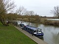
 Landing Stage on the Great Ouse - geograph.org.uk - 4602712.jpg 1,600 × 1,066; 392 KB
-
 Lane towards Moggerhanger - geograph.org.uk - 5599005.jpg 640 × 480; 208 KB
-
 Lock near Willington - geograph.org.uk - 191381.jpg 640 × 480; 93 KB
-
 Mobile home, Wood Lane - geograph.org.uk - 4755218.jpg 640 × 480; 81 KB
-
 Mowbray Place - geograph.org.uk - 5711024.jpg 640 × 480; 145 KB
-
 National Cycle Network 51 - geograph.org.uk - 4602696.jpg 1,600 × 1,066; 555 KB
-
 NCN51 at Willington - geograph.org.uk - 4543239.jpg 3,264 × 2,448; 5.38 MB
-
 New bench near Danish Camp - geograph.org.uk - 4685519.jpg 1,200 × 1,600; 666 KB
-
 Northill Road at Mox Hill - geograph.org.uk - 3633122.jpg 1,024 × 768; 153 KB
-
 Oak Farm - geograph.org.uk - 5096145.jpg 1,600 × 1,066; 443 KB
-
 Ouse Valley Way and cycle path - geograph.org.uk - 4602747.jpg 1,600 × 1,066; 754 KB
-
 Ouse Valley Way at Willington - geograph.org.uk - 4543226.jpg 3,264 × 2,448; 5.49 MB
-
 Ouse Valley Way going west - geograph.org.uk - 4602715.jpg 1,600 × 1,066; 840 KB
-
 Path junction - geograph.org.uk - 4602754.jpg 1,600 × 1,066; 581 KB
-
 Path towards Ouse Valley Way - geograph.org.uk - 4602697.jpg 1,600 × 1,066; 569 KB
-
 Reservoir - geograph.org.uk - 5096152.jpg 1,600 × 1,066; 268 KB
-
 River Great Ouse - geograph.org.uk - 4685475.jpg 1,600 × 1,200; 815 KB
-
 River Ouse at Danish Camp - geograph.org.uk - 5711027.jpg 640 × 480; 152 KB
-
 Sheep - geograph.org.uk - 2399306.jpg 768 × 1,024; 141 KB
-
 Sheerhatch Wood - geograph.org.uk - 5096126.jpg 1,600 × 1,066; 479 KB
-
 SignpostWillingtonRoute51.JPG 2,136 × 2,848; 2.21 MB
-
 Snoopy in Church End, Willington - geograph.org.uk - 1825369.jpg 2,671 × 2,000; 1.51 MB
-
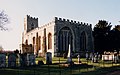 St Lawrence, Willington - geograph.org.uk - 3263854.jpg 1,000 × 628; 165 KB
-
 ST LAWRENCES AND STABLE HOUSE.jpg 5,312 × 2,988; 3.65 MB
-
 St.Lawrence's Church, Willington - geograph.org.uk - 1825368.jpg 4,000 × 3,000; 4.42 MB
-
 Telephone mast - geograph.org.uk - 5075977.jpg 1,066 × 1,600; 361 KB
-
 The River Great Ouse at Willington - geograph.org.uk - 4543210.jpg 3,264 × 2,448; 5.07 MB
-
 The summit ridge of Mox Hill - geograph.org.uk - 3633151.jpg 1,024 × 768; 205 KB
-
 The Timbers, on Barford Road - geograph.org.uk - 4283237.jpg 3,264 × 2,448; 4.58 MB
-
 TheCrownWillington.JPG 2,816 × 2,112; 2.44 MB
-
 Track through Sheerhatch Wood - geograph.org.uk - 5096041.jpg 1,066 × 1,600; 590 KB
-
 Unfenced field at Mox Hill - geograph.org.uk - 3633153.jpg 1,024 × 768; 203 KB
-

-
 Water near Willington - geograph.org.uk - 2399312.jpg 768 × 1,024; 288 KB
-
 Wheatfield next to Sheerhatch Wood, Mox Hill - geograph.org.uk - 3633135.jpg 1,024 × 768; 153 KB
-
 Where Christmas begins - geograph.org.uk - 4283250.jpg 3,264 × 2,448; 3.19 MB
-
 Willington - geograph.org.uk - 100053.jpg 600 × 450; 63 KB
-
 Willington Dovecot - geograph.org.uk - 4685451.jpg 1,600 × 1,200; 351 KB
-
 Willington Dovecote - geograph.org.uk - 1825364.jpg 4,000 × 3,000; 3.47 MB
-
 Willington Dovecote - geograph.org.uk - 5711029.jpg 640 × 480; 146 KB
-
 Willington Lock - geograph.org.uk - 2602046.jpg 1,600 × 1,200; 832 KB
-
 Willington Lock - geograph.org.uk - 4602692.jpg 1,600 × 1,066; 469 KB
-
 Willington, St Lawrence - geograph.org.uk - 5441434.jpg 4,608 × 3,456; 5.34 MB
-
 WillingtonLock.JPG 1,280 × 960; 382 KB
-
 WillingtonLowerSchool.JPG 1,280 × 960; 363 KB
-
 A ditch, a field and a tree - geograph.org.uk - 426139.jpg 640 × 480; 103 KB
-
 A field of rape near Hill Farm - geograph.org.uk - 426132.jpg 640 × 480; 128 KB
-
 Entrance to bridleway - geograph.org.uk - 288780.jpg 640 × 480; 136 KB
-
 Interesting house - geograph.org.uk - 191402.jpg 640 × 480; 93 KB
-

-
 Ploughed wheat field - geograph.org.uk - 549805.jpg 640 × 480; 106 KB
-
 Track of Footpath to Water End and Cople - geograph.org.uk - 549816.jpg 640 × 480; 103 KB
-
 Willowhill Farm - geograph.org.uk - 426090.jpg 640 × 480; 53 KB
-
 Wood Lane. - geograph.org.uk - 426111.jpg 640 × 480; 103 KB


