Category:William Wharton (Royal Navy officer)
Jump to navigation
Jump to search
British admiral and Hydrographer of the Navy  | |||||
| Upload media | |||||
| Date of birth | 2 March 1843 London | ||||
|---|---|---|---|---|---|
| Date of death | 29 September 1905 Cape Town | ||||
| Occupation | |||||
| Member of | |||||
| Award received | |||||
| |||||
Subcategories
This category has only the following subcategory.
Media in category "William Wharton (Royal Navy officer)"
The following 37 files are in this category, out of 37 total.
-
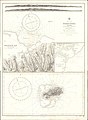
 Admiralty Chart No 1032 Channels between Kilwa Pont and North Mafia Channel, Published 1916.jpg 11,299 × 18,372; 42.47 MB
-
 Admiralty Chart No 1198 Nautical chart of the Bosphorus, Published 1871.jpg 10,158 × 12,151; 20.8 MB
-
 Admiralty Chart No 1390 Chale Pt. to Pangani including Pemba, Published 1890, Large Corrections 1902.jpg 12,482 × 16,015; 40.19 MB
-
 Admiralty Chart No 1805 France south coast Cette (Sète) to Marseille, Published 1894.jpg 12,454 × 8,337; 10.88 MB
-
 Admiralty Chart No 1812 West Coast of Pemba Island, Published 1880, New Edition 1928.jpg 11,333 × 17,703; 63.66 MB
-
 Admiralty Chart No 188 Catania to Cefalu Published 1872 (cropped).jpg 1,702 × 403; 296 KB
-
 Admiralty Chart No 188 Catania to Cefalu Published 1872.jpg 10,426 × 7,208; 8.26 MB
-
 Admiralty Chart No 2001 Bahia de Maldonado and Bahia de Montevideo, Published 1895, New Edition 1924.jpg 11,067 × 16,383; 26.54 MB
-
 Admiralty Chart No 2001 Bahia de Montevideo, Published 1936.jpg 11,082 × 16,257; 21.27 MB
-
 Admiralty Chart No 2238 Bosphorus to Kerempe Burnu, Published 1854.jpg 16,423 × 11,262; 33.29 MB
-

-
 Admiralty Chart No 2286 Approach to the Bosphorus, Published 1882.jpg 13,682 × 11,264; 20.57 MB
-

-
 Admiralty Chart No 2604 San Stefano to Erekli, Published 1920.jpg 18,495 × 11,214; 29.6 MB
-
 Admiralty Chart No 2605 Erekli to Hora Burnu, Published 1887.jpg 15,250 × 10,857; 48.12 MB
-
 Admiralty Chart No 3309 Fanjove Island to Dar Es Salaam, Published 1967.jpg 11,282 × 16,357; 15.82 MB
-
 Admiralty Chart No 3414 Approaches to Marseilles, Published 1904.jpg 16,416 × 11,303; 15.38 MB
-
 Admiralty Chart No 3414, 1904 (detail of Marseilles).jpg 1,625 × 1,624; 743 KB
-
 Admiralty Chart No 483a Trinidad Island and Gulf of Paria, Published 1869.jpg 11,074 × 16,238; 35.21 MB
-
-
 Admiralty Chart No 497 Gulf of Ismid at the Sea of Marmara, Surveyed 1879, Published 1883.png 3,898 × 2,200; 13.94 MB
-
 Admiralty Chart No 661 Kilwa Kisiwani, Published 1879.jpg 8,247 × 11,251; 19.04 MB
-

-
 Admiralty Chart No 663 Manza and Tanga Bays, Published 1894, Large Corrections 1951.jpg 11,261 × 16,494; 28.12 MB
-
 Admiralty Chart No 664 Africa east coast Zanzibar to Malindi, Published 1891.jpg 8,413 × 12,637; 10.23 MB
-
 Admiralty Chart No 715 Rodriguez Island, Published 1876.jpg 8,218 × 11,219; 16.43 MB
-
 Admiralty Chart No 884 Nautical chart of Artaki Bay, Sea of Marmara, Published 1881.jpg 8,184 × 6,036; 7.33 MB
-

-
 Admiralty Chart No 907 Fanar Adasi to Kalolimno Island, Published 1919.jpg 18,388 × 11,021; 23.03 MB
-
 Admiralty Chart No 908 Kalolimno Island to Gulf of Ismid, Published 1919.jpg 18,517 × 11,302; 31.99 MB
-
-

-
 Kapıdağ Peninsula (cropped).tif 1,231 × 920; 3.27 MB
-
 Marmara Island (cropped).tif 1,215 × 681; 2.4 MB
-
 Paşalimanı, Avşa, Koyun, Yer and Ekinlik Islands (cropped).tif 881 × 624; 1.61 MB
-
 PSM V68 D015 British association members of the voyage.png 1,677 × 1,287; 486 KB
-
 SeaSurveys Edgell 1965 0020 01 William Wharton.jpg 700 × 928; 329 KB


_to_Marseille,_Published_1894.jpg)


.jpg)


_-_Rear_Admiral_Sir_William_Wharton_(1843%E2%80%931905)_-_BHC3087_-_Royal_Museums_Greenwich.jpg)
_-_Sir_William_Wharton_-_NPG_1497_-_National_Portrait_Gallery.jpg)

.jpg)