Category:Willersey
Jump to navigation
Jump to search
village in United Kingdom  | |||||
| Upload media | |||||
| Instance of | |||||
|---|---|---|---|---|---|
| Location | Cotswold, Gloucestershire, South West England, England | ||||
| Population |
| ||||
 | |||||
English: Willersey Is a village located South West of Evesham, Gloucestershire. It is an old village with two pubs, a post office, a school, and over 400 houses.
Subcategories
This category has the following 2 subcategories, out of 2 total.
B
- Bell Inn, Willersey (7 F)
S
Media in category "Willersey"
The following 200 files are in this category, out of 245 total.
(previous page) (next page)-
 A house called Condicup - geograph.org.uk - 3094746.jpg 4,320 × 3,240; 4.81 MB
-

-

-
 Across the field - geograph.org.uk - 2449179.jpg 4,288 × 3,216; 4.24 MB
-
 Across the recreation ground - geograph.org.uk - 2449227.jpg 4,288 × 3,216; 3.37 MB
-
 Across the road - geograph.org.uk - 1912548.jpg 4,000 × 3,000; 2.05 MB
-
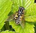
 Adela reaumurella (29868113918).jpg 1,245 × 1,099; 354 KB
-
 Adela reaumurella (43691142962).jpg 1,212 × 1,746; 367 KB
-
 Alongside the railway - geograph.org.uk - 2449199.jpg 4,288 × 3,216; 1.66 MB
-
 Andrena fulva female (43689729812).jpg 1,661 × 1,575; 494 KB
-
 Arable land above Fish Hill - geograph.org.uk - 1731324.jpg 640 × 426; 76 KB
-
 Badsey Lane - geograph.org.uk - 3517885.jpg 2,592 × 1,944; 1.31 MB
-
 Badsey Lane - geograph.org.uk - 5073582.jpg 2,000 × 1,333; 1.28 MB
-
 Blocked bridge - geograph.org.uk - 1723449.jpg 4,000 × 3,000; 4.7 MB
-
 Boot sale on the village green - geograph.org.uk - 6331927.jpg 4,000 × 3,000; 2.74 MB
-
 Bridge at Willersey - geograph.org.uk - 1094600.jpg 640 × 480; 98 KB
-
 Bridge near Willersey - geograph.org.uk - 1094632.jpg 640 × 480; 125 KB
-
 Broad-bodied Chaser. Libellula depressa female (43021458514).jpg 4,237 × 2,092; 1.52 MB
-
 Broadway Road, Willersey - geograph.org.uk - 2803263.jpg 800 × 600; 73 KB
-
 Buckle Street - geograph.org.uk - 3517868.jpg 2,592 × 1,944; 1.42 MB
-
 Buckle Street - geograph.org.uk - 5325254.jpg 640 × 480; 227 KB
-

-
 Campden Lane descends to Willersey - geograph.org.uk - 3517875.jpg 2,592 × 1,944; 1.63 MB
-
 Chiffchaff. Phylloscopus collybita(2) (43737951421).jpg 2,839 × 2,151; 1.19 MB
-
 Chiffchaff. Phylloscopus collybita(3) (43689718372).jpg 3,149 × 2,352; 1.03 MB
-
 Christen Mares - geograph.org.uk - 2445563.jpg 4,288 × 3,216; 3.63 MB
-
 Circular Straw Bales, Broadway - geograph.org.uk - 52555.jpg 640 × 480; 83 KB
-
 Collin Lane, Willersey - geograph.org.uk - 3517919.jpg 2,592 × 1,944; 2.11 MB
-
 Completely Bonkers - geograph.org.uk - 6331925.jpg 4,000 × 3,000; 2.91 MB
-
 Cotswold stone house in Willersey - geograph.org.uk - 1513969.jpg 640 × 480; 262 KB
-
 Cotswold Way 006 - geograph.org.uk - 3636221.jpg 640 × 480; 139 KB
-
 Cottage in Willersey - geograph.org.uk - 1723486.jpg 640 × 426; 75 KB
-
 Cottage with roses - geograph.org.uk - 2444011.jpg 4,288 × 3,216; 3.64 MB
-
 Crane fly Tipula fascipennis (28826047357).jpg 2,015 × 1,605; 645 KB
-
 Crane fly Tipula fascipennis (43714041192).jpg 2,933 × 2,527; 1.14 MB
-
 Cranefly Tipula vernalis (43714037002).jpg 3,284 × 2,976; 1.76 MB
-
 Dereham House, Willersey - geograph.org.uk - 4049697.jpg 4,000 × 3,000; 3.36 MB
-
 Division of paths, NE of Willersey - geograph.org.uk - 2642372.jpg 640 × 480; 110 KB
-
 Dolichopodidae (41929029190).jpg 1,996 × 1,822; 708 KB
-
 Dormy House Hotel (1) - geograph.org.uk - 1909215.jpg 4,000 × 3,000; 2.12 MB
-
 Dormy House Hotel (2) - geograph.org.uk - 1909220.jpg 4,000 × 3,000; 2.57 MB
-
 Duck pond - geograph.org.uk - 407531.jpg 640 × 480; 110 KB
-
 Elderly barn - geograph.org.uk - 1723432.jpg 4,000 × 3,000; 3.11 MB
-
 Empis tessellata (41953763960).jpg 1,110 × 1,053; 305 KB
-
 Empis tessellata (42858145195).jpg 1,247 × 1,063; 302 KB
-
 Enclosed path - geograph.org.uk - 2900756.jpg 4,320 × 3,240; 5.04 MB
-
 End of the path - geograph.org.uk - 1912533.jpg 4,000 × 3,000; 3.96 MB
-
-
 Epistrophe eligans (41953599760).jpg 2,307 × 2,030; 829 KB
-
 Farm access road - geograph.org.uk - 5072174.jpg 2,000 × 1,333; 1.32 MB
-
 Farm buildings and tractor near Willersey - geograph.org.uk - 3294689.jpg 4,000 × 3,000; 3.77 MB
-
 Farmland and churches - geograph.org.uk - 1723443.jpg 4,000 × 3,000; 2.3 MB
-
 Farmland near Willersey - geograph.org.uk - 1723936.jpg 640 × 426; 96 KB
-
 Farmland near Willersey - geograph.org.uk - 1723943.jpg 640 × 426; 113 KB
-
 Farncombe Estate (1) - geograph.org.uk - 2445566.jpg 4,288 × 3,216; 3.85 MB
-
 Farncombe Estate (2) - geograph.org.uk - 2445571.jpg 4,288 × 3,216; 3.26 MB
-
 Farncombe Estate (3) - geograph.org.uk - 2445592.jpg 4,288 × 3,216; 3.37 MB
-
 Farncombe Estate (4) - geograph.org.uk - 2445599.jpg 4,288 × 3,216; 1.85 MB
-
 Farncombe Estate - geograph.org.uk - 3294712.jpg 4,000 × 3,000; 2.56 MB
-
 Fence the brambles - geograph.org.uk - 2906961.jpg 4,320 × 3,240; 4.86 MB
-
 Field edge footpath - geograph.org.uk - 2445631.jpg 4,288 × 3,216; 2.95 MB
-
 Fields and power lines north east of Badsey Lane - geograph.org.uk - 5071980.jpg 2,000 × 1,333; 1.21 MB
-
 Fields at Willersey Farm - geograph.org.uk - 3517882.jpg 2,592 × 1,944; 1.63 MB
-
 Fields near Willersey - geograph.org.uk - 3294702.jpg 4,000 × 3,000; 3.27 MB
-
 Fields near Willersey - geograph.org.uk - 3294710.jpg 4,000 × 3,000; 2.74 MB
-
 Follow that stream - geograph.org.uk - 2358017.jpg 4,288 × 3,216; 3.7 MB
-
 Follow the wheel marks - geograph.org.uk - 2449184.jpg 4,288 × 3,216; 3.99 MB
-
 Footpath from St. Peter's churchyard - geograph.org.uk - 1513963.jpg 640 × 480; 270 KB
-
 Footpath junction - geograph.org.uk - 2449172.jpg 4,288 × 3,216; 2.38 MB
-
 Footpath meets road - geograph.org.uk - 1909212.jpg 4,000 × 3,000; 2.86 MB
-
 Footpaths leave the road - geograph.org.uk - 2445553.jpg 4,288 × 3,216; 2.78 MB
-

-
 Four ways to go - geograph.org.uk - 1909233.jpg 4,000 × 3,000; 2.6 MB
-
 Friendly Crows not Scare ‘Y’ Crows - geograph.org.uk - 6331924.jpg 4,000 × 3,000; 2.31 MB
-
 Friendly faces - geograph.org.uk - 2445643.jpg 4,288 × 3,216; 2.49 MB
-
-
 Gate pier, Fish Hill - geograph.org.uk - 5041624.jpg 576 × 1,024; 203 KB
-
 Gate pier, Fish Hill - geograph.org.uk - 5041626.jpg 576 × 1,024; 208 KB
-
 Gate piers on Fish Hill - geograph.org.uk - 5041616.jpg 1,024 × 768; 298 KB
-
 Gently flows the stream - geograph.org.uk - 3094688.jpg 4,320 × 3,240; 5.1 MB
-
 Glasshouses near Willersey - geograph.org.uk - 52564.jpg 640 × 349; 56 KB
-
 Glasshouses off Badsey Lane - geograph.org.uk - 5072170.jpg 2,000 × 1,333; 1.32 MB
-
 Grassland in Gloucestershire - geograph.org.uk - 2906984.jpg 4,320 × 3,240; 4.49 MB
-
 Heading towards Fish Hill - geograph.org.uk - 3424318.jpg 800 × 600; 142 KB
-
 Helophilus pendulus (41953604940).jpg 2,036 × 1,885; 841 KB
-
 Hill Farm - geograph.org.uk - 1909239.jpg 4,000 × 3,000; 2.79 MB
-
 Holiday accommodation, Willersey - geograph.org.uk - 1723498.jpg 426 × 640; 74 KB
-
 House and pond in Willersey - geograph.org.uk - 3294698.jpg 4,000 × 3,000; 3.15 MB
-
 House on the Corner, Willersey - geograph.org.uk - 4049702.jpg 1,600 × 1,046; 427 KB
-
 Houses in Willersey - geograph.org.uk - 1723502.jpg 640 × 426; 98 KB
-
 Houses in Willersey - geograph.org.uk - 1726356.jpg 640 × 426; 97 KB
-
 Ice fall - geograph.org.uk - 2900750.jpg 3,240 × 4,320; 5.05 MB
-
 Into the overgrown section - geograph.org.uk - 3094696.jpg 4,320 × 3,240; 4.9 MB
-
 Into the woodland - geograph.org.uk - 2357998.jpg 4,288 × 3,216; 4.5 MB
-
 Junction on Broadway Hill - geograph.org.uk - 2054221.jpg 640 × 480; 48 KB
-
 Large Red Damselfly, Pyrrhosoma nymphula, female (41929026400).jpg 3,222 × 2,356; 1.1 MB
-
 Leaving the copse, be warned - geograph.org.uk - 3258780.jpg 640 × 480; 149 KB
-
 Leucozona lucorum (42857974125).jpg 2,742 × 2,276; 1.18 MB
-
 Main Street dwelling - geograph.org.uk - 2449250.jpg 4,288 × 3,216; 2.47 MB
-
 Main Street dwellings - geograph.org.uk - 2449242.jpg 4,288 × 3,216; 1.75 MB
-
 Main Street pond - geograph.org.uk - 2449251.jpg 4,288 × 3,216; 2.81 MB
-
 Main Street, Willersey - geograph.org.uk - 4093785.jpg 1,600 × 1,064; 429 KB
-
 Mesembrina meridiana (43689709342).jpg 2,519 × 1,916; 834 KB
-
 Miniature clapper bridge near Willersey - geograph.org.uk - 3210443.jpg 1,695 × 1,203; 1.4 MB
-
 Muck bury in field entrance - geograph.org.uk - 1726032.jpg 640 × 426; 81 KB
-
 New housing - geograph.org.uk - 2449218.jpg 4,288 × 3,216; 2.49 MB
-
 New lake - geograph.org.uk - 2358005.jpg 4,288 × 3,216; 3.11 MB
-
 New stables - geograph.org.uk - 3094749.jpg 4,320 × 3,240; 4.47 MB
-
 Oak giant (1) - geograph.org.uk - 3094712.jpg 4,320 × 3,240; 5.67 MB
-
 Oak giant - geograph.org.uk - 3094715.jpg 3,240 × 4,320; 5.34 MB
-
 Old Cheltenham to Stratford railway - geograph.org.uk - 1726319.jpg 640 × 426; 130 KB
-
 Once the Cotswold Way - geograph.org.uk - 1912539.jpg 4,000 × 3,000; 2.45 MB
-
 Once were trains (1) - geograph.org.uk - 2449207.jpg 4,288 × 3,216; 3.39 MB
-
 Once were trains (2) - geograph.org.uk - 2449214.jpg 4,288 × 3,216; 2.58 MB
-
 Onward to Bretforton (1) - geograph.org.uk - 2357988.jpg 4,288 × 3,216; 4.35 MB
-
 Onward to Bretforton (2) - geograph.org.uk - 2357990.jpg 4,288 × 3,216; 4.1 MB
-
 Ornamental Pond - geograph.org.uk - 2537823.jpg 640 × 425; 78 KB
-
 Out of the churchyard - geograph.org.uk - 2444153.jpg 4,288 × 3,216; 5.25 MB
-
 Out of the playing field - geograph.org.uk - 3094550.jpg 4,320 × 3,240; 4.93 MB
-
 Over the bridge - geograph.org.uk - 2906949.jpg 4,320 × 3,240; 5.02 MB
-
 Over the railway - geograph.org.uk - 3096766.jpg 4,320 × 3,240; 4.72 MB
-
 Over the water - geograph.org.uk - 2357663.jpg 4,288 × 3,216; 3.14 MB
-
 Overgrown stile (1) - geograph.org.uk - 2449163.jpg 4,288 × 3,216; 4.43 MB
-
 Overgrown stile (2) - geograph.org.uk - 3096732.jpg 3,240 × 4,320; 5.21 MB
-
 Pararge aegeria (43689705162).jpg 1,848 × 1,532; 803 KB
-
 Partly mown - geograph.org.uk - 3094677.jpg 4,320 × 3,240; 5.45 MB
-
 Path by ditch, Willersey - geograph.org.uk - 2642389.jpg 640 × 480; 132 KB
-
 Path crosses road (1) - geograph.org.uk - 2906999.jpg 4,320 × 3,240; 4.68 MB
-
 Path crosses road (2) - geograph.org.uk - 2907008.jpg 4,320 × 3,240; 4.81 MB
-
 Path leaves road - geograph.org.uk - 3096745.jpg 4,320 × 3,240; 4.74 MB
-
 Path meets road - geograph.org.uk - 3094732.jpg 4,320 × 3,240; 5.62 MB
-
 Path through oil seed rape - geograph.org.uk - 4584857.jpg 6,000 × 4,000; 5.05 MB
-
 Path through oil seed rape - geograph.org.uk - 4584872.jpg 6,000 × 4,000; 5.56 MB
-
 Pisaura mirablis (41929019290).jpg 1,175 × 1,049; 323 KB
-
 Playing field at Willersey - geograph.org.uk - 1723910.jpg 640 × 426; 107 KB
-
 Private drive, near Willersey - geograph.org.uk - 1723949.jpg 640 × 426; 87 KB
-
 Private road - public footpath near Willersey - geograph.org.uk - 3294705.jpg 4,000 × 3,000; 2.93 MB
-
 Probably a Pipizine (41953602150).jpg 1,987 × 1,906; 853 KB
-
 Railway trackbed near Willersey, looking north - geograph.org.uk - 3294683.jpg 4,000 × 3,000; 3.96 MB
-
 Railway trackbed near Willersey, looking south - geograph.org.uk - 3294678.jpg 4,000 × 3,000; 2.91 MB
-
 Rex House - geograph.org.uk - 2449248.jpg 4,288 × 3,216; 2.55 MB
-
 Rhingia campestris (43046189954).jpg 1,949 × 1,855; 750 KB
-
 Rhingia rostrata (41953593100).jpg 2,410 × 2,076; 716 KB
-
 Rickety fence off Badsey Lane - geograph.org.uk - 5073579.jpg 2,000 × 1,333; 1.36 MB
-
 Road to Badsey - geograph.org.uk - 1723927.jpg 640 × 426; 69 KB
-

-
 Sawfly Tenthredo temula (28826279457).jpg 1,821 × 2,125; 795 KB
-
 Sawfly Tenthredo temula (43762400011).jpg 2,395 × 1,752; 799 KB
-
 Sawfly Tenthredo temula (43762400441).jpg 1,058 × 823; 229 KB
-
 School buildings - geograph.org.uk - 2444044.jpg 4,288 × 3,216; 2.16 MB
-
 Sheep in the cherry orchard, Willersey - geograph.org.uk - 231413.jpg 640 × 480; 214 KB
-
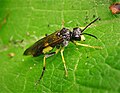
 Small Ichneumon Wasp (42858143855).jpg 1,678 × 1,842; 555 KB
-
 Snow on Buckle Street - geograph.org.uk - 3386144.jpg 980 × 735; 310 KB
-
 Spot the path - geograph.org.uk - 3094701.jpg 4,320 × 3,240; 5.07 MB
-
 Spot the path - geograph.org.uk - 3096728.jpg 4,320 × 3,240; 4.85 MB
-
 St Peter, Willersey - Chancel - geograph.org.uk - 6370401.jpg 900 × 675; 492 KB
-
 St Peter, Willersey - Corbel - geograph.org.uk - 6370408.jpg 762 × 900; 522 KB
-
 St Peter, Willersey - Font - geograph.org.uk - 6370400.jpg 556 × 900; 475 KB
-
 St Peter, Willersey - Sanctuary - geograph.org.uk - 6370398.jpg 607 × 900; 469 KB
-
 St Peter, Willersey - War Memorial - geograph.org.uk - 6370404.jpg 900 × 562; 452 KB
-
 Stack of bales - geograph.org.uk - 1513910.jpg 640 × 480; 248 KB
-
 Start of bridleway - geograph.org.uk - 3094737.jpg 4,320 × 3,240; 5.29 MB
-
 Steeply down the hill - geograph.org.uk - 1911109.jpg 4,000 × 3,000; 3.45 MB
-
 Stone marking Millennium, Willersey - geograph.org.uk - 1723906.jpg 426 × 640; 126 KB
-
 Straight path - geograph.org.uk - 5902322.jpg 2,048 × 1,536; 1.06 MB
-
 Superfluous stile - geograph.org.uk - 2906966.jpg 4,320 × 3,240; 4.55 MB
-
 Sycamore House (geograph 7070025).jpg 1,024 × 683; 842 KB
-
 Sycamore House - geograph.org.uk - 3096813.jpg 4,320 × 3,240; 5.07 MB
-
 Syrphus sp. (29891350008).jpg 1,610 × 1,687; 667 KB
-
 Tachina fera (41929015930).jpg 1,708 × 1,605; 674 KB
-
 The A44 from Fish Hill - geograph.org.uk - 3424371.jpg 800 × 600; 145 KB
-
 The Bell Inn - geograph.org.uk - 6090815.jpg 1,024 × 768; 252 KB
-
 The Bell Inn, Willersey - geograph.org.uk - 3235239.jpg 640 × 480; 118 KB
-
 The Bell Inn, Willersey - geograph.org.uk - 6090822.jpg 768 × 1,024; 258 KB
-
 The Bell Inn, Willersey - geograph.org.uk - 6090824.jpg 1,024 × 768; 248 KB
-
 The Cotswold Way (1) - geograph.org.uk - 1912545.jpg 4,000 × 3,000; 2.29 MB
-
 The Cotswold Way (2) - geograph.org.uk - 1912550.jpg 4,000 × 3,000; 1.88 MB
-
 The Cotswold Way at Fish Hill - geograph.org.uk - 3424321.jpg 800 × 600; 146 KB
-

-
 The Cotswold Way to Chipping Campden - geograph.org.uk - 3510235.jpg 1,500 × 1,000; 142 KB
-
 The Limestone Trail on Fish Hill - geograph.org.uk - 3510240.jpg 1,000 × 1,500; 290 KB
-

-
 The New Inn, Willersey - geograph.org.uk - 4049729.jpg 3,884 × 2,680; 2.19 MB
-
 The New Inn, Willersey - geograph.org.uk - 6331932.jpg 4,000 × 3,000; 2.22 MB
-
 The Old Rectory - geograph.org.uk - 2444133.jpg 4,288 × 3,216; 3.77 MB
-
 The view from Saintbury - geograph.org.uk - 2445544.jpg 4,288 × 3,216; 2.62 MB
-
 The village green at Willersey - geograph.org.uk - 3517879.jpg 2,592 × 1,944; 1.33 MB
-
 The Village Green, Willersey - geograph.org.uk - 1608253.jpg 640 × 428; 78 KB
-
 Through the crop - geograph.org.uk - 3094556.jpg 4,320 × 3,240; 4.9 MB
-
 Through the orchard - geograph.org.uk - 2900792.jpg 4,320 × 3,240; 4.91 MB
-
 Towards Bretforton - geograph.org.uk - 2357775.jpg 4,288 × 3,216; 3.47 MB
-
 Towards the lane - geograph.org.uk - 1721990.jpg 4,000 × 3,000; 4.22 MB
-
 Towards the light - geograph.org.uk - 1912530.jpg 4,000 × 3,000; 3.92 MB
-
 Towards the manor - geograph.org.uk - 2445561.jpg 4,288 × 3,216; 2 MB
-
 Towards the road - geograph.org.uk - 2445548.jpg 4,288 × 3,216; 4.07 MB
-
 Towards Willersey - geograph.org.uk - 2357764.jpg 4,288 × 3,216; 1.51 MB
-
 Towards Willersey - geograph.org.uk - 2449174.jpg 4,288 × 3,216; 1.77 MB
-
 Towards Willersey - geograph.org.uk - 3094599.jpg 4,320 × 3,240; 5.56 MB
-
 Track to Foxhill Manor - geograph.org.uk - 2445559.jpg 4,288 × 3,216; 2.5 MB
-
 Tractor turning at headland - geograph.org.uk - 2642403.jpg 640 × 480; 74 KB


.jpg)
.jpg)

.jpg)


.jpg)


_(43737951421).jpg)
_(43689718372).jpg)


.jpg)
.jpg)
.jpg)


.jpg)
_-_geograph.org.uk_-_1909215.jpg)
_-_geograph.org.uk_-_1909220.jpg)


.jpg)
.jpg)


.jpg)


_-_geograph.org.uk_-_2445566.jpg)
_-_geograph.org.uk_-_2445571.jpg)
_-_geograph.org.uk_-_2445592.jpg)
_-_geograph.org.uk_-_2445599.jpg)


.jpg)


.jpg)

.jpg)


.jpg)


_-_geograph.org.uk_-_3094712.jpg)


_-_geograph.org.uk_-_2449207.jpg)
_-_geograph.org.uk_-_2449214.jpg)
_-_geograph.org.uk_-_2357988.jpg)
_-_geograph.org.uk_-_2357990.jpg)


_-_geograph.org.uk_-_2449163.jpg)
_-_geograph.org.uk_-_3096732.jpg)
.jpg)


_-_geograph.org.uk_-_2906999.jpg)
_-_geograph.org.uk_-_2907008.jpg)


.jpg)


.jpg)


.jpg)
.jpg)


.jpg)
.jpg)
.jpg)


.jpg)


.jpg)

.jpg)
.jpg)


_-_geograph.org.uk_-_1912545.jpg)
_-_geograph.org.uk_-_1912550.jpg)


