Category:Willaston, Cheshire West and Chester
Jump to navigation
Jump to search
village near Neston in Cheshire West and Chester, UK  | |||||
| Upload media | |||||
| Instance of | |||||
|---|---|---|---|---|---|
| Location | Cheshire West and Chester, Cheshire, North West England, England | ||||
| Different from | |||||
 | |||||
English: Willaston is an up-market village on the Wirral Peninsula, Cheshire, England. Centred on a village green, it is located in the unitary authority of Cheshire West and Chester between Neston and Ellesmere Port, just south of the boundary with the Metropolitan Borough of Wirral. At the 2001 Census, the total population of the ward was 3,913.
Subcategories
This category has the following 16 subcategories, out of 16 total.
B
C
E
H
- Heath Lane bridge, Willaston (14 F)
L
P
- Pollard Inn, Willaston (8 F)
W
- Wayside Cottage. Willaston (2 F)
- Willaston Methodist church (3 F)
Media in category "Willaston, Cheshire West and Chester"
The following 68 files are in this category, out of 68 total.
-
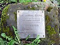 'The Wirral Stone' information plaque - geograph.org.uk - 6034511.jpg 1,600 × 1,200; 629 KB
-
 'The Wirral Stone', Willaston - geograph.org.uk - 6034490.jpg 1,600 × 1,200; 745 KB
-
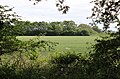
 Approach to Willaston Village - geograph.org.uk - 818765.jpg 600 × 450; 96 KB
-
 Benty Heath Lane - geograph.org.uk - 1415554.jpg 640 × 480; 121 KB
-
 Birkenhead Road (B5151), Willaston - geograph.org.uk - 6349078.jpg 800 × 600; 148 KB
-
 Blain Boland & Co, Willaston.jpg 4,728 × 3,264; 7.74 MB
-

-

-
 Bridleway near Willaston - geograph.org.uk - 1383371.jpg 480 × 640; 131 KB
-
 Bridleway north of Street Hey Lane - geograph.org.uk - 1383369.jpg 480 × 640; 131 KB
-
 Bridleway off Heath Lane. - geograph.org.uk - 532409.jpg 640 × 480; 148 KB
-
 Change Lane, Willaston 1.JPG 3,648 × 2,736; 3.57 MB
-
 Change Lane, Willaston 2.JPG 3,648 × 2,736; 3.55 MB
-
 Elm Road, Willaston - geograph.org.uk - 6349075.jpg 800 × 600; 119 KB
-
 Farmland near Willaston - geograph.org.uk - 1415506.jpg 640 × 480; 85 KB
-
 Farmland near Willaston - geograph.org.uk - 1415541.jpg 640 × 480; 83 KB
-
 Field of maize near Willaston - geograph.org.uk - 214798.jpg 640 × 480; 138 KB
-
 Field, Willaston 1.JPG 3,648 × 2,736; 3.62 MB
-
 Fields in Willaston south of the Wirral Way.jpg 5,040 × 3,304; 9.99 MB
-
 Follyfield Nurseries, Willaston - geograph.org.uk - 5556342.jpg 4,000 × 3,000; 2.94 MB
-
 Footpath near Willaston - geograph.org.uk - 1200564.jpg 640 × 480; 170 KB
-
 Footpath north of Willaston - geograph.org.uk - 1415533.jpg 640 × 480; 95 KB
-
 Hadlow Road sewage pumping station, Willaston.JPG 2,736 × 3,648; 3.58 MB
-
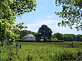
 Hanns Hall Farm, Willaston - geograph.org.uk - 196708.jpg 640 × 480; 60 KB
-
 Heath Lane - geograph.org.uk - 532415.jpg 640 × 480; 132 KB
-
 Heath Lane, Willaston - geograph.org.uk - 6349060.jpg 800 × 600; 158 KB
-
 Hooton Road (B5133), Willaston - geograph.org.uk - 6349062.jpg 800 × 600; 98 KB
-
 Hooton Road (B5133), Willaston - geograph.org.uk - 6349064.jpg 800 × 600; 123 KB
-
 House on Chester High Road (A540) - geograph.org.uk - 6185874.jpg 800 × 498; 136 KB
-
 Houses on Hooton Road (B5133), Willaston - geograph.org.uk - 6349063.jpg 800 × 600; 110 KB
-
 Houses on Hooton Road, Willaston - geograph.org.uk - 6349061.jpg 800 × 600; 107 KB
-
 Leaswood Farm, Willaston - geograph.org.uk - 214807.jpg 640 × 480; 102 KB
-

-

-
 Lodge on Birkenhead Road, Willaston - geograph.org.uk - 6349077.jpg 800 × 600; 117 KB
-
 Looking across the field to Five Oaks - geograph.org.uk - 180304.jpg 640 × 480; 61 KB
-

-
 National cycling route 56 sign, Willaston 2.JPG 2,736 × 3,648; 3.59 MB
-
 Neston Road (B5133), Willaston - geograph.org.uk - 6349076.jpg 800 × 600; 123 KB
-
 New Hey Lane - geograph.org.uk - 6349072.jpg 800 × 600; 127 KB
-

-

-
 Pond near Willaston - geograph.org.uk - 1415500.jpg 640 × 480; 130 KB
-
 Pond on Street Hey Lane, Willaston - geograph.org.uk - 180301.jpg 640 × 480; 61 KB
-

-
 Public footpath sign, Change Lane, Willaston.JPG 2,736 × 3,648; 3.56 MB
-
 Pylon, Willaston 1.JPG 2,736 × 3,648; 3.54 MB
-
 Redstones, Willaston.jpg 4,943 × 3,231; 15.6 MB
-
 Road bridge over Wirral Way - geograph.org.uk - 6087943.jpg 5,184 × 3,888; 5.96 MB
-
 Street Hey Lane, Willaston - geograph.org.uk - 1383364.jpg 480 × 640; 102 KB
-
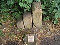 The Wirral Stone, near Willaston - geograph.org.uk - 214805.jpg 640 × 480; 145 KB
-
 The Wirral Way at Willaston - geograph.org.uk - 5551626.jpg 4,000 × 3,000; 5 MB
-
 The Wirral Way near Willaston - geograph.org.uk - 5551629.jpg 4,000 × 3,000; 3.95 MB
-
 Track near Willaston - geograph.org.uk - 5570594.jpg 4,000 × 3,000; 3.96 MB
-
 Track near Willaston - geograph.org.uk - 5570598.jpg 4,000 × 3,000; 4.46 MB
-
 Trans-Bridleway Footpath - geograph.org.uk - 1415519.jpg 640 × 480; 90 KB
-
 View of Footpath north of Willaston - geograph.org.uk - 1415524.jpg 640 × 480; 121 KB
-
 Willaston - geograph.org.uk - 2490.jpg 640 × 431; 43 KB
-
 Willaston Barber Shop and the Nags Head - geograph.org.uk - 5548461.jpg 4,000 × 3,000; 2.97 MB
-
 Willaston Methodist Church - geograph.org.uk - 6349074.jpg 800 × 600; 110 KB
-
 Willaston post office.jpg 4,376 × 3,184; 11.65 MB
-
 Willaston village - scan01.png 2,004 × 1,476; 4.76 MB
-
 Willaston, Cheshire - geograph.org.uk - 5548457.jpg 4,000 × 3,000; 4.03 MB
-
 Wirral Way - geograph.org.uk - 6087954.jpg 5,184 × 3,888; 6.19 MB
-
 Wirral Way, cutting and footbridge - geograph.org.uk - 6087995.jpg 5,184 × 3,888; 6.7 MB
-
 Wirral Way, Willaston 1.JPG 3,648 × 2,736; 3.65 MB
-
 Wirral Way, Willaston 11.JPG 3,648 × 2,736; 3.56 MB
-
 Wirral Way, Willaston 2.JPG 3,648 × 2,736; 3.53 MB


,_Willaston_-_geograph.org.uk_-_6349078.jpg)


,_Willaston_-_geograph.org.uk_-_6349062.jpg)
,_Willaston_-_geograph.org.uk_-_6349064.jpg)
_-_geograph.org.uk_-_6185874.jpg)
,_Willaston_-_geograph.org.uk_-_6349063.jpg)


_-_geograph.org.uk_-_6349069.jpg)


,_Willaston_-_geograph.org.uk_-_6349076.jpg)


