Category:Wikivoyage maps of India
Jump to navigation
Jump to search
Media in category "Wikivoyage maps of India"
The following 60 files are in this category, out of 60 total.
-
 Andaman and Nicobar Islands Wikivoyage map.png 1,392 × 1,899; 970 KB
-
 Andaman and Nicobar Islands Wikivoyage map.svg 550 × 750; 384 KB
-
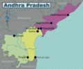 Andhra Pradesh WV.png 2,773 × 2,292; 1.11 MB
-
 Andhra Pradesh WV.svg 1,027 × 849; 615 KB
-
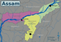 Assam Wikivoyage map.png 3,580 × 2,475; 1.25 MB
-
 Assam Wikivoyage map.svg 1,414 × 978; 921 KB
-
 Chennai Wikivoyage map.png 3,403 × 4,577; 1.91 MB
-
 Chennai Wikivoyage map.svg 1,344 × 1,808; 641 KB
-
 Delhi map wikivoyage.png 7,557 × 8,102; 2.31 MB
-
 Delhi map wikivoyage.svg 2,985 × 3,200; 1.67 MB
-
 Eastern India WV.svg 400 × 468; 800 KB
-
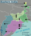 Eastern India.png 375 × 439; 79 KB
-
 English Wikivoyage Map of Himachal Pradesh.png 2,631 × 2,676; 1.24 MB
-
 English Wikivoyage Map of Himachal Pradesh.svg 1,039 × 1,057; 239 KB
-
 Gujarat WV.svg 2,170 × 1,722; 556 KB
-
 Havelock.png 1,025 × 947; 290 KB
-
 Havelock.svg 744 × 1,052; 556 KB
-
 Himalayan North WV.png 1,013 × 1,051; 284 KB
-
 Himalayan North.svg 400 × 415; 344 KB
-
 Hyderabad Zones.PNG 1,634 × 1,442; 455 KB
-
 Hyderabad-districts.svg 1,886 × 2,566; 352 KB
-
 India colour.png 978 × 1,144; 73 KB
-
 India map ru.png 1,155 × 1,585; 209 KB
-
 India regions map (cs).png 1,564 × 1,826; 569 KB
-
 Kashmir WV.svg 1,722 × 1,301; 215 KB
-
 Kochi map.svg 490 × 675; 1.09 MB
-
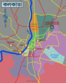 Kolkata Bengali Wikivoyage map.png 1,061 × 1,324; 321 KB
-
 Kolkata English Wikivoyage map.png 1,061 × 1,324; 307 KB
-
 Kolkata English Wikivoyage map.svg 419 × 523; 740 KB
-
 Kolkata Wikivoyage map PNG.png 260 × 450; 73 KB
-
 Kolkata Wikivoyage map.svg 744 × 1,052; 494 KB
-
 Map of Himachal Pradesh.png 1,732 × 1,765; 698 KB
-
 Map of Himachal Pradesh.svg 1,039 × 1,057; 282 KB
-
 Map of India (fr).png 1,001 × 1,169; 337 KB
-
 Map of India (ru).png 1,675 × 1,955; 657 KB
-
 Map of India (zh-hans)-印度地图.png 1,987 × 2,320; 886 KB
-
 Map of India hi.svg 1,251 × 1,461; 940 KB
-
 Map of India WV.svg 1,251 × 1,461; 923 KB
-
 Map of India.png 3,000 × 3,502; 1.16 MB
-
 Map-India-Goa01.svg 1,253 × 1,102; 401 KB
-
 Mumbai English Wikivoyage map 2.png 3,418 × 4,608; 2.41 MB
-
 Mumbai English Wikivoyage map 2.svg 1,350 × 1,820; 625 KB
-
 Mumbai English Wikivoyage map.svg 757 × 1,351; 612 KB
-
 Mumbai travel map.png 1,917 × 3,422; 959 KB
-
 Mumbai travel map.svg 757 × 1,351; 607 KB
-
 NortheastIndia.png 1,919 × 2,115; 815 KB
-
 Odisha Wikivoyage map.png 3,047 × 2,323; 1.29 MB
-
 Odisha Wikivoyage map.svg 1,128 × 860; 784 KB
-
 Southern India.png 1,500 × 1,725; 247 KB
-
 The Plains WV.png 2,000 × 1,804; 420 KB
-
 The Plains.svg 585 × 535; 990 KB
-
 Udupi Krishna Temple Complex.png 2,253 × 2,000; 566 KB
-
 Udupi Krishna Temple Complex.svg 969 × 803; 661 KB
-
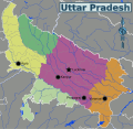
 Uttar Pradesh Wikivoyage map.png 1,073 × 1,046; 461 KB
-
 Uttar Pradesh Wikivoyage map.svg 1,006 × 981; 1.02 MB
-
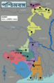 West Bengal Wikivoyage map bn.png 2,631 × 4,013; 1.55 MB
-
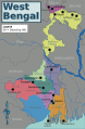
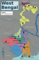 West Bengal Wikivoyage map.png 2,631 × 4,013; 1.53 MB
-
 West Bengal Wikivoyage map.svg 1,039 × 1,585; 967 KB
-
 Western India.png 2,000 × 2,550; 507 KB
-
 मुम्बई यात्रा मानचित्र.svg 757 × 1,351; 608 KB


.png)


.png)
.png)
-%E5%8D%B0%E5%BA%A6%E5%9C%B0%E5%9B%BE.png)


