Category:Wikidata maps
Jump to navigation
Jump to search
Subcategories
This category has the following 4 subcategories, out of 4 total.
O
- OSM-Wikidata Map Framework (4 F)
W
- Wikidata geocoding (1 P, 144 F)
- Maps of the world about Wikidata (119 F)
Media in category "Wikidata maps"
The following 8 files are in this category, out of 8 total.
-
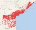 AP villages with coordinates on wikidata.png 807 × 663; 404 KB
-
 Europe important.png 3,000 × 2,000; 6.93 MB
-
 LOD Upper German Limes Wikidata Enriched Height.png 1,318 × 933; 1.96 MB
-
 Oarsoaldeko-tokien-mapa-Wikidata-2020.png 1,357 × 833; 905 KB
-
 Referèndums amb la plantilla infobox election - còpia.svg 680 × 520; 800 KB
-
 Tool for images management wikidata Italy.jpg 2,363 × 2,953; 574 KB
-
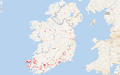 Wikidata Ogham Sites v1.png 1,917 × 1,199; 1.32 MB
-
 WikidataBrasil-logo.svg 512 × 538; 35 KB


