Category:WikiProject India State Maps
Jump to navigation
Jump to search
Pages in category "WikiProject India State Maps"
This category contains only the following page.
Media in category "WikiProject India State Maps"
The following 53 files are in this category, out of 53 total.
-
Andhra Pradesh locator map (1956-2014).svg 2,716 × 2,531; 372 KB
-
Andhra Pradesh locator map.png 2,717 × 2,531; 806 KB
-
Arunachal Pradesh locator map.svg 2,393 × 1,956; 263 KB
-
Assam locator map.svg 2,393 × 1,956; 264 KB
-
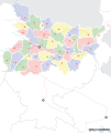
Bihar locator map.svg 1,614 × 1,915; 258 KB
-
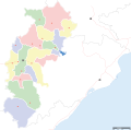
Chhattisgarh locator map.svg 2,269 × 2,241; 156 KB
-
Goa locator map.svg 274 × 331; 93 KB
-
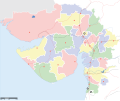
Gujarat locator map.svg 2,145 × 1,789; 247 KB
-
Haryana locator map.svg 954 × 1,188; 83 KB
-
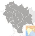
Himachal Pradesh districts.png 1,039 × 1,057; 155 KB
-
Himachal Pradesh locator map.svg 1,039 × 1,057; 138 KB
-
Himachal Pradesh locator map2.svg 1,039 × 1,057; 945 KB
-
India Karnataka COVID-19 map.svg 1,630 × 2,356; 260 KB
-
Jammu and Kashmir locator map.svg 2,160 × 1,696; 679 KB
-
Jharkhand locator map.svg 1,614 × 1,915; 231 KB
-
Karnataka locator map.svg 1,630 × 2,356; 235 KB
-
Karnataka-locator-map-blank.svg 1,630 × 2,356; 156 KB
-
Kashmir map-es.svg 2,028 × 1,611; 472 KB
-
Kerala locator map.svg 1,340 × 1,627; 151 KB
-
Ladakh locator map de.svg 2,160 × 1,696; 261 KB
-
Ladakh locator map.svg 2,160 × 1,696; 202 KB
-
Location map India Andhra Pradesh (1956-2014).png 643 × 600; 105 KB
-
Location map India Andhra Pradesh.png 878 × 747; 136 KB
-
Location map India Telangana (blank).svg 1,070 × 740; 424 KB
-
Location map India Telangana.png 1,018 × 708; 206 KB
-
Location map Uttar Pradesh Hindi.png 572 × 599; 131 KB
-
Location map Uttar Pradesh.png 572 × 599; 127 KB
-
Madhya Pradesh districts location map big.svg 1,041 × 732; 313 KB
-
Maharashtra Divisions Eng.svg 3,106 × 2,453; 289 KB
-
Maharashtra Divisions-gu.svg 3,106 × 2,453; 249 KB
-
Maharashtra Divisions-kn.svg 3,106 × 2,453; 270 KB
-
Maharashtra Divisions-mr.svg 3,106 × 2,453; 248 KB
-
Maharashtra Divisions-pa.svg 3,106 × 2,453; 245 KB
-
Maharashtra Divisions-te.svg 3,106 × 2,453; 245 KB
-
Maharashtra Divisions-ur.svg 512 × 362; 446 KB
-
Maharashtra locator map.svg 2,789 × 2,232; 357 KB
-
Manipur districts blank.png 744 × 632; 104 KB
-
Manipur locator map.svg 2,393 × 1,956; 261 KB
-
Meghalaya locator map.svg 2,393 × 1,956; 260 KB
-
Nagaland locator map.svg 2,393 × 1,956; 277 KB
-
Odisha locator map.svg 2,269 × 2,241; 211 KB
-
Orissa State map-bn.svg 2,184 × 1,769; 1.79 MB
-
Orissa State map-gu.svg 2,184 × 1,769; 1.76 MB
-
Orissa State map-pa.svg 2,184 × 1,769; 1.76 MB
-
Orissa State map-te.svg 2,184 × 1,769; 1.76 MB
-
Orissa State map.svg 2,184 × 1,769; 1.77 MB
-
Punjab locator map.svg 955 × 1,029; 174 KB
-
Rajasthan locator map.svg 605 × 530; 161 KB
-
Sikkim locator map.svg 1,595 × 2,256; 244 KB
-
Tamil Nadu locator map-2010-29-10.svg 1,598 × 1,979; 412 KB
-
Tamil Nadu locator map.svg 1,591 × 1,975; 222 KB
-
Uttar Pradesh locator map.svg 909 × 886; 838 KB
-
West Bengal locator map.svg 1,595 × 2,256; 254 KB


