Category:WikiProject India/Maps
Jump to navigation
Jump to search
 See also: Commons:WikiProject India.

Media in category "WikiProject India/Maps"
The following 15 files are in this category, out of 15 total.
-
 Airports and seaports map.png 1,000 × 1,138; 236 KB
-
 India-states-numbered-bn.png 1,594 × 1,868; 605 KB
-
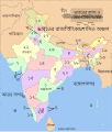 India-states-numbered-bn.svg 1,594 × 1,868; 320 KB
-
 India-states-numbered.svg 1,594 × 1,868; 306 KB
-
 Indian Railways Rajdhani Shatabdi Lines.gif 1,000 × 1,138; 47 KB
-
 Indiastates&utnumbered 2 de.PNG 1,000 × 1,138; 59 KB
-
 Indiastates&utnumbered 2.PNG 1,000 × 1,138; 135 KB
-
 Indiastates&utnumbered fr.png 1,000 × 1,138; 165 KB
-
 Indiastates&utnumbered.png 1,000 × 1,138; 175 KB
-
 National highway network map.png 1,000 × 1,138; 146 KB
-
 Railway network map of India - Schematic.png 2,282 × 2,500; 928 KB
-
 Railway network of India.png 1,000 × 1,138; 130 KB
-
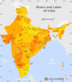 Rivers and lakes map.png 1,000 × 1,138; 91 KB
-
 Rivers and lakes topo map.png 1,000 × 1,138; 99 KB
-
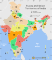
 State and union territories map.png 1,000 × 1,138; 71 KB


