Category:Wiggenhall St Germans
Jump to navigation
Jump to search
village in United Kingdom  | |||||
| Upload media | |||||
| Instance of | |||||
|---|---|---|---|---|---|
| Location | King's Lynn and West Norfolk, Norfolk, East of England, England | ||||
| Population |
| ||||
| Area |
| ||||
 | |||||
Subcategories
This category has the following 4 subcategories, out of 4 total.
Media in category "Wiggenhall St Germans"
The following 200 files are in this category, out of 202 total.
(previous page) (next page)-
 Access road to Polver Farm - geograph.org.uk - 3110384.jpg 640 × 480; 158 KB
-
 Bank Farm near the River Great Ouse - geograph.org.uk - 3645814.jpg 4,000 × 2,883; 3.5 MB
-

-
 Boat along the River Great Ouse - geograph.org.uk - 3649891.jpg 3,571 × 2,655; 2.77 MB
-

-
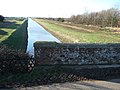
 Bridge across the Great Ouse - geograph.org.uk - 5602933.jpg 3,456 × 2,592; 3.89 MB
-
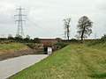
 Bridge on the outfall of Smeeth Lode - geograph.org.uk - 2249523.jpg 2,848 × 2,136; 3.13 MB
-
 Bridge over drainage channel - geograph.org.uk - 593914.jpg 640 × 480; 98 KB
-
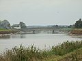
 Bridge over River Great Ouse - geograph.org.uk - 6122276.jpg 1,024 × 768; 142 KB
-

-
 Bridge, pub and church - geograph.org.uk - 593851.jpg 640 × 480; 97 KB
-
 Bungalows near Wiggenhall St Germans - geograph.org.uk - 3647187.jpg 2,757 × 1,875; 1.46 MB
-
-
 Concrete pier in the River Great Ouse - geograph.org.uk - 3652856.jpg 1,843 × 1,472; 967 KB
-
 Concrete piers in Great Ouse - geograph.org.uk - 6122300.jpg 1,024 × 768; 140 KB
-

-
 Crown and Anchor pub sign - geograph.org.uk - 3648599.jpg 4,000 × 3,000; 3.56 MB
-
 Deviation pylon near Tilney - geograph.org.uk - 1955910.jpg 480 × 640; 68 KB
-
 Dike and farmland near Wiggenhall St Mary Magdalen - geograph.org.uk - 2250254.jpg 2,848 × 2,136; 3.06 MB
-
 Dike south of King's Lynn power station - geograph.org.uk - 2293749.jpg 2,848 × 2,136; 3.07 MB
-
 Ditch alongside Eaubrink Bank - geograph.org.uk - 2249282.jpg 2,848 × 2,136; 3.01 MB
-
 Dog mess bin along Eau Brink Road - geograph.org.uk - 3653078.jpg 2,707 × 2,103; 1.87 MB
-
 Dog mess bin along Eau Brink Road - geograph.org.uk - 3653153.jpg 4,000 × 3,000; 4.99 MB
-
 Drainage channel to the River Great Ouse - geograph.org.uk - 2250020.jpg 2,848 × 2,136; 2.93 MB
-
 Drainage ditch beside Hastings Lane - geograph.org.uk - 3110417.jpg 640 × 480; 210 KB
-
 Eau Brink Road and the River Great Ouse - geograph.org.uk - 3652830.jpg 4,000 × 3,000; 3.62 MB
-
 Eau Brink Road bridge - geograph.org.uk - 3648551.jpg 2,083 × 1,451; 811 KB
-
 Eau Brink Road bridge - geograph.org.uk - 3649904.jpg 4,000 × 3,000; 3.31 MB
-
 Eaubrink Bank - geograph.org.uk - 2249303.jpg 2,848 × 2,136; 3.07 MB
-
 Electricity poles and pylon - geograph.org.uk - 3649921.jpg 2,953 × 2,882; 2.37 MB
-
 Electricity pylons - geograph.org.uk - 6122291.jpg 768 × 1,024; 120 KB
-
 Electricity pylons near the River Great Ouse - geograph.org.uk - 3647140.jpg 3,066 × 2,536; 2.26 MB
-
 Entering Saddlebow over Saddlebow Bridge - geograph.org.uk - 5351563.jpg 3,648 × 2,736; 3.96 MB
-
 Entering Wiggenhall St Mary The Virgin - geograph.org.uk - 5320256.jpg 3,648 × 2,736; 3.95 MB
-
 Entrance to Cycle Route 1's route around South Lynn - geograph.org.uk - 5351729.jpg 3,648 × 2,736; 3.91 MB
-
 Exposed mud bank in the River Great Ouse - geograph.org.uk - 5326458.jpg 800 × 612; 130 KB
-
 Fallow Pipe Farm - geograph.org.uk - 3645884.jpg 2,976 × 2,353; 1.96 MB
-
 Farm buildings at Fitton House - geograph.org.uk - 283534.jpg 640 × 427; 88 KB
-
 Farm machinery near St Germans Church - geograph.org.uk - 5327546.jpg 800 × 635; 159 KB
-
 Farmland near Brinkside - geograph.org.uk - 3653205.jpg 3,361 × 2,650; 2.89 MB
-
 Fen Rivers Way along the River Great Ouse - geograph.org.uk - 3645588.jpg 3,995 × 2,752; 4.03 MB
-
 Fenland farmland - geograph.org.uk - 5842934.jpg 1,024 × 681; 81 KB
-
 Fenland scenery - geograph.org.uk - 5846857.jpg 1,024 × 681; 73 KB
-
 Fenland Water Ski Club - geograph.org.uk - 5471506.jpg 800 × 590; 97 KB
-
 Fields by Magdalen High Road - geograph.org.uk - 4583808.jpg 2,560 × 1,920; 1.56 MB
-
 Fields by Polver Farm - geograph.org.uk - 3110389.jpg 640 × 480; 147 KB
-
 Fields north of Polver Farm - geograph.org.uk - 3110388.jpg 640 × 480; 175 KB
-
 Fields of Rapeseed - geograph.org.uk - 6122314.jpg 1,024 × 768; 139 KB
-
 Fitton House and barns, Wiggenhall St Germans - geograph.org.uk - 2251006.jpg 2,848 × 2,136; 3.01 MB
-
 Flat farmland at Eau Brink - geograph.org.uk - 3653000.jpg 3,682 × 2,780; 3.13 MB
-
 Flat farmland north of Wiggenhall St Germans - geograph.org.uk - 3648556.jpg 3,381 × 2,605; 2.34 MB
-
 Flat farmland west of Eau Brink Road - geograph.org.uk - 3653143.jpg 4,000 × 3,000; 3.52 MB
-
 Footbridge along Eau Brink Road - geograph.org.uk - 3652862.jpg 2,712 × 2,196; 2.08 MB
-
 Footpath - geograph.org.uk - 1714732.jpg 1,600 × 1,200; 344 KB
-

-
 Former Wesleyan Chapel, Wiggenhall St Germans - geograph.org.uk - 5320929.jpg 3,648 × 2,736; 3.85 MB
-
 Gas pipeline markers on the river bank - geograph.org.uk - 3645887.jpg 3,188 × 2,566; 2.54 MB
-
 Gate on top of the raised river bank - geograph.org.uk - 3645819.jpg 3,174 × 2,397; 2.45 MB
-
 Gate on top of the raised river bank - geograph.org.uk - 3647152.jpg 3,590 × 2,673; 2.93 MB
-
 Gate on top of the raised river bank - geograph.org.uk - 3648567.jpg 4,000 × 3,000; 3.52 MB
-
 Gates to St Mary's Hall at Wiggenhall St Mary The Virgin - geograph.org.uk - 2249935.jpg 2,848 × 2,136; 2.87 MB
-
 Green lane near Ivy Farm, Wiggenhall St Germans - geograph.org.uk - 2250998.jpg 2,848 × 2,136; 3.02 MB
-
 Half a tree - geograph.org.uk - 2294058.jpg 2,848 × 2,136; 3.06 MB
-
 Heading north along Eau Brink Road - geograph.org.uk - 3649884.jpg 4,000 × 3,000; 3.51 MB
-
 Heading south along the Fen Rivers Way - geograph.org.uk - 3645614.jpg 3,741 × 2,552; 2.9 MB
-
 Houses in Wiggenhall St Germans - geograph.org.uk - 3648570.jpg 3,692 × 2,813; 3.08 MB
-
 Houses on Sluice Road - geograph.org.uk - 5327587.jpg 800 × 547; 95 KB
-
 King's Lynn power station - geograph.org.uk - 5355551.jpg 3,648 × 2,736; 4.1 MB
-
 Kings Lynn power station seen from Saddle Bow bridge - geograph.org.uk - 3505746.jpg 4,320 × 3,240; 3.32 MB
-
 Lane near Eaubrink Farm - geograph.org.uk - 2249324.jpg 2,848 × 2,136; 3.08 MB
-
 Left bank at Wiggenhall St Germans - geograph.org.uk - 5607579.jpg 640 × 360; 62 KB
-
 Lewis Drive, Wiggenhall St Germans - geograph.org.uk - 5320887.jpg 3,648 × 2,736; 3.84 MB
-

-
 Looking north along the River Great Ouse - geograph.org.uk - 3652819.jpg 2,837 × 2,719; 2.4 MB
-

-
 Looking south along the River Great Ouse - geograph.org.uk - 3648612.jpg 4,000 × 3,000; 3.33 MB
-

-
 Lynn Road in Wiggenhall St Germans - geograph.org.uk - 3649878.jpg 3,937 × 2,851; 3.35 MB
-
 Lynn Road in Wiggenhall St Germans - geograph.org.uk - 5327583.jpg 800 × 430; 117 KB
-
 Lynn Road, Wiggenhall St Germans - geograph.org.uk - 2487560.jpg 640 × 427; 125 KB
-
 Magdalen Bridge - geograph.org.uk - 2649736.jpg 3,872 × 2,592; 3 MB
-
 Magdalen Bridge - geograph.org.uk - 4583530.jpg 2,560 × 1,920; 1.63 MB
-

-
-

-
 Magdalen Bridge over the Middle Level Main Drain - geograph.org.uk - 2250201.jpg 2,848 × 2,136; 3.08 MB
-
 Magdalen High Road - geograph.org.uk - 2250270.jpg 2,848 × 2,136; 3.08 MB
-

-
 Magdalen High Road at Lordsbridge - geograph.org.uk - 5329165.jpg 800 × 454; 83 KB
-
 Medieval Seal (FindID 528404).jpg 2,064 × 1,440; 1.72 MB
-
 Memorial Hall, Wiggenhall St Germans - geograph.org.uk - 5320904.jpg 3,648 × 2,736; 5.02 MB
-
 Middle Level Drain - geograph.org.uk - 281007.jpg 640 × 480; 92 KB
-
 Middle Level Main Drain - geograph.org.uk - 3649896.jpg 4,000 × 3,000; 3.8 MB
-
 Middle Level Main Drain - geograph.org.uk - 5329116.jpg 800 × 544; 115 KB
-
 Middle Level Main Drain - geograph.org.uk - 5329151.jpg 800 × 600; 176 KB
-
 Middle Level Main Drain - geograph.org.uk - 5329189.jpg 800 × 570; 126 KB
-

-
-
 Middle Level Outfall Sluice, Wiggenhall St Germans - geograph.org.uk - 2249911.jpg 2,848 × 2,136; 3.01 MB
-
 Mill Basin - geograph.org.uk - 6518654.jpg 1,024 × 768; 183 KB
-
 Mill Road and Wiggenhall Bridge - geograph.org.uk - 5471508.jpg 800 × 547; 85 KB
-
 Mill Road level crossing, Wiggenhall St Germans - geograph.org.uk - 2294006.jpg 2,848 × 2,136; 3.06 MB
-
 North along the Middle Level Main Drain - geograph.org.uk - 5329135.jpg 800 × 551; 134 KB
-
 Oil seed rape crop - geograph.org.uk - 3652890.jpg 1,237 × 957; 431 KB
-
 Oil seed rape crop along Eau Brink Road - geograph.org.uk - 3653044.jpg 3,631 × 2,907; 3.15 MB
-
 Oil seed rape crop near Bank Farm - geograph.org.uk - 3645822.jpg 4,000 × 3,000; 3.58 MB
-
 Oil seed rape crop near Bank Farm - geograph.org.uk - 3645891.jpg 3,790 × 2,678; 3.62 MB
-
 Oil seed rape crop near Eau Brink River Farm - geograph.org.uk - 3652838.jpg 3,122 × 2,823; 2.8 MB
-
 Oil seed rape crop north of Eau Brink - geograph.org.uk - 3653134.jpg 3,209 × 2,527; 2.54 MB
-
 Old railway goods van, recycled as a shed - geograph.org.uk - 5603254.jpg 3,189 × 2,392; 4.4 MB
-
 On Saddlebow Bridge near King's Lynn - geograph.org.uk - 2293911.jpg 2,848 × 2,136; 2.91 MB
-
 On the bank of the River Great Ouse - geograph.org.uk - 2249397.jpg 2,848 × 2,136; 3.04 MB
-
 On Wiggenhall Bridge over the Relief Channel - geograph.org.uk - 2294030.jpg 2,848 × 2,136; 2.84 MB
-
 Ordnance Survey Cut Mark - geograph.org.uk - 4283278.jpg 4,000 × 3,000; 4.6 MB
-
 Overgrown shed beside Hastings Lane - geograph.org.uk - 3110415.jpg 640 × 480; 273 KB
-
 Passing place on Eau Brink Road - geograph.org.uk - 3649924.jpg 4,000 × 3,000; 4.87 MB
-

-
 Peter's Drove bridge crossing the Middle Level Main Drain - geograph.org.uk - 2251014.jpg 2,848 × 2,136; 2.94 MB
-
-
 Peter’s Drove Bridge - geograph.org.uk - 2649729.jpg 3,872 × 2,592; 2.92 MB
-

-
 Polver Pumping Station outfall - geograph.org.uk - 2285411.jpg 2,848 × 2,136; 3.1 MB
-
 Pub and bridge in Wiggenhall St Germans - geograph.org.uk - 3648564.jpg 4,000 × 3,000; 3.6 MB
-
 Red Barn Farm - geograph.org.uk - 4583801.jpg 2,560 × 1,920; 1.46 MB
-

-
 Redundant bridge piers in the River Great Ouse - geograph.org.uk - 2249445.jpg 2,848 × 2,136; 3.08 MB
-
 Relief Channel seen from the bridge, Saddle Bow - geograph.org.uk - 3505735.jpg 4,320 × 3,240; 3.04 MB
-
 River Great Ouse - geograph.org.uk - 5327551.jpg 800 × 603; 118 KB
-
 River Great Ouse - geograph.org.uk - 593995.jpg 640 × 480; 95 KB
-
 River Great Ouse - geograph.org.uk - 6122252.jpg 1,024 × 768; 132 KB
-
 River Great Ouse - geograph.org.uk - 6573382.jpg 1,024 × 684; 229 KB
-
River Great Ouse - geograph.org.uk - 6573389.jpg File missing
-
 River Great Ouse - geograph.org.uk - 6573395.jpg 1,024 × 684; 172 KB
-
 River Great Ouse - geograph.org.uk - 6573403.jpg 1,024 × 684; 142 KB
-
 River Great Ouse from the bridge on Eau Brink Road - geograph.org.uk - 4589188.jpg 2,903 × 1,080; 351 KB
-
 River Great Ouse in Wiggenhall St Germans - geograph.org.uk - 3648606.jpg 4,000 × 3,000; 3.72 MB
-
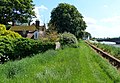
 Riverbank of the Great Ouse - geograph.org.uk - 3648560.jpg 3,597 × 2,806; 3.18 MB
-
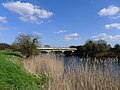
 Road bridge across the River Great Ouse - geograph.org.uk - 3648594.jpg 3,817 × 2,878; 3.43 MB
-
 Road bridge across the River Great Ouse - geograph.org.uk - 3648605.jpg 4,000 × 3,000; 3.75 MB
-
 Road bridge across the River Great Ouse - geograph.org.uk - 5327569.jpg 800 × 553; 145 KB
-
-
 Road bridge over the Great Ouse at Wiggenhall St Germans - geograph.org.uk - 3505443.jpg 4,320 × 3,240; 2.87 MB
-
 Royal Mail postbox in Eau Brink - geograph.org.uk - 3653011.jpg 3,379 × 2,668; 3.08 MB
-

-

-
 Sand train crossing Polver Drain - geograph.org.uk - 2294131.jpg 2,848 × 2,136; 3.02 MB
-
 Shed, Mill Road, Wiggenhall St Germans - geograph.org.uk - 5320942.jpg 3,648 × 2,736; 4.11 MB
-
 Silver birch tree along Eau Brink Road - geograph.org.uk - 3652922.jpg 4,000 × 3,000; 4.06 MB
-
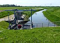 Sluice on Mill Basin Drain - geograph.org.uk - 3649906.jpg 3,601 × 2,624; 2.83 MB
-
 Sluice pipes along Mill Basin Drain - geograph.org.uk - 3649909.jpg 3,527 × 2,549; 2.58 MB
-

-
 Small pumping station, Wiggenhall St Germans - Inlet - geograph.org.uk - 2249586.jpg 2,848 × 2,136; 3.1 MB
-
 Smeeth Lode Drain - geograph.org.uk - 3649913.jpg 4,000 × 3,000; 3.54 MB
-
 Smeeth Lode pumping station - geograph.org.uk - 6515543.jpg 1,024 × 768; 144 KB
-
 South along Eau Brink Road - geograph.org.uk - 3653127.jpg 4,000 × 3,000; 3.62 MB
-
 South along the Middle Level Main Drain - geograph.org.uk - 5329139.jpg 800 × 599; 141 KB
-

-
 St Germans Hall (geograph 3648583).jpg 3,921 × 2,708; 3.03 MB
-
 St Germans Level Crossing - geograph.org.uk - 577905.jpg 3,008 × 2,000; 2.38 MB
-
 St Germans pumping station demolition - geograph.org.uk - 2285568.jpg 2,848 × 2,136; 2.8 MB
-
 St Germans pumping stations - New and remains of old - geograph.org.uk - 2285575.jpg 2,848 × 2,136; 2.86 MB
-
 St Mary's Bridge - geograph.org.uk - 5320883.jpg 3,648 × 2,736; 3.68 MB
-

-
 Swans on the Relief Channel - geograph.org.uk - 2293942.jpg 2,848 × 2,136; 3.17 MB
-

-
 The disused piers of a pipeline bridge - geograph.org.uk - 3645605.jpg 3,581 × 2,954; 3.14 MB
-
 The disused piers of a pipeline bridge - geograph.org.uk - 3645825.jpg 2,543 × 2,022; 1.41 MB
-
 The Great Ouse at Wiggenhall St Germans - geograph.org.uk - 5320919.jpg 3,648 × 2,736; 3.85 MB
-
 The Great Ouse from Magdalen Bridge - geograph.org.uk - 3710874.jpg 1,024 × 696; 953 KB
-
 The last few wagons of the sand train - geograph.org.uk - 2294145.jpg 2,848 × 2,136; 2.97 MB
-
 The Middle Level Main Drain - A view from Magdalen Bridge - geograph.org.uk - 2250187.jpg 2,848 × 2,136; 2.92 MB
-

-
 The Middle Level Main Drain near Magdalen Bridge - geograph.org.uk - 2250222.jpg 2,848 × 2,136; 3.07 MB
-
 The mist gets thicker^ - geograph.org.uk - 5030840.jpg 640 × 426; 35 KB
-
 The Relief Channel at Saddlebow - geograph.org.uk - 2293960.jpg 2,848 × 2,136; 2.98 MB
-
 The Relief Channel from Wiggenhall Bridge - geograph.org.uk - 2294020.jpg 2,848 × 2,136; 2.87 MB
-

-
 The River Great Ouse - geograph.org.uk - 2249420.jpg 2,848 × 2,136; 3.08 MB
-
 The River Great Ouse, Wiggenhall St Germans - geograph.org.uk - 2249490.jpg 2,848 × 2,136; 3.09 MB
-
 To Wiggenhall Bridge on Hastings Lane - geograph.org.uk - 3110413.jpg 640 × 480; 182 KB
-

-
 Towards the Great Ouse - geograph.org.uk - 3711973.jpg 1,200 × 900; 1.23 MB
-
 Towards Wiggenhall St Germans church - geograph.org.uk - 3712006.jpg 1,024 × 768; 1.01 MB
-

-
 Turnoff to Thiefgate Lane from Mill Road - geograph.org.uk - 5351445.jpg 3,648 × 2,736; 4.06 MB
-
 Twenty-two pylons - geograph.org.uk - 3647117.jpg 2,562 × 1,687; 1.05 MB
-
 View across Wiggenhall Bridge - geograph.org.uk - 3110430.jpg 640 × 480; 143 KB
-
 Wesleyan chapel, Saddle Bow - geograph.org.uk - 3505732.jpg 3,240 × 4,320; 3 MB
-
 Wheeled gate along Eau Brink Road - geograph.org.uk - 3652875.jpg 4,000 × 3,000; 4.68 MB
-
 Wiggenhall Bridge - geograph.org.uk - 5320951.jpg 3,648 × 2,736; 3.82 MB
-

-
 Wiggenhall St Germans (right bank) - geograph.org.uk - 5607586.jpg 640 × 360; 74 KB
-
 Wiggenhall St Germans - geograph.org.uk - 2487552.jpg 640 × 424; 72 KB
-
 Wiggenhall St Germans - geograph.org.uk - 5607613.jpg 640 × 360; 53 KB
-
 Wiggenhall St Germans bridge - geograph.org.uk - 593965.jpg 640 × 480; 89 KB
-

-

-
 Wiggenhall St Germans village sign - geograph.org.uk - 250382.jpg 517 × 640; 95 KB
-
 Wiggenhall St Germans, looking west towards the river - geograph.org.uk - 3282016.jpg 1,600 × 1,064; 256 KB
-
 Wildflowers on the river bank - geograph.org.uk - 3645829.jpg 4,000 × 3,000; 4.68 MB


.jpg)


.jpg)


_-_geograph.org.uk_-_5607586.jpg)


