Category:Wielse Sluis
Jump to navigation
Jump to search
| Object location | | View all coordinates using: OpenStreetMap |
|---|
 | |||||
| Upload media | |||||
| Instance of | |||||
|---|---|---|---|---|---|
| Part of | |||||
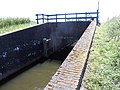
| Location | Nijkerk, Gelderland, Netherlands | ||||
| Street address |
| ||||
| Heritage designation |
| ||||
 | |||||
|
This is a category about rijksmonument number 482300
|
| Address |
|
Media in category "Wielse Sluis"
The following 6 files are in this category, out of 6 total.
-
 Kademuur - Nijkerk - 20166485 - RCE.jpg 1,200 × 1,188; 441 KB
-
 Kademuur van de sluis - Nijkerk - 20166484 - RCE.jpg 1,200 × 1,197; 390 KB
-
 Nijkerk - Sluis Stoomgemaal Hertog Reynout RM482300.JPG 4,608 × 3,456; 2.54 MB
-
 Overzicht - Nijkerk - 20166483 - RCE.jpg 1,195 × 1,200; 301 KB
-
 Sluisdeuren - Nijkerk - 20166486 - RCE.jpg 1,200 × 1,200; 392 KB
-
 Sluisdeuren - Nijkerk - 20166487 - RCE.jpg 1,200 × 1,190; 369 KB


