Category:Wieża wodna w zespole dawnej Huty Donnersmarck
Jump to navigation
Jump to search
| Object location | | View all coordinates using: OpenStreetMap |
|---|
 | |||||
| Upload media | |||||
| Instance of | |||||
|---|---|---|---|---|---|
| Location | Zabrze, Silesian Voivodeship, Poland | ||||
| Street address |
| ||||
| Heritage designation |
| ||||
| Inception |
| ||||
 | |||||
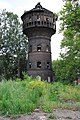
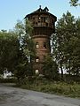
Polski: Wieża wodna z 1871 roku - Zabrze, ul. Hagera
Media in category "Wieża wodna w zespole dawnej Huty Donnersmarck"
The following 15 files are in this category, out of 15 total.
-
 D7k 3080.jpg 3,280 × 4,948; 8.43 MB
-
 Wieża ciśnień Huty Donnersmarcka szapiro.JPG 1,067 × 1,600; 2.01 MB
-
 Wieża wodna w Zabrzu (1871 r.).jpg 1,861 × 2,821; 2.49 MB
-
 Wieża wodna w zespole dawnej Huty Donnersmarck Zabrze (2) KS.JPG 3,872 × 2,592; 4.62 MB
-
 Wieża wodna w zespole dawnej Huty Donnersmarck Zabrze (3) KS.JPG 2,592 × 3,872; 4.83 MB
-
 Wieża wodna w zespole dawnej Huty Donnersmarck Zabrze KS.JPG 2,592 × 3,872; 4.83 MB
-
 Zabrze huta wieza cisnien 1.jpg 2,112 × 2,816; 4.58 MB
-
 Zabrze huta wieza cisnien 2.jpg 2,816 × 2,112; 4.16 MB
-
 Zabrze huta wieza cisnien 3.jpg 2,112 × 2,816; 4.33 MB
-
 Zabrze huta wieza cisnien 4.jpg 2,112 × 2,816; 3.94 MB
-
 Zabrze water tower dissasembling 2016.jpg 2,115 × 3,100; 4.31 MB
-
 Zabrze wieża ciśnień DSC 5445.jpg 2,238 × 3,358; 1.78 MB
-
 Zabrze wieża ciśnień Huty Zabrze 01 09 2011 P9019414.jpg 2,774 × 3,699; 2.4 MB
-
 Zabrze wieża ciśnień Huty Zabrze 01 09 2011 P9019422.jpg 2,386 × 3,180; 2.07 MB
-
 Zabrze, wieża wodna, 1871.JPG 3,244 × 4,866; 2.77 MB


.jpg)
_KS.JPG)
_KS.JPG)


