Category:Widdrington Village
Jump to navigation
Jump to search
English: Widdrington Village is a village and civil parish in the county of Northumberland, England.
village and civil parish in Northumberland, England  | |||||
| Upload media | |||||
| Instance of | |||||
|---|---|---|---|---|---|
| Location | Northumberland, North East England, England | ||||
| Population |
| ||||
 | |||||
Subcategories
This category has the following 5 subcategories, out of 5 total.
Media in category "Widdrington Village"
The following 200 files are in this category, out of 368 total.
(previous page) (next page)-
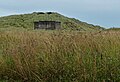
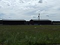
 "The Country Barn" - geograph.org.uk - 2518658.jpg 640 × 480; 76 KB
-
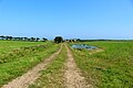
 A path near High Chibburn Farm - geograph.org.uk - 3321555.jpg 800 × 600; 105 KB
-
 A pillbox at Hemscotthill Links - geograph.org.uk - 3321487.jpg 800 × 600; 83 KB
-

-
 A tilting WWII pill box - geograph.org.uk - 3751195.jpg 1,600 × 1,200; 221 KB
-
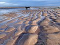
 A walk on Druridge Bay at high tide - geograph.org.uk - 6635310.jpg 640 × 486; 73 KB
-
 A wild day on Druridge beach - geograph.org.uk - 6635290.jpg 640 × 480; 80 KB
-
 A wild day on Druridge Beach - geograph.org.uk - 6635362.jpg 640 × 480; 68 KB
-
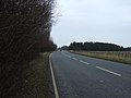
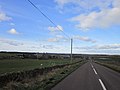
 A1068 heading north - geograph.org.uk - 3407304.jpg 640 × 480; 49 KB
-
 A1068 heading north - geograph.org.uk - 3407461.jpg 640 × 480; 95 KB
-
 A1068 heading north - geograph.org.uk - 3407465.jpg 640 × 480; 43 KB
-
 A1068 heading north - geograph.org.uk - 3407484.jpg 640 × 480; 57 KB
-
 A1068 near Holy Trinity Church, Widdrington - geograph.org.uk - 5834943.jpg 1,024 × 719; 146 KB
-
 A1068 near Houndalee Farm - geograph.org.uk - 5834936.jpg 1,024 × 763; 89 KB
-
 A1068 north of Widdrington - geograph.org.uk - 5834954.jpg 1,024 × 771; 82 KB
-
 Alpacas at Hemscott Hill - geograph.org.uk - 5870365.jpg 640 × 367; 80 KB
-
 Alpacas at Hemscott Hill - geograph.org.uk - 6252140.jpg 2,000 × 1,333; 479 KB
-
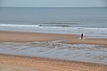
 An empty Druridge Bay - geograph.org.uk - 5675254.jpg 2,000 × 1,500; 189 KB
-
 Anti Tank cubes, Druridge Bay - geograph.org.uk - 1965855.jpg 1,280 × 853; 292 KB
-

-

-
 Approaching storm over the Northumberland Coast Path - geograph.org.uk - 3751213.jpg 1,600 × 1,117; 271 KB
-
 Arable field boundary, Hemscott Hill Farm - geograph.org.uk - 6251025.jpg 2,000 × 1,333; 544 KB
-
 Arable field near Houndalee Farm - geograph.org.uk - 6250982.jpg 2,000 × 1,333; 411 KB
-
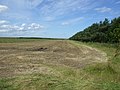
 Arable field south west of Widdrington - geograph.org.uk - 6054665.jpg 2,000 × 1,333; 391 KB
-
 Arable field with geese overhead - geograph.org.uk - 6061904.jpg 1,333 × 2,000; 245 KB
-
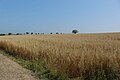
 Arable field with straw bales - geograph.org.uk - 6253923.jpg 2,000 × 1,333; 560 KB
-
 Arable field, Hemscott Hill Farm - geograph.org.uk - 6251029.jpg 2,000 × 1,333; 455 KB
-
 Arable land behind Almar Cottage - geograph.org.uk - 6251006.jpg 2,000 × 1,333; 567 KB
-
 Avocet at Cresswell Pools Nature Reserve - geograph.org.uk - 3448215.jpg 1,066 × 800; 204 KB
-
 B1337 - geograph.org.uk - 4576023.jpg 640 × 426; 50 KB
-
 Barns at High Chibburn Farm - geograph.org.uk - 2920387.jpg 3,264 × 2,448; 2.06 MB
-
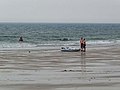 Bathers on Druridge Beach - geograph.org.uk - 2532555.jpg 640 × 480; 70 KB
-
 Beach and surf at Druridge Bay - geograph.org.uk - 5555884.jpg 1,600 × 1,060; 237 KB
-
 Beach near Hemscotthill Links - geograph.org.uk - 4840313.jpg 1,024 × 667; 114 KB
-
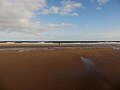
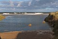
 Beach on Druridge Bay - geograph.org.uk - 5510324.jpg 1,024 × 760; 96 KB
-
 Beach, Druridge Bay - geograph.org.uk - 5675274.jpg 2,000 × 1,500; 246 KB
-
 Bench Mark, Widdrington - geograph.org.uk - 2582687.jpg 480 × 640; 69 KB
-
 Beware of Red Squirrels - geograph.org.uk - 3800652.jpg 1,600 × 1,091; 429 KB
-

-
 Blocked lay-by off the A1068 - geograph.org.uk - 3407298.jpg 640 × 480; 107 KB
-
 Blowing sand on Druridge Bay - geograph.org.uk - 5687134.jpg 2,000 × 1,500; 143 KB
-
 Breakers and spray, Druridge Bay - geograph.org.uk - 4369121.jpg 1,024 × 629; 135 KB
-
 Building on Hemscott Hill - geograph.org.uk - 4179542.jpg 640 × 428; 87 KB
-
 Bus stops at Widdrington village - geograph.org.uk - 2518655.jpg 640 × 480; 82 KB
-
 Campaigns past and present, Druridge Bay - geograph.org.uk - 4368075.jpg 1,024 × 707; 300 KB
-
 Campsite at Hemscott Hill - geograph.org.uk - 6441222.jpg 1,600 × 1,200; 357 KB
-

-
 Cattle and shelter belt - geograph.org.uk - 2518665.jpg 640 × 480; 104 KB
-
 Cattle at Cresswell Pond - geograph.org.uk - 2532558.jpg 640 × 480; 81 KB
-
 Cattle in a field north of High Chibburn - geograph.org.uk - 6253803.jpg 2,000 × 1,333; 430 KB
-
 Cattle on Hemscotthill Links - geograph.org.uk - 3600646.jpg 1,600 × 1,200; 333 KB
-
 Cattle on the links - geograph.org.uk - 3177925.jpg 4,608 × 3,456; 5.3 MB
-
 Causeway at Cresswell Pond - geograph.org.uk - 2518690.jpg 640 × 480; 95 KB
-
 Churchyard, Widdrington Parish Church - geograph.org.uk - 6061871.jpg 2,000 × 1,333; 615 KB
-
 Coal road - geograph.org.uk - 2518628.jpg 640 × 480; 123 KB
-
 Coast and Castles route at Druridge Bay - geograph.org.uk - 2518679.jpg 640 × 480; 135 KB
-
 Coast Road to Cresswell - geograph.org.uk - 5101957.jpg 1,024 × 682; 169 KB
-
 Coastal cattle grazing - geograph.org.uk - 6253928.jpg 2,000 × 1,333; 405 KB
-

-

-
 Coastal road towards Druridge - geograph.org.uk - 3048995.jpg 640 × 480; 68 KB
-
 Coastal road towards Druridge - geograph.org.uk - 3049002.jpg 640 × 480; 42 KB
-
 Colliersdean Plantation - geograph.org.uk - 3049671.jpg 1,024 × 533; 167 KB
-
 Control building, Widdrington Wind Farm - geograph.org.uk - 6061926.jpg 2,000 × 1,333; 357 KB
-
 Converted farm buildings at Druridge - geograph.org.uk - 2920396.jpg 3,264 × 2,448; 1.79 MB
-
 Converted farm buildings, Druridge - geograph.org.uk - 6252150.jpg 2,000 × 1,333; 448 KB
-
 Cottages, Houndalee Farm - geograph.org.uk - 3407305.jpg 640 × 480; 75 KB
-
 Cresswell Causeway - geograph.org.uk - 4642305.jpg 1,600 × 1,210; 294 KB
-
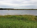
 Cresswell Pond - geograph.org.uk - 2518688.jpg 640 × 480; 78 KB
-
 Cresswell Pond - geograph.org.uk - 2518692.jpg 640 × 480; 92 KB
-
 Cresswell Pond - geograph.org.uk - 3599888.jpg 1,600 × 1,157; 208 KB
-
 Crop field near Druridge - geograph.org.uk - 3049001.jpg 640 × 480; 65 KB
-
 Crop field, Chibburn - geograph.org.uk - 3049157.jpg 640 × 480; 77 KB
-
 Cutting silage at Widdrington Moor - geograph.org.uk - 2518639.jpg 640 × 480; 91 KB
-
 Cyclists near the sea, Druridge Bay - geograph.org.uk - 4840288.jpg 1,024 × 692; 193 KB
-
 Dead bird, Widdrington - geograph.org.uk - 2582651.jpg 640 × 480; 95 KB
-
 Defenders' view - geograph.org.uk - 2533314.jpg 640 × 480; 65 KB
-
 Descent from Hemscott Hill - geograph.org.uk - 4179545.jpg 640 × 428; 79 KB
-
 Disguised pillbox, Hemscott Hill - geograph.org.uk - 5555621.jpg 1,600 × 1,060; 407 KB
-
 Ditch, Widdrington Moor - geograph.org.uk - 4554014.jpg 800 × 450; 193 KB
-
 Drain and hedgerow - geograph.org.uk - 3407475.jpg 640 × 480; 82 KB
-
 Driftwood at Helmscotthill Links - geograph.org.uk - 2533318.jpg 640 × 480; 97 KB
-
 Druridge - geograph.org.uk - 2518673.jpg 640 × 480; 87 KB
-
 Druridge Bay - geograph.org.uk - 4121742.jpg 1,600 × 1,080; 209 KB
-
 Druridge Bay - geograph.org.uk - 4121760.jpg 1,600 × 1,200; 268 KB
-
 Druridge Bay - geograph.org.uk - 4121765.jpg 1,600 × 1,136; 254 KB
-
 Druridge Bay - geograph.org.uk - 4368622.jpg 640 × 480; 130 KB
-
 Druridge Bay - geograph.org.uk - 5455246.jpg 5,152 × 3,864; 6.25 MB
-
 Druridge Bay - geograph.org.uk - 5675301.jpg 2,000 × 1,500; 222 KB
-
 Druridge Bay - geograph.org.uk - 6440589.jpg 1,600 × 1,200; 259 KB
-
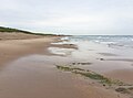
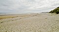
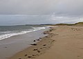
 Druridge Bay beach - geograph.org.uk - 5675180.jpg 2,000 × 1,500; 261 KB
-
 Druridge Bay beach - geograph.org.uk - 5675268.jpg 2,000 × 1,500; 182 KB
-
 Druridge Bay beach and dunes looking towards Cresswell - geograph.org.uk - 4163903.jpg 3,966 × 2,188; 4.49 MB
-
 Druridge Bay Nature Reserve - geograph.org.uk - 2518676.jpg 640 × 480; 110 KB
-
 Druridge Beach - geograph.org.uk - 5705580.jpg 1,800 × 1,012; 864 KB
-
 Druridge Beach - geograph.org.uk - 6635364.jpg 640 × 472; 56 KB
-
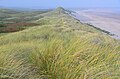
 Druridge dunes - geograph.org.uk - 4179532.jpg 640 × 428; 103 KB
-
 Druridge Links - geograph.org.uk - 2956589.jpg 640 × 315; 175 KB
-
 Druridge Pools Nature Reserve - geograph.org.uk - 5927087.jpg 640 × 438; 94 KB
-
 Druridge Pools Wildlife Reserve - geograph.org.uk - 5510327.jpg 1,024 × 768; 204 KB
-
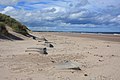
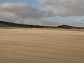
 Druridge Sands - geograph.org.uk - 919909.jpg 640 × 469; 41 KB
-
 Dunbar Burn - geograph.org.uk - 6635371.jpg 640 × 480; 55 KB
-
 Dunbar Burn at the beach, Druridge Bay - geograph.org.uk - 6287946.jpg 1,600 × 1,066; 322 KB
-
 Dunes at Chibburn Links - geograph.org.uk - 5555887.jpg 1,600 × 1,060; 433 KB
-
 Dunes, Druridge Bay - geograph.org.uk - 2956583.jpg 640 × 360; 208 KB
-
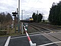
 East Coast Main Line - geograph.org.uk - 4449634.jpg 640 × 480; 88 KB
-
 East Coast Main Line from Feltonlane Level Crossing - geograph.org.uk - 5704925.jpg 1,800 × 1,013; 1.08 MB
-
 East Coast Main Line train heading north - geograph.org.uk - 3800657.jpg 1,600 × 1,203; 282 KB
-
 Emerging from the wood - geograph.org.uk - 1888429.jpg 4,000 × 3,000; 3.65 MB
-
 End of the tarmac, Chibburn Mouth - geograph.org.uk - 5555897.jpg 1,600 × 1,060; 351 KB
-
 England Coast Path at Druridge Bay - geograph.org.uk - 5927111.jpg 640 × 456; 80 KB
-

-
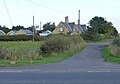
 Entering Widdrington Village - geograph.org.uk - 3321559.jpg 800 × 600; 174 KB
-
 Famous pillbox on Helmscott hill near Cresswell - geograph.org.uk - 2895277.jpg 4,752 × 3,168; 1.86 MB
-
 Farm at Hemscott Hill - geograph.org.uk - 5927077.jpg 640 × 434; 75 KB
-
 Farm at Widdrington - geograph.org.uk - 2920355.jpg 3,264 × 2,448; 1.67 MB
-
 Farm buildings at Widdrington - geograph.org.uk - 2920348.jpg 3,264 × 2,448; 1.45 MB
-
 Farm buildings, Stonecroft - geograph.org.uk - 3049017.jpg 640 × 480; 54 KB
-
 Farm shop at Widdrington - geograph.org.uk - 4371418.jpg 1,024 × 678; 126 KB
-
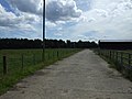
 Farm track near Houndalee Farm - geograph.org.uk - 6250993.jpg 2,000 × 1,333; 380 KB
-
 Farm track North of Widdrington - geograph.org.uk - 2920369.jpg 3,264 × 2,448; 1.91 MB
-
 Farm track west of Hemscott Hill Farm - geograph.org.uk - 6252088.jpg 2,000 × 1,333; 439 KB
-
 Farm track, High Chibburn - geograph.org.uk - 6252167.jpg 2,000 × 1,333; 474 KB
-
 Farm track, Stonecroft - geograph.org.uk - 3049019.jpg 640 × 480; 60 KB
-
 Farmers Road to Widdrington - geograph.org.uk - 2106594.jpg 2,048 × 1,536; 981 KB
-
 Farmland at Hemscott Hill, Druridge - geograph.org.uk - 4371393.jpg 1,024 × 678; 238 KB
-
 Farmland off the A1068 - geograph.org.uk - 3407292.jpg 640 × 480; 59 KB
-
 Farmland west of Widdrington - geograph.org.uk - 3407474.jpg 640 × 480; 61 KB
-
 Farmland, Hemscotthill Links - geograph.org.uk - 3048993.jpg 640 × 480; 57 KB
-
 Farmland, High Chibburn - geograph.org.uk - 3049011.jpg 640 × 480; 83 KB
-
 Farmland, High Chibburn - geograph.org.uk - 3049028.jpg 640 × 480; 78 KB
-
 Farmland, Main Bridge - geograph.org.uk - 3407469.jpg 640 × 480; 53 KB
-
 Farmland, Stonecroft - geograph.org.uk - 3049025.jpg 640 × 480; 72 KB
-
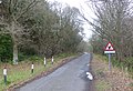
 Felton Lane - geograph.org.uk - 4577364.jpg 800 × 450; 218 KB
-
 Felton lane Level Crossing - geograph.org.uk - 4449631.jpg 640 × 480; 73 KB
-
 Felton lane Level Crossing - geograph.org.uk - 4449638.jpg 640 × 480; 66 KB
-
 Felton Lane Railway Crossing - geograph.org.uk - 2231131.jpg 1,824 × 1,216; 801 KB
-
 Feltonlane Crossing - geograph.org.uk - 2694743.jpg 640 × 480; 47 KB
-
 Fields near Widdrington - geograph.org.uk - 4553257.jpg 800 × 450; 138 KB
-
 Fishing, Druridge Bay - geograph.org.uk - 5675294.jpg 1,500 × 2,000; 292 KB
-
 Flush bracket S9207, Widdrington - geograph.org.uk - 2582612.jpg 480 × 640; 96 KB
-
 Footpath at High Chibburn - geograph.org.uk - 6252155.jpg 2,000 × 1,333; 406 KB
-
 Footpath near Widdrington - geograph.org.uk - 2582515.jpg 640 × 481; 77 KB
-
 Footpath west of Houndalee Farm - geograph.org.uk - 6054649.jpg 2,000 × 1,333; 555 KB
-
 Footpath, Main Bridge - geograph.org.uk - 3407468.jpg 640 × 480; 60 KB
-
 Footpath, Widdrington - geograph.org.uk - 2582643.jpg 640 × 481; 73 KB
-
 Former opencast land west of Widdrington - geograph.org.uk - 6061915.jpg 2,000 × 1,333; 479 KB
-
 Former opencast site, Widdrington Moor - geograph.org.uk - 4553228.jpg 800 × 533; 126 KB
-
 Garth Lane, Widdrington - geograph.org.uk - 307764.jpg 640 × 480; 89 KB
-
 Garth Lane, Widdrington - geograph.org.uk - 6061889.jpg 2,000 × 1,333; 598 KB
-
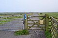
 Gate across the coastal footpath - geograph.org.uk - 3705695.jpg 4,608 × 3,456; 4.68 MB
-
 Gate near Chibburn Mouth - geograph.org.uk - 4179526.jpg 640 × 428; 95 KB
-
 Gate on Chibburn Links - geograph.org.uk - 4179528.jpg 640 × 428; 110 KB
-
 Geese on land, water and in the air - geograph.org.uk - 4641597.jpg 1,600 × 1,392; 287 KB
-
 Grassfield west of Hemscott Hill Farm - geograph.org.uk - 6251016.jpg 2,000 × 1,333; 483 KB
-
 Grassland in front of Sisters Wind Farm - geograph.org.uk - 6054655.jpg 2,000 × 1,333; 341 KB
-
 Grassland west of Stonecroft - geograph.org.uk - 6252164.jpg 2,000 × 1,333; 358 KB
-
 Graylag geese - geograph.org.uk - 1163879.jpg 640 × 428; 26 KB
-
 Grazing and woodland, Widdrington - geograph.org.uk - 3407462.jpg 640 × 480; 69 KB
-
 Grazing, Houndalee Farm - geograph.org.uk - 3407303.jpg 640 × 480; 57 KB
-
 Grazing, Widdrington - geograph.org.uk - 3407459.jpg 640 × 480; 60 KB
-
 Grazing, Widdrington Moor - geograph.org.uk - 4434485.jpg 640 × 409; 51 KB
-
 Greylag geese at Cresswell Pond - geograph.org.uk - 5926951.jpg 640 × 426; 65 KB
-
 Gulls and turbines, Widdrington - geograph.org.uk - 6287640.jpg 1,600 × 1,066; 237 KB
-
 Harrowing after ploughing - geograph.org.uk - 4702054.jpg 1,600 × 1,148; 400 KB
-
 Harvesting oats, west of Hemscott Hill Farm - geograph.org.uk - 6251020.jpg 2,000 × 1,333; 608 KB
-
 Hedge trimmer lets traffic through - geograph.org.uk - 3800677.jpg 1,600 × 1,049; 267 KB
-
 Hempscott Hill Farm - geograph.org.uk - 2889019.jpg 2,017 × 1,419; 450 KB
-
 Hemscott Hill - geograph.org.uk - 1637390.jpg 640 × 479; 92 KB
-
 Hemscott Hill - geograph.org.uk - 3600639.jpg 1,600 × 1,200; 312 KB
-
 Hemscott Hill - geograph.org.uk - 4179537.jpg 640 × 428; 71 KB
-
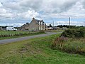
 Hemscott Hill Farm - geograph.org.uk - 3321499.jpg 800 × 600; 80 KB
-
 Hemscotthill Links - geograph.org.uk - 2956594.jpg 640 × 360; 186 KB
-
 Hemscotthill Links - geograph.org.uk - 4179540.jpg 640 × 428; 79 KB
-
 High Chibburn Farm - geograph.org.uk - 2889010.jpg 2,904 × 2,141; 1.2 MB
-
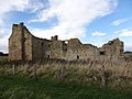
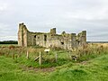
 Historic ruins at Low Chibburn - geograph.org.uk - 6287668.jpg 1,600 × 1,066; 543 KB
-
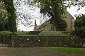 Holy Trinity, Widdrington - geograph.org.uk - 4553249.jpg 800 × 533; 263 KB
-
 Holy Trinity, Widdrington - geograph.org.uk - 4553251.jpg 800 × 533; 311 KB
-
 Houndalee Farm - geograph.org.uk - 3407301.jpg 1,024 × 613; 146 KB
-
 Houndalee Farm - geograph.org.uk - 6054643.jpg 2,000 × 1,333; 447 KB
-
 Houndalee Farm - geograph.org.uk - 6250989.jpg 2,000 × 1,333; 381 KB
-
 House and farm buildings - geograph.org.uk - 558528.jpg 640 × 425; 64 KB
-

-
 House on Widdrington Moor - geograph.org.uk - 2518634.jpg 640 × 480; 85 KB
-
 House, Widdrington - geograph.org.uk - 3407460.jpg 640 × 480; 92 KB
-
 Houses at Druridge - geograph.org.uk - 3321511.jpg 800 × 600; 93 KB
-
 Houses near Houndalee Farm - geograph.org.uk - 4702015.jpg 1,600 × 1,114; 228 KB
-
 Housing by Houndalee - geograph.org.uk - 3695174.jpg 3,633 × 2,665; 1.34 MB
-
 Invaders' view - geograph.org.uk - 2533313.jpg 640 × 480; 62 KB
-
 Lake in former open cast coal mine - geograph.org.uk - 6441156.jpg 1,600 × 1,200; 326 KB
-
 Landscaped former opencast workings - geograph.org.uk - 3800665.jpg 1,600 × 1,161; 270 KB
-
 Lone figure, Druridge Bay - geograph.org.uk - 4368098.jpg 1,024 × 678; 115 KB
-
 Look out for red squirrels - geograph.org.uk - 4449651.jpg 640 × 480; 104 KB
-
 Looking inland from the beach at Druridge - geograph.org.uk - 4121826.jpg 1,600 × 1,200; 210 KB
-
 Looking south along the coast at Druridge Bay - geograph.org.uk - 3751189.jpg 1,600 × 1,131; 134 KB
-

-
 Low Chibburn - geograph.org.uk - 3720828.jpg 1,024 × 768; 185 KB
-
 Low Chibburn - geograph.org.uk - 4642231.jpg 1,600 × 1,107; 379 KB
-
 Low Chibburn - geograph.org.uk - 5507281.jpg 1,024 × 768; 220 KB


