Category:Whitley, Cheshire
Jump to navigation
Jump to search
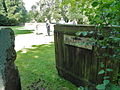
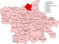
English: Whitley is a civil parish in the unitary authority of Cheshire West and Chester and the ceremonial county of Cheshire, England. It is surrounded by the parishes of Antrobus, Comberbach, Little Leigh and Dutton. It also borders Daresbury in Halton borough as well as Hatton and Stretton in Warrington borough.
civil parish in Cheshire, UK  | |||||
| Upload media | |||||
| Instance of | |||||
|---|---|---|---|---|---|
| Location | Cheshire West and Chester, Cheshire, North West England, England | ||||
 | |||||
Subcategories
This category has the following 3 subcategories, out of 3 total.
Media in category "Whitley, Cheshire"
The following 85 files are in this category, out of 85 total.
-
 A field boundary at Whitley Gorse - geograph.org.uk - 4810454.jpg 640 × 426; 111 KB
-
 A small barn on Knutsford Road - geograph.org.uk - 4808476.jpg 4,430 × 2,475; 7.14 MB
-
 A willow overlooks the pond at Higher Whitley - geograph.org.uk - 4810603.jpg 2,712 × 3,663; 7.66 MB
-

-
 A49 approaching Raddel Lane - geograph.org.uk - 2778400.jpg 640 × 480; 72 KB
-
 A49 Approaching Services at Dones Green - geograph.org.uk - 5016061.jpg 640 × 480; 353 KB
-

-
 A49 at Brookhouse Lane - geograph.org.uk - 2778363.jpg 640 × 480; 72 KB
-
 A49 at Grimsditch Lane - geograph.org.uk - 2778401.jpg 640 × 480; 66 KB
-
 A49 at Pillmoss Lane crossroads - geograph.org.uk - 2778411.jpg 640 × 480; 67 KB
-
 A49 at Street Lane junction - geograph.org.uk - 2778368.jpg 640 × 480; 60 KB
-
 A49 crosses Whitley Brook - geograph.org.uk - 2778362.jpg 640 × 480; 51 KB
-
 Bentley Farm - geograph.org.uk - 4808449.jpg 4,581 × 2,305; 6.83 MB
-
 Bowling green, Whitley - geograph.org.uk - 4316169.jpg 800 × 600; 474 KB
-
 Brookhouse Lane - geograph.org.uk - 4810471.jpg 640 × 357; 90 KB
-
 Chetwode Arms - geograph.org.uk - 4316167.jpg 800 × 600; 421 KB
-
 Cottage at Norcott Brook - geograph.org.uk - 3868810.jpg 3,994 × 2,702; 4.16 MB
-
 Dark Lane - geograph.org.uk - 1725485.jpg 2,816 × 2,112; 1.53 MB
-
 Dark Lane - geograph.org.uk - 2461361.jpg 640 × 480; 152 KB
-
 Dark Lane - geograph.org.uk - 4056310.jpg 640 × 480; 330 KB
-
 Direction Sign – Signpost - geograph.org.uk - 6505232.jpg 714 × 960; 154 KB
-
 Field, near Higher Whitley - geograph.org.uk - 5780916.jpg 1,024 × 683; 353 KB
-
 Flooded field, Grimsditch - geograph.org.uk - 5780905.jpg 1,024 × 683; 339 KB
-
 Goosebrook Lane - geograph.org.uk - 4808737.jpg 640 × 443; 87 KB
-
 Greenhill Lane - geograph.org.uk - 4810500.jpg 640 × 426; 90 KB
-
 Greenhills Farm - geograph.org.uk - 4810488.jpg 4,592 × 2,872; 7.7 MB
-
 Grimsditch Lane at its junction with Greenhill Lane - geograph.org.uk - 4808390.jpg 4,592 × 2,405; 7.7 MB
-

-
 Grimsditch Mill Pool - geograph.org.uk - 133296.jpg 640 × 480; 251 KB
-
 HGV on Tarporley Road - geograph.org.uk - 5016021.jpg 640 × 480; 330 KB
-
 High Barn - geograph.org.uk - 1725510.jpg 2,816 × 2,112; 1.24 MB
-
 High Whitley - Willowbank Farm ^ Town Pit (Pond) - geograph.org.uk - 6409308.jpg 5,184 × 2,920; 6.45 MB
-
 House on the A49 - geograph.org.uk - 3868804.jpg 4,434 × 2,553; 4.71 MB
-
 Houses at Norcott Brook, A49 - geograph.org.uk - 2778409.jpg 640 × 480; 65 KB
-
 Isolated house beside the A49 - geograph.org.uk - 2778372.jpg 640 × 480; 49 KB
-
 Junction of Pillmoss Lane and A49 - geograph.org.uk - 2936637.jpg 640 × 480; 148 KB
-
 Lake Lane - geograph.org.uk - 1725470.jpg 2,340 × 1,755; 970 KB
-
 Lake Lane - geograph.org.uk - 4808460.jpg 640 × 306; 82 KB
-
 Lay-by by A49 north of Lower Whitley - geograph.org.uk - 6312452.jpg 1,600 × 801; 469 KB
-
 Layby on Tarporley Road near to Whitley - geograph.org.uk - 5016008.jpg 640 × 427; 317 KB
-
 Limes Lane - geograph.org.uk - 6312446.jpg 1,600 × 1,200; 650 KB
-
 Limes Lane off the A49 - geograph.org.uk - 2936640.jpg 640 × 480; 159 KB
-
 Norman's Lane - geograph.org.uk - 5780908.jpg 1,024 × 683; 337 KB
-
 Norman's Lane - geograph.org.uk - 5780917.jpg 1,024 × 683; 374 KB
-
 Northbound layby on the A49 - geograph.org.uk - 2778361.jpg 640 × 480; 58 KB
-
 Northwich Road looking north - geograph.org.uk - 2523603.jpg 640 × 480; 49 KB
-
 Northwich Road-Lake Lane junction - geograph.org.uk - 2523598.jpg 640 × 480; 48 KB
-
 Old meets new - geograph.org.uk - 1110745.jpg 640 × 426; 39 KB
-
 Old Mill Farm - geograph.org.uk - 4808760.jpg 2,441 × 3,219; 5.95 MB
-
 Old Mill Lane - geograph.org.uk - 4808743.jpg 4,592 × 3,056; 7.12 MB
-
 Old Thatched Cottage.jpg 4,928 × 3,264; 8.95 MB
-

-

-

-
 Private fishing at Whitley - geograph.org.uk - 4810373.jpg 4,492 × 2,475; 6.48 MB
-
 Quaker Burial Ground, Whitley.jpg 640 × 480; 113 KB
-
 Reflections in the pond at Higher Whitley - geograph.org.uk - 4808409.jpg 4,592 × 3,056; 7.83 MB
-
 School Lane, Higher Whitley - geograph.org.uk - 4055734.jpg 640 × 480; 314 KB
-
 Sheep Pasture at Lower Whitley - geograph.org.uk - 3868416.jpg 2,606 × 1,274; 1.49 MB
-
 Sign at the entrance to Greenhills Farm - geograph.org.uk - 227027.jpg 636 × 496; 173 KB
-
 Snowdrops - geograph.org.uk - 4810505.jpg 4,592 × 3,056; 7.07 MB
-
 Southbound layby on the A49 - geograph.org.uk - 2778369.jpg 640 × 480; 61 KB
-
 Tarporley Road - geograph.org.uk - 4423946.jpg 4,592 × 3,056; 7.82 MB
-
 Tarporley Road looking north - geograph.org.uk - 3209155.jpg 640 × 480; 94 KB
-
 The Birch and Bottle - geograph.org.uk - 4466282.jpg 4,320 × 3,240; 4.52 MB
-
 The Church of St Luke, Whitley - geograph.org.uk - 4810422.jpg 4,308 × 2,383; 7.74 MB
-
 The entrance to Grimsditch Hall - geograph.org.uk - 4808332.jpg 4,488 × 2,218; 7.34 MB
-
 Town Pit - geograph.org.uk - 1725501.jpg 2,816 × 2,112; 1.62 MB
-
 Town Pit - geograph.org.uk - 1725514.jpg 2,816 × 2,112; 1.38 MB
-
 Village Lane - geograph.org.uk - 1725493.jpg 2,816 × 2,112; 1.67 MB
-

-
 Vr whitley.png 591 × 443; 63 KB
-
 Welcome to Warrington on the A49 - geograph.org.uk - 2778416.jpg 640 × 480; 72 KB
-
 Well Lane - geograph.org.uk - 4808693.jpg 3,056 × 3,480; 5.95 MB
-
 Well Lane - geograph.org.uk - 5780919.jpg 1,024 × 683; 245 KB
-
 Whitley - Chetwode Arms Inn - 20220923100939.jpg 4,032 × 3,024; 3.83 MB
-
 Whitley - Sundial in Churchyard of Church of St Luke - 20220923100746.jpg 4,032 × 3,024; 5.41 MB
-
 Whitley - Sundial in Churchyard of Church of St Luke - 20220923100750.jpg 4,032 × 3,024; 5.95 MB
-
 Whitley - Willow Bank Farmhouse - 20220923101410.jpg 4,032 × 3,024; 5.05 MB
-
 Whitley Methodist Chapel - geograph.org.uk - 2936629.jpg 640 × 480; 125 KB
-
 Whitley Methodist Chapel, Nameboard - geograph.org.uk - 2936632.jpg 640 × 480; 123 KB
-
 Whitley Methodist Chapel, Porch - geograph.org.uk - 2936634.jpg 480 × 640; 88 KB
-
 Whitley Methodist Church - geograph.org.uk - 1110716.jpg 640 × 426; 61 KB
-
 Whitley Village School - geograph.org.uk - 4316164.jpg 800 × 600; 383 KB
-
 Greenhills Farm - geograph.org.uk - 227017.jpg 640 × 459; 163 KB


_-_geograph.org.uk_-_6409308.jpg)


