Category:Whiterock, County Down
Jump to navigation
Jump to search
English: Whiterock is a small village in County Down, Northern Ireland, near Killinchy, on the shore of Strangford Lough. In the 2001 Census it had a population of 351 people. It is situated within the Ards Borough Council area. Nearby is the well known pub and restaurant Daft Eddys.
Svenska: Whiterock är ett distrikt i västra Belfast, känt för den rad incidenter som inträffat under The Troubles i Nordirland.katolska och Nationalistisk område.
village in County Down, Northern Ireland, UK | |||||
| Upload media | |||||
| Instance of | |||||
|---|---|---|---|---|---|
| Location | Northern Ireland | ||||
 | |||||
Media in category "Whiterock, County Down"
The following 26 files are in this category, out of 26 total.
-
 Ballymorran Bay, Strangford Lough - geograph.org.uk - 292455.jpg 640 × 426; 122 KB
-
 Ballymorran Quay - geograph.org.uk - 752460.jpg 640 × 480; 64 KB
-
 Car park at Whiterock Bay - geograph.org.uk - 752479.jpg 640 × 480; 57 KB
-
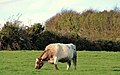 Cattle, Whiterock, Killinchy - geograph.org.uk - 3227189.jpg 640 × 400; 94 KB
-
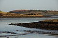
 Drowned drumlins, Strangford Lough - geograph.org.uk - 3226122.jpg 640 × 363; 68 KB
-
 Drumlin near Killinchy - geograph.org.uk - 3087576.jpg 640 × 377; 98 KB
-
 Drystone wall near Killinchy - geograph.org.uk - 3087552.jpg 640 × 423; 131 KB
-
 Head of Ballymorran Bay - geograph.org.uk - 438618.jpg 640 × 480; 73 KB
-
 Letter box, Whiterock, Killinchy - geograph.org.uk - 2929015.jpg 640 × 399; 63 KB
-
 Monkey Puzzle - geograph.org.uk - 752451.jpg 640 × 480; 88 KB
-
-
 Public toilets, Whiterock, Killinchy - geograph.org.uk - 3226417.jpg 640 × 390; 95 KB
-
 Sea aster, Strangford Lough - geograph.org.uk - 3087627.jpg 640 × 403; 132 KB
-
 Seaweed, Strangford Lough - geograph.org.uk - 3087680.jpg 640 × 421; 144 KB
-
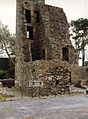 Sketrick Castle.jpg 472 × 640; 137 KB
-

-
 Sketrick Island, Strangford Lough (2) - geograph.org.uk - 3227054.jpg 640 × 366; 105 KB
-
 Southern corner of Ballymorran Bay - geograph.org.uk - 752446.jpg 640 × 480; 82 KB
-
 Strangford Lough Yacht Club - geograph.org.uk - 752468.jpg 640 × 480; 77 KB
-

-
 The Ballydorn Road near Killinchy - geograph.org.uk - 706325.jpg 640 × 390; 77 KB
-
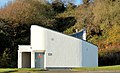
 The Clubhouse - geograph.org.uk - 137113.jpg 640 × 480; 69 KB
-
 Valerian, Whiterock, Killinchy - geograph.org.uk - 3226433.jpg 640 × 416; 71 KB
-
 View from Killinakin - geograph.org.uk - 2369922.jpg 640 × 480; 122 KB
-
 Whiterock beach scenes…Mt Baker (15907042707).jpg 4,003 × 2,669; 7.03 MB
-
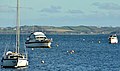
 Yachts, Strangford Lough - geograph.org.uk - 3087716.jpg 640 × 397; 101 KB


_-_geograph.org.uk_-_3226988.jpg)
_-_geograph.org.uk_-_3227054.jpg)


.jpg)
