Category:Whiteley
Appearance
community in Hampshire, England, UK | |||||
| Upload media | |||||
| Instance of | |||||
|---|---|---|---|---|---|
| Location | City of Winchester, Hampshire, South East England, England | ||||
| Population |
| ||||
 | |||||
English: Whiteley is a community in the county of Hampshire, England, near Fareham. The development straddles the boundary between two council districts: the borough of Fareham to the south and east, and the city of Winchester to the north and west.
Media in category "Whiteley"
The following 200 files are in this category, out of 225 total.
(previous page) (next page)-
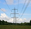
400 KV supergrid pylons in Botley Wood - geograph.org.uk - 452234.jpg 640 × 591; 135 KB
-
Absence of through route on Whiteley Lane - geograph.org.uk - 454602.jpg 640 × 427; 143 KB
-
Approaching M27 jn 9 on the A27 - geograph.org.uk - 459682.jpg 640 × 427; 122 KB
-
Autumn Tree colour in Botley Wood - geograph.org.uk - 89716.jpg 480 × 640; 135 KB
-
Avenue of trees - near Ridge Farm - geograph.org.uk - 89643.jpg 480 × 640; 167 KB
-
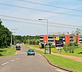
Badger Way, Whiteley - geograph.org.uk - 242041.jpg 640 × 480; 92 KB
-
Bluebells in Botley Wood - geograph.org.uk - 2387621.jpg 640 × 480; 143 KB
-
Bridge in Botley Wood - geograph.org.uk - 451165.jpg 640 × 427; 295 KB
-
Bridleway through Skylark Golf Course - geograph.org.uk - 7129766.jpg 683 × 1,024; 320 KB
-
Building work in Fontley Dell - geograph.org.uk - 458403.jpg 640 × 427; 257 KB
-
Burridge Post Office - geograph.org.uk - 89625.jpg 640 × 480; 131 KB
-
Burridge, the post office - geograph.org.uk - 625919.jpg 640 × 480; 104 KB
-
Business units at Parkway, Whiteley - geograph.org.uk - 7129313.jpg 1,024 × 683; 140 KB
-
Cineworld Cinema Whiteley.jpg 4,032 × 3,024; 3.01 MB
-
City of Winchester , M27 Motorway - geograph.org.uk - 5738921.jpg 6,000 × 4,000; 6.4 MB
-
City of Winchester , M27 Motorway - geograph.org.uk - 5738922.jpg 6,000 × 4,000; 6.25 MB
-
City of Winchester , M27 Motorway - geograph.org.uk - 5738924.jpg 6,000 × 4,000; 5.98 MB
-
Curious find in Sawpit Copse - geograph.org.uk - 2269950.jpg 640 × 480; 139 KB
-
Deer behind Whiteley Cottages - geograph.org.uk - 89719.jpg 640 × 480; 126 KB
-
Drainage work on Whiteley Way - geograph.org.uk - 7343793.jpg 1,024 × 683; 253 KB
-
Electricity sub station - geograph.org.uk - 3874064.jpg 480 × 640; 129 KB
-
Electricity Substation, Whiteley - geograph.org.uk - 454749.jpg 640 × 427; 175 KB
-
Entering Burridge southwards on the A3051 - geograph.org.uk - 219982.jpg 640 × 480; 176 KB
-
Entrance to Whiteley Farm - geograph.org.uk - 2243771.jpg 640 × 427; 218 KB
-
Fareham District , Wickham Scenery - geograph.org.uk - 3127270.jpg 2,560 × 1,920; 1.9 MB
-
Fontley Mill - geograph.org.uk - 458375.jpg 640 × 427; 203 KB
-
Footbridge over stream in Botley Wood - geograph.org.uk - 452219.jpg 640 × 427; 302 KB
-
Footpath adjacent to Whiteley Shopping Centre - geograph.org.uk - 7343823.jpg 1,024 × 683; 377 KB
-
Footpath adjacent to Whiteley Way - geograph.org.uk - 7343825.jpg 1,024 × 683; 371 KB
-
Footpath approaching Sawpit Copse - geograph.org.uk - 2243719.jpg 640 × 427; 137 KB
-
Footpath from Burridge to Ridge Farm - geograph.org.uk - 2243715.jpg 427 × 640; 247 KB
-
Footpath in Ridge Copse - geograph.org.uk - 3016897.jpg 640 × 480; 172 KB
-
Footpath into Botley Wood - geograph.org.uk - 3016907.jpg 640 × 480; 186 KB
-
Footpath into Lee Ground Coppice - geograph.org.uk - 7129315.jpg 1,024 × 683; 296 KB
-
Footpath leaving Sawpit Copse - geograph.org.uk - 2243727.jpg 427 × 640; 219 KB
-
Footpath near Whitley Way - geograph.org.uk - 3016587.jpg 640 × 480; 141 KB
-
Footpath through Botley Wood - geograph.org.uk - 7343819.jpg 1,024 × 683; 332 KB
-
Footpath to Burridge - geograph.org.uk - 2243716.jpg 640 × 427; 160 KB
-
Footpath towards Glassfield Road - geograph.org.uk - 7343747.jpg 1,024 × 683; 373 KB
-
Footpaths to Botley Wood - geograph.org.uk - 3016906.jpg 640 × 480; 197 KB
-
Forum Four, Solent Business Park - geograph.org.uk - 453282.jpg 640 × 427; 154 KB
-
Junction 9 overbridges, M27 - geograph.org.uk - 2860105.jpg 640 × 430; 34 KB
-
Junction 9, overbridge, M27 - geograph.org.uk - 2860106.jpg 640 × 200; 27 KB
-
Lee Ground Coppice - geograph.org.uk - 7129318.jpg 1,024 × 683; 370 KB
-
M27 - Whiteley Lane bridge - geograph.org.uk - 3204956.jpg 640 × 428; 66 KB
-
M27 junction 9 - geograph.org.uk - 4725692.jpg 640 × 354; 44 KB
-
M27 looking eastwards from Whiteley Lane in 1987 - geograph.org.uk - 5485155.jpg 7,198 × 4,755; 4.1 MB
-
M27 looking eastwards from Whiteley Lane in 2017 - geograph.org.uk - 5486158.jpg 3,872 × 2,592; 4.4 MB
-
M27 looking eastwards from Whiteley Lane in 2017 - zoom shot - geograph.org.uk - 5486172.jpg 3,872 × 2,592; 4.06 MB
-
M27 looking westwards from Whiteley Lane in 1987 - geograph.org.uk - 5482087.jpg 7,199 × 4,731; 3.52 MB
-
M27 looking westwards from Whiteley Lane in 2017 - geograph.org.uk - 5482965.jpg 3,319 × 2,105; 3.97 MB
-
M27 looking westwards from Whiteley Lane in 2017 - zoom shot - geograph.org.uk - 5482973.jpg 3,872 × 2,592; 4.15 MB
-
M27 westbound slip-road at Junction 9 - geograph.org.uk - 3296539.jpg 3,648 × 2,736; 1.13 MB
-
M27, Whiteley Lane Bridge - geograph.org.uk - 3735168.jpg 640 × 480; 262 KB
-
Mature trees along the boundary line - geograph.org.uk - 2243806.jpg 640 × 319; 96 KB
-
Muddy path through Ridge Copse - geograph.org.uk - 2243729.jpg 427 × 640; 191 KB
-
New houses on a new road, Whiteley Way - geograph.org.uk - 7381490.jpg 1,024 × 684; 258 KB
-
New Houses, Whiteley - geograph.org.uk - 89704.jpg 640 × 480; 109 KB
-
New housing at Whiteley - geograph.org.uk - 238707.jpg 640 × 480; 348 KB
-
New road under construction, Whiteley - geograph.org.uk - 7343752.jpg 1,024 × 683; 200 KB
-
New road under construction, Whiteley - geograph.org.uk - 7343789.jpg 1,024 × 683; 236 KB
-
Newly built houses in Brunel Way, Whiteley - geograph.org.uk - 7343741.jpg 1,024 × 683; 164 KB
-
Path in Botley Wood - geograph.org.uk - 452192.jpg 427 × 640; 228 KB
-
Path in Lee Ground Coppice - geograph.org.uk - 7129319.jpg 1,024 × 683; 324 KB
-
Path in Ridge Copse - geograph.org.uk - 7343817.jpg 1,024 × 683; 322 KB
-
Path junction in Ridge Copse - geograph.org.uk - 2243733.jpg 640 × 427; 167 KB
-
Path through Botley Woods - geograph.org.uk - 2383899.jpg 640 × 480; 129 KB
-
Path through Ridge Copse - geograph.org.uk - 2243730.jpg 535 × 640; 218 KB
-
Path through Ridge Copse - geograph.org.uk - 2243735.jpg 427 × 640; 209 KB
-
Playing Field, Whiteley - geograph.org.uk - 453393.jpg 640 × 453; 99 KB
-
Pylons at entrance to sub station - geograph.org.uk - 89665.jpg 640 × 480; 93 KB
-
Pylons in Botley Wood - geograph.org.uk - 89653.jpg 480 × 640; 104 KB
-
Quindell Golf Club Course - geograph.org.uk - 3016597.jpg 640 × 480; 150 KB
-
Recreation ground, Whiteley Village - geograph.org.uk - 2580327.jpg 640 × 482; 63 KB
-
Roundabout, Whiteley - geograph.org.uk - 2580335.jpg 640 × 482; 85 KB
-
Rubbish Train, Whiteley Village - geograph.org.uk - 774296.jpg 640 × 427; 139 KB
-
Sign at Botley Woods - geograph.org.uk - 2383889.jpg 640 × 480; 147 KB
-
Silver Birch Way, Whiteley - geograph.org.uk - 238720.jpg 640 × 480; 239 KB
-
Southampton to Fareham Railway Line - geograph.org.uk - 459726.jpg 640 × 427; 166 KB
-
Southern Water Authority Anode - geograph.org.uk - 2243761.jpg 427 × 640; 196 KB
-
Spring has arrived (33588592206).jpg 3,253 × 4,596; 7.94 MB
-
Stream near Ridge Farm (2) - geograph.org.uk - 2269936.jpg 480 × 640; 115 KB
-
Tall trees in Botley Wood - geograph.org.uk - 2387624.jpg 480 × 640; 129 KB
-
Tesco Supermarket - Whiteley - geograph.org.uk - 791907.jpg 640 × 480; 68 KB
-
The end of the road - geograph.org.uk - 2475683.jpg 640 × 482; 75 KB
-
The M27 runs under the A27 - geograph.org.uk - 7419148.jpg 3,926 × 2,566; 660 KB
-
The M27 runs under Whiteley Lane - geograph.org.uk - 7419155.jpg 4,000 × 2,664; 728 KB
-
The Whiteley Surgery, Yew Tree Drive - geograph.org.uk - 454576.jpg 640 × 427; 149 KB
-
Track and footpath in Botley Wood - geograph.org.uk - 452254.jpg 640 × 427; 209 KB
-
Track branching away from footpath, Whiteley - geograph.org.uk - 7343797.jpg 1,024 × 683; 341 KB
-
Track in Botley Wood - geograph.org.uk - 452206.jpg 640 × 427; 206 KB
-
Track to Ridge Farm - geograph.org.uk - 2270937.jpg 640 × 480; 138 KB
-
Tree-lined footpath, Whiteley - geograph.org.uk - 7343751.jpg 1,024 × 683; 374 KB
-
Waterfall behind Solent Business Park Offices - geograph.org.uk - 2071466.jpg 1,024 × 768; 207 KB
-
Waterfall in Sawpit Copse - geograph.org.uk - 2243724.jpg 640 × 427; 215 KB
-
Westbound M27 - geograph.org.uk - 3204951.jpg 640 × 428; 61 KB
-
Westbound M27 - geograph.org.uk - 3204960.jpg 640 × 428; 82 KB
-
Whispy Winter (31914592533).jpg 5,440 × 3,627; 10.65 MB
-
Whiteley Community Centre - geograph.org.uk - 453360.jpg 640 × 427; 148 KB
-
Whiteley Farm roundabout on Whiteley Way - geograph.org.uk - 7381480.jpg 1,024 × 684; 261 KB
-
Whiteley Lane - geograph.org.uk - 7129323.jpg 1,024 × 683; 312 KB
-
Whiteley Lane bridge over M27 - geograph.org.uk - 3572248.jpg 1,024 × 511; 70 KB
-
Whiteley Lane Bridge, M27 - geograph.org.uk - 2860134.jpg 640 × 430; 29 KB
-
Whiteley Lane overbridge - geograph.org.uk - 4725701.jpg 640 × 483; 51 KB
-
Whiteley Outlet Shopping Centre - geograph.org.uk - 1575934.jpg 640 × 426; 184 KB
-
Whiteley Outlet Village - geograph.org.uk - 2458864.jpg 640 × 482; 99 KB
-
Whiteley Outlet Village - geograph.org.uk - 791933.jpg 640 × 480; 74 KB
-
Whiteley Outlet Village 2 - geograph.org.uk - 791938.jpg 640 × 480; 94 KB
-
Whiteley Waste Water Pumping Station - geograph.org.uk - 455819.jpg 640 × 427; 137 KB
-
Whiteley Way (1986) - geograph.org.uk - 2356320.jpg 640 × 418; 60 KB
-
Whiteley Way, Whiteley - geograph.org.uk - 7381466.jpg 1,024 × 684; 328 KB
-
Whiteley.png 1,953 × 1,867; 6.19 MB
-
Work on the bridges at M27 junction 9 - geograph.org.uk - 3572251.jpg 1,024 × 559; 81 KB
-
Afternoon Mist in Botley Woods - geograph.org.uk - 89688.jpg 480 × 640; 142 KB
-
Botley Wood Titchfield Lane Entrance - geograph.org.uk - 89673.jpg 640 × 480; 220 KB
-
Botley Woods - geograph.org.uk - 89661.jpg 640 × 480; 202 KB
-
Botley Woods - geograph.org.uk - 89678.jpg 480 × 640; 142 KB
-
Burridge Cricket Club - geograph.org.uk - 219979.jpg 640 × 361; 86 KB
-
Concorde Close - geograph.org.uk - 238640.jpg 640 × 480; 279 KB
-
Crossing point off Leafy Lane, Whiteley - geograph.org.uk - 453319.jpg 640 × 462; 206 KB
-
Domestic junk yard off Springles Lane - geograph.org.uk - 455871.jpg 640 × 427; 172 KB
-
Elm Tree Pub - geograph.org.uk - 89711.jpg 640 × 480; 106 KB
-
Entrance to Whiteley Village - geograph.org.uk - 451151.jpg 640 × 427; 153 KB
-
Entrance to Whiteley Village - geograph.org.uk - 774289.jpg 640 × 427; 104 KB
-
Fern in Blackmoor Copse - geograph.org.uk - 452050.jpg 640 × 427; 279 KB
-
Fontley House Farm - geograph.org.uk - 458452.jpg 640 × 427; 198 KB
-
Fontley House Farm buildings - geograph.org.uk - 458445.jpg 640 × 427; 193 KB
-
Footpath through Flagpond Copse - geograph.org.uk - 455971.jpg 427 × 640; 217 KB
-
Footpath through Lee Ground Coppice - geograph.org.uk - 455827.jpg 427 × 640; 205 KB
-
Footpath through Stonyfield Copse - geograph.org.uk - 455966.jpg 427 × 640; 198 KB
-
Funtley Landfill site - geograph.org.uk - 455923.jpg 640 × 427; 209 KB
-
Great Fontley Farm - geograph.org.uk - 458369.jpg 640 × 427; 169 KB
-
Great Funtley Farm buildings - geograph.org.uk - 458370.jpg 640 × 414; 134 KB
-
Horses In Field - Whiteley Cottages - geograph.org.uk - 89633.jpg 640 × 480; 119 KB
-
Houses in Witherbed Lane, Segensworth - geograph.org.uk - 467481.jpg 640 × 427; 174 KB
-
Housing in Whiteley Way - geograph.org.uk - 453409.jpg 640 × 427; 106 KB
-
Housing near Thyme Avenue, Whiteley - geograph.org.uk - 453387.jpg 640 × 351; 99 KB
-
Industrial park - geograph.org.uk - 230601.jpg 640 × 480; 41 KB
-
Lavey's Farm, Lavey's Lane - geograph.org.uk - 455953.jpg 640 × 427; 129 KB
-
More horsiculture - geograph.org.uk - 77230.jpg 640 × 480; 129 KB
-
Northern tip of Blackmoor Copse - geograph.org.uk - 451086.jpg 640 × 427; 304 KB
-
Offices - geograph.org.uk - 242029.jpg 480 × 640; 73 KB
-
Old road parallel to the M27 - geograph.org.uk - 467482.jpg 640 × 427; 149 KB
-
Part of Bleriot Crescent, Whiteley - geograph.org.uk - 454683.jpg 640 × 427; 154 KB
-
Part of Whiteley Golf Course - geograph.org.uk - 455839.jpg 640 × 427; 123 KB
-
Part of Whiteley Golf Course - geograph.org.uk - 455858.jpg 640 × 427; 137 KB


