Category:Whitekirk
Jump to navigation
Jump to search
human settlement in East Lothian, Scotland, UK  | |||||
| Upload media | |||||
| Instance of | |||||
|---|---|---|---|---|---|
| Part of |
| ||||
| Location |
| ||||
 | |||||
Media in category "Whitekirk"
The following 17 files are in this category, out of 17 total.
-
 Barn behind Whitekirk Church - geograph.org.uk - 923250.jpg 640 × 480; 55 KB
-
 Driving range, Whitekirk - geograph.org.uk - 1234047.jpg 640 × 480; 73 KB
-
 Driving range, Whitekirk - geograph.org.uk - 1234052.jpg 640 × 480; 102 KB
-

-
 East Lothian Road Sign, Whitekirk - geograph.org.uk - 345555.jpg 480 × 640; 68 KB
-
 Heading to Whitekirk in East Lothian - geograph.org.uk - 1250384.jpg 640 × 480; 56 KB
-
 Quarry, Whitekirk - geograph.org.uk - 767832.jpg 640 × 480; 113 KB
-
 Tithe Barn, Whitekirk - geograph.org.uk - 1234008.jpg 640 × 480; 99 KB
-
 Tithe Barn, Whitekirk - geograph.org.uk - 345573.jpg 640 × 480; 90 KB
-
 Tramlines, Whitekirk - geograph.org.uk - 1027078.jpg 640 × 480; 78 KB
-
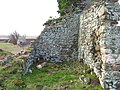 Waughton Castle and Doocot - geograph.org.uk - 137844.jpg 640 × 480; 140 KB
-
 Wheatfield near Whitekirk - geograph.org.uk - 1443755.jpg 640 × 480; 58 KB
-
 Whitekirk Bridge - geograph.org.uk - 584280.jpg 640 × 480; 96 KB
-
 Whitekirk Golf and Country Club - geograph.org.uk - 1143425.jpg 640 × 427; 49 KB
-

-
 Burn, Gleghornie. - geograph.org.uk - 140740.jpg 640 × 480; 94 KB
-
 Whitekirk Golf Course - geograph.org.uk - 8490.jpg 640 × 480; 60 KB


_-_view_from_the_east_(geograph_1870768).jpg)


