Category:Whitecross, County Armagh
Jump to navigation
Jump to search
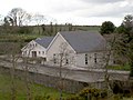
English: Whitecross is a small village in County Armagh, Northern Ireland. In the 2001 Census it had a population of 285 people. It lies within the Newry and Mourne District Council area. It currently has one public house which was built in the 1970s on the site of the old Police barracks. The original public house was situated a few hundred yards away at the bottom of the Ballymoyer Road. Among them were Doran's shop, the Creamery, the Blacksmiths and the Forester's Hall. The old creamery was held in high regard and was once noted for producing fine butter and cheese for rich Irish households, it was also one of the earliest co-operatives in the country.
village in County Armagh, Northern Ireland, UK  | |||||
| Upload media | |||||
| Instance of | |||||
|---|---|---|---|---|---|
| Location | Northern Ireland | ||||
 | |||||
Subcategories
This category has only the following subcategory.
K
Media in category "Whitecross, County Armagh"
The following 69 files are in this category, out of 69 total.
-
 "Kill Your Speed" sign on the Ballymoyer Road - geograph.org.uk - 4991306.jpg 1,200 × 1,600; 453 KB
-
 A chimneyed farm building opposite Lurgana House - geograph.org.uk - 3988032.jpg 1,024 × 749; 192 KB
-
 A dangerous crossroads in the centre of Whitecross - geograph.org.uk - 4991317.jpg 1,600 × 1,200; 522 KB
-
 Ardmore Park, off Mowhan Road, Whitecross - geograph.org.uk - 3980695.jpg 1,024 × 768; 147 KB
-

-
 Ballymoyer Road entering the village of Whitecross - geograph.org.uk - 5274405.jpg 4,000 × 1,869; 1.8 MB
-
 Ballymoyer, Whitecross - geograph.org.uk - 1442928.jpg 640 × 480; 60 KB
-
 Bar and Lounge at the cross roads in Whitecross - geograph.org.uk - 3980707.jpg 1,024 × 768; 170 KB
-
 Bend in the Lurgana Road - geograph.org.uk - 3988241.jpg 955 × 1,024; 156 KB
-
 Building foundations at Whitecross Crossroads - geograph.org.uk - 4991407.jpg 1,600 × 1,109; 440 KB
-

-
 Countryside north of Whitecross - geograph.org.uk - 5001816.jpg 1,600 × 1,199; 370 KB
-
 Dairy Farm north of Whitecross - geograph.org.uk - 3988000.jpg 1,024 × 767; 135 KB
-
 Defaced road direction signs at Whitecross Crossroads - geograph.org.uk - 4991382.jpg 1,600 × 1,200; 591 KB
-
 Drumcrow Road near Whitecross - geograph.org.uk - 1533699.jpg 640 × 480; 140 KB
-
 Drumleacht, Whitecross - geograph.org.uk - 1528196.jpg 640 × 480; 63 KB
-

-
 Drumnahoney Road near Whitecross - geograph.org.uk - 1533697.jpg 640 × 480; 148 KB
-
 Farm building opposite Lurgana House, Ballymoyer - geograph.org.uk - 3988122.jpg 1,024 × 768; 187 KB
-
 Farm buildings at Lurgana House - geograph.org.uk - 3989556.jpg 1,024 × 761; 262 KB
-
 Farmland near Glenanne - geograph.org.uk - 4991434.jpg 1,600 × 1,124; 277 KB
-
 Greyhillan Road, Whitecross - geograph.org.uk - 1533691.jpg 640 × 480; 151 KB
-
 Harvested hay-fields between Whitecross and Kingsmills - geograph.org.uk - 5274879.jpg 3,847 × 2,454; 1.41 MB
-
 House on Creggan West Road - geograph.org.uk - 4991418.jpg 1,600 × 1,130; 412 KB
-
 Houses in Corlat Drive, Whitecross - geograph.org.uk - 4991346.jpg 1,600 × 1,063; 384 KB
-
 Keadybeg Road, Kingsmills - geograph.org.uk - 1542018.jpg 640 × 480; 116 KB
-
 Kingsmills Road at Whitecross - geograph.org.uk - 1528182.jpg 640 × 480; 60 KB
-
 Lurgana House - geograph.org.uk - 3988118.jpg 1,024 × 751; 286 KB
-
 Lurgana House from the Ballymoyer Road - geograph.org.uk - 3988069.jpg 1,024 × 768; 195 KB
-

-

-

-
 Mowhan Road near Whitecross - geograph.org.uk - 729648.jpg 640 × 480; 63 KB
-

-

-

-

-

-

-
 The western end of Tullyherron Road - geograph.org.uk - 4991423.jpg 1,600 × 1,104; 452 KB
-
 The Whitecross Cross-Roads from the corner of Corlat Drive - geograph.org.uk - 5274874.jpg 3,299 × 2,347; 2.05 MB
-
 Tullyah Road, Whitecross - geograph.org.uk - 1528184.jpg 640 × 480; 64 KB
-
 View north along Mowham Road, Whitecross - geograph.org.uk - 3993946.jpg 1,024 × 754; 151 KB
-

-

-
 View south along Tullyah Road - geograph.org.uk - 3993949.jpg 1,024 × 768; 166 KB
-
 View west along Ballymoyer Road - geograph.org.uk - 3988013.jpg 869 × 1,024; 207 KB
-
 View WNW across the Creagan Valley from the Ballymoyer Road - geograph.org.uk - 5284870.jpg 3,463 × 2,388; 2.18 MB
-
 Visitor's Car Park at the Ballymoyer Forest Park - geograph.org.uk - 5284862.jpg 4,000 × 3,000; 4.36 MB
-

-
 Whitecross cross roads - geograph.org.uk - 5274873.jpg 3,596 × 2,176; 1.76 MB
-
 Whitecross Cross-Roads - geograph.org.uk - 3993941.jpg 1,024 × 633; 159 KB
-
 Whitecross, County Armagh - geograph.org.uk - 1230970.jpg 640 × 480; 51 KB
-
 Aghinturk Road, Mowhan, Markethill - geograph.org.uk - 729568.jpg 640 × 480; 93 KB
-
-
-
 Ballylane Road, Mowhan, Markethill - geograph.org.uk - 729564.jpg 640 × 480; 60 KB
-
 Cladymilltown Road, Markethill - geograph.org.uk - 729588.jpg 640 × 480; 77 KB
-
 Disused Buildings, Glenanne - geograph.org.uk - 729654.jpg 640 × 480; 61 KB
-

-

-

-
-
 Landscape, Mowhan Road - geograph.org.uk - 730176.jpg 640 × 480; 49 KB
-
 Lane off Upper Lisdrumchor Road - geograph.org.uk - 727968.jpg 640 × 480; 81 KB
-
 Lisdrumchor Upper Townland - geograph.org.uk - 727961.jpg 640 × 480; 48 KB
-
 Mowhan - geograph.org.uk - 529679.jpg 640 × 480; 104 KB
-
 Road Sign at Kilmachugh, Markethill - geograph.org.uk - 707074.jpg 640 × 480; 134 KB
-
 Shaws Lake - geograph.org.uk - 529666.jpg 640 × 480; 88 KB


_Frazer_UDR_on_Ballymoyer_Road_-_geograph.org.uk_-_3986751.jpg)


