Category:White lines (road markings)
Jump to navigation
Jump to search
Subcategories
This category has the following 2 subcategories, out of 2 total.
R
- Reflective glass beads (10 F)
V
- Vehicles crossing white lines (11 F)
Media in category "White lines (road markings)"
The following 129 files are in this category, out of 129 total.
-
 2008 05 29 - Bowie - MD564 over CSX - Ground pavement marking 2.JPG 4,000 × 3,000; 5.25 MB
-
 2008 05 29 - Bowie - MD564 over CSX - Pavement marking.JPG 4,000 × 3,000; 4.45 MB
-
 Social housing terrace, John Street, Whitworth, Lancashire, England.jpg 2,494 × 1,870; 3.76 MB
-
 The Kings School Grantham.jpg 2,264 × 1,509; 2.75 MB
-
 Bridge over Pincey Brook on Matching Road, Hatfield Heath, Essex, England 02.jpg 3,500 × 2,333; 8.55 MB
-
 Bridge over Pincey Brook on Matching Road, Hatfield Heath, Essex, England 03.jpg 3,500 × 2,333; 6.99 MB
-
 Pincey Brook bridge on Church Lane, Sheering, Essex, England 01.jpg 3,500 × 2,333; 10.75 MB
-
 Hatfield Heath Festival 2017 - car park off the A1060 road.jpg 3,500 × 1,969; 4.88 MB
-
 Stonards Hill at Coopersale Street hamlet, Essex, England.jpg 6,087 × 4,058; 17.98 MB
-
 Traffic bollards at Sainsbury's Low Hall, Chingford, London 1.jpg 5,148 × 3,861; 16.78 MB
-

-

-

-
-

-

-

-

-
 A1060 road White Roding Essex England - Black Horse Inn.jpg 5,605 × 3,153; 20.34 MB
-
 A1060 road White Roding Essex England.jpg 5,472 × 3,078; 14.17 MB
-
 Abridge - junction of Market Place and Abridge Rd (1) 6D.jpg 5,472 × 3,120; 7.18 MB
-
 Abstandsmarkierungen in der Corona-Krise, Düsseldorf Rheinufer-Treppe, 13 Juli 2020 (1).JPG 5,226 × 3,578; 3.75 MB
-
 Abstandsmarkierungen in der Corona-Krise, Düsseldorf Rheinufer-Treppe, 13 Juli 2020 (2).JPG 5,472 × 3,648; 6.06 MB
-
 Abstandsmarkierungen in der Corona-Krise, Düsseldorf Rheinufer-Treppe, 13 Juli 2020 (3).JPG 5,472 × 3,648; 6.44 MB
-
 Abstandsmarkierungen in der Corona-Krise, Düsseldorf Rheinufer-Treppe, 13 Juli 2020 (4).JPG 5,472 × 3,648; 5.81 MB
-
 Abstandsmarkierungen in der Corona-Krise, Düsseldorf Rheinufer-Treppe, 13 Juli 2020 (5).JPG 4,946 × 3,625; 5.58 MB
-
 Abstreuen mit Reflexperlen.jpg 2,613 × 3,898; 6.11 MB
-
 Along Chelmsford Road from South Street, Great Waltham, Essex, England 02.JPG 5,391 × 3,524; 14.65 MB
-
 Amboy (California, USA) -- 2012 -- 5704.jpg 4,809 × 3,206; 7.51 MB
-
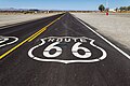
 Amboy (California, USA), Hist. Route 66 -- 2012 -- 1.jpg 5,065 × 2,570; 5.92 MB
-
 Amboy (California, USA), Hist. Route 66 -- 2012 -- 5705.jpg 4,891 × 3,261; 7.58 MB
-
 Athruzstriping.JPG 533 × 400; 178 KB
-
 Aŭtoriparejo en strato Novatorov (Tjumeno) 01.jpg 4,608 × 2,592; 3.65 MB
-
 Aŭtoriparejo en strato Novatorov (Tjumeno) 02.jpg 4,608 × 2,592; 3.7 MB
-
 Aŭtoriparejo en strato Novatorov (Tjumeno) 03.jpg 4,608 × 2,592; 3.47 MB
-
 B1393 Epping High Street Epping Essex England.jpg 5,211 × 2,931; 11.37 MB
-
 Birds Green, Essex, England - at T-junction looking east.jpg 5,472 × 3,648; 7.68 MB
-
 Birds Green, Essex, England - at T-junction looking north-west.jpg 5,472 × 3,648; 7.53 MB
-
 Bodenmarkierung Sonderzeichen Piktogramm Familie und Fahrrad auf dem Sperberweg 2023-09-16.jpg 5,472 × 3,648; 11.15 MB
-
 Bridge-4158, Dingle Peninsula, Co. Kerry, Ireland.jpg 1,920 × 1,080; 466 KB
-
 Brignais - Marquage au sol limitation à 20 kmh.jpg 3,823 × 1,835; 1.93 MB
-
 Bus parking stripes on asphalt 20170529.jpg 4,592 × 2,584; 10.22 MB
-
 Carretera W-589, Quinchao, 2019 (01).jpg 4,272 × 2,848; 5.22 MB
-
 Carretera W-589, Quinchao, 2019 (02).jpg 4,272 × 2,848; 5.48 MB
-
 Carretera W-589, Quinchao, 2019 (03).jpg 4,272 × 2,848; 4.99 MB
-
 Carretera W-589, Quinchao, 2019 (04).jpg 4,272 × 2,848; 5.56 MB
-
 Church End at Panfield Essex England 1.jpg 3,000 × 2,000; 6.58 MB
-
 Church End at Panfield Essex England 2.jpg 3,000 × 2,000; 6.02 MB
-
 Church Lane junction White Roding Essex England.jpg 5,472 × 3,078; 20.79 MB
-
 Corfu white cat bgiu.jpg 2,048 × 1,536; 1.25 MB
-
 Crow, road markings - geograph.org.uk - 1426779.jpg 640 × 480; 72 KB
-
 Different phases of life.JPG 3,968 × 2,232; 1.92 MB
-
 Dülmen, Autobahn 43, ehemaliger Notlandeplatz -- 2019 -- 2732.jpg 6,720 × 4,480; 15.65 MB
-
 Dülmen, Autobahn 43, ehemaliger Notlandeplatz -- 2019 -- 2735.jpg 4,387 × 5,484; 11.33 MB
-
 Dülmen, Autobahn 43, ehemaliger Notlandeplatz -- 2019 -- 2739.jpg 6,451 × 4,301; 13.85 MB
-
 Dülmen, Halterner Straße (Innenstadt) -- 2012 -- 8651.jpg 4,992 × 3,312; 11.85 MB
-
 Dülmen, Halterner Straße (Innenstadt) -- 2012 -- 8664.jpg 5,184 × 3,456; 11.37 MB
-
 Dülmen, Halterner Straße -- 2012 -- 8648.jpg 5,067 × 3,167; 9.19 MB
-
 Dülmen, Haus Löhning -- 2012 -- 8751.jpg 4,683 × 2,836; 6.27 MB
-
 Dülmen, Kirchspiel, Autobahn 43 (Richtung Lavesum) -- 2021 -- 8239.jpg 6,720 × 4,480; 14.64 MB
-
 Dülmen, Kirchspiel, Autobahn 43 (Richtung Lavesum) -- 2021 -- 8507+42.jpg 6,721 × 4,481; 19.66 MB
-
 Dülmen, Münsterstraße -- 2015 -- 5738.jpg 5,028 × 3,061; 7.17 MB
-
 Dülmen, Münsterstraße -- 2015 -- 5739.jpg 5,108 × 3,405; 8.28 MB
-
 Easole Street, Nonington, Kent, England - road looking southeast.jpg 3,000 × 2,250; 5.38 MB
-
 Falinta parkumsigno (Tjumeno).jpg 4,000 × 1,800; 3.01 MB
-
 Gunnera tinctoria, Quinchao, 2019 (03).jpg 4,272 × 2,848; 8.74 MB
-
 HK SW 上環 Sheung Wan 皇后大道中 Queen's Road Central bus stop marking April 2020 SS2 01.jpg 3,096 × 4,128; 2.51 MB
-
-
 Hoehenstrasse between Cobenzl and Kahlenberg.JPG 2,816 × 2,112; 2.91 MB
-
 Isoodon obesulus.jpg 1,662 × 1,171; 644 KB
-
 Italian traffic signs - strisce longitudinali (figura II 415).svg 5,500 × 3,470; 27 KB
-
 Kermán, provincia (2000) 06.jpg 1,032 × 669; 665 KB
-
 Kohlenbrennerbrücke, sett paved white lines 01.jpg 3,264 × 4,928; 8.59 MB
-
 Kohlenbrennerbrücke, sett paved white lines 02.jpg 3,652 × 2,535; 4.55 MB
-
 Lanzarote, carreteras 1993 03.jpg 1,058 × 672; 1.08 MB
-
 Lanzarote, carreteras 1993 04.jpg 1,065 × 707; 994 KB
-
 MAIN STREET, WELBY, LINCS.jpg 2,560 × 1,920; 1.41 MB
-
 Markierung.jpg 511 × 188; 74 KB
-
 Melbourne (AU), City Circle Tram -- 2019 -- 1547.jpg 6,720 × 3,780; 15.95 MB
-
 Misiones 1994 05.jpg 1,068 × 710; 578 KB
-
 'Model Traffic Area' at Lordship Recreation Ground Haringey London England 01.jpg 3,500 × 2,333; 8.28 MB
-
 'Model Traffic Area' at Lordship Recreation Ground Haringey London England 03.jpg 3,500 × 2,333; 8.55 MB
-
 'Model Traffic Area' at Lordship Recreation Ground Haringey London England 04.jpg 3,500 × 2,333; 7.84 MB
-
 'Model Traffic Area' at Lordship Recreation Ground Haringey London England 05.jpg 3,500 × 2,333; 8.21 MB
-
 Mountain View-1100094, Dingle Peninsula, Co. Kerry, Ireland.jpg 4,896 × 3,672; 6.01 MB
-
 Normanton village looking north.jpg 4,608 × 3,456; 7.65 MB
-
 Normanton village looking south.jpg 4,608 × 3,456; 6.93 MB
-
 Paris 12e - Boulevard Diderot - Depuis le quai de la Rapée.jpg 4,128 × 2,322; 4.16 MB
-
 Parking bay white line detail, Tesco, Oban, July 2020.jpg 3,504 × 2,336; 9.09 MB
-
 Pavement (26096648911).jpg 4,240 × 2,832; 7.79 MB
-
 Planta en la linea blanca del camino.JPG 1,280 × 960; 580 KB
-
 Quinchao – árbol cerca la carretera W-589, 2019.jpg 2,848 × 4,272; 6.44 MB
-
 Road 6.jpg 3,120 × 4,160; 3.71 MB
-
 Road Marking-1110129, Dingle Peninsula, Co. Kerry, Ireland.jpg 4,896 × 3,672; 4.38 MB
-
 Road Marking-1120253, Wellington, New Zealand.jpg 4,896 × 3,672; 8.97 MB
-
 Road Marking-1120254, Wellington, New Zealand.jpg 4,896 × 3,672; 4.28 MB
-
 Road surface deterioration by pavement markings.jpg 3,264 × 2,448; 4.37 MB
-
 Sign-1010439, Dingle Peninsula, Co. Kerry, Ireland.jpg 4,896 × 3,672; 3.36 MB
-
 Sign-1010485, Dingle Peninsula, Co. Kerry, Ireland.jpg 4,896 × 3,672; 4.54 MB
-
 Sign-1090981, Dingle Peninsula, Co. Kerry, Ireland.jpg 4,896 × 3,672; 8.82 MB
-
 Sign-1100066, Dingle Peninsula, Co. Kerry, Ireland.jpg 4,896 × 3,672; 2.2 MB
-
 Sign-1100095, Dingle Peninsula, Co. Kerry, Ireland.jpg 4,896 × 3,672; 1.93 MB
-
 Sign-1100497, Cork-Kerry Boundary, Ireland.jpg 4,896 × 3,672; 2.85 MB
-
 Sign-1100703, Dingle Peninsula, Co. Kerry, Ireland.jpg 4,896 × 3,672; 2.2 MB
-
 Sign-6891, Limerick, Ireland.jpg 5,184 × 3,456; 3.32 MB
-
 Signs-1070957, Dingle Peninsula, Co. Kerry, Ireland.jpg 4,896 × 3,672; 2.8 MB
-
 Signs-1090441, Dingle, Co. Kerry, Ireland.jpg 4,896 × 3,672; 7.8 MB
-
 Stripes (2136639372).jpg 2,816 × 1,584; 3.93 MB
-
 Test von Fahrbahnmarkierungen.jpg 1,600 × 1,200; 612 KB
-
 Thermoplastic spraying.jpg 547 × 220; 57 KB
-
 Tram track markings, Latrobe Street, Melbourne.jpg 2,272 × 1,704; 991 KB
-
 TW-Art155.1.png 560 × 659; 73 KB
-
 TW-Art156.png 591 × 1,003; 96 KB
-
 TW-Art157.1.png 296 × 362; 54 KB
-
 TW-Art157.2.png 500 × 768; 46 KB
-
 TW-Art158-1994.png 826 × 782; 92 KB
-
 TW-Art163.png 296 × 565; 26 KB
-
 TW-Art167.1-1989.png 197 × 633; 153 KB
-
 TW-Art167.1-1998.png 111 × 424; 17 KB
-
 TW-Art167.2-1998.png 114 × 428; 13 KB
-
 TW-Art176.png 408 × 887; 123 KB
-
 TW-Art184.1.png 179 × 631; 38 KB
-
 TW-Art184.2.png 480 × 592; 105 KB
-
 TW-Art189.png 532 × 528; 36 KB
-
 TW-Art192-1989.png 309 × 1,105; 74 KB
-
 Viña del Mar Avenida Viana, plaza Sucre, estación.jpg 3,822 × 2,548; 5.73 MB
-
 White parking stripes on asphalt.jpg 3,648 × 2,736; 7.3 MB
-
 Нанесение дорожной разметки в Москве.jpg 5,134 × 3,423; 10.2 MB
-
 Ул.Шумского на березняках. - panoramio.jpg 2,592 × 1,552; 1.02 MB


_in_the_Mountainview_section_of_Ewing_Township,_Mercer_County,_New_Jersey.jpg)
_in_the_Mountainview_section_of_Ewing_Township,_Mercer_County,_New_Jersey.jpg)
_at_Interstate_295_in_Ewing_Township,_Mercer_County,_New_Jersey.jpg)
_at_Interstate_295_in_Ewing_Township,_Mercer_County,_New_Jersey.jpg)
.JPG)
.JPG)
.JPG)
.JPG)


_6D.jpg)
.JPG)
.JPG)
.JPG)
.JPG)
.JPG)


_--_2012_--_5704.jpg)
,_Hist._Route_66_--_2012_--_1.jpg)
,_Hist._Route_66_--_2012_--_5705.jpg)

_01.jpg)
_02.jpg)
_03.jpg)


.jpg)
.jpg)
.jpg)
.jpg)


_--_2012_--_8651.jpg)
_--_2012_--_8664.jpg)


_--_2021_--_8239.jpg)
_--_2021_--_8507%2B42.jpg)


.jpg)
.jpg)


.svg)
_06.jpg)


,_City_Circle_Tram_--_2019_--_1547.jpg)


.jpg)


.jpg)


