Category:White Waltham
Jump to navigation
Jump to search
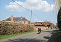
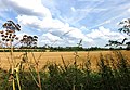
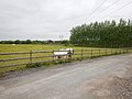
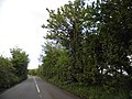
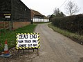
English: White Waltham is a village and civil parish, two miles west of Maidenhead, in the English county of Berkshire. It is the location of White Waltham Airfield.
Français : White Waltham est un village du Berkshire,Angleterre. Ce village est situé à environ 3 km au sud-ouest de Maidenhead.
Nederlands: White Waltham is een dorp (village en civil parish) in het Engelse graafschap Berkshire. Het dorp ligt in het district Windsor and Maidenhead en telt 2881 inwoners.
Polski: White Waltham - wieś i parafia w okręgu Windsor and Maidenhead w hrabstwie Berkshire, znajduje się tam lotnisko White Waltham Airfield.
village and civil parish in Berkshire, UK  | |||||
| Upload media | |||||
| Instance of | |||||
|---|---|---|---|---|---|
| Location | Windsor and Maidenhead, Berkshire, South East England, England | ||||
| Population |
| ||||
| Area |
| ||||
 | |||||
Subcategories
This category has the following 5 subcategories, out of 5 total.
Media in category "White Waltham"
The following 173 files are in this category, out of 173 total.
-
 1932 Waltham Church Hall - geograph.org.uk - 5738821.jpg 3,497 × 2,511; 1.73 MB
-
 A3024 passes The Royal Oak - geograph.org.uk - 3015197.jpg 3,648 × 2,736; 1.48 MB
-
 B3024 at Cedars Farm - geograph.org.uk - 5738839.jpg 3,245 × 2,235; 1.3 MB
-
 B3024 Bridge, M4 - geograph.org.uk - 5219415.jpg 640 × 426; 44 KB
-
 B3024, Paley Street - geograph.org.uk - 72823.jpg 400 × 597; 74 KB
-
 Barley, White Waltham - geograph.org.uk - 872770.jpg 640 × 480; 157 KB
-
 Barns at Smewins Farm, Shottesbrooke - geograph.org.uk - 566510.jpg 640 × 480; 113 KB
-
 Basketball, Phipps Close - geograph.org.uk - 4120313.jpg 4,000 × 3,000; 2.34 MB
-
 Bonfire, Orchard farm - geograph.org.uk - 4054177.jpg 1,991 × 1,492; 753 KB
-
 Bridleway, Orchard Farm - geograph.org.uk - 4054169.jpg 2,048 × 1,536; 1.33 MB
-
 Bulging wall - geograph.org.uk - 2253910.jpg 2,272 × 1,704; 2.74 MB
-
 Cannon Lane east of Woodlands Park - geograph.org.uk - 3017105.jpg 3,648 × 2,595; 1.8 MB
-
 Cannon Lane, Woodlands Park - geograph.org.uk - 875455.jpg 640 × 480; 121 KB
-
 Cattle, Woolley Green - geograph.org.uk - 872690.jpg 640 × 480; 103 KB
-
 Cherry Garden Lane - geograph.org.uk - 1351492.jpg 640 × 480; 70 KB
-
 Church Hill Road junction with Waltham Road - geograph.org.uk - 3016391.jpg 3,576 × 2,625; 2.03 MB
-
 Church Hill Road passes St Mary's Church - geograph.org.uk - 3016387.jpg 3,648 × 2,736; 1.54 MB
-
 Church Hill Road passes Waltham Place - geograph.org.uk - 3016377.jpg 3,648 × 2,736; 1.56 MB
-
 Church of St Mary, White Waltham - geograph.org.uk - 6546736.jpg 5,825 × 3,883; 3.27 MB
-
 Cold Harbour - geograph.org.uk - 4904.jpg 640 × 427; 209 KB
-
 Cold Harbour - geograph.org.uk - 4905.jpg 640 × 427; 210 KB
-
 Copse in farmland, Littlewick Green - geograph.org.uk - 872789.jpg 640 × 480; 93 KB
-
 Cottage, Paley Street - geograph.org.uk - 872760.jpg 640 × 480; 173 KB
-
 Countryside off Howe Lane - geograph.org.uk - 805217.jpg 640 × 424; 81 KB
-

-
 Dead hedging - geograph.org.uk - 2253931.jpg 2,272 × 1,704; 3.05 MB
-
 Disused Chapel For Sale - geograph.org.uk - 5738831.jpg 1,600 × 1,121; 621 KB
-
 Drain across the fields - geograph.org.uk - 4055540.jpg 2,048 × 1,536; 1.35 MB
-
 Drift Road - geograph.org.uk - 805204.jpg 640 × 424; 73 KB
-
 Eastbound M4, Littlefield Green Bridge - geograph.org.uk - 4481310.jpg 640 × 480; 276 KB
-
 Eastbound M4, Paley Street Footbridge - geograph.org.uk - 4481320.jpg 640 × 480; 246 KB
-
 Edge of Maidenhead - geograph.org.uk - 2866367.jpg 640 × 330; 44 KB
-
 Farmland on the edge of Maidenhead - geograph.org.uk - 3961488.jpg 640 × 398; 48 KB
-
 Farmland, White Waltham - geograph.org.uk - 814129.jpg 640 × 480; 138 KB
-
 Field by Littlefield Green - geograph.org.uk - 4462210.jpg 2,440 × 1,748; 1.11 MB
-
 Field entrance on Paley Street - geograph.org.uk - 4460802.jpg 2,560 × 1,920; 1.96 MB
-
 Field off Pendry's Lane - geograph.org.uk - 4132377.jpg 2,002 × 1,502; 958 KB
-
 Field on the edge of town - geograph.org.uk - 4122945.jpg 3,860 × 2,684; 1.93 MB
-
 Fields and Foundation Park - geograph.org.uk - 4729988.jpg 800 × 419; 72 KB
-
 Flat Farmland near Paley Street - geograph.org.uk - 5739464.jpg 3,437 × 2,399; 1.74 MB
-
 Footbridge over the M4 - geograph.org.uk - 4812063.jpg 640 × 379; 42 KB
-
 Footbridge, M4 - geograph.org.uk - 5219418.jpg 640 × 426; 44 KB
-
 Footpath corner - geograph.org.uk - 2253942.jpg 2,272 × 1,704; 2.17 MB
-
 Footpath near White Waltham - geograph.org.uk - 5738782.jpg 3,888 × 2,592; 3.35 MB
-
 Ford, Westleymill - geograph.org.uk - 73666.jpg 597 × 400; 141 KB
-
 Fruit ^ Footpath - geograph.org.uk - 4122940.jpg 3,648 × 2,704; 2.67 MB
-
 Gardens at Waltham Place - geograph.org.uk - 2433289.jpg 2,048 × 1,536; 507 KB
-
 Gas Marker by the Track - geograph.org.uk - 6024953.jpg 4,194 × 2,891; 2.52 MB
-
 Gates to Woolley Hall - geograph.org.uk - 4324467.jpg 1,024 × 749; 212 KB
-
 Getting ready to go - geograph.org.uk - 4119975.jpg 3,760 × 2,360; 1.95 MB
-
 Grassland, Woodlands Park - geograph.org.uk - 875444.jpg 640 × 480; 168 KB
-
 Great Wood at White Waltham - geograph.org.uk - 2214356.jpg 2,560 × 1,920; 966 KB
-
 Grove House, White Waltham - geograph.org.uk - 4120296.jpg 3,940 × 2,744; 1.93 MB
-
 GWR, from Highfield Lane bridge - geograph.org.uk - 78501.jpg 597 × 400; 84 KB
-
 Horse Farm near Braywoodside - geograph.org.uk - 5403124.jpg 4,608 × 3,456; 6.24 MB
-
 House on Hurst Lane, White Waltham - geograph.org.uk - 4460812.jpg 2,560 × 1,920; 2.08 MB
-
 Hurst Lane, White Waltham - geograph.org.uk - 4462060.jpg 2,560 × 1,920; 1.92 MB
-
 Hurst Lane, White Waltham - geograph.org.uk - 4462079.jpg 2,560 × 1,920; 2.09 MB
-
 Ignore sat-nav - geograph.org.uk - 2253949.jpg 2,272 × 1,704; 2.01 MB
-
 In a cutting - geograph.org.uk - 3961492.jpg 494 × 640; 89 KB
-
 In a cutting, Shottesbrooke - geograph.org.uk - 3961496.jpg 448 × 640; 85 KB
-
 Lane by Yates's Farm - geograph.org.uk - 5808570.jpg 4,597 × 2,940; 2.21 MB
-
 Little Used Footpath towards Westleymill - geograph.org.uk - 5403120.jpg 4,608 × 3,456; 6.34 MB
-
 Littlefield Green - geograph.org.uk - 5403083.jpg 4,608 × 3,456; 6.53 MB
-
 Littlefield Green Bridge - geograph.org.uk - 3719305.jpg 4,596 × 2,001; 2.07 MB
-
 Littlefield Green Bridge, M4 - geograph.org.uk - 3649402.jpg 640 × 430; 41 KB
-
 Littlefield Green Bridge, M4 - geograph.org.uk - 4812052.jpg 640 × 354; 42 KB
-
 Littlewick Green - geograph.org.uk - 6500062.jpg 3,840 × 2,160; 4.13 MB
-
 Littlewick Green - geograph.org.uk - 6763104.jpg 6,016 × 4,512; 3.57 MB
-
 M4 eastbound - geograph.org.uk - 3883821.jpg 640 × 467; 43 KB
-
 M4 eastbound - geograph.org.uk - 3883829.jpg 640 × 488; 44 KB
-
 M4 eastbound - geograph.org.uk - 5609070.jpg 640 × 428; 92 KB
-
 M4 eastbound - geograph.org.uk - 5609072.jpg 640 × 428; 88 KB
-
 M4 Motorway - geograph.org.uk - 4531989.jpg 1,280 × 720; 521 KB
-
 M4 road bridge - geograph.org.uk - 3617790.jpg 2,505 × 1,548; 1.67 MB
-
 M4 roadbridge carrying B3024 - geograph.org.uk - 2570507.jpg 3,648 × 2,736; 1.23 MB
-
 M4 westbound footbridge - geograph.org.uk - 3617573.jpg 2,280 × 1,356; 1.57 MB
-
 Maidenhead Business Park from the air - geograph.org.uk - 3989817.jpg 480 × 640; 202 KB
-
 Maidenhead from the air - geograph.org.uk - 3989821.jpg 640 × 480; 209 KB
-
 Masts, Paley Street - geograph.org.uk - 875491.jpg 640 × 480; 155 KB
-
 Meadow, White Waltham - geograph.org.uk - 814123.jpg 640 × 480; 143 KB
-
 Meadow, White Waltham - geograph.org.uk - 814127.jpg 640 × 480; 187 KB
-
 Meadow, White Waltham - geograph.org.uk - 872765.jpg 640 × 480; 118 KB
-
 Mutual back-scratching, Woolley Green - geograph.org.uk - 875274.jpg 640 × 480; 156 KB
-
 National Cycle Route 4 - geograph.org.uk - 4122400.jpg 4,000 × 3,000; 2.36 MB
-
 New Housing, Woodlands Park - geograph.org.uk - 6024960.jpg 4,838 × 3,161; 2.02 MB
-
 New Residential Development - geograph.org.uk - 4536988.jpg 1,280 × 720; 452 KB
-
 No longer the Bridge House, Paley Street - geograph.org.uk - 4460285.jpg 2,560 × 1,920; 2 MB
-
 Old Church Hall, side view - geograph.org.uk - 5738850.jpg 3,188 × 2,074; 1.22 MB
-
 Old Tyre on a Private Road - geograph.org.uk - 4121799.jpg 3,288 × 2,440; 1.63 MB
-
 Paddock Wood - geograph.org.uk - 6073771.jpg 3,589 × 1,491; 371 KB
-

-
 Paley Street, The Cut - geograph.org.uk - 1032531.jpg 640 × 480; 135 KB
-
 Phipps Close, Woodlands Park - geograph.org.uk - 4120317.jpg 3,820 × 2,776; 1.67 MB
-

-
 Preparing to resume matches - geograph.org.uk - 6546731.jpg 5,277 × 3,518; 3.01 MB
-
 Railway cutting - geograph.org.uk - 5582533.jpg 640 × 426; 98 KB
-
 Rape field by Hurst Lane - geograph.org.uk - 4462100.jpg 2,462 × 1,780; 870 KB
-
 Rape field by Hurst Lane - geograph.org.uk - 4462103.jpg 2,560 × 1,920; 1.34 MB
-
 Red Car at White Waltham - geograph.org.uk - 4116717.jpg 3,688 × 2,616; 1.52 MB
-
 Redroofs, former home of Ivor Novello - geograph.org.uk - 6500284.jpg 3,242 × 1,824; 2.45 MB
-
 Restricted byway, White Waltham - geograph.org.uk - 875487.jpg 640 × 480; 120 KB
-
 Road to Heywood Farm - geograph.org.uk - 6024950.jpg 5,059 × 3,518; 3.04 MB
-
 Rural Detached House - geograph.org.uk - 5398145.jpg 4,608 × 3,456; 5.8 MB
-
 Sheepcote Lane, Touchen End - geograph.org.uk - 6025002.jpg 1,600 × 1,079; 987 KB
-
 Shottesbrooke Park - geograph.org.uk - 695699.jpg 640 × 480; 126 KB
-
 Sideways On Farm - geograph.org.uk - 3939856.jpg 2,048 × 1,536; 1.19 MB
-
 Snowball Hill, Woodlands Park - geograph.org.uk - 875474.jpg 640 × 480; 111 KB
-
 The A4, Woolley Green - geograph.org.uk - 875306.jpg 640 × 480; 155 KB
-
 The Bale is Sprouting - geograph.org.uk - 5738791.jpg 1,600 × 1,067; 713 KB
-
 The Bayleaf Tree on Bath Road - geograph.org.uk - 4608169.jpg 2,304 × 1,728; 827 KB
-
 The Beehive, White Waltham - geograph.org.uk - 5787854.jpg 6,000 × 4,000; 7.36 MB
-
 The Cricketers pub - geograph.org.uk - 6500068.jpg 3,840 × 2,160; 3.68 MB
-
 The Cut - geograph.org.uk - 552031.jpg 640 × 480; 135 KB
-
 The Cut at Westleymill - geograph.org.uk - 1909866.jpg 640 × 480; 112 KB
-
 The Cut, Westleymill Ford - geograph.org.uk - 1909845.jpg 640 × 480; 119 KB
-
 The M4, Stud Green - geograph.org.uk - 552034.jpg 640 × 480; 132 KB
-
 The M4, White Waltham - geograph.org.uk - 875497.jpg 640 × 480; 117 KB
-
 The Old Bakery and the Parish Hall - geograph.org.uk - 5787879.jpg 6,000 × 4,000; 7.16 MB
-
 The Royal Oak Parley Street - geograph.org.uk - 5398139.jpg 4,608 × 3,456; 6.36 MB
-
 Track and farmland, Littlewick Green - geograph.org.uk - 814973.jpg 640 × 480; 115 KB
-
 Tractor on the Road - geograph.org.uk - 5739459.jpg 2,741 × 1,789; 1,021 KB
-
 Tree at Duell Farm - geograph.org.uk - 5741549.jpg 640 × 427; 78 KB
-
 Trees, White Waltham - geograph.org.uk - 1049616.jpg 640 × 480; 102 KB
-
 Turf growing off Howe lane - geograph.org.uk - 805231.jpg 640 × 424; 54 KB
-
 Village cricket at White Waltham - geograph.org.uk - 5787850.jpg 6,000 × 4,000; 6.55 MB
-
 Village Sign, Touchen End - geograph.org.uk - 6024988.jpg 1,600 × 954; 660 KB
-
 Waltham Chapel Hall - geograph.org.uk - 2253961.jpg 1,704 × 2,272; 1.36 MB
-
 Waltham Place - geograph.org.uk - 2433269.jpg 2,048 × 1,536; 538 KB
-
 Waltham Place - geograph.org.uk - 78493.jpg 597 × 400; 95 KB
-
 Waltham Road enters Woodlands Park - geograph.org.uk - 3016398.jpg 3,648 × 2,537; 1.31 MB
-
 Waltham Road, White Waltham - geograph.org.uk - 5787868.jpg 6,000 × 4,000; 7.74 MB
-
 Waltham Road, Woodlands Park - geograph.org.uk - 872703.jpg 640 × 480; 111 KB
-
 Waltham Road, Woodlands Park - geograph.org.uk - 875468.jpg 640 × 480; 133 KB
-
 War memorial in White Waltham - geograph.org.uk - 5787889.jpg 5,749 × 3,832; 3.47 MB
-
 Water trough outside Burycourt Farm - geograph.org.uk - 6551185.jpg 6,000 × 4,000; 6.62 MB
-
 West London Aero Clubhouse at White Waltham Airfield - geograph.org.uk - 3016404.jpg 3,648 × 2,736; 1.78 MB
-
 Westacott Way - geograph.org.uk - 3487538.jpg 2,048 × 1,536; 1.33 MB
-
 Westacott Way - geograph.org.uk - 4122401.jpg 4,000 × 3,000; 2.91 MB
-
 Wheat, Paley Street - geograph.org.uk - 875493.jpg 640 × 480; 133 KB
-
 Wheat, Shottesbrooke - geograph.org.uk - 872786.jpg 640 × 480; 150 KB
-
 Wheat, White Waltham - geograph.org.uk - 872750.jpg 640 × 480; 113 KB
-
 Wheat, White Waltham - geograph.org.uk - 875490.jpg 640 × 480; 116 KB
-
 White Paddock. Woodlands Park - geograph.org.uk - 872710.jpg 640 × 480; 123 KB
-
 White Waltham - geograph.org.uk - 4906.jpg 640 × 427; 238 KB
-
 White Waltham - geograph.org.uk - 73659.jpg 597 × 400; 89 KB
-
 White Waltham aerodrome, aerial - geograph.org.uk - 3515987.jpg 640 × 427; 45 KB
-
 White Waltham airfield - aircraft dispersal-parking - geograph.org.uk - 3016524.jpg 3,648 × 2,736; 1.71 MB
-

-
 White Waltham Church - geograph.org.uk - 4537001.jpg 1,280 × 720; 338 KB
-
 White Waltham to Woodlands Park road - geograph.org.uk - 2253632.jpg 2,272 × 1,704; 1.55 MB
-
 White Waltham War Memorial - geograph.org.uk - 6546726.jpg 6,000 × 4,000; 6.68 MB
-
 Windsor and Maidenhead , M4 Motorway - geograph.org.uk - 5725511.jpg 6,000 × 4,000; 6.22 MB
-
 Windsor and Maidenhead , M4 Motorway - geograph.org.uk - 5725512.jpg 6,000 × 4,000; 6.9 MB
-
 Woodlands Park - Willant Close - geograph.org.uk - 5331059.jpg 4,608 × 3,456; 6.23 MB
-
 Woodlands Park Village Centre - geograph.org.uk - 4120368.jpg 3,932 × 2,712; 2.33 MB
-
 Bird Hills Golf Centre - geograph.org.uk - 78442.jpg 597 × 400; 69 KB
-
 Bonfire, Shottesbrooke - geograph.org.uk - 695697.jpg 640 × 480; 153 KB
-
 Countryside, from Breadcroft Lane - geograph.org.uk - 78503.jpg 597 × 400; 69 KB
-
 Cox Green Community Centre - geograph.org.uk - 206709.jpg 640 × 480; 82 KB
-
 Cox Green, Highfield Lane bridge - geograph.org.uk - 206713.jpg 640 × 480; 95 KB
-
 Farmland near Stud Green - geograph.org.uk - 72806.jpg 597 × 400; 76 KB
-
 Farmland north of Paley Street - geograph.org.uk - 72795.jpg 597 × 400; 75 KB
-
 Farmland, Braywoodside - geograph.org.uk - 78446.jpg 597 × 400; 73 KB
-
 How Lane - geograph.org.uk - 73667.jpg 400 × 597; 90 KB
-
 M4 - geograph.org.uk - 72808.jpg 597 × 400; 63 KB
-
 Pastoral farmland, Cox Green - geograph.org.uk - 551987.jpg 640 × 480; 106 KB
-
 Pasture, Shottesbrooke - geograph.org.uk - 695698.jpg 640 × 480; 141 KB
-
 Railway, west of Maidenhead - geograph.org.uk - 78511.jpg 597 × 400; 97 KB
-
 Sheepcote Lane - geograph.org.uk - 78450.jpg 597 × 400; 140 KB
-
 Shottesbrooke sunset - geograph.org.uk - 524890.jpg 640 × 480; 75 KB
-
 The western edge of Maidenhead - geograph.org.uk - 78507.jpg 597 × 400; 77 KB
-
 Woodlands Park - geograph.org.uk - 78495.jpg 597 × 400; 90 KB


_-_geograph.org.uk_-_2672526.jpg)


