Category:White Hills (Arizona)
Jump to navigation
Jump to search
range of hills in Mohave County, Arizona  | |||||
| Upload media | |||||
| Instance of | |||||
|---|---|---|---|---|---|
| Location |
| ||||
| Width |
| ||||
| Elevation above sea level |
| ||||
 | |||||
Subcategories
This category has the following 3 subcategories, out of 3 total.
B
- Big Gypsum Ledges (4 F)
- Buckskin Mine (1 F)
R
- Rosie's Den (2 F)
Media in category "White Hills (Arizona)"
The following 10 files are in this category, out of 10 total.
-
 Black Mountains, Arizona (6780622011).jpg 4,000 × 3,000; 5.25 MB
-
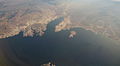
 Bonelli Bay, Lake Mead National Recreation Area, East of Las Vegas, Nevada (15830857829).jpg 4,000 × 3,000; 3.03 MB
-
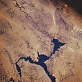
 Bonelli Bay, Lake Mead National Recreation Area, East of Las Vegas, Nevada (16014931741).jpg 4,000 × 2,190; 1.37 MB
-
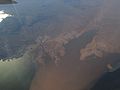
 Bonelli Bay, Near Eastern Terminus of Lake Mead, Arizona (6780622383).jpg 3,960 × 2,855; 5.34 MB
-
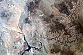 Grand Canyon area of Arizona by Sally Ride EarthKAM.jpg 4,312 × 2,868; 6.62 MB
-
 Lake Mead National Recreation Area, Nevada-Arizona (90024897).jpg 1,280 × 960; 95 KB
-
 Lake mead satellite image.jpg 584 × 852; 87 KB
-
 Lake mead.jpg 634 × 639; 160 KB
-
 Mount Wilson AZ looking northeast 1.jpg 2,400 × 1,600; 520 KB
-
 Rosie's Den. HWY 93, Arizona. Аризона, Соединённые Штаты Америки - panoramio.jpg 2,334 × 1,752; 864 KB
.jpg)
.jpg)
.jpg)
.jpg)

.jpg)


