Category:Whiskey Bottom Road
Jump to navigation
Jump to search
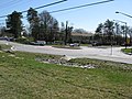
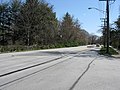
English: Whiskey Bottom Road or Whisky Bottom Road, a centuries-old road in Maryland. It runs through western Anne Arundel County and Howard County north and east of Laruel.
- (en) Whiskey Bottom Road
Media in category "Whiskey Bottom Road"
The following 12 files are in this category, out of 12 total.
-
 2008 03 20 - Whiskey Bottom Rd @ All Saints Rd - Roundabout 1.JPG 4,000 × 3,000; 4.16 MB
-
 2008 03 20 - Whiskey Bottom Rd @ All Saints Rd - Roundabout 2.JPG 4,000 × 3,000; 4.74 MB
-
 2008 03 20 - Whiskey Bottom Rd @ All Saints Rd - Roundabout 3.JPG 4,000 × 3,000; 5.44 MB
-
 2008 03 20 - Whiskey Bottom Rd @ All Saints Rd - Roundabout 4.jpg 8,491 × 2,856; 6.02 MB
-
 2008 03 20 - Whiskey Bottom Rd @ All Saints Rd - Roundabout 5.JPG 4,000 × 3,000; 4.95 MB
-
 2008 03 20 - Whiskey Bottom Rd @ Old Lantern Way - EB.JPG 4,000 × 3,000; 4.99 MB
-
 2008 03 20 - Whiskey Bottom Rd @ Old Lantern Way - WB.JPG 4,000 × 3,000; 4.39 MB
-
 North Laurel Aug 1998.jpg 4,128 × 2,986; 17.34 MB
-
 Traffic Calming June 2011.jpg 1,045 × 789; 324 KB
-
 WBR-1795.png 1,642 × 1,389; 1.97 MB
-
 Whiskey Bottom Road 2000.jpg 2,914 × 4,212; 17.97 MB
-
 Whiskey Bottom Road and US Route 1 Intersection.jpg 826 × 504; 243 KB


