Category:Wheelock, Cheshire
Jump to navigation
Jump to search
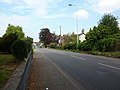
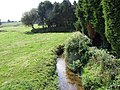
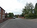
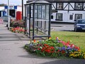
English: Wheelock is a long village in the civil parish of Sandbach which is in the unitary authority of Cheshire East and the ceremonial county of Cheshire, England. It is south of Sandbach on the road to Crewe. It was named after the River Wheelock.
village in Cheshire, United Kingdom  | |||||
| Upload media | |||||
| Instance of | |||||
|---|---|---|---|---|---|
| Location | Sandbach, Cheshire East, Cheshire, North West England, England | ||||
 | |||||
Subcategories
This category has the following 6 subcategories, out of 6 total.
C
- Christ Church, Wheelock (5 F)
T
Media in category "Wheelock, Cheshire"
The following 48 files are in this category, out of 48 total.
-
 Barn at Wheelock Hall Farm, Sandbach - geograph.org.uk - 5350447.jpg 1,024 × 682; 129 KB
-
 Christ Church, Wheelock, Graveyard - geograph.org.uk - 2528547.jpg 640 × 480; 145 KB
-
 Crewe Road, Wheelock - geograph.org.uk - 2528551.jpg 640 × 480; 133 KB
-
 Crewe Road, Wheelock - geograph.org.uk - 2528894.jpg 640 × 480; 116 KB
-
 Crewe Road, Wheelock - geograph.org.uk - 2529960.jpg 640 × 480; 114 KB
-
 Dingle Brook at Wheelock - geograph.org.uk - 3629937.jpg 1,024 × 768; 517 KB
-
 Entrance to Zan Business Park, Wheelock - geograph.org.uk - 2529965.jpg 640 × 480; 149 KB
-
 Farm buildings, Wheelock Hall Farm - geograph.org.uk - 2837639.jpg 1,024 × 768; 234 KB
-
 Forge Fields, Wheelock - geograph.org.uk - 2529972.jpg 640 × 480; 103 KB
-
 Forge Fields, Wheelock - geograph.org.uk - 2529975.jpg 640 × 480; 120 KB
-
 Former Cooperative Industrial building, Wheelock - geograph.org.uk - 3630112.jpg 1,024 × 768; 203 KB
-

-

-
 Former stable and ticket office, Wheelock 01.jpg 4,000 × 3,000; 4.62 MB
-
 Former stable and ticket office, Wheelock 02.jpg 4,000 × 3,000; 4.55 MB
-
 Former stable and ticket office, Wheelock.jpg 800 × 518; 233 KB
-
 Goldcrest (32665704226).jpg 900 × 1,200; 402 KB
-
 Green Bank Wheelock Spring 2009.jpg 2,816 × 2,112; 1.47 MB
-
 Hind Heath Road leaving Wheelock - geograph.org.uk - 2244989.jpg 640 × 480; 53 KB
-
 Nag Heads Hotel, Wheelock - geograph.org.uk - 2528905.jpg 640 × 480; 130 KB
-
 Old road sign in Wheelock - geograph.org.uk - 1263054.jpg 480 × 640; 234 KB
-

-
 Remains of Wheelock station - geograph.org.uk - 3630067.jpg 1,024 × 768; 388 KB
-
 River Wheelock - geograph.org.uk - 3629949.jpg 1,024 × 768; 261 KB
-
 Sandbach Jubilee Preperations (52117806754).jpg 3,600 × 2,400; 3.51 MB
-
 Sandy Lane, Wheelock Heath - geograph.org.uk - 411775.jpg 640 × 480; 53 KB
-
 Vodafone mast on Crewe Road, Wheelock - geograph.org.uk - 3629928.jpg 768 × 1,024; 192 KB
-

-

-
 Wheelock - Hind Heath Road - geograph.org.uk - 2244986.jpg 640 × 480; 62 KB
-

-
 Wheelock - the village centre - geograph.org.uk - 2244979.jpg 640 × 480; 66 KB
-
 Wheelock Bypass - geograph.org.uk - 3630060.jpg 1,024 × 768; 194 KB
-
 Wheelock Congregational Church - geograph.org.uk - 1263042.jpg 640 × 480; 141 KB
-
 Wheelock Hall Farm - geograph.org.uk - 172258.jpg 480 × 640; 68 KB
-
 Wheelock Hall Farm - geograph.org.uk - 2837634.jpg 1,024 × 768; 300 KB
-
 Wheelock Hall Farm - geograph.org.uk - 5350564.jpg 1,024 × 682; 226 KB
-
 Wheelock Methodist Church - geograph.org.uk - 4421582.jpg 4,608 × 3,456; 6.83 MB
-
 Wheelock Rail Trail - geograph.org.uk - 1263066.jpg 640 × 480; 309 KB
-
 Wheelock, Crewe Road - geograph.org.uk - 4421587.jpg 3,840 × 2,880; 6.43 MB
-
 Zan Business Park, Wheelock, Clock - geograph.org.uk - 2529967.jpg 640 × 480; 172 KB
-
 Zan Drive - geograph.org.uk - 1263078.jpg 640 × 480; 302 KB
-
 Zan Industrial Park, Wheelock - geograph.org.uk - 3630109.jpg 1,024 × 768; 238 KB
-
 Fields Farm - geograph.org.uk - 242601.jpg 640 × 480; 27 KB
-
 Hassall Green - geograph.org.uk - 194876.jpg 640 × 480; 102 KB
-
 Wheelock Heath Baptist Church - geograph.org.uk - 411759.jpg 640 × 480; 43 KB
-
 Wheelock Heath Farm - geograph.org.uk - 411762.jpg 640 × 481; 32 KB
-
 Wheelock Rail Trail - geograph.org.uk - 208887.jpg 640 × 480; 60 KB


.jpg)


.jpg)


