Category:Wheatley, Oxfordshire
Jump to navigation
Jump to search
village and civil parish in South Oxfordshire, England  | |||||
| Upload media | |||||
| Instance of | |||||
|---|---|---|---|---|---|
| Location | South Oxfordshire, Oxfordshire, South East England, England | ||||
| Population |
| ||||
| Area |
| ||||
| official website | |||||
 | |||||
Subcategories
This category has the following 12 subcategories, out of 12 total.
F
- Wheatley Fire Station (2 F)
G
- The George Gallery, Wheatley (6 F)
L
- Lock Up, Wheatley (11 F)
P
V
W
- Wheatley Mill, Oxfordshire (22 F)
- Wheatley railway station (2 F)
- Wheatley War Memorial (3 F)
Media in category "Wheatley, Oxfordshire"
The following 200 files are in this category, out of 266 total.
(previous page) (next page)-
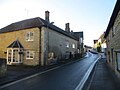
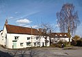
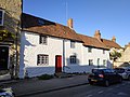 101 and 103, High Street, Wheatley.jpg 4,000 × 3,000; 5.23 MB
-
 103, High Street, Wheatley.jpg 4,000 × 3,000; 4.9 MB
-
 105, High Street, Wheatley.jpg 4,000 × 3,000; 5.95 MB
-
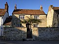
 19, Crown Road, Entrance left door.jpg 3,000 × 4,000; 5.54 MB
-
 19, Crown Road, Entrance right door.jpg 3,000 × 4,000; 5.95 MB
-
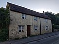
 38, High Street.jpg 4,000 × 3,000; 5.46 MB
-
 40, High Street, Wheatley.jpg 4,000 × 3,000; 5.04 MB
-
 46, High Street, Wheatley.jpg 4,000 × 3,000; 4.72 MB
-
 47, High Street, Wheatley.jpg 4,000 × 3,000; 4.87 MB
-
 5, Bell Lane.jpg 4,000 × 3,000; 4.48 MB
-
 5, Roman Road.jpg 4,000 × 3,000; 4.76 MB
-
 55, High Street,Wheatley.jpg 4,000 × 3,000; 5.27 MB
-
 82, High Street, Wheatley.jpg 4,000 × 3,000; 4.67 MB
-
 90, High Street, Wheatley.jpg 4,000 × 3,000; 3.84 MB
-
 97, High Street, Wheatley.jpg 4,000 × 3,000; 6.34 MB
-
 A glimpse of Wheatley Mill - geograph.org.uk - 5389882.jpg 1,600 × 1,064; 447 KB
-
 A house on High Street - geograph.org.uk - 4773222.jpg 1,500 × 1,125; 141 KB
-
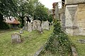
 A Row of Tombs - geograph.org.uk - 4677097.jpg 1,024 × 683; 227 KB
-
 A view from the windmill - geograph.org.uk - 5394181.jpg 1,600 × 1,200; 685 KB
-
 A View With Vegetables - geograph.org.uk - 3265792.jpg 3,244 × 2,731; 1.98 MB
-
 A40 with Park and Ride Sign, Oxford - geograph.org.uk - 325471.jpg 640 × 480; 179 KB
-
 Along side the Wall - geograph.org.uk - 4678594.jpg 1,024 × 683; 243 KB
-
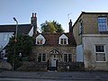
 Ambrose Farmhouse.jpg 4,000 × 3,000; 5.64 MB
-
 Angel with Harp - geograph.org.uk - 4680048.jpg 533 × 800; 142 KB
-
 Angel ^ Mandolin - geograph.org.uk - 4680050.jpg 533 × 800; 142 KB
-
 Archaeological Journal, Volume 2, 0376.png 1,566 × 816; 1 MB
-
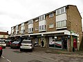
 ASDA supermarket in Wheatley - geograph.org.uk - 1306724.jpg 640 × 427; 56 KB
-
 Asda Wheatley View - geograph.org.uk - 3527059.jpg 800 × 600; 81 KB
-
 Asda, Wheatley - geograph.org.uk - 2019776.jpg 3,872 × 2,489; 2.51 MB
-
 Beech Road, Wheatley - geograph.org.uk - 3891689.jpg 1,600 × 1,200; 340 KB
-
 Bell Lane - geograph.org.uk - 4730017.jpg 1,024 × 768; 232 KB
-
 Benchmark on St Mary - geograph.org.uk - 4678581.jpg 533 × 800; 125 KB
-
 Benchmark on St Mary - geograph.org.uk - 4678585.jpg 533 × 800; 165 KB
-
 Benchmark on the windmill, Windmill Lane - geograph.org.uk - 2248594.jpg 600 × 800; 236 KB
-

-
 Benchmark on ^63 Littleworth Road - geograph.org.uk - 2250202.jpg 800 × 600; 185 KB
-
 Benchmark on ^69 Old Road - geograph.org.uk - 2250942.jpg 600 × 800; 116 KB
-

-
 Beware of the Dog - geograph.org.uk - 3116169.jpg 1,600 × 1,200; 546 KB
-
 Biscoe Court, Wheatley - geograph.org.uk - 6274346.jpg 800 × 600; 122 KB
-
 Blenheim Road running up to Old Road - geograph.org.uk - 5753152.jpg 2,700 × 2,025; 492 KB
-
 Blue Pebbles - geograph.org.uk - 4679703.jpg 1,024 × 683; 230 KB
-

-
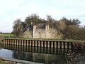
 Bridge pillar by the River Thame - geograph.org.uk - 3716975.jpg 1,500 × 990; 220 KB
-
 Broken Headstone - geograph.org.uk - 4679725.jpg 1,024 × 683; 245 KB
-
 Carting away the new bins.jpg 3,072 × 2,048; 2.91 MB
-
 Church Road - geograph.org.uk - 4678106.jpg 1,024 × 683; 142 KB
-
 Church Road - geograph.org.uk - 4680247.jpg 1,024 × 683; 197 KB
-
 Church Road Wheatley - geograph.org.uk - 2521489.jpg 1,600 × 1,200; 604 KB
-
 Church Road Wheatley - geograph.org.uk - 2521672.jpg 1,600 × 1,200; 584 KB
-
 Church Road, Wheatley - geograph.org.uk - 6274341.jpg 800 × 600; 112 KB
-
 Cinnamons on High Street - geograph.org.uk - 4859764.jpg 1,500 × 1,118; 163 KB
-
 Close up of the Flowers - geograph.org.uk - 4729044.jpg 1,024 × 768; 153 KB
-
 Clover field near New Barn - geograph.org.uk - 6656476.jpg 6,000 × 4,000; 6.09 MB
-
 COLLEGE FARM, 117, HIGH STREET, WHEATLEY.jpg 4,000 × 3,000; 6.25 MB
-
 Corner of Ambrose Rise and London Road, Wheatley - geograph.org.uk - 2522027.jpg 1,600 × 1,200; 378 KB
-
 Corner of Holton Road and Old London Road - geograph.org.uk - 2523650.jpg 1,600 × 1,200; 566 KB
-
 Corner of Old London Road and London Road Wheatley - geograph.org.uk - 2523660.jpg 1,600 × 1,200; 633 KB
-
 Cottages across the Square - geograph.org.uk - 4730152.jpg 1,024 × 768; 189 KB
-
 Country Collections on High Street - geograph.org.uk - 4773219.jpg 1,500 × 1,118; 194 KB
-
 Crisp winter morning in Wheatley.jpg 3,072 × 2,304; 1.99 MB
-
 Cromwell House on High Street - geograph.org.uk - 4874622.jpg 1,500 × 1,125; 196 KB
-
 Cromwell House, Wheatley.jpg 4,000 × 3,000; 6.56 MB
-
 Cross of Ivy - geograph.org.uk - 4679698.jpg 533 × 800; 163 KB
-
 Cross ^ Obelisk - geograph.org.uk - 4677101.jpg 1,024 × 683; 228 KB
-
 Crossroad on Church Road - geograph.org.uk - 4680246.jpg 1,024 × 683; 127 KB
-
 Crossroads of Church Road and Holloway Road Wheatley - geograph.org.uk - 2521682.jpg 1,600 × 1,200; 583 KB
-
 Door at the Base - geograph.org.uk - 4678578.jpg 1,024 × 683; 197 KB
-
 East end of St Mary - geograph.org.uk - 4679714.jpg 1,024 × 683; 121 KB
-
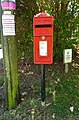 Elizabeth II postbox on Old Road, Littleworth - geograph.org.uk - 6275008.jpg 2,660 × 4,029; 3.45 MB
-
 Eroded ^ Broken - geograph.org.uk - 4680044.jpg 1,024 × 683; 209 KB
-

-
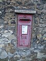 Faded postbox - geograph.org.uk - 4729059.jpg 600 × 800; 122 KB
-
 Fallen from the Second War - geograph.org.uk - 4730013.jpg 1,024 × 768; 160 KB
-
 Fan tail at Wheatley Mill - geograph.org.uk - 5394192.jpg 1,200 × 1,600; 310 KB
-
 Farm Close Road, Wheatley - geograph.org.uk - 2809263.jpg 640 × 480; 195 KB
-
 Farm track to Wheatley - geograph.org.uk - 6656451.jpg 6,000 × 4,000; 7.29 MB
-
 Farmland near Wheatley - geograph.org.uk - 3717041.jpg 1,500 × 999; 266 KB
-
 Field boundary south of Wheatley - geograph.org.uk - 6655485.jpg 6,000 × 4,000; 5.89 MB
-
 Flood plain of the River Thame - geograph.org.uk - 6655471.jpg 6,000 × 4,000; 4.89 MB
-
 Flowers in the Leaves - geograph.org.uk - 4729034.jpg 1,024 × 768; 233 KB
-
 Footbridge over a drain - geograph.org.uk - 3717016.jpg 1,500 × 999; 404 KB
-
 Footpath on the edge of Littleworth - geograph.org.uk - 3965113.jpg 3,872 × 2,592; 6.24 MB
-
 Footpath to Castle Hill - geograph.org.uk - 3717026.jpg 1,500 × 999; 383 KB
-
 Footpath to Castle Hill - geograph.org.uk - 3717030.jpg 1,500 × 999; 277 KB
-
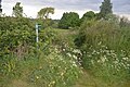 Footpath to Littleworth - geograph.org.uk - 5389891.jpg 1,600 × 1,064; 461 KB
-
 Footpath to Shotover - geograph.org.uk - 3983058.jpg 3,872 × 2,592; 4.83 MB
-
 Footpath up Castle Hill - geograph.org.uk - 3717037.jpg 1,500 × 999; 277 KB
-
 Former Post Office - geograph.org.uk - 4729074.jpg 1,024 × 768; 129 KB
-
 Friday Lane - geograph.org.uk - 4730147.jpg 1,024 × 768; 147 KB
-
 Friday Lane, Wheatley - geograph.org.uk - 2522021.jpg 1,600 × 1,200; 401 KB
-
 Gardiner Close - geograph.org.uk - 4680249.jpg 1,024 × 683; 153 KB
-
 Graves on the South Side - geograph.org.uk - 4679718.jpg 1,024 × 683; 245 KB
-
 Graves under the Yew - geograph.org.uk - 4677090.jpg 1,024 × 683; 233 KB
-
 Greystones, 88 High St, Wheatley.jpg 4,000 × 3,000; 4.76 MB
-
 Hall at the Back - geograph.org.uk - 4730154.jpg 1,024 × 768; 119 KB
-
 Headstone near the Wall - geograph.org.uk - 4677091.jpg 1,024 × 683; 247 KB
-
 Headstone ^ Tombs - geograph.org.uk - 4679711.jpg 1,024 × 683; 225 KB
-
 High Street - geograph.org.uk - 4730144.jpg 1,024 × 768; 125 KB
-
 High Street Wheatley - geograph.org.uk - 4729064.jpg 1,024 × 768; 175 KB
-
 High Street Wheatley - geograph.org.uk - 4730027.jpg 1,024 × 768; 160 KB
-
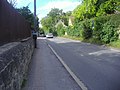
 Holloway Road - geograph.org.uk - 4676798.jpg 1,024 × 683; 188 KB
-
 Holloway Road - geograph.org.uk - 4680080.jpg 1,024 × 683; 162 KB
-
 Holloway Road - geograph.org.uk - 4729215.jpg 1,024 × 768; 175 KB
-
 Holloway Road, Wheatley - geograph.org.uk - 2521477.jpg 1,600 × 1,200; 575 KB
-
 Holloway Road, Wheatley - geograph.org.uk - 2521480.jpg 1,600 × 1,200; 515 KB
-
 Holton Road Wheatley - geograph.org.uk - 2521895.jpg 1,600 × 1,200; 613 KB
-
 Howe allotments in Windmill Lane - geograph.org.uk - 1433610.jpg 640 × 416; 84 KB
-
 Howe Allotments, Windmill Lane, Wheatley - geograph.org.uk - 589991.jpg 640 × 480; 118 KB
-
 Inscription on the base - geograph.org.uk - 4729225.jpg 1,024 × 768; 209 KB
-
 Jackson Lane, Wheatley - geograph.org.uk - 2809350.jpg 640 × 480; 100 KB
-
 Junction of Ladder Hill and Windmill Lane - geograph.org.uk - 3725647.jpg 1,024 × 683; 197 KB
-
 Kiln Lane, Wheatley - geograph.org.uk - 6274334.jpg 800 × 600; 129 KB
-
 King and Queen along the Street - geograph.org.uk - 4732873.jpg 1,024 × 768; 187 KB
-
 Kissing gate on the footpath - geograph.org.uk - 3717035.jpg 1,500 × 999; 362 KB
-
 List of the Fallen - geograph.org.uk - 4729228.jpg 1,024 × 768; 182 KB
-
 List of the Fallen 2 - geograph.org.uk - 4729231.jpg 1,024 × 768; 189 KB
-
 List of the Fallen 3 - geograph.org.uk - 4730010.jpg 1,024 × 768; 199 KB
-
 Local shops on High Street - geograph.org.uk - 4859758.jpg 1,500 × 1,125; 183 KB
-

-
 London Road Wheatley - geograph.org.uk - 4676800.jpg 1,024 × 683; 198 KB
-
 London Road, Wheatley - geograph.org.uk - 2523642.jpg 1,600 × 1,200; 266 KB
-
 London Road, Wheatley - geograph.org.uk - 4110416.jpg 3,872 × 2,592; 4.69 MB
-
 London Road, Wheatley - geograph.org.uk - 4110432.jpg 3,872 × 2,592; 4.75 MB
-

-
 Looking East on High Street - geograph.org.uk - 4729069.jpg 1,024 × 768; 146 KB
-
 Looking West - geograph.org.uk - 4677093.jpg 1,024 × 683; 208 KB
-
 Lychgate at St Mary - geograph.org.uk - 4678108.jpg 1,024 × 683; 239 KB
-
 Lychgate closeup - geograph.org.uk - 4678110.jpg 533 × 800; 141 KB
-
 Lychgate on the Path - geograph.org.uk - 4680059.jpg 533 × 800; 150 KB
-
 Memorial Day parade, Wheatley Village.jpg 3,072 × 2,304; 2.91 MB
-
 Memorial in the Distance - geograph.org.uk - 4680072.jpg 533 × 800; 135 KB
-
 Memorial in the Setting Sun - geograph.org.uk - 4730015.jpg 600 × 800; 117 KB
-
 Memorial on the Lychgate - geograph.org.uk - 4678113.jpg 1,024 × 683; 145 KB
-
 Men from the First War - geograph.org.uk - 4678384.jpg 1,024 × 683; 214 KB
-
 Morland Close - geograph.org.uk - 4676845.jpg 1,024 × 683; 168 KB
-
 Morland House Surgery - geograph.org.uk - 4680254.jpg 1,024 × 683; 147 KB
-
 Nave in St Mary the Virgin - geograph.org.uk - 4678259.jpg 1,024 × 575; 134 KB
-
 New Barn, Castle Hill - geograph.org.uk - 3891569.jpg 1,600 × 984; 380 KB
-
 New Club on the Left - geograph.org.uk - 4730159.jpg 1,024 × 768; 174 KB
-
 North side from the Gate - geograph.org.uk - 4677088.jpg 1,024 × 683; 201 KB
-
 North side of St Mary - geograph.org.uk - 4679705.jpg 1,024 × 683; 130 KB
-
 Old Houses in Wheatley - geograph.org.uk - 3914292.jpg 1,600 × 1,109; 367 KB
-
 Old London Road, Wheatley - geograph.org.uk - 2521907.jpg 1,600 × 1,200; 244 KB
-
 Old London Road, Wheatley - geograph.org.uk - 6274348.jpg 800 × 600; 187 KB
-
 Old Road heading down to Wheatley - geograph.org.uk - 5753153.jpg 2,700 × 2,025; 540 KB
-
 Old Road to Wheatley - geograph.org.uk - 2441327.jpg 1,500 × 1,000; 234 KB
-
 Old Road, Littleworth - geograph.org.uk - 6275010.jpg 4,601 × 2,770; 3.75 MB
-
 Pasture, Wheatley - geograph.org.uk - 2809345.jpg 640 × 480; 116 KB
-
 Pasture, Wheatley - geograph.org.uk - 2809847.jpg 640 × 480; 135 KB
-
 Path across the churchyard - geograph.org.uk - 4678267.jpg 1,024 × 683; 208 KB
-
 Path by an oat field - geograph.org.uk - 6656456.jpg 6,000 × 4,000; 5.82 MB
-
 Path by the River Thame - geograph.org.uk - 6655448.jpg 6,000 × 4,000; 6.77 MB
-
 Path to the War memorial - geograph.org.uk - 4729217.jpg 1,024 × 768; 234 KB
-
 Path up to New Barn - geograph.org.uk - 6656483.jpg 6,000 × 4,000; 6.34 MB
-
 Pipes over the River Thame - geograph.org.uk - 3717019.jpg 1,500 × 999; 272 KB
-
 Porch on St Mary - geograph.org.uk - 4678126.jpg 533 × 800; 123 KB
-
 Porch ^ Spire - geograph.org.uk - 4678134.jpg 533 × 800; 96 KB
-
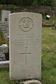 Private A.H.J.Kibble - geograph.org.uk - 4678393.jpg 533 × 800; 103 KB
-
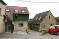
 Private road (footpath) - geograph.org.uk - 6274337.jpg 800 × 600; 162 KB
-
 Pub sign on High Street - geograph.org.uk - 4732871.jpg 600 × 800; 115 KB
-
 Public conveniences at A40 layby. - geograph.org.uk - 325409.jpg 640 × 480; 118 KB
-
 River Thame near Wheatley - geograph.org.uk - 6655438.jpg 6,000 × 4,000; 5.67 MB
-
 River Thame near Wheatley - geograph.org.uk - 6655461.jpg 6,000 × 4,000; 3.96 MB
-
 Road to the Sports Grounds - geograph.org.uk - 4676801.jpg 1,024 × 683; 144 KB
-
 Roman Road, Wheatley - geograph.org.uk - 2522029.jpg 1,600 × 1,200; 583 KB
-
 Roman Road, Wheatley - geograph.org.uk - 3958533.jpg 1,024 × 640; 175 KB
-
 School beyond the Gate - geograph.org.uk - 4680056.jpg 1,024 × 683; 217 KB
-
 School Gate - geograph.org.uk - 4680061.jpg 1,024 × 683; 220 KB
-
 Shop on the Corner - geograph.org.uk - 4729053.jpg 1,024 × 768; 116 KB
-
 Shrub on the Grave - geograph.org.uk - 4678484.jpg 533 × 800; 135 KB
-
 Sign by the Gate - geograph.org.uk - 4678129.jpg 1,024 × 683; 187 KB
-
 Sign for the Kings Arms, Wheatley - geograph.org.uk - 6274344.jpg 624 × 800; 150 KB
-
-
 Snobby Dogs and Crumbs on High Street - geograph.org.uk - 4859768.jpg 1,500 × 1,026; 146 KB
-
 St Mary from the West - geograph.org.uk - 4680052.jpg 533 × 800; 97 KB
-
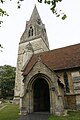
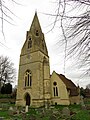 St Mary the Virgin church in Wheatley - geograph.org.uk - 4874630.jpg 1,125 × 1,500; 273 KB
-
 St Mary the Virgin Church, Wheatley - geograph.org.uk - 6274338.jpg 640 × 480; 92 KB
-
 St Mary's Church Wheatley - geograph.org.uk - 4677098.jpg 1,024 × 683; 130 KB
-
 St Mary, Wheatley - geograph.org.uk - 5360005.jpg 640 × 360; 62 KB
-

-
 Stone barn on Church Road, Wheatley - geograph.org.uk - 6274340.jpg 800 × 589; 94 KB
-
 Sun on the Corner - geograph.org.uk - 4730157.jpg 1,024 × 768; 133 KB
-
 Sunnyside, Wheatley - geograph.org.uk - 4110436.jpg 3,872 × 2,592; 4.54 MB
-
 Taylors Services on High Street - geograph.org.uk - 4859746.jpg 1,500 × 1,125; 221 KB
-
 THE CREST, 37, HIGH STREET, WHEATLEY.jpg 3,000 × 4,000; 4.51 MB
-
 The Glebe - geograph.org.uk - 4676856.jpg 1,024 × 683; 181 KB
-
 The Glebe on the Right - geograph.org.uk - 4676855.jpg 1,024 × 683; 178 KB
-
 The junction of Kiln Lane and Westfield Road - geograph.org.uk - 3983090.jpg 3,872 × 2,592; 4.39 MB
-
 The King ^ Queen - geograph.org.uk - 4732868.jpg 600 × 800; 98 KB
-
 The King ^ Queen on High Street - geograph.org.uk - 4859753.jpg 1,500 × 1,145; 224 KB
-
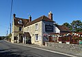 The Kings Arms, Wheatley - geograph.org.uk - 6274342.jpg 800 × 562; 116 KB
-
 The lych gate to St Mary the Virgin Church - geograph.org.uk - 4874626.jpg 1,118 × 1,500; 261 KB
-
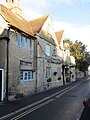
 The Manor House - geograph.org.uk - 4730229.jpg 1,024 × 768; 239 KB
-
 The Medical Centre - geograph.org.uk - 4680251.jpg 1,024 × 683; 137 KB
-
 The Merry Bells - geograph.org.uk - 3891618.jpg 1,600 × 1,082; 380 KB
-
 The Merry Bells - geograph.org.uk - 4730024.jpg 1,024 × 768; 166 KB
-
 The Merry Bells village hall on High Street - geograph.org.uk - 4859773.jpg 1,500 × 1,125; 213 KB
-
 The Nativity - geograph.org.uk - 4678264.jpg 1,024 × 575; 105 KB
-
 The New Club, Wheatley - geograph.org.uk - 6274332.jpg 800 × 569; 104 KB


_-_geograph.org.uk_-_6274337.jpg)


