Category:Wheatfield, Oxfordshire
Jump to navigation
Jump to search
English: Wheatfield is a village and civil parish in the South Oxfordshire district, about south of Thame in Oxfordshire.
civil parish in South Oxfordshire, England  | |||||
| Upload media | |||||
| Instance of | |||||
|---|---|---|---|---|---|
| Location | South Oxfordshire, Oxfordshire, South East England, England | ||||
| Population |
| ||||
 | |||||
Subcategories
This category has the following 2 subcategories, out of 2 total.
P
- Wheatfield Park Coach House (2 F)
Media in category "Wheatfield, Oxfordshire"
The following 44 files are in this category, out of 44 total.
-

-

-

-

-

-

-

-
 Between Wheatfield and South Weston - geograph.org.uk - 139828.jpg 640 × 480; 87 KB
-
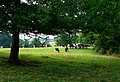 Cow gathering near Wheatfield - geograph.org.uk - 3879049.jpg 1,024 × 699; 775 KB
-
 Crosses on the north side - geograph.org.uk - 5735728.jpg 1,024 × 683; 178 KB
-
 East end and north side - geograph.org.uk - 5735723.jpg 1,024 × 683; 102 KB
-
 Farmland, Wheatfield - geograph.org.uk - 2813616.jpg 640 × 480; 140 KB
-
 Farmland, Wheatfield - geograph.org.uk - 2813632.jpg 640 × 480; 130 KB
-
 Farmland, Wheatfield - geograph.org.uk - 2813654.jpg 640 × 480; 131 KB
-
 Farmland, Wheatfield - geograph.org.uk - 6717240.jpg 1,024 × 683; 286 KB
-
 Graves at the east end - geograph.org.uk - 5735731.jpg 1,024 × 683; 158 KB
-
 He'll Go Under - geograph.org.uk - 3434916.jpg 2,334 × 1,782; 1.09 MB
-
 Interior of St Andrew's Church, Wheatfield - geograph.org.uk - 1963707.jpg 1,600 × 1,200; 232 KB
-
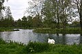 Lake, Adwell - geograph.org.uk - 1860414.jpg 640 × 427; 99 KB
-
 Lane from Stoke Talmage - geograph.org.uk - 814856.jpg 640 × 480; 87 KB
-
 Lane junction for Adwell and South Weston - geograph.org.uk - 2894024.jpg 3,648 × 2,736; 1.64 MB
-
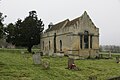
 North side of St Andrew's - geograph.org.uk - 5735724.jpg 1,024 × 683; 108 KB
-
 Porch on the west end - geograph.org.uk - 5735727.jpg 533 × 800; 104 KB
-
 Road towards Tetsworth - geograph.org.uk - 6422760.jpg 1,024 × 684; 382 KB
-
 Road towards Tetsworth - geograph.org.uk - 6422768.jpg 1,024 × 684; 250 KB
-

-
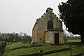
 St Andrew's across the field - geograph.org.uk - 5735719.jpg 1,024 × 683; 134 KB
-
 St Andrew's church Wheatfield - geograph.org.uk - 3905525.jpg 4,320 × 3,240; 6.66 MB
-
 St Andrew, Wheatfield - geograph.org.uk - 1860382.jpg 640 × 427; 57 KB
-
 St Andrew, Wheatfield - geograph.org.uk - 1860391.jpg 640 × 427; 64 KB
-
 St Andrews east end - geograph.org.uk - 5735721.jpg 1,024 × 683; 124 KB
-
 St Andrews over the fence - geograph.org.uk - 5735732.jpg 1,024 × 683; 129 KB
-
 St Andrews Wheatfield - geograph.org.uk - 5735718.jpg 1,024 × 683; 127 KB
-
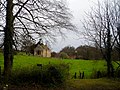
 Stoke Grange - geograph.org.uk - 4864730.jpg 1,024 × 635; 173 KB
-
 To the west end - geograph.org.uk - 5735725.jpg 1,024 × 683; 107 KB
-
 Tombs near the east end - geograph.org.uk - 5735729.jpg 1,024 × 683; 168 KB
-
 Towards Stoke Grange - geograph.org.uk - 4864888.jpg 1,600 × 1,067; 490 KB
-
 Trees in Wheatfield Park - geograph.org.uk - 2425668.jpg 3,264 × 2,272; 1.18 MB
-
 View from St. Andrews Churchyard - geograph.org.uk - 2423009.jpg 3,264 × 2,448; 1.29 MB
-
 Wheatfield Cottages - geograph.org.uk - 3434919.jpg 2,560 × 1,920; 2.02 MB
-
 Wheatfield Park and St Andrew's Church - geograph.org.uk - 3905531.jpg 4,320 × 3,240; 4.43 MB
-
 Wheatfield, Wheatfield - geograph.org.uk - 932723.jpg 640 × 480; 172 KB
-
 Winter Tree Colours - geograph.org.uk - 4864906.jpg 1,024 × 683; 252 KB
-

_-_geograph.org.uk_-_3943817.jpg)
_-_geograph.org.uk_-_3943820.jpg)
_-_geograph.org.uk_-_3943821.jpg)
_-_geograph.org.uk_-_3943823.jpg)
_-_geograph.org.uk_-_3943824.jpg)
_-_geograph.org.uk_-_3943827.jpg)
_-_geograph.org.uk_-_3943829.jpg)


_-_geograph.org.uk_-_3937707.jpg)


