Category:Whatton-in-the-Vale
Jump to navigation
Jump to search
English: Whatton-in-the-Vale is a village and civil parish in the English county of Nottinghamshire.

village in Nottinghamshire, England, UK | |||||
| Upload media | |||||
| Instance of | |||||
|---|---|---|---|---|---|
| Location | Rushcliffe, Nottinghamshire, East Midlands, England | ||||
 | |||||
Subcategories
This category has only the following subcategory.
Media in category "Whatton-in-the-Vale"
The following 105 files are in this category, out of 105 total.
-
 A52 passing Whatton Lodge farm - geograph.org.uk - 4226003.jpg 640 × 480; 202 KB
-
 A52 towards Nottingham - geograph.org.uk - 2888363.jpg 640 × 480; 57 KB
-
 A52 towards Nottingham - geograph.org.uk - 2888374.jpg 640 × 480; 74 KB
-
 A52 West of Whatton - geograph.org.uk - 4226011.jpg 640 × 480; 256 KB
-
 A52, Whatton-in-the-Vale - geograph.org.uk - 4226009.jpg 640 × 480; 263 KB
-
 Aslockton village sign - geograph.org.uk - 3923446.jpg 1,280 × 960; 420 KB
-
 Beck near the railway - geograph.org.uk - 4953020.jpg 1,024 × 768; 363 KB
-
 Beyond the railway - geograph.org.uk - 4984231.jpg 1,024 × 768; 154 KB
-
 Bon Moor - geograph.org.uk - 4312924.jpg 640 × 430; 44 KB
-
 Bridge NOG1-23 - geograph.org.uk - 4951977.jpg 1,024 × 768; 222 KB
-
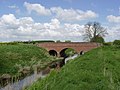
 Bridge over the River Smite - geograph.org.uk - 4953056.jpg 1,024 × 768; 351 KB
-
 Church Street Whatton - geograph.org.uk - 3954957.jpg 1,280 × 960; 415 KB
-
 Church Walk, Whatton - geograph.org.uk - 3954952.jpg 1,280 × 960; 433 KB
-
 Conery Lane, Whatton - geograph.org.uk - 3954959.jpg 1,280 × 960; 660 KB
-
 Cricket match at Whatton in the Vale - geograph.org.uk - 4950158.jpg 1,024 × 768; 165 KB
-
 Diverted bridleway - geograph.org.uk - 4953180.jpg 1,024 × 768; 174 KB
-
 Electricity pylons in the Vale of Belvoir - geograph.org.uk - 6391538.jpg 1,024 × 768; 90 KB
-
 Farm buildings, Whatton Lodge Farm - geograph.org.uk - 2888358.jpg 640 × 480; 57 KB
-
 Farm track at Whatton in the Vale - geograph.org.uk - 4951979.jpg 1,024 × 768; 230 KB
-
 Field entrance off Granby Lane - geograph.org.uk - 2888428.jpg 640 × 480; 102 KB
-
 Fingerpost at Granby Lane-Manor Lane, Whatton - geograph.org.uk - 3954983.jpg 960 × 1,280; 607 KB
-
 Flush bracket bench mark, Jubilee Hall, Whatton - geograph.org.uk - 3933412.jpg 1,280 × 1,280; 415 KB
-
 Flush Bracket OSBM S8788, Whatton, Jubilee Hall - geograph.org.uk - 6360033.jpg 960 × 1,280; 422 KB
-
 Flush Bracket OSBM S8788, Whatton, Jubilee Hall - geograph.org.uk - 6360037.jpg 960 × 1,280; 242 KB
-
 Footpath alongside a narrow plantation - geograph.org.uk - 6237390.jpg 1,024 × 768; 136 KB
-
 Footpath entering a small area of woodland - geograph.org.uk - 4984239.jpg 1,024 × 768; 357 KB
-
 Footpath to Whatton in the Vale - geograph.org.uk - 4953047.jpg 1,024 × 768; 213 KB
-
 Former Methodist Chapel, Whatton - geograph.org.uk - 3925569.jpg 1,280 × 934; 358 KB
-
 Granby Lane - geograph.org.uk - 2888423.jpg 640 × 480; 52 KB
-
 Granby Lane - geograph.org.uk - 2888425.jpg 640 × 480; 47 KB
-
 Granby Lane - geograph.org.uk - 2888432.jpg 640 × 480; 110 KB
-
 Granby Lane at Conery Lane - geograph.org.uk - 3954968.jpg 1,280 × 960; 263 KB
-
 Grassfield near Whatton Fields Farm - geograph.org.uk - 4984203.jpg 1,024 × 768; 147 KB
-
 Grassland and a small area of woodland - geograph.org.uk - 4984237.jpg 1,024 × 768; 183 KB
-
 Horse chestnut in flower, Whatton in the Vale - geograph.org.uk - 4951982.jpg 1,024 × 768; 241 KB
-
 Horses in a Field - geograph.org.uk - 1016505.jpg 640 × 480; 61 KB
-
 In the Smite Valley - geograph.org.uk - 4312920.jpg 640 × 430; 41 KB
-
 Ivy Row, Whatton - geograph.org.uk - 3925602.jpg 1,280 × 960; 380 KB
-
 Junction of Granby Lane and Manor Lane - geograph.org.uk - 3954994.jpg 1,280 × 941; 436 KB
-
 Looking west on the A52, Whatton - geograph.org.uk - 5106202.jpg 1,600 × 1,064; 330 KB
-
 Main Street, Whatton-in-the Vale - geograph.org.uk - 1016511.jpg 640 × 480; 156 KB
-
 Manor Lane. Whatton - geograph.org.uk - 3954973.jpg 1,280 × 954; 490 KB
-
 Manor Lane. Whatton - geograph.org.uk - 3954975.jpg 1,280 × 960; 443 KB
-
 Manor Lodge, Whatton - geograph.org.uk - 3954986.jpg 1,280 × 960; 434 KB
-
 Minor road towards Belvoir - geograph.org.uk - 2888352.jpg 640 × 480; 67 KB
-
 New fence near Whatton Fields Farm - geograph.org.uk - 4984211.jpg 1,024 × 768; 206 KB
-
 Oilseed rape and Blackberry Hill - geograph.org.uk - 4951956.jpg 1,024 × 768; 197 KB
-
 Old Grantham Road - geograph.org.uk - 1085030.jpg 640 × 427; 126 KB
-
 Old Grantham Road - geograph.org.uk - 1085128.jpg 640 × 427; 120 KB
-
 Old Grantham Road - geograph.org.uk - 3933404.jpg 1,280 × 960; 488 KB
-
 Orston Lane - geograph.org.uk - 4950161.jpg 1,024 × 768; 283 KB
-
 Orston Lane - geograph.org.uk - 4953170.jpg 1,024 × 768; 289 KB
-
 Paired laybys on the A52, Whatton - geograph.org.uk - 5106198.jpg 1,600 × 1,064; 274 KB
-
 Postbox at Whatton Green ref NG13 342 - geograph.org.uk - 3925591.jpg 1,280 × 960; 330 KB
-
 Pylons and Blackberry Hill - geograph.org.uk - 4951958.jpg 1,024 × 768; 150 KB
-
 River Smite - geograph.org.uk - 1016520.jpg 640 × 480; 81 KB
-
 River Smite - geograph.org.uk - 4312908.jpg 640 × 430; 58 KB
-
 River Smite at Whatton - geograph.org.uk - 3954948.jpg 1,280 × 960; 422 KB
-
 River Smite at Whatton-in-the-Vale - geograph.org.uk - 256826.jpg 640 × 427; 113 KB
-
 River Smite from Thorough Bridge - geograph.org.uk - 2888421.jpg 640 × 480; 68 KB
-
 Stile and electrified fence - geograph.org.uk - 4984216.jpg 1,024 × 768; 190 KB
-
 The former railway to Harby Junction - geograph.org.uk - 4984226.jpg 1,024 × 768; 238 KB
-
 The Gables, Whatton - geograph.org.uk - 3925586.jpg 1,280 × 961; 322 KB
-
 The Green, Whatton in the Vale - geograph.org.uk - 3925588.jpg 1,280 × 960; 340 KB
-
 The old school, Whatton - geograph.org.uk - 3925574.jpg 1,280 × 960; 257 KB
-
 The Old Vicarage, Whatton in the Vale - geograph.org.uk - 4953095.jpg 1,024 × 768; 242 KB
-
 The River Smite - geograph.org.uk - 2888370.jpg 640 × 480; 83 KB
-
 The River Whipling - geograph.org.uk - 4951954.jpg 1,024 × 768; 248 KB
-
 The River Whipling - geograph.org.uk - 4953174.jpg 1,024 × 768; 237 KB
-
 The River Whipling - geograph.org.uk - 6237393.jpg 1,024 × 768; 296 KB
-
 The Vale of Belvoir Inn, on the A52 - geograph.org.uk - 2534092.jpg 640 × 475; 86 KB
-
 The Village Green, Whatton in the Vale - geograph.org.uk - 4953099.jpg 1,024 × 768; 293 KB
-
 The White House, Conery Lane - geograph.org.uk - 3925599.jpg 1,280 × 960; 248 KB
-

-
 Thorough Bridge, Whatton - geograph.org.uk - 3954963.jpg 1,280 × 960; 224 KB
-
 Thorough Bridge, Whatton - geograph.org.uk - 3954965.jpg 1,280 × 960; 317 KB
-
 Track to Vicars Croft - geograph.org.uk - 2888424.jpg 640 × 480; 48 KB
-
 Track to Whatton Fields Farm - geograph.org.uk - 4984224.jpg 1,024 × 768; 180 KB
-
 Tree Lined Avenue - Whatton in the Vale - geograph.org.uk - 5040136.jpg 640 × 480; 157 KB
-

-
 View towards New Covert - geograph.org.uk - 3955477.jpg 1,280 × 960; 328 KB
-
 View towards the church, Whatton in the Vale - geograph.org.uk - 4953042.jpg 1,024 × 674; 101 KB
-
 View towards Whatton in the Vale - geograph.org.uk - 4952302.jpg 1,024 × 768; 225 KB
-
 We're coming to look at your dog - geograph.org.uk - 4953063.jpg 1,024 × 768; 197 KB
-
 Westbound A52 near Whatton - geograph.org.uk - 4226004.jpg 640 × 480; 203 KB
-
 Whatton and Aslockton Playing Fields - geograph.org.uk - 3923449.jpg 1,280 × 960; 230 KB
-
 Whatton Grange - geograph.org.uk - 3923492.jpg 1,280 × 960; 363 KB
-
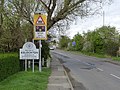
 Whatton in the Vale village sign - geograph.org.uk - 3923443.jpg 1,280 × 960; 542 KB
-
 Whatton Jubilee Hall - geograph.org.uk - 3925579.jpg 1,280 × 960; 273 KB
-
 Whatton Jubilee Hall - geograph.org.uk - 3925582.jpg 1,280 × 960; 191 KB
-
 Whatton Village Hall - geograph.org.uk - 1008184.jpg 640 × 484; 65 KB
-
 Whatton-in-the-Vale - geograph.org.uk - 1085125.jpg 640 × 427; 111 KB
-
 Wheat field off Conery Lane - geograph.org.uk - 6237389.jpg 1,024 × 768; 225 KB
-
 Where's it gone^ - geograph.org.uk - 4951967.jpg 1,024 × 768; 259 KB
-

-

-
 Manor Lane near Whatton, Nottinghamshire - geograph.org.uk - 162388.jpg 640 × 427; 193 KB
-
 Manor Lane near Whatton, Nottinghamshire - geograph.org.uk - 162393.jpg 640 × 427; 178 KB
-
 Moor Dyke near the A52 - geograph.org.uk - 163786.jpg 640 × 427; 120 KB
-
 Paddocks at Whatton - geograph.org.uk - 256821.jpg 640 × 427; 106 KB
-
 River Whipling - geograph.org.uk - 324019.jpg 424 × 640; 128 KB
-

-
 The Vale of Belvoir Inn and Hotel - geograph.org.uk - 163792.jpg 640 × 427; 150 KB
-
 Whatton Fields - geograph.org.uk - 324017.jpg 640 × 417; 113 KB
-
 Whatton Manor Estate - geograph.org.uk - 162397.jpg 640 × 427; 149 KB


