Category:Wharfedale
Jump to navigation
Jump to search
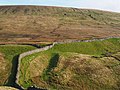
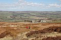
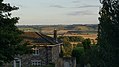
English: Wharfedale is a geographic area in Yorkshire, England, corresponding to the river valley of the River Wharfe. The upper reaches of the River Wharfe's valley are known as Langstrothdale, with Wharfedale running from after Hubberholme in North Yorkshire to Wetherby in West Yorkshire, after which the River Wharfe enters the Vale of York.
A ward in the City of Bradford is named after the valley, but covers only part of it.
one of the Yorkshire Dales in England | |||||
| Upload media | |||||
| Instance of | |||||
|---|---|---|---|---|---|
| Located in protected area | |||||
| Location |
| ||||
| Maintained by | |||||
 | |||||
Subcategories
This category has the following 39 subcategories, out of 39 total.
- Maps of Wharfedale (10 F)
- Wharfedale in art (3 F)
A
B
C
- Conistone Dib (36 F)
D
F
G
- Grass Wood, Wharfedale (17 F)
H
I
K
L
O
P
T
W
Media in category "Wharfedale"
The following 41 files are in this category, out of 41 total.
-
 2013 Great Whernside.jpg 4,608 × 3,456; 9.4 MB
-
 A Wharfedale barn. - geograph.org.uk - 1706491.jpg 640 × 480; 121 KB
-
 Bolton Abbey and Wharfedale by Bernard Walter Evans.jpg 1,500 × 776; 193 KB
-
 Carr Bottom Farm, Burley Moor - geograph.org.uk - 528918.jpg 640 × 480; 75 KB
-
 Climbing out of Wharfedale (43078456322).jpg 3,648 × 2,736; 5.53 MB
-
 Climbing out of Wharfedale (43078456852).jpg 3,648 × 2,736; 4.76 MB
-
 Cotton Grass and countryside - geograph.org.uk - 849324.jpg 640 × 334; 57 KB
-
 Cow and Calf Hotel, Ilkley Moor - geograph.org.uk - 744134.jpg 640 × 426; 76 KB
-
 Cray from the western slopes of Buckden Pike.jpg 2,700 × 1,800; 4.79 MB
-
 Fossilised tree bark 1.jpg 4,032 × 3,024; 3.63 MB
-
 Fossilised tree bark.jpg 3,024 × 4,032; 5.41 MB
-
 Fossilised tree stump (further).jpg 4,032 × 3,024; 4.46 MB
-
 Fossilised tree trunk (distant).jpg 4,032 × 3,024; 4.34 MB
-
 Fossilised tree trunk (far).jpg 4,032 × 3,024; 4.1 MB
-
 Fossilised tree trunk 1.jpg 4,032 × 3,024; 4.17 MB
-
 From the Wharfe viaduct - geograph.org.uk - 535277.jpg 640 × 478; 109 KB
-
 Hangingstone Road - geograph.org.uk - 755527.jpg 640 × 426; 86 KB
-
 Kettlewell and Wharfedale - geograph.org.uk - 242307.jpg 640 × 232; 87 KB
-
 Kilnsey from Conistone Pie, east.jpg 2,508 × 1,184; 794 KB
-
 Lower Wharfedale from Ilkley Moor - geograph.org.uk - 744142.jpg 640 × 395; 75 KB
-
 Lower Wharfedale Panorama.jpg 14,018 × 3,628; 9.34 MB
-
 North West from The Chevin - geograph.org.uk - 1021018.jpg 640 × 370; 52 KB
-
 Otley Panorama.jpg 8,190 × 3,985; 20.49 MB
-
 Piper's Crag Stone - geograph.org.uk - 48287.jpg 640 × 480; 123 KB
-
 Piper's Crag Stone - geograph.org.uk - 48289.jpg 640 × 480; 217 KB
-
 River wharfe at Grassington 2022.jpg 4,032 × 3,024; 4.05 MB
-
 Shooters Hut - geograph.org.uk - 237126.jpg 640 × 480; 112 KB
-
 The view from Conistone Pie - geograph.org.uk - 1248170.jpg 640 × 438; 77 KB
-
 Top Mere Road, Wharfedale - geograph.org.uk - 731156.jpg 640 × 338; 65 KB
-
 Upper Wharfedale from north of Buckden - geograph.org.uk - 834546.jpg 640 × 480; 101 KB
-
 View over lower Wharfedale from Kirkby Overblow (9th August 2017).jpg 3,872 × 2,176; 3.47 MB
-
 Volcanic Lavender.jpg 1,024 × 681; 314 KB
-
 Wharfedale - geograph.org.uk - 1756493.jpg 3,488 × 2,616; 6.13 MB
-
 Wharfedale from Barden Scale - geograph.org.uk - 1157006.jpg 640 × 326; 36 KB
-
 Wharfedale from Buckden (12th February 2013).JPG 3,872 × 2,176; 1.57 MB
-
 Wharfedale from Simon's Seat - geograph.org.uk - 523131.jpg 640 × 479; 65 KB
-
 Wharfedale Panorama - geograph.org.uk - 272941.jpg 640 × 160; 139 KB
-
 Above Wharfedale - geograph.org.uk - 795870.jpg 640 × 427; 231 KB
-
 Zig-Zag track in Upper Wharfedale - geograph.org.uk - 838183.jpg 480 × 640; 136 KB
-

-
 The Upper Wharfedale valley - geograph.org.uk - 144934.jpg 640 × 480; 93 KB


.jpg)
.jpg)


.jpg)
.jpg)
.jpg)


.jpg)


.JPG)


