Category:Whaddon, Cambridgeshire
Jump to navigation
Jump to search
English: Whaddon is a village and civil parish in South Cambridgeshire, England. At the time of the 2001 census, the parish's population was 481 people.
a village located in South Cambridgeshire, United Kingdom  | |||||
| Upload media | |||||
| Instance of | |||||
|---|---|---|---|---|---|
| Location | South Cambridgeshire, Cambridgeshire, East of England, England | ||||
 | |||||
Subcategories
This category has the following 2 subcategories, out of 2 total.
Media in category "Whaddon, Cambridgeshire"
The following 72 files are in this category, out of 72 total.
-
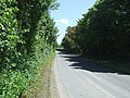
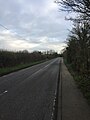
 A1198 towards Royston - geograph.org.uk - 5425002.jpg 640 × 480; 80 KB
-
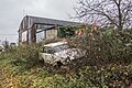 Abandoned Car - geograph.org.uk - 5201954.jpg 1,600 × 1,067; 816 KB
-
 Abandoned Truck - geograph.org.uk - 5201966.jpg 1,600 × 1,067; 883 KB
-
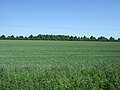
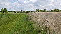
 Barley field near Whaddon - geograph.org.uk - 4078126.jpg 1,600 × 1,200; 571 KB
-
 Bridge over River Rhee - geograph.org.uk - 5201947.jpg 1,600 × 1,067; 701 KB
-
 Bridge Street, Whaddon - geograph.org.uk - 3273927.jpg 2,592 × 1,944; 2.07 MB
-
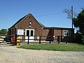
 Bumpkins Day Nursery - geograph.org.uk - 4078095.jpg 1,600 × 1,200; 703 KB
-

-
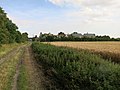
 Cereal crop, Whaddon Gap - geograph.org.uk - 5425017.jpg 640 × 480; 55 KB
-
 Church Street, Whaddon - geograph.org.uk - 5425025.jpg 640 × 480; 108 KB
-
-
 Cottages, in Whaddon (geograph 2389477).jpg 800 × 600; 88 KB
-
-
 Day nursery, Whaddon - geograph.org.uk - 5425023.jpg 640 × 480; 83 KB
-
 Dyer's Green - geograph.org.uk - 3273921.jpg 2,592 × 1,944; 1.9 MB
-
 Dyer's Green, cottage in Bridge Street - geograph.org.uk - 3885892.jpg 1,024 × 1,024; 1.08 MB
-
 Edge of Overgrown Lake on the Wimpole Avenue Formal Garden - geograph.org.uk - 4954509.jpg 3,264 × 1,840; 2.54 MB
-
-
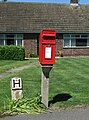 Elizabeth II postbox on Meldreth Road, Whaddon - geograph.org.uk - 5427051.jpg 1,776 × 2,400; 977 KB
-
 Entering Whaddon - geograph.org.uk - 5425021.jpg 640 × 480; 75 KB
-
 Ermine Street Roman Road (A1198) - geograph.org.uk - 5424996.jpg 640 × 480; 73 KB
-
 Ermine Street Roman Road (A1198) - geograph.org.uk - 5425001.jpg 640 × 480; 90 KB
-
 Ermine Street Roman Road (A1198) - geograph.org.uk - 5425006.jpg 640 × 480; 109 KB
-
 Field boundary by Harcamlow Way - geograph.org.uk - 4078084.jpg 1,600 × 1,200; 712 KB
-
 Field by Old North Road, Whaddon - geograph.org.uk - 5566578.jpg 2,048 × 1,536; 1.49 MB
-
 Field, south of Wimpole Lodge - geograph.org.uk - 2389233.jpg 800 × 600; 111 KB
-
 Fifteenth century tower of St Marys church, Whaddon (geograph 4277102).jpg 4,320 × 3,240; 5.89 MB
-
 Footpath around Whaddon - geograph.org.uk - 6013857.jpg 768 × 1,024; 219 KB
-
 Footpath Signpost, Whaddon - geograph.org.uk - 2389535.jpg 800 × 600; 164 KB
-
 Footpath to Orwell - geograph.org.uk - 4078087.jpg 1,600 × 1,200; 779 KB
-
 Footpath to Orwell - geograph.org.uk - 4078113.jpg 1,600 × 1,200; 647 KB
-
 Footpath to Orwell - geograph.org.uk - 4078122.jpg 1,600 × 1,200; 884 KB
-
 Footpath to Orwell - geograph.org.uk - 4078128.jpg 1,600 × 1,200; 756 KB
-
 Footpath to Orwell - geograph.org.uk - 6013831.jpg 768 × 1,024; 149 KB
-
 Fountain Farm at Dyer's Green - geograph.org.uk - 344177.jpg 640 × 480; 109 KB
-
 Grazing, Whaddon - geograph.org.uk - 5425024.jpg 640 × 480; 71 KB
-
 Harcamlow Way - geograph.org.uk - 4078075.jpg 1,600 × 1,200; 668 KB
-
 Harcamlow Way - geograph.org.uk - 4078080.jpg 1,600 × 1,200; 806 KB
-
 Harcamlow Way, Whaddon - geograph.org.uk - 2389526.jpg 800 × 600; 100 KB
-
 Harcamlow Way, Whaddon - geograph.org.uk - 4078068.jpg 1,600 × 1,200; 661 KB
-
 Haystack on Harcamlow Way - geograph.org.uk - 5200037.jpg 1,600 × 1,067; 538 KB
-
 Hoback Farm - geograph.org.uk - 4078134.jpg 1,600 × 1,200; 713 KB
-
 Hoback Farm and outbuildings - geograph.org.uk - 428177.jpg 640 × 426; 117 KB
-
 Horse Rider next to the Cam - geograph.org.uk - 4954514.jpg 3,264 × 1,840; 3.04 MB
-
 House in Whaddon (geograph 6494310).jpg 1,024 × 768; 176 KB
-
 In Whaddon village - geograph.org.uk - 3273855.jpg 2,592 × 1,944; 1.92 MB
-
 Looking towards Wimpole Hall across Reed Bed - geograph.org.uk - 4954523.jpg 3,264 × 1,840; 2.86 MB
-

-
 New house in Whaddon - geograph.org.uk - 4078100.jpg 1,600 × 1,200; 647 KB
-
 North Road Farm - geograph.org.uk - 4650614.jpg 640 × 480; 106 KB
-
 Oilseed rape field - geograph.org.uk - 4078117.jpg 1,600 × 1,200; 579 KB
-

-
 On Church End, Whaddon - geograph.org.uk - 6013829.jpg 768 × 1,024; 134 KB
-
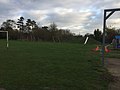
 On Whaddon Playing Field in March (geograph 3886161).jpg 1,200 × 906; 1.35 MB
-
 Overgrown Footpath, Whaddon - geograph.org.uk - 2389548.jpg 800 × 600; 211 KB
-
 Paths south of Dyer's Green - geograph.org.uk - 3885880.jpg 1,024 × 1,024; 1.26 MB
-
 Pickering Farm, Whaddon (geograph 6013827).jpg 1,024 × 768; 122 KB
-
 Ripe oilseed rape pods - geograph.org.uk - 4078121.jpg 1,600 × 1,200; 1.02 MB
-
 Ripening barley - geograph.org.uk - 4078091.jpg 1,600 × 1,200; 724 KB
-
 River Cam near River Cam Farm - geograph.org.uk - 4954471.jpg 3,264 × 1,840; 3 MB
-
 Secure gated track onto M.O.D. land - geograph.org.uk - 5424999.jpg 640 × 399; 68 KB
-
 Southern View of Wimpole Avenue - geograph.org.uk - 4954534.jpg 2,048 × 1,126; 1.28 MB
-
 The edge of Dyer's Green - geograph.org.uk - 3885909.jpg 1,200 × 900; 1.22 MB
-
 The main street in Whaddon (geograph 3273867).jpg 2,592 × 1,944; 1.36 MB
-
 Whaddon Gap - geograph.org.uk - 5425013.jpg 640 × 480; 81 KB
-
 Whaddon playground (geograph 6013826).jpg 1,024 × 768; 126 KB
-
 Wheat and barley fields - geograph.org.uk - 4078131.jpg 1,600 × 1,200; 573 KB
-
 Wheat field by Harcamlow Way - geograph.org.uk - 4078071.jpg 1,600 × 1,200; 661 KB
-
 Wimpole Avenue, Wimpole - geograph.org.uk - 2389357.jpg 800 × 600; 154 KB
-

-
-
 Farm track near Whaddon - geograph.org.uk - 344159.jpg 640 × 480; 81 KB


.jpg)
.jpg)
_-_geograph.org.uk_-_5424943.jpg)


_-_geograph.org.uk_-_5424996.jpg)
_-_geograph.org.uk_-_5425001.jpg)
_-_geograph.org.uk_-_5425006.jpg)


.jpg)


.jpg)


.jpg)


.jpg)


.jpg)

.jpg)


_-_geograph.org.uk_-_5425003.jpg)

