Category:Wexham
Jump to navigation
Jump to search
English: Wexham is a settlement in the county of Buckinghamshire. It is on the borders of the unitary authority of Slough and the non-metropolitan county of Berkshire, in southern England.
Nederlands: Wexham is een plaats in het bestuurlijke gebied South Bucks, in het Engelse graafschap Buckinghamshire.
civil parish in Buckinghamshire, England  | |||||
| Upload media | |||||
| Instance of | |||||
|---|---|---|---|---|---|
| Location |
| ||||
| Area |
| ||||
 | |||||
Subcategories
This category has the following 5 subcategories, out of 5 total.
G
L
- Langley Park, Buckinghamshire (18 F)
M
- Church of St Mary, Wexham (1 F)
S
T
- Teikyo School United Kingdom (3 F)
Media in category "Wexham"
The following 200 files are in this category, out of 227 total.
(previous page) (next page)-
 "Go Ape" net trampoline with beach balls, Black Park - geograph.org.uk - 5673330.jpg 3,648 × 2,736; 4.77 MB
-
 "Go Ape" nets and platforms in trees, Black Park - geograph.org.uk - 5673323.jpg 1,943 × 2,592; 2.93 MB
-
 "Limehouse" Going Home - geograph.org.uk - 3377523.jpg 1,830 × 1,611; 1,018 KB
-

-
 A412 near Pinewood Hotel - geograph.org.uk - 4865344.jpg 640 × 481; 64 KB
-

-
 A412 Uxbridge Road - geograph.org.uk - 2824885.jpg 640 × 444; 232 KB
-
 A412 Uxbridge Road - geograph.org.uk - 2824894.jpg 640 × 451; 234 KB
-
 A412 Uxbridge Road at Langley Park - geograph.org.uk - 4865364.jpg 640 × 479; 50 KB
-
 A412, northbound - geograph.org.uk - 3207720.jpg 640 × 430; 42 KB
-
 A412, Uxbridge Rd - geograph.org.uk - 3207722.jpg 640 × 430; 42 KB
-
 Alice's Tree House, Black Park - geograph.org.uk - 5673872.jpg 3,648 × 2,736; 4.34 MB
-
 Autumn Leaves, Langley Country Park - geograph.org.uk - 5561165.jpg 3,452 × 2,498; 3.44 MB
-
 Barn near Love Hill House Farm - geograph.org.uk - 4318501.jpg 640 × 480; 115 KB
-
 Beeches Way (67) - geograph.org.uk - 3474784.jpg 800 × 600; 186 KB
-
 Beeches Way (68) - geograph.org.uk - 3474785.jpg 800 × 600; 119 KB
-
 Beeches Way (69) - geograph.org.uk - 3474787.jpg 800 × 600; 164 KB
-
 Beeches Way (70) - geograph.org.uk - 3474788.jpg 600 × 800; 181 KB
-
 Beeches Way (71) - geograph.org.uk - 3474789.jpg 800 × 600; 189 KB
-
 Beeches Way (72) - geograph.org.uk - 3474790.jpg 800 × 668; 210 KB
-
 Beeches Way (73) - geograph.org.uk - 3474791.jpg 800 × 600; 139 KB
-
 Beeches Way (74) - geograph.org.uk - 3474792.jpg 600 × 800; 162 KB
-
 Beeches Way (75) - geograph.org.uk - 3474793.jpg 800 × 600; 202 KB
-
 Beeches Way (76) - geograph.org.uk - 3474794.jpg 800 × 600; 211 KB
-
 Beeches Way (77) - geograph.org.uk - 3474797.jpg 800 × 600; 210 KB
-
 Beeches Way - geograph.org.uk - 3301612.jpg 640 × 480; 138 KB
-
 Beeches Way - geograph.org.uk - 3301619.jpg 640 × 480; 163 KB
-
 Beeches Way - geograph.org.uk - 3301629.jpg 640 × 480; 148 KB
-
 Beeches Way - geograph.org.uk - 3301645.jpg 480 × 640; 89 KB
-
 Billet Lane, Shreding Green - geograph.org.uk - 5626651.jpg 2,304 × 1,728; 869 KB
-
 Black Park - geograph.org.uk - 6026220.jpg 3,647 × 3,633; 4.55 MB
-
 Black Park Country Park - geograph.org.uk - 3058151.jpg 1,600 × 1,200; 1.11 MB
-
 Black Park Country Park - geograph.org.uk - 6026197.jpg 3,648 × 2,736; 6.16 MB
-
 Black Park in the snow - geograph.org.uk - 2008458.jpg 3,488 × 2,616; 2.19 MB
-
 Black Park Model Boat regatta - display includes submarine - geograph.org.uk - 5529360.jpg 3,648 × 2,736; 2.65 MB
-

-
 Black Park Model Boat regatta - members controlling boats - geograph.org.uk - 5529331.jpg 3,506 × 2,628; 1.73 MB
-
 Black Park Model Boat regatta - model rowing boat - geograph.org.uk - 5529437.jpg 2,736 × 2,050; 1.89 MB
-
 Black Park Model Boat regatta - naval ship models on display - geograph.org.uk - 5529344.jpg 3,648 × 2,736; 3.29 MB
-
 Black Park Model Boat regatta - yacht and powerboat - geograph.org.uk - 5529410.jpg 1,857 × 2,049; 1.86 MB
-
 Black Park Model Boat regatta - yacht heels over in wind - geograph.org.uk - 5529413.jpg 1,552 × 1,166; 820 KB
-
 Black Park Model Boat regatta - yachts - geograph.org.uk - 5529148.jpg 2,390 × 1,790; 2.07 MB
-
 Black Park Road near Wexham Street - geograph.org.uk - 5624492.jpg 2,304 × 1,728; 787 KB
-
 Black Park Road overlooking Rowley Farm - geograph.org.uk - 3163669.jpg 2,048 × 1,536; 1.47 MB
-
 Black Park Road, Iver Heath - geograph.org.uk - 3163675.jpg 2,048 × 1,536; 1.58 MB
-

-
 Blackpark Lake - geograph.org.uk - 3058134.jpg 1,600 × 1,200; 393 KB
-
 Boatyard on the Canal - geograph.org.uk - 3378636.jpg 2,463 × 1,626; 1.02 MB
-

-
 Bridge 7, Slough Arm, Grand Union Canal - geograph.org.uk - 3564789.jpg 640 × 480; 118 KB
-
 Bridge 7, Slough Arm, Grand Union Canal - geograph.org.uk - 4325427.jpg 640 × 480; 128 KB
-
 Bridge 8, Slough Arm, Grand Union Canal - geograph.org.uk - 4325344.jpg 640 × 480; 156 KB
-
 Bridge 8, Slough Arm, Grand Union Canal - geograph.org.uk - 4325454.jpg 640 × 480; 140 KB
-
 Bridge 9, Slough Arm, Grand Union Canal - geograph.org.uk - 4325323.jpg 640 × 480; 107 KB
-
 Building site, Langley - geograph.org.uk - 3564769.jpg 640 × 480; 97 KB
-
 Building site, Slough - geograph.org.uk - 4325175.jpg 640 × 480; 116 KB
-
 Building site, Slough - geograph.org.uk - 4325176.jpg 640 × 480; 87 KB
-
 Bushy pasture, Langley - geograph.org.uk - 3565599.jpg 640 × 480; 133 KB
-
 Canal bridge near Langley - geograph.org.uk - 2085627.jpg 640 × 480; 99 KB
-
 Car park at Blackpark Lake - geograph.org.uk - 2824794.jpg 640 × 492; 245 KB
-
 Cattle beach, Langley Park lake - geograph.org.uk - 4502164.jpg 3,648 × 2,736; 3.82 MB
-
 Coming out of the Pinewood Hotel - geograph.org.uk - 3057787.jpg 1,600 × 1,200; 907 KB
-
 Coot chicks, mother under water, Langley Park Lake - geograph.org.uk - 4502869.jpg 1,978 × 1,478; 1.59 MB
-
 Dead Tree in Langley Park, Buckinghamshire - geograph.org.uk - 4998080.jpg 2,128 × 2,832; 1,004 KB
-

-
 Dry ditch, Black Park - geograph.org.uk - 4325100.jpg 640 × 480; 158 KB
-
 Dung heap in field next to Langley Park - geograph.org.uk - 4501761.jpg 3,648 × 2,736; 2.71 MB
-
 Entrance to Lidstone Court - geograph.org.uk - 2824881.jpg 640 × 420; 231 KB
-
 Field east of Middlegreen Road - geograph.org.uk - 4325162.jpg 640 × 480; 78 KB
-
 Field edge near Love Hill House Farm - geograph.org.uk - 4318127.jpg 640 × 480; 149 KB
-
 Field next to Wexham Park Lane - geograph.org.uk - 6020944.jpg 5,120 × 3,840; 6.35 MB
-
 Fields near Wexham Park Hospital - geograph.org.uk - 4554574.jpg 2,000 × 1,333; 2.82 MB
-
 Flowers by a field - geograph.org.uk - 5562522.jpg 1,600 × 898; 590 KB
-
 Fly-tipping, Rowley Woods, Wexham Street - geograph.org.uk - 4997943.jpg 2,048 × 1,536; 2.51 MB
-
 Footbridge near Trenches Farm - geograph.org.uk - 4318036.jpg 640 × 480; 167 KB
-
 Footbridge over the A412 - geograph.org.uk - 3207713.jpg 640 × 448; 42 KB
-

-
 Footpath by Park Stile Lodge - geograph.org.uk - 4318534.jpg 640 × 480; 130 KB
-
 Framewood Road at the junction of Rowley Lane - geograph.org.uk - 3163213.jpg 2,048 × 1,536; 1.64 MB
-
 Fulmer Common Road - geograph.org.uk - 5629553.jpg 2,304 × 1,728; 1.46 MB
-
 Fulmer Common Road - geograph.org.uk - 5629555.jpg 2,304 × 1,728; 1.78 MB
-
 Fulmer Common Road at the junction of Cherry Tree Lane - geograph.org.uk - 5629554.jpg 2,304 × 1,728; 1.54 MB
-
 Fungus in Black Park, probably Russula nigricans - geograph.org.uk - 5528685.jpg 2,347 × 1,762; 2.06 MB
-
 Fungus in Black Park, view of stem and gills - geograph.org.uk - 5528699.jpg 1,584 × 1,186; 1.05 MB
-
 Galleons Lane - geograph.org.uk - 2824790.jpg 427 × 640; 211 KB
-
 Galleons Lane - geograph.org.uk - 4554605.jpg 2,000 × 1,333; 3.18 MB
-
 Gate at Langley Park boundary - geograph.org.uk - 4318553.jpg 640 × 480; 140 KB
-
 George Green - Withycroft - geograph.org.uk - 6020892.jpg 3,128 × 2,346; 1.92 MB
-
 Go Ape sculpture in Black Park Country Park - geograph.org.uk - 5240926.jpg 2,056 × 3,648; 3.12 MB
-
 Grand Union Canal Slough Arm - geograph.org.uk - 3184649.jpg 640 × 480; 136 KB
-
-
 Grand Union canal, Slough arm, at Langley. - geograph.org.uk - 5438015.jpg 5,202 × 3,465; 3.59 MB
-
 Grand Union canal, Slough arm. Moored boats. - geograph.org.uk - 5438010.jpg 5,202 × 3,465; 3.52 MB
-
 Grassland near Love Hill House Farm - geograph.org.uk - 4318143.jpg 640 × 480; 138 KB
-
 Ha-ha and rhododendrons, Temple Gardens, Langley Park - geograph.org.uk - 4501733.jpg 3,648 × 2,736; 3.87 MB
-
 Ha-ha at edge of Temple Gardens, Langley Park - geograph.org.uk - 4501740.jpg 3,648 × 2,736; 3.62 MB
-
 High Line Yachting marina - geograph.org.uk - 5438008.jpg 5,202 × 3,465; 3.47 MB
-
 In Langley Park - geograph.org.uk - 4318569.jpg 640 × 480; 166 KB
-
 In Langley Park - geograph.org.uk - 4318575.jpg 640 × 480; 104 KB
-
 In Langley Park - geograph.org.uk - 4325152.jpg 640 × 480; 122 KB
-
 ISCA drawing.jpg 960 × 653; 74 KB
-
 ISCA review.jpg 960 × 640; 91 KB
-
 Iver Village Sign - geograph.org.uk - 5562531.jpg 3,888 × 2,592; 3.95 MB
-

-

-
 Junction of paths in Strawberry Wood - geograph.org.uk - 3470593.jpg 800 × 600; 178 KB
-

-

-
 Keeper's Cottage, Wexham Park Lane - geograph.org.uk - 2824857.jpg 640 × 432; 216 KB
-
 Kissing gate with wheelchair access, Langley Park arboretum - geograph.org.uk - 4502195.jpg 3,564 × 2,672; 2.34 MB
-
 Lake at Langley Park - geograph.org.uk - 5677222.jpg 3,840 × 2,160; 4.77 MB
-
 Langley Park lake - geograph.org.uk - 4502111.jpg 3,466 × 2,599; 3.46 MB
-
 Langley Park Road bridge - geograph.org.uk - 5438012.jpg 5,202 × 3,465; 3.99 MB
-
 Layby on Uxbridge Road, Iver Heath - geograph.org.uk - 5626573.jpg 2,304 × 1,728; 1.3 MB
-
 Layby on Uxbridge Road, Iver Heath - geograph.org.uk - 5626575.jpg 2,304 × 1,728; 859 KB
-
 Looking east on Rowley Lane - geograph.org.uk - 3465290.jpg 800 × 517; 114 KB
-
 Looking south on Black Park Road - geograph.org.uk - 3465284.jpg 600 × 800; 186 KB
-
 Marish Wharf - geograph.org.uk - 3376937.jpg 2,289 × 1,764; 1.26 MB
-

-

-
 Moorings near Langley - geograph.org.uk - 3378632.jpg 2,560 × 1,920; 1.31 MB
-
 Narrowboats near Iver Golf Course - geograph.org.uk - 2085220.jpg 640 × 480; 99 KB
-
 Narrowboats near Iver Golf Course - geograph.org.uk - 2085225.jpg 640 × 453; 101 KB
-
 Narrowboats near Langley - geograph.org.uk - 2085241.jpg 640 × 480; 114 KB
-
 National Cycle Route 61 - geograph.org.uk - 5562536.jpg 1,600 × 1,109; 1,002 KB
-
 North of Marish Wharf - geograph.org.uk - 3377512.jpg 2,333 × 1,746; 1.09 MB
-
 Not the entrance to Black Park - geograph.org.uk - 4315093.jpg 640 × 480; 164 KB
-
 Notice at Black Park Country Park - geograph.org.uk - 3470589.jpg 601 × 800; 118 KB
-
 Old farm building south of Middle Green - geograph.org.uk - 2309554.jpg 1,024 × 768; 205 KB
-
 Old footbridge over canal - geograph.org.uk - 5551431.jpg 2,832 × 2,128; 2.44 MB
-
 Old pollards in Langley Park - geograph.org.uk - 2309597.jpg 1,024 × 768; 279 KB
-
 Old sign at the entrance to Twin Trees Farm - geograph.org.uk - 5625351.jpg 2,304 × 1,728; 855 KB
-
 Orange Way after Wiltshire (473) - geograph.org.uk - 3639901.jpg 800 × 600; 126 KB
-
 Orange Way after Wiltshire (475) - geograph.org.uk - 3639936.jpg 800 × 600; 229 KB
-
 Orange Way after Wiltshire (476) - geograph.org.uk - 3639946.jpg 800 × 600; 165 KB
-
 Orange Way after Wiltshire (477) - geograph.org.uk - 3639976.jpg 800 × 600; 173 KB
-
 Orange Way after Wiltshire (479) - geograph.org.uk - 3640007.jpg 800 × 600; 131 KB
-
 Orange Way after Wiltshire (480) - geograph.org.uk - 3640028.jpg 800 × 600; 133 KB
-
 Orange Way after Wiltshire (481) - geograph.org.uk - 3640038.jpg 800 × 600; 159 KB
-
 Orange Way after Wiltshire (482) - geograph.org.uk - 3640629.jpg 800 × 600; 115 KB
-
 Orange Way after Wiltshire (483) - geograph.org.uk - 3640631.jpg 800 × 600; 113 KB
-

-
 Parkland near Wexham (2) - geograph.org.uk - 6100819.jpg 1,024 × 768; 487 KB
-
 Parkland near Wexham (3) - geograph.org.uk - 6100822.jpg 1,024 × 768; 497 KB
-
 Parkland near Wexham (4) - geograph.org.uk - 6100827.jpg 1,024 × 768; 436 KB
-
 Parkland near Wexham (5) - geograph.org.uk - 6100828.jpg 1,024 × 633; 358 KB
-
 Parkland near Wexham (6) - geograph.org.uk - 6100831.jpg 1,024 × 768; 455 KB
-
 Path by Bell Farm - geograph.org.uk - 4554583.jpg 2,000 × 1,333; 2.35 MB
-
 Path into the Temple Gardens - geograph.org.uk - 4325134.jpg 640 × 480; 192 KB
-
 Path junction, Langley Park - geograph.org.uk - 4318110.jpg 640 × 480; 114 KB
-
 Paths and bushes in Temple Gardens, Langley Park - geograph.org.uk - 4501709.jpg 3,648 × 2,736; 4.08 MB
-
 Pinewood Road at the junction of Alderbourne Lane - geograph.org.uk - 5624458.jpg 2,304 × 1,728; 1.69 MB
-
 Public bridleway, Black Park - geograph.org.uk - 4325108.jpg 640 × 480; 154 KB
-
 Public bridleway, Black Park - geograph.org.uk - 4325126.jpg 640 × 480; 165 KB
-
 Public bridleway, Black Park - geograph.org.uk - 4325129.jpg 640 × 480; 173 KB
-
 Public footpath towards Langley Park - geograph.org.uk - 4318023.jpg 640 × 480; 119 KB
-
 Public footpath, Langley Park - geograph.org.uk - 4318009.jpg 640 × 480; 138 KB
-
 Public footpath, Langley Park - geograph.org.uk - 4318062.jpg 640 × 480; 176 KB
-
 Pylon near Lavender Farm - geograph.org.uk - 4325166.jpg 640 × 480; 78 KB
-
 Queen's Drive in Black Park Country Park - geograph.org.uk - 3470606.jpg 800 × 600; 198 KB
-
 Rear of Pinewood Hotel - geograph.org.uk - 3058125.jpg 1,600 × 1,200; 745 KB
-
 Rhododendron flower, Temple Gardens, Langley Park - geograph.org.uk - 4501693.jpg 2,851 × 2,420; 2.65 MB
-
 Rhododendrons, Temple Gardens, Langley Park (1) - geograph.org.uk - 4501678.jpg 3,648 × 2,736; 3.99 MB
-
 Rhododendrons, Temple Gardens, Langley Park (2) - geograph.org.uk - 4501686.jpg 2,736 × 3,648; 6.29 MB
-
 Ride in Black Park Country Park - geograph.org.uk - 2824800.jpg 640 × 427; 197 KB
-
 Road junction at Middle Green - geograph.org.uk - 855788.jpg 640 × 480; 129 KB
-
 Road Junction on Billet Lane - geograph.org.uk - 6024474.jpg 3,648 × 2,736; 4.78 MB
-
 Row of giant sequoia trees, Langley Park - geograph.org.uk - 5745526.jpg 3,648 × 2,736; 2.15 MB
-
 Rowley Farm - geograph.org.uk - 2824802.jpg 640 × 422; 177 KB
-
 Rowley Lane - geograph.org.uk - 2824783.jpg 640 × 447; 204 KB
-
 Rowley Lane at the junction of Framewood Road - geograph.org.uk - 3163209.jpg 2,048 × 1,536; 1.49 MB
-
 Rowley Lane near Stoke Poges - geograph.org.uk - 6101623.jpg 1,024 × 768; 674 KB
-
 Rowley Lane reaches Framewood Road - geograph.org.uk - 3465302.jpg 800 × 600; 131 KB
-
 Rowley Lane, Wexham Street - geograph.org.uk - 3163739.jpg 2,048 × 1,536; 1.63 MB
-
 Rowley Lane, Wexham Street - geograph.org.uk - 3163920.jpg 2,048 × 1,536; 785 KB
-

-
 Rowley Wood, Wexham Street - geograph.org.uk - 5625352.jpg 2,304 × 1,728; 1.63 MB
-
 Rural landscape near Wexham Park - geograph.org.uk - 4554615.jpg 2,000 × 1,333; 3.25 MB
-
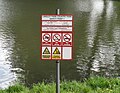 Safety notice, Langley Park lake - geograph.org.uk - 4502021.jpg 3,505 × 2,715; 1.95 MB
-
 Slough arm of Grand Union Canal - geograph.org.uk - 2085360.jpg 640 × 451; 104 KB
-
 Slough arm of the Grand Union Canal - geograph.org.uk - 2085346.jpg 640 × 429; 72 KB
-
 Slough arm of the Grand Union Canal - geograph.org.uk - 2085478.jpg 640 × 481; 73 KB
-
 Slough arm west of Middlegreen Road Bridge - geograph.org.uk - 5439198.jpg 5,202 × 3,465; 3.68 MB
-
 Slough Arm, Grand Union Canal - geograph.org.uk - 3564748.jpg 640 × 480; 88 KB
-
 Slough Arm, Grand Union Canal - geograph.org.uk - 4318717.jpg 640 × 480; 105 KB
-
 Slough Arm, Grand Union Canal - geograph.org.uk - 4325174.jpg 640 × 480; 104 KB
-
 Slough Arm, Grand Union Canal - geograph.org.uk - 4325439.jpg 640 × 480; 131 KB
-
 South end of Langley Park Lake - geograph.org.uk - 5561620.jpg 3,888 × 2,592; 3.84 MB
-
 St Mary's church - geograph.org.uk - 2824842.jpg 427 × 640; 202 KB
-
 Strawberry Wood - geograph.org.uk - 6231197.jpg 3,648 × 2,736; 5.76 MB
-

-

-
 The entrances to Saw Mill Cottages on Black Park Road - geograph.org.uk - 3163401.jpg 2,048 × 1,536; 1.62 MB
-
 The George, public house - geograph.org.uk - 2976729.jpg 800 × 600; 106 KB
-
 The Lake at Langley Park - geograph.org.uk - 5561611.jpg 3,888 × 2,592; 3.73 MB
-
 The road to Langley Marish from Middle Green - geograph.org.uk - 2309524.jpg 1,024 × 768; 217 KB
-
 The Segway Experience - geograph.org.uk - 3470601.jpg 800 × 600; 212 KB
-
 The Slough Arm - geograph.org.uk - 5677208.jpg 3,840 × 2,160; 4.25 MB
-
 The Stag - geograph.org.uk - 6025536.jpg 3,648 × 2,736; 2.97 MB
-
 The Stag at Wexham Street - geograph.org.uk - 148494.jpg 640 × 480; 76 KB


_-_geograph.org.uk_-_3474784.jpg)
_-_geograph.org.uk_-_3474785.jpg)
_-_geograph.org.uk_-_3474787.jpg)
_-_geograph.org.uk_-_3474788.jpg)
_-_geograph.org.uk_-_3474789.jpg)
_-_geograph.org.uk_-_3474790.jpg)
_-_geograph.org.uk_-_3474791.jpg)
_-_geograph.org.uk_-_3474792.jpg)
_-_geograph.org.uk_-_3474793.jpg)
_-_geograph.org.uk_-_3474794.jpg)
_-_geograph.org.uk_-_3474797.jpg)


_-_geograph.org.uk_-_3639901.jpg)
_-_geograph.org.uk_-_3639936.jpg)
_-_geograph.org.uk_-_3639946.jpg)
_-_geograph.org.uk_-_3639976.jpg)
_-_geograph.org.uk_-_3640007.jpg)
_-_geograph.org.uk_-_3640028.jpg)
_-_geograph.org.uk_-_3640038.jpg)
_-_geograph.org.uk_-_3640629.jpg)
_-_geograph.org.uk_-_3640631.jpg)

_-_geograph.org.uk_-_6100819.jpg)
_-_geograph.org.uk_-_6100822.jpg)
_-_geograph.org.uk_-_6100827.jpg)
_-_geograph.org.uk_-_6100828.jpg)
_-_geograph.org.uk_-_6100831.jpg)


_-_geograph.org.uk_-_4501678.jpg)
_-_geograph.org.uk_-_4501686.jpg)


