Category:Wetterstein
Jump to navigation
Jump to search
Internationalization
Deutsch: Wettersteingebirge
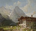
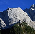
English: The mountain range of Wetterstein belongs to Bavaria (Germany) and Tyrol (Austria). Main summit is Zugspitze, 2962 m. Zugspitze is the highest mountain of Germany.
mountain range of the Alps in Bavaria, Germany, and Tyrol, Austria | |||||
| Upload media | |||||
| Instance of | |||||
|---|---|---|---|---|---|
| Made from material | |||||
| Located in protected area | |||||
| Location | |||||
| Mountain range | |||||
| Highest point | |||||
| Elevation above sea level |
| ||||
 | |||||
Subcategories
This category has the following 12 subcategories, out of 12 total.
Media in category "Wetterstein"
The following 126 files are in this category, out of 126 total.
-
01 Zugspitze.JPG 3,888 × 2,592; 5.85 MB
-
14-Grainau-S.jpg 3,006 × 1,942; 2.52 MB
-
20090906-Estergebirge von Süden.JPG 2,592 × 1,944; 2.77 MB
-
2019-07-02 Wettersteingebirge 11.jpg 5,184 × 3,456; 4.18 MB
-
2019-07-02 Wettersteingebirge 13.jpg 5,184 × 3,456; 5.35 MB
-
2019-07-02 Wettersteingebirge 14.jpg 5,184 × 3,456; 7.72 MB
-
2019-07-02 Wettersteingebirge 15.jpg 3,456 × 5,184; 6.25 MB
-
2019-07-02 Wettersteingebirge 19.jpg 5,184 × 3,456; 6.84 MB
-
2019-07-02 Wettersteingebirge 20.jpg 3,456 × 5,184; 5.66 MB
-
A mountain view from Tuftl Alm.jpg 2,592 × 1,944; 998 KB
-
Alpen Schneefernerkopf.jpg 3,264 × 2,448; 1.31 MB
-
Alpen Wettersteingebirge Abstieg Knorrhütte Reintal.jpg 1,000 × 667; 825 KB
-
Alpen Wettersteingebirge Am Steinernen Hüttl.jpg 1,000 × 667; 683 KB
-
Alpen Wettersteingebirge Ehrwalder Alm.jpg 1,000 × 667; 657 KB
-
Alpen Wettersteingebirge Felderer Joch Aufstieg.jpg 1,000 × 667; 760 KB
-
Alpen Wettersteingebirge Felderer Joch Aufstieg2.jpg 1,000 × 667; 789 KB
-
Alpen Wettersteingebirge Felderer Joch.jpg 1,000 × 667; 705 KB
-
Alpen Wettersteingebirge Fels am Gatterl.jpg 1,000 × 667; 805 KB
-
Alpen Wettersteingebirge Geröllfeld Knorrhütte.jpg 1,000 × 667; 811 KB
-
Alpen Wettersteingebirge Meilerhütte.jpg 1,000 × 667; 676 KB
-
Alpspitze aus Richtung Bernadeinkopf.jpg 4,032 × 2,268; 6.85 MB
-
Altusried östl - Illertal, Zugspitze 01.jpg 4,000 × 2,248; 1.86 MB
-
Bernadeinwand Sonnenuntergang.jpg 4,032 × 2,268; 7.42 MB
-
Bernadeinwand.jpg 4,032 × 2,268; 4.6 MB
-
Bernbeuren - Auerberg - Firstberg, Zugspitze, Schneefernerkopf 230918 - 02.jpg 4,608 × 2,167; 605 KB
-
Birgitz-gegen-Wetterstein-Gebirge-und-Reitherspitze.jpg 2,103 × 1,487; 760 KB
-
Blaetter wetterstein.jpg 2,175 × 1,335; 978 KB
-
Blick auf die Pensionen im Schulweg Seefeld 2023-10-11.jpg 5,472 × 3,648; 9.71 MB
-
Blick auf Seefeld Bahnhofsplatz in Richtung Wetterstein 2023-10-11.jpg 5,472 × 3,648; 9.37 MB
-
Blick von Dreitorspitze MQ.jpg 2,592 × 1,944; 451 KB
-
Bundesautobahn 95, Ausfahrt Seeshaupt, Bergblick.jpg 3,791 × 2,854; 4.49 MB
-
Bürkel Bauernhof vor Garmisch.jpg 1,500 × 1,308; 268 KB
-
Dreitorspitzen und Leutascher Platt.jpg 3,872 × 2,592; 7.53 MB
-
Eibsee Grainau Zugspitze.jpg 3,024 × 4,032; 2.01 MB
-
ETH-BIB-Hochmähder, Wettersteingebirge-LBS H1-021907.tif 5,015 × 3,984; 57.21 MB
-
ETH-BIB-Wetterstein, Zugspitze-LBS H1-020328.tif 6,310 × 5,010; 90.5 MB
-
Fahrradlkante.jpg 3,072 × 2,304; 886 KB
-
Flug -Rom-Düsseldorf-Hamburg 2013 by-RaBoe 177.jpg 3,606 × 2,395; 1.14 MB
-
Gaistal Leutasch02.jpg 3,172 × 1,896; 561 KB
-
Gaistal von W HQ.jpg 1,280 × 960; 870 KB
-
Gaistal-Panorama01.jpg 5,592 × 2,136; 1.06 MB
-
Grainau 3.JPG 2,560 × 1,920; 2.39 MB
-
Grainau, Eibsee, Blick zum Waxensteinkamm.JPG 4,267 × 2,764; 3.01 MB
-
Grainau, Eibsee, view to the Waxensteinkamm.JPG 4,272 × 2,848; 2.84 MB
-
Grubig-Ost-Pano.jpg 8,192 × 1,856; 4.23 MB
-
Heinrich Bürkel Gebirgsdorf mit Brunnen c1845.jpg 5,572 × 4,449; 5.57 MB
-
Hochwanner im Wettersteingebirge.jpg 2,382 × 706; 814 KB
-
Hoher Kranzberg.jpg 1,600 × 1,200; 715 KB
-
Innsbruck - 29-47.jpg 3,442 × 4,960; 3.87 MB
-
Inntal Mieminger Wetterstein02.jpg 3,920 × 1,532; 398 KB
-
Interalpen-Hotel Tyrol.jpg 1,350 × 899; 147 KB
-
Jubiläumsgrat from Zugspitze to Alpspitze.jpg 1,920 × 1,080; 2.49 MB
-
Klettersteig Riffelscharte.jpeg 5,536 × 2,160; 4.16 MB
-
Krün - Geroldsee mit Hochblassen, Zugspitze, Waxenstein und Daniel von links.jpg 3,991 × 2,677; 1.51 MB
-
Lautersee-Wiese-mit-Kapelle-Maria-Koenigin-Wetterstein.jpg 3,362 × 2,427; 2.26 MB
-
Leutasch - Leutascher Ache mit Wettersteinkamm.jpg 3,971 × 2,956; 1.44 MB
-
Leutasch - Mieminger Kette vom Gaistal, Hochwand 2721 üNN..jpg 3,000 × 4,000; 2.04 MB
-
Leutascher tal Loipe Gasse A7 mit Wettersteingebirge 01 2019.JPG 4,320 × 2,880; 3.79 MB
-
Leutascher Tal Loipe Gasse A7 mit Wettersteingebirge zwei 01 2019.JPG 4,320 × 2,880; 3.22 MB
-
Looking up the hill - panoramio.jpg 2,592 × 1,944; 1.05 MB
-
Luftaufnahme Interalpen-Hotel Tyrol.jpg 4,256 × 2,832; 2.26 MB
-
Luftbild Alpen 04 (RaBoe).jpg 1,000 × 750; 669 KB
-
Luftbild Alpen 05 (RaBoe).jpg 1,000 × 750; 676 KB
-
Luftbild aus 10.000 Meter Höhe vom Wettersteingebirge und der Zugspitze.jpg 4,272 × 2,848; 1.68 MB
-
Mittenwald - Buckelwiesen nördl Ri W, Wettersteingeb 02.JPG 3,264 × 1,840; 2.88 MB
-
Musterstein HQ.jpg 941 × 624; 199 KB
-
Musterstein von Osten.jpg 1,256 × 733; 767 KB
-
Panorama 1 von Seefeld von Bahnhofsplatz, Riehlweg über Schulweg bis zu Milserstraße 2023-10-11.jpg 11,904 × 2,560; 11.33 MB
-
Panorama 2 von Seefeld von Bahnhofsplatz, Riehlweg über Schulweg bis zu Milserstraße 2023-10-11.jpg 16,000 × 3,840; 21.77 MB
-
Partenkirchen Wettersteingebirge 1900.jpg 3,542 × 2,633; 4 MB
-
Partnachursprung.jpg 1,932 × 2,576; 2.02 MB
-
Riffeltorkopf 2.jpg 2,000 × 1,333; 2.9 MB
-
Riffeltorkopf.JPG 2,301 × 2,249; 5.29 MB
-
Riffelwandspitzen.jpg 1,940 × 2,276; 4.09 MB
-
Rosshuette Wetterstein peak names 02 kl.jpg 2,374 × 825; 1.34 MB
-
Schachen Hochblassen.jpg 1,216 × 816; 123 KB
-
Seefelder Plateau.jpg 4,596 × 2,866; 6.88 MB
-
Südliche Riffelspitze.JPG 2,592 × 3,888; 7.59 MB
-
Vollkarspitze ost 20110712.jpg 1,200 × 1,600; 985 KB
-
Vollkarspitze von N.jpg 3,008 × 1,296; 3.66 MB
-
Walter Thamm Blühende Obstbäume im Wettersteingebirge.jpg 4,253 × 3,188; 3.24 MB
-
Wedastoagebirg.ogg 1.5 s; 25 KB
-
Wegweiser Felderer Joch.jpg 1,944 × 2,592; 1.11 MB
-
Wegweiser Scharnitztal.jpg 1,932 × 2,576; 1.2 MB
-
Weidachsee.jpg 3,872 × 2,592; 7.22 MB
-
Wetterstein - Flickr - DaOpfer.jpg 7,360 × 4,912; 21.48 MB
-
Wetterstein 2004 016.jpg 4,191 × 3,113; 3.5 MB
-
Wetterstein 2004 042.jpg 3,008 × 2,234; 2.68 MB
-
Wetterstein chain.jpg 8,939 × 2,435; 3.03 MB
-
Wetterstein Karte 1881.jpg 5,215 × 3,049; 817 KB
-
Wetterstein Karte ca1835.png 1,853 × 806; 2.09 MB
-
Wetterstein von Arnspitzgruppe.jpg 3,872 × 2,592; 6.91 MB
-
Wetterstein Zugspitz Karte 1826.jpg 2,060 × 1,465; 2.83 MB
-
Wetterstein Zugspitzgletscher Karte 1826.jpg 620 × 577; 472 KB
-
Wetterstein-1980 hg.jpg 2,161 × 1,568; 469 KB
-
Wetterstein-Buckelwiesen-Mittenwald-JR-E-6601-2023-08-16.jpg 4,762 × 3,169; 7.6 MB
-
Wetterstein-Buckelwiesen-Mittenwald-JR-E-6609-6613-2023-08-16.jpg 10,255 × 2,925; 14.28 MB
-
Wetterstein.jpg 800 × 378; 48 KB
-
Wetterstein01.jpg 1,600 × 1,102; 980 KB
-
Wettersteingebirge (und Zugspitze) - panoramio.jpg 3,008 × 2,000; 2.09 MB
-
Wettersteingebirge hg.jpg 1,989 × 1,491; 675 KB
-
Wettersteingebirge map.png 3,731 × 1,630; 1.07 MB
-
Wettersteingebirge Tur9616.jpg 1,789 × 1,212; 1.09 MB
-
Wettersteingebirge und Mieminger Kette.png 3,731 × 3,009; 1.98 MB
-
Wettersteinhauptkamm mit Reintal von S HQ.jpg 1,280 × 465; 684 KB
-
Wettersteinkopf, Wettersteinwand und Rotplattenspitze.jpg 3,872 × 2,592; 6.77 MB
-
Wettersteinspitze Blick auf Mittenwald.jpg 1,280 × 960; 242 KB
-
Wörnersattel, Blick auf das Wettersteingebirge und Mittenwald - panoramio.jpg 2,560 × 1,920; 1.19 MB
-
Zirl und Nassereith. NYPL1226617.tiff 4,496 × 5,419; 69.71 MB
-
Zugspitze Airview 01.jpg 2,814 × 2,111; 4.12 MB
-
Zugspitze-Wettersteinkamm.jpg 2,816 × 2,112; 1.84 MB
-
Östliche Einfahrt Pfarrbichltunnel Seefeld mit Arnspitze im Hintergrund 2023-10-11.jpg 5,472 × 3,648; 7.74 MB


