Category:Wetlands of California
Jump to navigation
Jump to search
States of the United States: Alabama · Alaska · Arizona · Arkansas · California · Colorado · Connecticut · Delaware · Florida · Georgia · Hawaii · Idaho · Illinois · Indiana · Iowa · Kansas · Louisiana · Maine · Maryland · Massachusetts · Michigan · Minnesota · Mississippi · Missouri · Montana · Nebraska · Nevada · New Hampshire · New Jersey · New Mexico · New York · North Carolina · North Dakota · Ohio · Oregon · Pennsylvania · South Carolina · South Dakota · Tennessee · Texas · Utah · Virginia · Washington · West Virginia · Wisconsin · Wyoming
English: Wetlands of California — the marshes, estuaries, swamps, vernal pools, and wetlands in California.
Wikimedia category | |||||
| Upload media | |||||
| Instance of | |||||
|---|---|---|---|---|---|
| Category combines topics | |||||
| California | |||||
state of the United States of America | |||||
| Pronunciation audio | |||||
| Instance of |
| ||||
| Part of | |||||
| Named after |
| ||||
| Location | Pacific States Region | ||||
| Located in or next to body of water | |||||
| Capital |
| ||||
| Legislative body | |||||
| Executive body | |||||
| Highest judicial authority | |||||
| Official language | |||||
| Anthem | |||||
| Head of government |
| ||||
| Inception |
| ||||
| Highest point | |||||
| Population |
| ||||
| Area |
| ||||
| Elevation above sea level |
| ||||
| Replaces |
| ||||
| Different from | |||||
| Said to be the same as | Golden State | ||||
| Maximum temperature record |
| ||||
| Minimum temperature record |
| ||||
| official website | |||||
 | |||||
Subcategories
This category has the following 37 subcategories, out of 37 total.
*
A
- Agua Hedionda Lagoon (37 F)
B
- Bolinas Lagoon (13 F)
- Buena Vista Lagoon (22 F)
E
G
H
- Hill Slough Wildlife Area (18 F)
K
L
- Lower Klamath National Wildlife Refuge (1 P, 51 F)
M
- Madrona Marsh Preserve (5 F)
O
- Oxford Basin (5 F)
P
- Phoenix Vernal Pools (5 F)
S
T
U
Y
- Yolo Bypass Wildlife Area (29 F)
Pages in category "Wetlands of California"
This category contains only the following page.
Media in category "Wetlands of California"
The following 111 files are in this category, out of 111 total.
-
Algae covered slough near Willow Creek - panoramio.jpg 960 × 1,280; 791 KB
-
Alviso Salt Ponds.jpg 3,072 × 2,304; 1.05 MB
-
ArdeaAlbaLizard.JPG 1,532 × 1,848; 953 KB
-
Artemisia douglasiana1stonebird.jpg 2,304 × 3,072; 2.13 MB
-
Ballona-Centinela.jpg 2,048 × 1,010; 709 KB
-
Bass Hill-Lassen Cr-Hulsman Ranch-024-LR (18932764022).jpg 640 × 480; 227 KB
-
Baylands Morning.jpg 3,648 × 2,691; 3.46 MB
-
Big Basin Redwood State Park, Rancho Del Oso, CA, jjron 24.03.2012.jpg 1,728 × 1,152; 931 KB
-
Boggslake.jpg 1,565 × 1,037; 547 KB
-
BoggsPier.jpg 1,565 × 1,037; 535 KB
-
Breuner Marsh.jpg 500 × 375; 122 KB
-
CALIFORNIA - NARA - 542993.jpg 3,000 × 2,036; 710 KB
-
California wetlands habitat strategy- helping meet the wetlands challenge (IA californiawetlan00unit).pdf 637 × 822, 56 pages; 12.84 MB
-
Caspar mill ruins 2.jpg 2,304 × 1,728; 1.53 MB
-
Caspar mill ruins.jpg 2,304 × 1,728; 1.46 MB
-
Suisun Marsh study, Solano County, California (IA CAT77685859).pdf 1,031 × 1,500, 210 pages; 11.78 MB
-
Chelsea Wetlands 1.jpg 4,624 × 3,472; 4.79 MB
-
Chelsea Wetlands 2.jpg 4,624 × 2,400; 4.55 MB
-
Chelsea Wetlands 3.jpg 4,624 × 3,472; 5.61 MB
-
China Camp State Park (10841944054).jpg 2,048 × 1,536; 907 KB
-
Connick Ranch Ferndale CA.jpg 1,600 × 1,121; 1.04 MB
-
Cosumnes River Preserve Birds.jpg 799 × 600; 367 KB
-
Dawn at the Slough.jpg 3,522 × 2,651; 2.23 MB
-
Death Valley Saratoga Spring 3.jpg 2,400 × 1,600; 740 KB
-
Devereux Slough California (5278661796).jpg 813 × 270; 40 KB
-
Former North Pacific Coast Railroad grade adjacent to Tomales Bay.JPG 1,216 × 912; 326 KB
-
Fremont, CA, USA - panoramio (18).jpg 3,236 × 2,410; 3.92 MB
-
Fryer Creek Trail - January 2023 - Sarah Stierch.jpg 4,032 × 3,024; 17.82 MB
-
Gull feeding on flies with tufa and Sierra Nevada in background-2000px.jpeg 2,000 × 926; 221 KB
-
Hamilton Air Force aerial view.jpg 1,500 × 1,001; 645 KB
-
Lagoon creek.jpg 413 × 600; 61 KB
-
Leavitt Lake-Bass Hill Wildlife Area (18906172010).jpg 938 × 704; 360 KB
-
LedsonMarsh3223.jpg 1,984 × 1,125; 2.05 MB
-
Loch Lomond Vernal Pool.jpg 1,024 × 768; 177 KB
-
Lupins in the dry slough - panoramio.jpg 1,296 × 972; 1.34 MB
-
Mallard-skyline.jpg 1,504 × 1,001; 41 KB
-
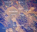
Wpdms nasa photo san pablo bay.jpg 534 × 467; 91 KB
-
Map of the San Joaquin, Sacramento and Tulare Valleys 1873 - Tulare Valley.jpg 2,384 × 1,885; 2.3 MB
-
MarinaDelRey-1890.jpg 800 × 479; 103 KB
-
Mill-valley-apartments-and-wetlands.jpg 4,547 × 3,319; 3.27 MB
-
Mission Bay Wetlands in San Diego (30209674373).jpg 4,260 × 2,844; 1.28 MB
-
Monkeyflowers on beaverdam Lundy Canyon.JPG 2,374 × 1,662; 3.6 MB
-
Nevada - Tahoe National Forest, California - NARA - 543569.jpg 3,000 × 2,039; 1.25 MB
-
NRCSCA01015 - California (647)(NRCS Photo Gallery).jpg 2,100 × 1,500; 4.51 MB
-
NRCSCA01021 - California (659)(NRCS Photo Gallery).tif 1,500 × 2,100; 12.02 MB
-
NRCSCA01024 - California (665)(NRCS Photo Gallery).tif 1,500 × 2,100; 12.02 MB
-
NRCSCA01026 - California (669)(NRCS Photo Gallery).jpg 1,500 × 2,100; 7.05 MB
-
NRCSCA01055 - California (725)(NRCS Photo Gallery).jpg 2,100 × 1,500; 5.62 MB
-
NRCSCA01055 - California (725)(NRCS Photo Gallery).tif 2,100 × 1,500; 12.02 MB
-
NRCSCA01055(14476)(NRCS Photo Gallery).jpg 2,100 × 1,500; 239 KB
-
Overly Protected Wetlands.jpg 3,456 × 2,304; 4.22 MB
-
Path At Tijuana Estuary.jpg 2,837 × 3,783; 3.44 MB
-
Pelican In Rodeo Lagoon.jpg 1,391 × 1,729; 801 KB
-
Pfeiffer Beach Stream.jpg 3,072 × 2,304; 2.83 MB
-
Pickle weed SanFranciscoBay Prostak specimen tag0190.jpg 3,888 × 2,592; 2.89 MB
-
Pickle weed SanFranciscoBay Prostak specimen tag0197.jpg 3,888 × 2,592; 3.07 MB
-
Pickle weed SanFranciscoBay Prostak specimen tag0220.jpg 2,592 × 3,888; 3.32 MB
-
Pickle weed SanFranciscoBay Prostak specimen tag0242.jpg 2,592 × 3,888; 3.14 MB
-
Pismo Beach Creek taken at Addie Vacation Townhomes 10x72.jpg 720 × 540; 374 KB
-
Prado1.jpg 320 × 220; 24 KB
-
Salt marsh in Shoreline Park IMG 2471.jpg 6,000 × 4,000; 4.44 MB
-
Salt marsh in Shoreline Park, Mountain View California IMG 2400.jpg 6,000 × 4,000; 6.69 MB
-
San Francisco Bay National Wildlife Refuge.jpg 1,500 × 1,200; 307 KB
-
San Luis National Wildlife Refuge 1.jpg 4,032 × 3,024; 2.1 MB
-
San Luis National Wildlife Refuge 2.jpg 4,032 × 3,024; 1.88 MB
-
San Luis National Wildlife Refuge 3.jpg 4,032 × 3,024; 2.39 MB
-
San Luis National Wildlife Refuge 4.jpg 4,032 × 3,024; 1.67 MB
-
Sanmateocreek-after.jpg 284 × 212; 9 KB
-
Stmargisle 001.jpg 1,280 × 960; 641 KB
-
Sears Point Restored Wetland (18907930578).jpg 865 × 513; 381 KB
-
Shoreline Park Mountain View California IMG 2490.jpg 6,000 × 4,000; 5.84 MB
-
Shoreline Park Mountain View California IMG 2511.jpg 6,000 × 4,000; 4.88 MB
-
Shoreline Park Mountain View California IMG 2524-x.jpg 6,000 × 4,000; 2.77 MB
-
Shoreline Park Mountain View California IMG 2541.jpg 6,000 × 4,000; 8.22 MB
-
Shoreline Park Mountain View California Salt marsh IMG 2357.jpg 6,000 × 4,000; 5.31 MB
-
Shoreline Park Mountain View California Salt marsh IMG 2358.jpg 6,000 × 4,000; 4.84 MB
-
Shoreline Park Mountain View California Salt marsh IMG 2359.jpg 6,000 × 4,000; 5.17 MB
-
Shoreline Park Mountain View California Salt marsh IMG 2361.jpg 6,000 × 4,000; 5.33 MB
-
Shoreline Park Mountain View California Salt marsh IMG 2380.jpg 6,000 × 4,000; 5.93 MB
-
Shoreline Park Mountain View California Salt marsh IMG 2385.jpg 6,000 × 4,000; 5.54 MB
-
Shoreline Park Mountain View California Salt marsh IMG 2386.jpg 6,000 × 4,000; 5.31 MB
-
Shoreline Park Mountain View California Salt marsh IMG 2445-12 (cropped).jpg 6,000 × 2,168; 5.6 MB
-
Shoreline Park Mountain View California Salt marsh IMG 2445-12.jpg 6,000 × 4,000; 7.74 MB
-
Shoreline Park Mountain View California Salt marsh IMG 2490-15.jpg 6,000 × 4,000; 6.61 MB
-
Shoreline Park Mountain View California Salt marsh IMG 2534-16.jpg 6,000 × 4,000; 4.07 MB
-
Shoreline Park salt marsh IMG 2480.jpg 6,000 × 4,000; 4.22 MB
-
Shoreline Park, Mountain View California IMG 2738.jpg 6,000 × 4,000; 4.29 MB
-
Shoreline Park, Mountain View California IMG 2747.jpg 4,000 × 4,051; 1.76 MB
-
Sierra Valley Ranchland - panoramio.jpg 4,032 × 3,024; 3.14 MB
-
Slough-redwoodcity.jpg 2,959 × 2,140; 870 KB
-
Snow Geese flocks at Sutter Buttes - panoramio.jpg 4,000 × 2,667; 1.55 MB
-
Snow geese flying at Sacramento wildlife refugee.jpg 1,944 × 1,296; 1.41 MB
-
SteamShovelSlough.jpg 1,620 × 1,186; 274 KB
-
Tijuana River Estuary.jpg 1,799 × 1,199; 248 KB
-
TulareBasinMap.jpg 4,167 × 4,167; 16.33 MB
-
Tule Lake Lower Marsh.jpg 3,872 × 2,592; 6.89 MB
-
Tuolumne Meadows - Lembert Dome - 02.JPG 4,288 × 2,848; 5.86 MB
-
Vernal pool early June - panoramio.jpg 2,918 × 2,189; 1.67 MB
-
ViewSantaVenetia4394.jpg 979 × 648; 312 KB
-
Wetland (25356257120).jpg 5,472 × 3,648; 6.59 MB
-
Wetlands along ocean north of Arcata, CA. (21932314505).jpg 2,048 × 1,536; 1.84 MB
-
Wetlands and forests along the Truckee River, near Tahoe City, 2011.jpg 3,008 × 2,000; 4.26 MB
-
Wetlands-and-power-substation.jpg 4,457 × 3,343; 1.97 MB
-
Yolo Bypass Refuge.jpg 3,072 × 2,304; 1.14 MB
-
Yolo bypass wildlife area.jpg 2,048 × 1,640; 144 KB
-
Yosemite-tuolumne meadows 1.jpeg 1,600 × 1,200; 631 KB
-
Saltponds-sfbay.jpg 2,508 × 1,831; 851 KB
-
Suisun Marsh Water Control.png 967 × 724; 139 KB
-
ZedlerMarsh.jpg 1,632 × 1,232; 189 KB


