Category:Weston Mill, Plymouth
Jump to navigation
Jump to search
area in Plymouth, Devon, England, UK  | |||||
| Upload media | |||||
| Instance of | |||||
|---|---|---|---|---|---|
| Part of | |||||
| Location | City of Plymouth, Devon, South West England, England | ||||
 | |||||
Subcategories
This category has the following 3 subcategories, out of 3 total.
S
W
- Weston Mill Viaduct (4 F)
Media in category "Weston Mill, Plymouth"
The following 136 files are in this category, out of 136 total.
-
 A3064 - B3396 junction - geograph.org.uk - 5687754.jpg 640 × 426; 67 KB
-
 A3064 - geograph.org.uk - 5009222.jpg 640 × 426; 55 KB
-
 A3064 - geograph.org.uk - 5009225.jpg 640 × 426; 65 KB
-
 A3064 - geograph.org.uk - 5572293.jpg 640 × 426; 58 KB
-
 A3064 - geograph.org.uk - 5679821.jpg 640 × 426; 97 KB
-
 A3064, Wolseley Rd - geograph.org.uk - 5687604.jpg 640 × 426; 61 KB
-
 Astroturf - geograph.org.uk - 5018741.jpg 478 × 640; 54 KB
-
 Astroturf - geograph.org.uk - 5023027.jpg 640 × 415; 55 KB
-
 B3396 - geograph.org.uk - 5658670.jpg 640 × 426; 64 KB
-
 B3396 - geograph.org.uk - 5687755.jpg 640 × 426; 63 KB
-
 Below Weston Mill Viaduct - geograph.org.uk - 5123120.jpg 640 × 409; 55 KB
-
 Below Weston Mill Viaduct - geograph.org.uk - 5175517.jpg 640 × 426; 52 KB
-
 Bend, Wolseley Rd - geograph.org.uk - 5009207.jpg 640 × 426; 58 KB
-
 Bend, Wolseley Rd - geograph.org.uk - 5687595.jpg 640 × 426; 59 KB
-
 Bridwell Rd - geograph.org.uk - 5679849.jpg 640 × 426; 57 KB
-
 Bridwell Rd - geograph.org.uk - 5679851.jpg 640 × 426; 40 KB
-
 Bridwell Rd - geograph.org.uk - 5679855.jpg 640 × 426; 54 KB
-
 Bridwell Rd - geograph.org.uk - 5679954.jpg 640 × 426; 58 KB
-
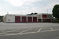 Camels Head fire station - geograph.org.uk - 195474.jpg 640 × 427; 183 KB
-
 Car park - geograph.org.uk - 5563090.jpg 640 × 426; 63 KB
-
 Car park - geograph.org.uk - 5563094.jpg 451 × 640; 53 KB
-
 Car park - geograph.org.uk - 5563099.jpg 572 × 640; 73 KB
-
 Car park - geograph.org.uk - 5679978.jpg 640 × 426; 77 KB
-
 Car park below Weston Mill Viaduct - geograph.org.uk - 5123111.jpg 640 × 458; 71 KB
-
 Car park below Weston Mill Viaduct - geograph.org.uk - 5123115.jpg 435 × 640; 51 KB
-

-
 Carlton St - geograph.org.uk - 5679976.jpg 640 × 426; 76 KB
-
 Churchway - geograph.org.uk - 5679852.jpg 640 × 426; 51 KB
-
 Churchway - geograph.org.uk - 5679955.jpg 640 × 426; 71 KB
-
 Cobbled backstreet - geograph.org.uk - 5679973.jpg 640 × 426; 81 KB
-
 Cobbled ope - geograph.org.uk - 5572292.jpg 640 × 426; 81 KB
-
 Cornish Main Line - geograph.org.uk - 5684311.jpg 640 × 426; 80 KB
-
 Devonport Dockyard from the railway - geograph.org.uk - 2941326.jpg 640 × 480; 53 KB
-
 Devonport energy from waste construction site - geograph.org.uk - 3617239.jpg 1,024 × 768; 182 KB
-
 Eliot St - geograph.org.uk - 5679957.jpg 640 × 426; 62 KB
-
 End of Dual Carriageway - geograph.org.uk - 5009206.jpg 640 × 375; 56 KB
-

-
 Entrance to New Power Station - geograph.org.uk - 5018746.jpg 640 × 578; 73 KB
-
 Erith Avenue - geograph.org.uk - 5684158.jpg 640 × 426; 59 KB
-
 Erith Avenue, Camel's Head - geograph.org.uk - 1708913.jpg 640 × 458; 68 KB
-
 Ferndale Avenue - geograph.org.uk - 5572298.jpg 640 × 426; 58 KB
-
 Ferndale Avenue - geograph.org.uk - 5684150.jpg 640 × 426; 64 KB
-
 First Avenue - geograph.org.uk - 5572299.jpg 640 × 426; 53 KB
-
 Flats, Keyham - geograph.org.uk - 4961077.jpg 640 × 356; 40 KB
-
 Flats, Weston Mill Hill - geograph.org.uk - 5679823.jpg 640 × 426; 83 KB
-
 Fleet St - geograph.org.uk - 5684282.jpg 640 × 426; 51 KB
-
 Fletemoor Rd - geograph.org.uk - 5679844.jpg 640 × 425; 45 KB
-
 Fletemoor Rd - geograph.org.uk - 5679848.jpg 640 × 426; 44 KB
-
 Football pitch, Weston Mill - geograph.org.uk - 4961090.jpg 640 × 426; 48 KB
-
 Gulf Filling Station - geograph.org.uk - 5687597.jpg 640 × 426; 43 KB
-
 Ham Brook - geograph.org.uk - 5679783.jpg 640 × 426; 126 KB
-
 Ham Brook - geograph.org.uk - 5679786.jpg 640 × 426; 118 KB
-
 Hamoaze Avenue - geograph.org.uk - 5767972.jpg 640 × 426; 72 KB
-
 Harbour Avenue - geograph.org.uk - 5009210.jpg 640 × 426; 61 KB
-
 Harbour Avenue - geograph.org.uk - 5658673.jpg 640 × 426; 69 KB
-
 Harbour Avenue - geograph.org.uk - 5767971.jpg 640 × 426; 63 KB
-
 HMS Ocean at Devonport - geograph.org.uk - 2765948.jpg 640 × 480; 141 KB
-
 Honda Dealership - geograph.org.uk - 5684140.jpg 640 × 426; 43 KB
-
 Just south of Weston Mill Viaduct - geograph.org.uk - 5023025.jpg 640 × 426; 101 KB
-
 Keyham St - geograph.org.uk - 5679968.jpg 640 × 426; 62 KB
-
 Keyham St - geograph.org.uk - 5679970.jpg 640 × 426; 70 KB
-
 Mowhay Rd - geograph.org.uk - 5679789.jpg 640 × 426; 109 KB
-
 Mowhay Rd - geograph.org.uk - 5679791.jpg 640 × 426; 65 KB
-
 North Prospect Rd - geograph.org.uk - 5679793.jpg 640 × 426; 51 KB
-
 North Prospect Rd - geograph.org.uk - 5679820.jpg 640 × 426; 60 KB
-
 North Prospect Road - geograph.org.uk - 4308617.jpg 640 × 480; 50 KB
-
 Northumberland St - geograph.org.uk - 5679963.jpg 640 × 426; 57 KB
-
 Northumberland St - geograph.org.uk - 5679964.jpg 640 × 425; 60 KB
-
 Ocean St - geograph.org.uk - 5684272.jpg 640 × 426; 68 KB
-
 Plymouth , St Budeaux Bypass, A3064 - geograph.org.uk - 4612511.jpg 4,072 × 2,705; 5.24 MB
-
 Plymouth , Weston Mill Drive - geograph.org.uk - 5358290.jpg 5,312 × 2,988; 3.76 MB
-
 Plymouth , Wolseley Road - geograph.org.uk - 5358289.jpg 5,312 × 2,988; 2.89 MB
-
 Plymouth CHP - geograph.org.uk - 5680866.jpg 640 × 426; 60 KB
-

-

-

-

-
 Premier Store - geograph.org.uk - 5679965.jpg 640 × 426; 71 KB
-
 Premier Stores - geograph.org.uk - 5684160.jpg 640 × 426; 61 KB
-
 Renown St - geograph.org.uk - 5684274.jpg 640 × 426; 54 KB
-
 Road below Weston Mill Viaduct - geograph.org.uk - 5563110.jpg 640 × 426; 73 KB
-
 Road junction and Industrial Estate - geograph.org.uk - 4961081.jpg 640 × 426; 56 KB
-
 Road to Devonport - geograph.org.uk - 5767964.jpg 640 × 356; 62 KB
-
 Rodney Street, Weston Mill - geograph.org.uk - 1708944.jpg 640 × 480; 66 KB
-
 Saltash Rd - geograph.org.uk - 5684161.jpg 640 × 426; 68 KB
-
 Saltash Rd - geograph.org.uk - 5684162.jpg 640 × 426; 66 KB
-
 Saltash Rd - geograph.org.uk - 5684279.jpg 640 × 426; 61 KB
-
 Saltash Rd, B3396 - geograph.org.uk - 5767958.jpg 640 × 426; 66 KB
-
 Second Avenue - geograph.org.uk - 5572300.jpg 640 × 425; 69 KB
-
 Second Avenue - geograph.org.uk - 5684154.jpg 640 × 426; 62 KB
-
 Sports ground, Weston Mill - geograph.org.uk - 3604118.jpg 1,024 × 768; 102 KB
-

-
 The Weston Mill - geograph.org.uk - 5679960.jpg 640 × 426; 72 KB
-
 Third Avenue - geograph.org.uk - 5572302.jpg 640 × 425; 54 KB
-
 Third Avenue - geograph.org.uk - 5684152.jpg 640 × 425; 55 KB
-
 Tidal stream, Weston Mill - geograph.org.uk - 4961095.jpg 640 × 426; 55 KB
-
 Trackside houses - geograph.org.uk - 5123101.jpg 640 × 426; 50 KB
-
 Tucker Close - geograph.org.uk - 4308625.jpg 640 × 480; 48 KB
-
 Victory St - geograph.org.uk - 5684277.jpg 640 × 426; 57 KB
-
 View from Weston Mill Viaduct - geograph.org.uk - 5827941.jpg 1,024 × 707; 98 KB
-
 Weston Mill - geograph.org.uk - 5023030.jpg 640 × 426; 63 KB
-
 Weston Mill Cemetery - geograph.org.uk - 5679857.jpg 640 × 426; 43 KB
-
 Weston Mill Community Primary School - geograph.org.uk - 5572294.jpg 640 × 420; 70 KB
-
 Weston Mill Community Primary School - geograph.org.uk - 5572295.jpg 640 × 426; 65 KB
-
 Weston Mill Community Primary School - geograph.org.uk - 5572297.jpg 640 × 426; 55 KB
-
 Weston Mill Community Primary School - geograph.org.uk - 5684146.jpg 640 × 426; 55 KB
-
 Weston Mill Community Primary School - geograph.org.uk - 5684147.jpg 640 × 426; 54 KB
-
 Weston Mill Community Primary School - geograph.org.uk - 5687599.jpg 640 × 425; 59 KB
-
 Weston Mill Drive - geograph.org.uk - 719212.jpg 640 × 480; 109 KB
-
 Weston Mill Hill - geograph.org.uk - 5679825.jpg 640 × 426; 72 KB
-
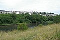 Weston Mill lake - geograph.org.uk - 195477.jpg 640 × 427; 268 KB
-
 Weston Mill Lake - geograph.org.uk - 5023028.jpg 640 × 536; 70 KB
-
 Weston Mill Lake - geograph.org.uk - 5123104.jpg 640 × 410; 45 KB
-
 Weston Mill Lake - geograph.org.uk - 5175508.jpg 640 × 433; 49 KB
-
 Weston Mill Lake - geograph.org.uk - 5563087.jpg 640 × 426; 63 KB
-
 Weston Mill Lake - geograph.org.uk - 5634912.jpg 640 × 426; 64 KB
-
 Weston Mill lake - geograph.org.uk - 5851068.jpg 1,024 × 681; 97 KB
-
 Weston Mill Lake from Weston Mill Viaduct - geograph.org.uk - 3599885.jpg 1,024 × 768; 123 KB
-
 Weston Mill Plymouth Power Station - geograph.org.uk - 5110791.jpg 640 × 480; 67 KB
-
 Weston Mill Recycling Centre - geograph.org.uk - 719223.jpg 640 × 386; 82 KB
-
 Weston Mill Viaduct - geograph.org.uk - 5009215.jpg 640 × 426; 49 KB
-
 Weston Mill Viaduct - geograph.org.uk - 5658671.jpg 640 × 426; 62 KB
-
 Weston Mill Viaduct - geograph.org.uk - 5684142.jpg 640 × 426; 60 KB
-
 Weston Mill Viaduct - geograph.org.uk - 5684145.jpg 640 × 426; 52 KB
-
 Weston Mill Viaduct - geograph.org.uk - 5687602.jpg 640 × 426; 46 KB
-
 Weston Mill Viaduct - geograph.org.uk - 5688525.jpg 640 × 425; 44 KB
-
 Wolseley Rd - geograph.org.uk - 5009209.jpg 640 × 426; 79 KB
-
 Wolseley Rd - geograph.org.uk - 5684139.jpg 640 × 426; 51 KB
-
 Wolseley Rd - geograph.org.uk - 5684141.jpg 640 × 426; 48 KB
-
 Wolseley Rd - geograph.org.uk - 5684151.jpg 640 × 426; 58 KB
-
 Wolseley Rd - geograph.org.uk - 5684157.jpg 640 × 426; 59 KB
-
 Wolseley Rd - geograph.org.uk - 5687593.jpg 640 × 426; 68 KB
-
 Wolseley Rd, A3064 - geograph.org.uk - 5009220.jpg 640 × 426; 55 KB
-
 Wombwell Crescent - geograph.org.uk - 5684275.jpg 640 × 425; 60 KB
-
 Wombwell Crescent - geograph.org.uk - 5684306.jpg 640 × 426; 62 KB
-
 York Road - geograph.org.uk - 4308627.jpg 640 × 480; 52 KB


