Category:Westerstede, Uithuizen
Jump to navigation
Jump to search
| Object location | | View all coordinates using: OpenStreetMap |
|---|
 | |||||
| Upload media | |||||
| Instance of | |||||
|---|---|---|---|---|---|
| Location | Uithuizen, Groningen, Netherlands | ||||
| Street address |
| ||||
| Located on street |
| ||||
| Heritage designation |
| ||||
 | |||||
|
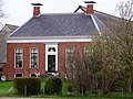
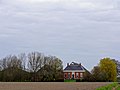
This is a category about rijksmonument number 21302
|
| Address |
|
Media in category "Westerstede, Uithuizen"
The following 20 files are in this category, out of 20 total.
-
 Achtergevel - Uithuizen - 20211204 - RCE.jpg 1,200 × 956; 250 KB
-
 Achtergevels schuren - Uithuizen - 20372638 - RCE.jpg 1,200 × 1,200; 191 KB
-
 Achtergevels schuren - Uithuizen - 20372640 - RCE.jpg 1,200 × 1,200; 359 KB
-
 Achterzijde van te slopen garage - Uithuizen - 20372663 - RCE.jpg 1,200 × 1,200; 222 KB
-
 Kop van de schuur achter woonhuis - Uithuizen - 20372659 - RCE.jpg 1,200 × 1,200; 327 KB
-
 Oude garage - Uithuizen - 20372639 - RCE.jpg 1,200 × 1,200; 235 KB
-
 Overzicht achterzijde - Uithuizen - 20211203 - RCE.jpg 1,200 × 956; 365 KB
-
 Overzicht complex met situering - Uithuizen - 20372637 - RCE.jpg 1,200 × 1,200; 253 KB
-
 Overzicht rechterzijaanzicht woonhuis en stal - Uithuizen - 20372643 - RCE.jpg 1,200 × 1,200; 356 KB
-
 Overzicht van voorzijde schuur - Uithuizen - 20372661 - RCE.jpg 1,200 × 1,200; 363 KB
-
 Overzicht voorzijde - Uithuizen - 20211201 - RCE.jpg 1,200 × 952; 332 KB
-
 Overzicht voorzijde van schuren - Uithuizen - 20372662 - RCE.jpg 1,200 × 1,200; 385 KB
-
 Overzicht voorzijde woonhuis - Uithuizen - 20372644 - RCE.jpg 1,200 × 1,200; 347 KB
-
 Overzicht zijgevel en gracht - Uithuizen - 20372636 - RCE.jpg 1,200 × 1,200; 407 KB
-
 Rechterzijaanzicht stal - Uithuizen - 20372645 - RCE.jpg 1,200 × 1,200; 454 KB
-
 Situering complex - Uithuizen - 20372641 - RCE.jpg 1,200 × 1,200; 307 KB
-
 Voor en rechter zijgevel - Uithuizen - 20211202 - RCE.jpg 1,200 × 953; 291 KB
-
 Westerstede1 Uithuizen.jpg 1,809 × 1,357; 630 KB
-
 Westerstede2 Uithuizen.jpg 3,597 × 2,698; 1.14 MB
-
 Zijgevel van woonhuis - Uithuizen - 20372660 - RCE.jpg 1,200 × 1,200; 374 KB


