Category:Western Valley
Jump to navigation
Jump to search
English: Western Valley is a civil parish in the Vale of White Horse district, in the county of Oxfordshire, England.
civil parish in Vale of White Horse, Oxfordshire, England  | |||||
| Upload media | |||||
| Instance of | |||||
|---|---|---|---|---|---|
| Location | Vale of White Horse, Oxfordshire, South East England, England | ||||
 | |||||
Media in category "Western Valley"
The following 20 files are in this category, out of 20 total.
-

-
 Car, A4130 - geograph.org.uk - 5263756.jpg 640 × 343; 39 KB
-
 Daily Mail - geograph.org.uk - 5646400.jpg 640 × 426; 33 KB
-
 Daily Mail, Didcot - geograph.org.uk - 5362654.jpg 640 × 415; 65 KB
-
 Great Western 43 passing a track maintenance vehicle - geograph.org.uk - 5598352.jpg 5,202 × 3,465; 2.75 MB
-
 Milestone (Wallingford 7 Wantage 7) beside B4493 - geograph.org.uk - 5327278.jpg 1,024 × 585; 101 KB
-
 Milton Park Estate - geograph.org.uk - 5362656.jpg 640 × 426; 71 KB
-
 Milton Road from Milton Siding - geograph.org.uk - 5666624.jpg 5,202 × 3,465; 4.7 MB
-

-
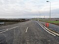 New link road - geograph.org.uk - 5727549.jpg 1,024 × 768; 123 KB
-
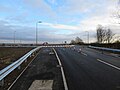
 Over the Armco - geograph.org.uk - 5727551.jpg 1,024 × 768; 129 KB
-
 Path on the other side - geograph.org.uk - 5727620.jpg 1,024 × 768; 135 KB
-
 Path towards the roundabout - geograph.org.uk - 5727618.jpg 1,024 × 768; 113 KB
-
 The A34, Harwell - geograph.org.uk - 6066626.jpg 1,280 × 1,920; 1.02 MB
-
 The A34, Harwell - geograph.org.uk - 6066628.jpg 1,920 × 1,280; 1.42 MB
-
 The A34, Harwell - geograph.org.uk - 6066630.jpg 1,854 × 1,172; 891 KB
-
 Towards the Didcot end - geograph.org.uk - 5727550.jpg 1,024 × 768; 83 KB
-

-
 View of Harwell - geograph.org.uk - 5961694.jpg 1,920 × 1,280; 992 KB
-
 Zulu Farm near Harwell - geograph.org.uk - 1315521.jpg 640 × 416; 53 KB
_-_geograph.org.uk_-_5327248.jpg)


_beside_B4493_-_geograph.org.uk_-_5327278.jpg)


