Category:Western Tasmania
Jump to navigation
Jump to search
English: Western Tasmania is the region of Tasmania, west of the Central Highlands, and north of the South West wilderness region of Tasmania
| Upload media | |||||
| |||||
Subcategories
This category has the following 38 subcategories, out of 38 total.
A
B
- Bird River, Tasmania (2 F)
C
- Comet Mine (5 F)
- Crotty Dam (2 F)
D
E
- Eldon Peak, Tasmania (1 F)
- Eldon Range, Tasmania (4 F)
F
- Franklin River, Tasmania (7 F)
- Frenchmans Cap, Tasmania (7 F)
G
H
- Henty River (2 F)
K
L
M
N
O
- Ocean Beach, Tasmania (3 F)
P
- Pyromorphite Lode (6 F)
Q
R
- Regatta Point, Tasmania (5 F)
- Rosebery, Tasmania (14 F)
S
- Sarah Island (9 F)
T
- Teepookana, Tasmania (3 F)
W
- Waratah, Tasmania (12 F)
- Williamsford, Tasmania (3 F)
Z
Pages in category "Western Tasmania"
This category contains only the following page.
Media in category "Western Tasmania"
The following 18 files are in this category, out of 18 total.
-
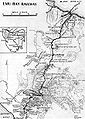 ARHS Emu Bay.jpg 440 × 618; 130 KB
-
 Bird River Bridge1.jpg 1,728 × 2,304; 2.19 MB
-
 Cape Sorell and ocean beach.JPG 2,025 × 484; 213 KB
-
 East Mount Owen.JPG 1,536 × 2,048; 847 KB
-
 Franklin meets Gordon River Tasmania 1.jpg 2,000 × 1,333; 2.13 MB
-
 Lake B regs.JPG 1,372 × 897; 416 KB
-
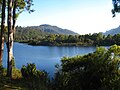 Lake Rosebery.jpg 1,024 × 768; 305 KB
-
 Landslide, Gordon River.jpg 1,536 × 2,048; 1.46 MB
-
 Mount Bischoff mine.jpg 2,048 × 1,536; 1.38 MB
-
 Mount Lyell western end 2006.jpg 2,019 × 514; 306 KB
-
 Mount Owen NE edge .jpg 2,022 × 1,501; 280 KB
-
 Mt McCall track from the air in the 1970s.jpg 4,176 × 2,720; 842 KB
-
 OceanBeachwest from air.jpg 1,765 × 1,182; 383 KB
-
 Penitentiary ruin on Sarah Island.jpg 2,048 × 1,536; 951 KB
-
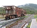 Rosebery Station Melba Line.JPG 2,272 × 1,704; 1.37 MB
-
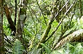 Tasmanian rainforest.jpg 809 × 534; 191 KB
-
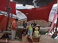 The Ship That Never Was 2.JPG 2,048 × 1,536; 579 KB
-
 Trial Harbour on the west coast Tasmania.jpg 6,297 × 4,369; 9.09 MB


