Category:Western Side of Southampton Town Walls
Jump to navigation
Jump to search
| Section Between Bugle Street and Bugle Tower: |
| |
| Section Between Simnal Street and the Site of the Bugle Tower: |
| |
| Section From 75yds East of Arundel Tower to Limit of Castle Site Including Arundel and Catchcold Towers: |
| |
| Section of Wall Running West From Bargate to Arundel Tower and Then South to Point Just South of Castle Water Gate: |
| |
| Sections of Wall Running South Along Esplanade From South-West Corner of Simnel Street to University Air Squadron Headquarters at South End of Bugle Street: |
|
Subcategories
This category has the following 3 subcategories, out of 3 total.
C
- Catchcold Tower, Southampton (9 F)
W
- Westgate, Southampton (26 F)
Media in category "Western Side of Southampton Town Walls"
The following 55 files are in this category, out of 55 total.
-
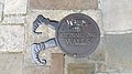 "Walk the Southampton Walls" Floor Plaque outside the West Gate.jpg 2,560 × 1,440; 2.35 MB
-
 A BIT OF OLD SOUTHAMPTON.jpg 4,536 × 2,929; 8.83 MB
-

-
 Arcades and western wall.jpg 850 × 567; 616 KB
-
 Arundel & Catchcold towers.jpg 850 × 572; 614 KB
-

-
 Arundel Tower and Westquay - geograph.org.uk - 5487032.jpg 640 × 360; 73 KB
-
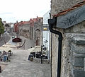
 Behind the Arcades - geograph.org.uk - 1428453.jpg 427 × 640; 196 KB
-
 Behind the Arcades - geograph.org.uk - 1428454.jpg 425 × 640; 198 KB
-
 Blue Anchor Lane and Town Wall in Southampton.jpg 4,896 × 3,264; 9.99 MB
-
 City Walls Southampton - geograph.org.uk - 2409023.jpg 1,600 × 1,200; 357 KB
-
 City Walls, Southampton - geograph.org.uk - 1744252.jpg 2,592 × 3,872; 5.11 MB
-
 City Walls, Southampton - geograph.org.uk - 1744256.jpg 2,592 × 3,872; 4.69 MB
-
 City Walls, Southampton - geograph.org.uk - 3838550.jpg 4,000 × 2,666; 7.27 MB
-
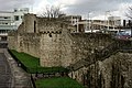
 External View of the Western Side of Southampton Town Walls.jpg 4,453 × 2,965; 6.85 MB
-
 From the top of the wall looking north.jpg 1,587 × 1,437; 883 KB
-
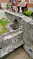 Medieval Ruins in the vicinity of Southampton Castle.jpg 1,440 × 2,560; 3.28 MB
-
 Medieval Ruins near Southampton Castle.jpg 2,560 × 1,440; 3.52 MB
-
 Soton city walls.jpg 700 × 445; 355 KB
-
 South from Catchcold Tower - geograph.org.uk - 1428399.jpg 640 × 426; 201 KB
-
 Southampton - mur medieval 02.JPG 1,918 × 1,274; 527 KB
-
 Southampton - mur medieval 03.JPG 2,045 × 944; 409 KB
-
 Southampton - mur medieval 04.JPG 2,045 × 1,291; 563 KB
-
 Southampton - mur medieval 05.JPG 1,959 × 753; 378 KB
-
 Southampton - mur medieval.JPG 1,828 × 1,300; 523 KB
-
 Southampton 13.JPG 2,045 × 1,324; 668 KB
-
 Southampton 14.JPG 2,048 × 890; 497 KB
-
 Southampton City Wall - geograph.org.uk - 23025.jpg 640 × 480; 103 KB
-
 Southampton City Wall - geograph.org.uk - 23027.jpg 640 × 480; 107 KB
-
 Southampton City Wall - geograph.org.uk - 23029.jpg 640 × 480; 90 KB
-
 Southampton City Walls - geograph.org.uk - 23024.jpg 640 × 480; 113 KB
-
 Southampton medevial walls and Catchcold Tower.jpg 2,800 × 2,100; 4.8 MB
-
 Southampton medieval walls Western Esplanade.jpg 2,800 × 2,100; 4.92 MB
-
 Southampton Town Wall - geograph.org.uk - 5511960.jpg 640 × 480; 121 KB
-
-

-

-

-

-

-

-
 Southampton town walls at West Quay - geograph.org.uk - 5616531.jpg 640 × 480; 104 KB
-
 Southampton Town Walls, western town wall alongside Western Esplanade.jpg 4,000 × 3,000; 4.66 MB
-

-
 Southampton, town walls - geograph.org.uk - 3013919.jpg 1,024 × 755; 161 KB
-
 The Arcades - geograph.org.uk - 1428450.jpg 640 × 426; 197 KB
-
 The Arcades - geograph.org.uk - 1428463.jpg 640 × 427; 188 KB
-
 The Arcades - geograph.org.uk - 1575167.jpg 640 × 427; 209 KB
-
 The Arundel Tower - Southampton.jpg 2,519 × 1,888; 829 KB
-

-
 View east through Blue Anchor Lane as it passes under the Southampton Town Wall.jpg 3,264 × 4,896; 9.59 MB
-
 Western Esplanade - geograph.org.uk - 5511513.jpg 640 × 480; 126 KB
-
 Western Esplanade, Southampton - geograph.org.uk - 26100.jpg 640 × 480; 70 KB
-
 Western wall, Southampton - geograph.org.uk - 4112644.jpg 480 × 640; 115 KB
-
 Łódź w chodniku - panoramio.jpg 2,048 × 1,360; 752 KB


.jpg)
.jpg)
.jpg)
.jpg)
.jpg)
.jpg)
.jpg)


