Category:Westerham
Jump to navigation
Jump to search
town and civil parish in the Sevenoaks District of Kent, UK  | |||||
| Upload media | |||||
| Instance of | |||||
|---|---|---|---|---|---|
| Location | Sevenoaks, Kent, South East England, England | ||||
| Population |
| ||||
| official website | |||||
 | |||||
Subcategories
This category has the following 15 subcategories, out of 15 total.
B
- Buses in Westerham (14 F)
C
- Chartwell (298 F)
- Churchill Statue, Westerham (6 F)
G
- George and Dragon, Westerham (2 F)
K
- Kings Arms, Westerham (4 F)
M
O
Q
- Quebec House, Westerham (13 F)
S
- Squerryes Court (5 F)
V
- Valence, Westerham (2 F)
W
- Westerham railway station (6 F)
- Westerham War Memorial (1 F)
Media in category "Westerham"
The following 200 files are in this category, out of 1,021 total.
(previous page) (next page)-
 ....and found the bed lumpy^ - geograph.org.uk - 4623622.jpg 640 × 480; 51 KB
-
 13 - 25a High Street - geograph.org.uk - 3437452.jpg 640 × 424; 339 KB
-
 A horse, French Street - geograph.org.uk - 2524476.jpg 640 × 480; 123 KB
-

-
 A pink house - Quebec Square - geograph.org.uk - 3104614.jpg 640 × 507; 60 KB
-
 A public footpath goes over the M25 - geograph.org.uk - 3023064.jpg 800 × 600; 65 KB
-
 A view into the valley of the Darent - geograph.org.uk - 2693666.jpg 640 × 426; 63 KB
-
 A wet day along Chestnut Avenue - geograph.org.uk - 6638520.jpg 3,227 × 2,478; 2.17 MB
-
 A wet day on Chestnut Avenue - geograph.org.uk - 6638517.jpg 4,000 × 3,000; 4.81 MB
-
 A233 overbridge - geograph.org.uk - 2033927.jpg 640 × 430; 70 KB
-
 A25 between Westerham and Brasted - geograph.org.uk - 2702509.jpg 640 × 362; 59 KB
-
 A25, Brasted Road - geograph.org.uk - 1954956.jpg 1,024 × 768; 236 KB
-
 A25, entering Brasted - geograph.org.uk - 2702511.jpg 640 × 430; 81 KB
-
 Access road to Coakham Lodge Farm - geograph.org.uk - 1754528.jpg 3,072 × 2,304; 1.72 MB
-
 Access road to Holy Trinity Church, Crockham Hill - geograph.org.uk - 4698978.jpg 2,304 × 1,728; 822 KB
-
 Acremead Cottage - geograph.org.uk - 1754459.jpg 3,072 × 2,304; 2.73 MB
-
 Ailing tree near Squerryes Court - geograph.org.uk - 6508096.jpg 1,024 × 768; 321 KB
-
 Almshouses, London Road, Westerham - geograph.org.uk - 2029172.jpg 640 × 480; 67 KB
-
 Almshouses, London Road, Westerham - geograph.org.uk - 2029176.jpg 640 × 480; 80 KB
-
 Anti-clockwise M25 Entering Kent - geograph.org.uk - 3732303.jpg 640 × 480; 243 KB
-
 Approach to Gaysham Farm - geograph.org.uk - 6019335.jpg 1,024 × 768; 322 KB
-

-

-
 Approaching London Road Bridge, M25 - geograph.org.uk - 4506019.jpg 640 × 439; 43 KB
-
 April Cottage seen from the Greensand Way - geograph.org.uk - 3547394.jpg 4,000 × 3,000; 3.97 MB
-
 April Cottage, French Street - geograph.org.uk - 6504630.jpg 1,024 × 768; 424 KB
-
 April Cottage, French Street - geograph.org.uk - 6504640.jpg 1,024 × 768; 348 KB
-
 Ash Tree in Field - geograph.org.uk - 4288290.jpg 640 × 427; 54 KB
-
 B2024 Croydon Road - geograph.org.uk - 6019360.jpg 1,024 × 768; 386 KB
-
 Bat cave at Hosey Hill - geograph.org.uk - 4414923.jpg 4,000 × 3,000; 4.17 MB
-
 Bee Boles on Cottage behind Quebec House - geograph.org.uk - 1296874.jpg 640 × 480; 130 KB
-
 Beggars Lane - geograph.org.uk - 3437422.jpg 640 × 424; 276 KB
-
 Beggars Lane, Westerham - geograph.org.uk - 2376201.jpg 4,320 × 3,240; 4.58 MB
-
 Beggars Lane, Westerham - geograph.org.uk - 2376202.jpg 4,320 × 3,240; 4.12 MB
-

-
 Bend in Hosey Common Road - geograph.org.uk - 2457677.jpg 640 × 430; 101 KB
-
 Betsoms Hill - geograph.org.uk - 2469474.jpg 1,024 × 768; 247 KB
-
 Blue Plaque of William Pitt - geograph.org.uk - 1756029.jpg 3,072 × 2,304; 1.66 MB
-
 Bluebells at Mariners Hill - geograph.org.uk - 4461275.jpg 4,000 × 3,000; 4.38 MB
-
 Bluebells at Mariners Hill - geograph.org.uk - 4461278.jpg 4,000 × 3,000; 4.08 MB
-
 Bluebells at Mariners Hill - geograph.org.uk - 4461285.jpg 4,000 × 3,000; 4.49 MB
-
 Bluebells at Mariners Hill - geograph.org.uk - 4461288.jpg 4,000 × 3,000; 4.17 MB
-
 Bluebells in Perry Wood - geograph.org.uk - 4461183.jpg 4,000 × 3,000; 4.28 MB
-
 Bluebells in Perry Wood - geograph.org.uk - 4461189.jpg 4,000 × 3,000; 4.11 MB
-
 Bluebells in Row Wood - geograph.org.uk - 4461195.jpg 4,000 × 3,000; 4.21 MB
-
 Bluebells in the Churchyard of St Mary the Virgin, Westerham - geograph.org.uk - 5776205.jpg 4,000 × 3,000; 4.72 MB
-
 Bluebells in the Churchyard of St Mary the Virgin, Westerham - geograph.org.uk - 5776207.jpg 4,000 × 3,000; 4.83 MB
-
 Bluebells in the Churchyard of St Mary the Virgin, Westerham - geograph.org.uk - 5776212.jpg 4,000 × 3,000; 4.87 MB
-
 Bluebells in the Churchyard of St Mary the Virgin, Westerham - geograph.org.uk - 5776215.jpg 4,000 × 3,000; 5.07 MB
-
 Bluebells on Crockhamhill Common - geograph.org.uk - 4481039.jpg 4,000 × 2,666; 7.77 MB
-
 Bluebells on Crockhamhill Common - geograph.org.uk - 4481048.jpg 4,000 × 2,666; 7.77 MB
-
 Brasted Road, near Westerham - geograph.org.uk - 2376190.jpg 4,320 × 3,240; 4.81 MB
-
 Bridleway and Footpath junction near Goodley Stock Road - geograph.org.uk - 1755878.jpg 3,072 × 2,304; 2.82 MB
-
 Bridleway crossing of Hosey Common Lane - geograph.org.uk - 6504420.jpg 1,024 × 768; 629 KB
-
 Bridleway in Hosey Common - geograph.org.uk - 1754185.jpg 2,304 × 3,072; 2.5 MB
-
 Bridleway junction near April Cottage - geograph.org.uk - 1754312.jpg 3,072 × 2,304; 3.25 MB
-
 Bridleway junction, Crockhamhill Common - geograph.org.uk - 2450797.jpg 640 × 430; 158 KB
-
 Bridleway near April Cottage - geograph.org.uk - 1754330.jpg 2,304 × 3,072; 2.51 MB
-
 Bridleway nearing French Street - geograph.org.uk - 6504430.jpg 1,024 × 768; 595 KB
-
 Bridleway SR358 near Crockham House - geograph.org.uk - 2524374.jpg 640 × 480; 197 KB
-
 Bridleway towards Mapleton Road - geograph.org.uk - 6503620.jpg 1,024 × 768; 639 KB
-
 Bridleway, High Chart - geograph.org.uk - 2444470.jpg 640 × 430; 129 KB
-
 Bridleway, Hosey Common - geograph.org.uk - 6504423.jpg 1,024 × 768; 582 KB
-
 Buddle's Wood - geograph.org.uk - 2457745.jpg 640 × 430; 76 KB
-
 Buddle's Wood - geograph.org.uk - 2459990.jpg 640 × 430; 77 KB
-
 Burial Ground, French Street - geograph.org.uk - 6727620.jpg 1,024 × 684; 228 KB
-
 Burial Ground, French Street - geograph.org.uk - 6727622.jpg 1,024 × 684; 272 KB
-
 Burial Ground, French Street - geograph.org.uk - 6727625.jpg 1,024 × 684; 233 KB
-

-
 Bushes - Squerryes Court - geograph.org.uk - 2614961.jpg 1,600 × 1,200; 340 KB
-
 Bushes and hedgeline - geograph.org.uk - 5629568.jpg 640 × 426; 65 KB
-
 Bushes and woodland, Crockhamhill Common - geograph.org.uk - 2450821.jpg 640 × 430; 158 KB
-
 By the M25 - geograph.org.uk - 4569263.jpg 640 × 426; 87 KB
-
 Byway to Mapleton Road - geograph.org.uk - 1754511.jpg 3,072 × 2,304; 2.58 MB
-
 Byway to Pootings Road - geograph.org.uk - 1754513.jpg 3,072 × 2,304; 2.12 MB
-
 Byway to Pootings Road - geograph.org.uk - 1948206.jpg 3,072 × 2,304; 2.58 MB
-
 Cafe at Chartwell - geograph.org.uk - 5571107.jpg 1,024 × 768; 284 KB
-
 Café at Chartwell - geograph.org.uk - 5567057.jpg 1,600 × 1,200; 524 KB
-
 Car Park at Chartwell - geograph.org.uk - 2028971.jpg 640 × 480; 90 KB
-
 Car park at Hosey Common - geograph.org.uk - 3908341.jpg 640 × 427; 88 KB
-
 Car park entrance, Chartwell - geograph.org.uk - 6503849.jpg 1,024 × 768; 546 KB
-
 Car park, Westerham - geograph.org.uk - 5246776.jpg 640 × 427; 96 KB
-
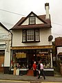
 Castle Antiques - geograph.org.uk - 2007567.jpg 480 × 640; 67 KB
-
 Castle Antiques Centre, Westerham - geograph.org.uk - 2029189.jpg 480 × 640; 74 KB
-
 Cat and Archway in Chart's Edge Garden - geograph.org.uk - 1757231.jpg 2,304 × 3,072; 3.27 MB
-
 Cattle by the M25 - geograph.org.uk - 2033931.jpg 640 × 338; 75 KB
-
 Cattle near Squerryes Court - geograph.org.uk - 6508060.jpg 1,024 × 768; 335 KB
-
 Chart's Edge, Hosey Hill - geograph.org.uk - 6506260.jpg 1,024 × 768; 378 KB
-
 Charts - geograph.org.uk - 6723204.jpg 1,024 × 684; 353 KB
-
 Charts Edge Cottages, Hosey Hill (geograph 6723168).jpg 1,024 × 684; 241 KB
-
 Charts Edge Lodge - geograph.org.uk - 1754053.jpg 3,072 × 2,304; 1.62 MB
-
 Chartwell - geograph.org.uk - 5570942.jpg 1,024 × 768; 240 KB
-
 Chartwell - geograph.org.uk - 5571101.jpg 800 × 600; 126 KB
-
 Chartwell - geograph.org.uk - 5922121.jpg 1,024 × 768; 231 KB
-
 Chartwell - geograph.org.uk - 5922129.jpg 1,024 × 768; 259 KB
-
 Chartwell Cottage - geograph.org.uk - 2457700.jpg 640 × 430; 83 KB
-
 Chartwell Cottage - geograph.org.uk - 2457704.jpg 640 × 430; 124 KB
-
 Chartwell Drive - geograph.org.uk - 2071688.jpg 800 × 600; 146 KB
-
 Chartwell Farm - geograph.org.uk - 2457736.jpg 640 × 430; 61 KB
-
 Chartwell grounds - geograph.org.uk - 5566046.jpg 1,600 × 1,200; 701 KB
-
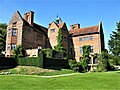
 Chartwell House - geograph.org.uk - 5565839.jpg 1,600 × 1,200; 429 KB
-
 Chartwell House - geograph.org.uk - 6099569.jpg 3,680 × 2,760; 2.23 MB
-
 Chartwell House - geograph.org.uk - 6183551.jpg 1,600 × 1,200; 556 KB
-
 Chartwell House Gardens - geograph.org.uk - 5565582.jpg 1,600 × 1,200; 657 KB
-
 Chartwell House grounds - geograph.org.uk - 5565608.jpg 1,024 × 768; 343 KB
-
 Chartwell House Grounds - geograph.org.uk - 5565823.jpg 1,024 × 768; 212 KB
-
 Chartwell House grounds - geograph.org.uk - 5565857.jpg 1,600 × 1,200; 369 KB
-
 Chestnut Avenue - geograph.org.uk - 6018644.jpg 1,024 × 768; 449 KB
-
 Chestnut Avenue - geograph.org.uk - 6018649.jpg 1,024 × 768; 460 KB
-
 Chestnut Avenue - geograph.org.uk - 6018660.jpg 1,024 × 768; 413 KB
-
 Chestnut Avenue - geograph.org.uk - 6018722.jpg 1,024 × 768; 464 KB
-
 Christmas Tree Festival in St Mary's Church, Westerham - geograph.org.uk - 6342720.jpg 4,000 × 3,000; 4.84 MB
-
 Christmas Tree Festival in St Mary's Church, Westerham - geograph.org.uk - 6342723.jpg 4,000 × 3,000; 4.65 MB
-
 Christmas Tree Festival in St Mary's Church, Westerham - geograph.org.uk - 6342726.jpg 4,000 × 3,000; 4.75 MB
-
 Christmas Tree Festival in St Mary's Church, Westerham - geograph.org.uk - 6342728.jpg 4,000 × 3,000; 4.92 MB
-
 Church Cottage - geograph.org.uk - 1923836.jpg 426 × 640; 133 KB
-
 Churchill Statue, Westerham - geograph.org.uk - 2937359.jpg 2,520 × 1,680; 473 KB
-
 Churchill Westerham - geograph.org.uk - 2007519.jpg 800 × 600; 135 KB
-
 Churchill's bench - geograph.org.uk - 2033179.jpg 640 × 426; 96 KB
-
 Cleared slope, Mariners Hill - geograph.org.uk - 6503758.jpg 1,024 × 768; 594 KB
-

-
-
 Clockwise M25 Entering Surrey - geograph.org.uk - 3732328.jpg 640 × 480; 263 KB
-

-
 Clockwise M25, London Road (A233) Bridge - geograph.org.uk - 3732343.jpg 640 × 480; 262 KB
-
 Closed Tatsfield Lane - geograph.org.uk - 2196595.jpg 3,072 × 2,304; 2.67 MB
-
 Clump of trees above Westerham - geograph.org.uk - 6508048.jpg 1,024 × 768; 292 KB
-
 Coakham Farm - geograph.org.uk - 4288281.jpg 640 × 427; 117 KB
-
 Coniferous woodland. Goodley Stock - geograph.org.uk - 2446001.jpg 640 × 430; 137 KB
-
 Conifers, Goodley Stock - geograph.org.uk - 2445995.jpg 640 × 430; 115 KB
-
 Coppicing, Hosey Common - geograph.org.uk - 6727592.jpg 1,024 × 684; 277 KB
-
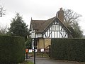
 Corner House - geograph.org.uk - 958451.jpg 640 × 480; 98 KB
-
 Corner of Hosey Common - geograph.org.uk - 6505946.jpg 1,024 × 768; 472 KB
-
 Corner of Hosey Common - geograph.org.uk - 6506243.jpg 1,024 × 768; 411 KB
-
 Corner of Spout Lane and Main Road, Crockham Hill - geograph.org.uk - 2877905.jpg 1,600 × 1,200; 494 KB
-
 Cottage alongside the track to Crockham Hill - geograph.org.uk - 4461240.jpg 4,000 × 3,000; 4.49 MB
-
 Cottage at French Street - geograph.org.uk - 3545835.jpg 4,000 × 3,000; 4.28 MB
-
 Cottage by the Greensand Way, Kent Hatch - geograph.org.uk - 2450788.jpg 640 × 430; 128 KB
-
 Cottage in Westerham - geograph.org.uk - 2702494.jpg 640 × 430; 62 KB
-
 Cottage on Mapleton Rd - geograph.org.uk - 2457699.jpg 640 × 430; 62 KB
-
 Cottage on the Hill - geograph.org.uk - 6723169.jpg 1,024 × 684; 223 KB
-
 Cottage on Westerham Hill - geograph.org.uk - 3941772.jpg 2,304 × 1,728; 819 KB
-
 Cottages at Crockham Hill - geograph.org.uk - 4474644.jpg 2,666 × 4,000; 7.68 MB
-
 Cottages at French Street - geograph.org.uk - 2693692.jpg 640 × 426; 87 KB
-
 Cottages on London Road, Westerham - geograph.org.uk - 2029186.jpg 640 × 480; 74 KB
-
 Cottages on the edge of Crockenhill Common - geograph.org.uk - 4414949.jpg 4,000 × 3,000; 4.06 MB
-
 Cottages, French Street - geograph.org.uk - 6504613.jpg 1,024 × 768; 366 KB
-
 Covered reservoir above Westerham - geograph.org.uk - 2524633.jpg 640 × 480; 91 KB
-
 Covered reservoir above Westerham - geograph.org.uk - 6507484.jpg 1,024 × 768; 280 KB
-
 Covered Reservoir, Puddledock Lane - geograph.org.uk - 1499884.jpg 640 × 430; 91 KB
-
 Covered Reservoir, Puddledock Lane - geograph.org.uk - 1499894.jpg 640 × 430; 122 KB
-
 Crockhall Hill - geograph.org.uk - 4474793.jpg 3,314 × 2,651; 7.04 MB
-
 Crockham Grange - geograph.org.uk - 4288289.jpg 640 × 427; 130 KB
-
 Crockham Hill - geograph.org.uk - 4474809.jpg 4,000 × 2,666; 7.11 MB
-
 Crockham Hill C of E Primary School - geograph.org.uk - 3470937.jpg 1,024 × 768; 239 KB
-
 Crockham Hill church in winter - geograph.org.uk - 4290505.jpg 4,000 × 3,000; 4.41 MB
-
 Crockham Hill Common - geograph.org.uk - 1501756.jpg 640 × 430; 164 KB
-

-
 Crockhamhill Common - geograph.org.uk - 2450794.jpg 640 × 430; 158 KB
-
 Crockhamhill Common - geograph.org.uk - 2450801.jpg 640 × 430; 155 KB
-
 Crockhamhill Common - geograph.org.uk - 2450810.jpg 640 × 430; 160 KB
-
 Crockhamhill Common - geograph.org.uk - 2450815.jpg 640 × 430; 148 KB
-
 Crockhamhill Common - geograph.org.uk - 2457590.jpg 640 × 430; 147 KB
-
 Crockhamhill Common - geograph.org.uk - 2457591.jpg 640 × 430; 168 KB
-
 Crockhamhill Common - geograph.org.uk - 2693681.jpg 640 × 426; 170 KB
-
 Crockhamhill Common, Mariners Hill - geograph.org.uk - 2457690.jpg 640 × 430; 150 KB
-
 Croft Road - geograph.org.uk - 3822856.jpg 800 × 530; 485 KB
-
 Croquet lawn at Chartwell - geograph.org.uk - 5571090.jpg 1,024 × 768; 233 KB
-
 Croydon Road - geograph.org.uk - 3822858.jpg 800 × 530; 505 KB
-
 Croydon Road going under the M25, Westerham - geograph.org.uk - 3261857.jpg 2,048 × 1,536; 1.48 MB
-
 Croydon Road looking towards the M25 - geograph.org.uk - 5449263.jpg 4,000 × 3,000; 5.06 MB
-
 Culvert under Mill Lane, Westerham - geograph.org.uk - 5287920.jpg 640 × 480; 106 KB
-
 Daffodils at Hosey Common - geograph.org.uk - 3908340.jpg 640 × 427; 99 KB
-
 Dahlias at Chartwell - geograph.org.uk - 5540746.jpg 4,000 × 3,000; 4.95 MB
-
 Dahlias at Chartwell - geograph.org.uk - 5540747.jpg 4,000 × 3,000; 5.16 MB
-
 Dahlias at Chartwell - geograph.org.uk - 5540751.jpg 4,000 × 3,000; 4.86 MB
-
 Dairy Lane - geograph.org.uk - 5428930.jpg 3,659 × 2,744; 2.85 MB
-
 Dairy Lane at Hurst Farm - geograph.org.uk - 1104183.jpg 640 × 427; 109 KB
-
 Dairy Lane, Crockham Hill - geograph.org.uk - 5249218.jpg 2,304 × 1,728; 804 KB
-
 Dairy Lane, Crockham Hill - geograph.org.uk - 5249437.jpg 2,304 × 1,728; 877 KB
-
 Darent Overflow car park, Westerham - geograph.org.uk - 4957731.jpg 3,264 × 2,448; 2.8 MB
-
 Dead tree in Squerryes Park - geograph.org.uk - 3545740.jpg 4,000 × 3,000; 4.01 MB
-
 Dennett Lodge Farm - geograph.org.uk - 2527675.jpg 640 × 480; 114 KB
-
 Derby Wood - geograph.org.uk - 2459999.jpg 640 × 430; 68 KB
-
 Derby Wood - geograph.org.uk - 2460334.jpg 640 × 430; 72 KB
-
 Derelict house, Chartwell - geograph.org.uk - 1500053.jpg 640 × 430; 152 KB
-
 Detail of Westerham - geograph.org.uk - 1247532.jpg 640 × 493; 122 KB
-

-
 Direction signs beside Chartwell - geograph.org.uk - 2959951.jpg 1,600 × 1,380; 929 KB
-
 Domesday Mosaic Westerham - geograph.org.uk - 1416457.jpg 4,000 × 3,000; 5.08 MB
-
 Door at Westerham - geograph.org.uk - 1247604.jpg 512 × 640; 69 KB
-
 Dovecot - Squerryes Court - geograph.org.uk - 2614942.jpg 1,600 × 1,200; 656 KB
-
 Drinking Fountain in Market Place Westerham Kent - geograph.org.uk - 1416455.jpg 3,000 × 4,000; 2.61 MB
-

-
 Drive off Froghole Lane - geograph.org.uk - 1500959.jpg 640 × 430; 148 KB
-
 Driveway to Crockham House, Kent - geograph.org.uk - 183995.jpg 640 × 480; 127 KB
-
 Driveway to Pilgrim House - geograph.org.uk - 1886886.jpg 640 × 428; 93 KB
-
 Driving the Flag - geograph.org.uk - 4474924.jpg 4,000 × 2,666; 7.08 MB
-
 East front - geograph.org.uk - 4775626.jpg 640 × 427; 86 KB
-
 Eastfield, Froghole Lane - geograph.org.uk - 1500952.jpg 640 × 430; 157 KB


.jpg)


_Bridge_-_geograph.org.uk_-_3732343.jpg)


