Category:Westby-with-Plumptons
Jump to navigation
Jump to search
English: Westby-with-Plumptons is a civil parish in Lancashire, North West England. The parish is in Fylde district and contains the hamlets of Great Plumpton, Little Plumpton, Lower Ballam, Higher Ballam, Moss Side (formerly Brown Moss Side), Peel, and Westby. As of the 2001 census, the parish had a population of 1,107. Westby and Plumpton were both mentioned in the Domesday Book, as "Westbi" and "Pluntun". (→Westby-with-Plumptons)
Nederlands: Westby-with-Plumptons is een plaats en civil parish in het bestuurlijke gebied Fylde, in het Engelse graafschap Lancashire met 1107 inwoners. (→Westby-with-Plumptons)
civil parish in Lancashire, England, UK  | |||||
| Upload media | |||||
| Instance of | |||||
|---|---|---|---|---|---|
| Location | Fylde, Lancashire, North West England, England | ||||
| Population |
| ||||
 | |||||
Subcategories
This category has the following 7 subcategories, out of 7 total.
Media in category "Westby-with-Plumptons"
The following 200 files are in this category, out of 230 total.
(previous page) (next page)-
 A 583 approaching Kirkham - geograph.org.uk - 2247222.jpg 640 × 461; 37 KB
-
 A 583 approaching M 55 roundabout - geograph.org.uk - 1883778.jpg 800 × 595; 59 KB
-
 A bend in Moss House Lane - geograph.org.uk - 4250665.jpg 640 × 480; 62 KB
-
 A field boundary with traffic on the M55 just in view - geograph.org.uk - 5779654.jpg 4,216 × 2,741; 7.86 MB
-
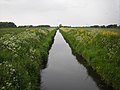
 A private fishing pond - geograph.org.uk - 5778811.jpg 4,592 × 3,056; 7.44 MB
-
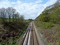
 A single track railway at Wrea Green - geograph.org.uk - 5332402.jpg 4,474 × 2,977; 7.86 MB
-
 A track onto a farm field with a fracking test rig in sight - geograph.org.uk - 5779615.jpg 4,561 × 2,447; 7.87 MB
-
 A windmill - geograph.org.uk - 5727005.jpg 4,592 × 3,056; 3.63 MB
-
 A windmill helping with the drainage - geograph.org.uk - 5727097.jpg 4,592 × 3,056; 5.34 MB
-
 A windmill helping with the drainage - geograph.org.uk - 5727120.jpg 4,005 × 2,764; 7.15 MB
-
 Access road, Westby Hall - geograph.org.uk - 3748097.jpg 4,608 × 3,456; 3.09 MB
-
 Anna's Road (track) - geograph.org.uk - 4250629.jpg 640 × 480; 67 KB
-
 Anna's Road - geograph.org.uk - 5717208.jpg 4,592 × 3,056; 6.18 MB
-
 Anna's Road, Ballam - geograph.org.uk - 1888479.jpg 1,600 × 1,200; 584 KB
-
 Approaching Birks Farm - geograph.org.uk - 3748849.jpg 4,608 × 3,456; 2.77 MB
-
 Approaching Little Plumpton on the road from Great Plumpton - geograph.org.uk - 3745057.jpg 4,608 × 3,456; 2.73 MB
-
 Approaching Lower Ballam - geograph.org.uk - 3748119.jpg 4,516 × 3,330; 2.25 MB
-

-
 Approaching White House Farm, Lower Ballam - geograph.org.uk - 3748121.jpg 4,608 × 3,456; 2.68 MB
-
 B5280, Great Plumpton - geograph.org.uk - 4252082.jpg 640 × 480; 75 KB
-
 Ballam Road - geograph.org.uk - 3748128.jpg 4,608 × 3,456; 2.85 MB
-
 Ballam Road - geograph.org.uk - 4252138.jpg 640 × 480; 51 KB
-
 Ballam Road - geograph.org.uk - 4252140.jpg 640 × 480; 50 KB
-
 Ballam Road - geograph.org.uk - 4252147.jpg 640 × 480; 62 KB
-
 Ballam Road - geograph.org.uk - 4252161.jpg 640 × 480; 63 KB
-
 Ballam Road - geograph.org.uk - 4252169.jpg 640 × 480; 63 KB
-
 Ballam Road - geograph.org.uk - 4252176.jpg 640 × 480; 81 KB
-
 Ballam Road - geograph.org.uk - 4752011.jpg 4,445 × 2,640; 7.84 MB
-
 Ballam Road at the junction with West Moss Lane - geograph.org.uk - 3748133.jpg 4,608 × 3,456; 6.47 MB
-
 Ballam Road meets the B5260 - geograph.org.uk - 3748008.jpg 4,000 × 2,764; 2.03 MB
-
 Ballam Road through Westby - geograph.org.uk - 3748084.jpg 4,608 × 3,456; 6.45 MB
-
 Big gate into field by Great Plumpton - geograph.org.uk - 2240182.jpg 1,600 × 1,168; 167 KB
-
 Branch Drain at Higher Ballam Bridge - geograph.org.uk - 3748131.jpg 4,608 × 3,456; 4.23 MB
-
 Brays Road - geograph.org.uk - 2342564.jpg 1,024 × 736; 70 KB
-
 Brays Road - geograph.org.uk - 3748127.jpg 4,608 × 3,456; 2.16 MB
-
 Brays Road - geograph.org.uk - 4252156.jpg 640 × 480; 56 KB
-
 Brays Road off Moss Side Lane - geograph.org.uk - 5332621.jpg 4,135 × 2,297; 5.43 MB
-
 Busy road between High Ballam and Lytham - geograph.org.uk - 3748659.jpg 4,608 × 3,456; 2.06 MB
-
 Buttercups carpeting Westby Wood - geograph.org.uk - 5763213.jpg 4,592 × 2,921; 7.75 MB
-
 Cartmel Lane - geograph.org.uk - 4752189.jpg 4,087 × 2,596; 7.79 MB
-
 Cartmell Lane - geograph.org.uk - 4252888.jpg 640 × 480; 49 KB
-
 Corka Lane - geograph.org.uk - 4252884.jpg 640 × 480; 61 KB
-
 Crop field near Lower Ballam - geograph.org.uk - 4252145.jpg 640 × 480; 74 KB
-
 Cropper Farm - geograph.org.uk - 4250644.jpg 640 × 480; 66 KB
-
 Cropper Road - geograph.org.uk - 2378718.jpg 800 × 600; 97 KB
-
 Cross at Fox Lane Ends, Wrea Green - geograph.org.uk - 699029.jpg 640 × 480; 111 KB
-
 Dairy cattle at Fox Lane Ends Farms - geograph.org.uk - 3747679.jpg 4,608 × 3,456; 6.24 MB
-
 Disused railway embankment - geograph.org.uk - 3384929.jpg 640 × 571; 58 KB
-
 DMU 142042 heading for Blackpool South - geograph.org.uk - 3919693.jpg 1,800 × 1,197; 755 KB
-
 Donkeys grazing - geograph.org.uk - 4252152.jpg 640 × 480; 53 KB
-
 Drain off Ballam Road - geograph.org.uk - 4252172.jpg 640 × 480; 74 KB
-
 Drain through farmland - geograph.org.uk - 3748831.jpg 4,006 × 3,033; 2.66 MB
-
 Ed's Tackle Box, Arkwright Court - geograph.org.uk - 2513312.jpg 640 × 480; 167 KB
-
 Electricity distribution centre - geograph.org.uk - 5717231.jpg 4,592 × 2,854; 7.6 MB
-
 Electricity pylons - geograph.org.uk - 5715557.jpg 640 × 426; 52 KB
-
 Entrance to Moss House Farm - geograph.org.uk - 2238126.jpg 1,600 × 1,184; 262 KB
-
 Entrance to Moss Side Farm - geograph.org.uk - 3747618.jpg 4,260 × 2,918; 2.05 MB
-
 Farm building, Ivy Farm - geograph.org.uk - 4252863.jpg 640 × 480; 49 KB
-

-
 Farm track - geograph.org.uk - 3748112.jpg 4,608 × 3,456; 3.17 MB
-
 Farm track to the south of Ballam Road - geograph.org.uk - 3748102.jpg 4,556 × 3,386; 2.32 MB
-
 Farmland and Main Drain - geograph.org.uk - 3748116.jpg 4,608 × 3,456; 6.21 MB
-
 Farmland east of Wild Lane - geograph.org.uk - 4250643.jpg 640 × 480; 73 KB
-
 Farmland near Manor House Farm - geograph.org.uk - 4252166.jpg 640 × 480; 68 KB
-
 Farmland near Smeath Hill Farm - geograph.org.uk - 4252887.jpg 640 × 480; 38 KB
-
 Farmland near the M55 - geograph.org.uk - 3384931.jpg 640 × 484; 82 KB
-
 Farmland north of Anna's Road - geograph.org.uk - 4250628.jpg 640 × 480; 66 KB
-
 Farmland north of Ballam Road - geograph.org.uk - 4252135.jpg 640 × 480; 47 KB
-
 Farmland north of Peg's Lane - geograph.org.uk - 4252181.jpg 640 × 480; 57 KB
-
 Farmland off Peg's Lane - geograph.org.uk - 4252177.jpg 640 × 480; 32 KB
-
 Farmland off Peg's Lane - geograph.org.uk - 4252858.jpg 640 × 480; 68 KB
-
 Farmland off Weeton Road - geograph.org.uk - 4252085.jpg 640 × 480; 69 KB
-
 Farmland off Wild Lane - geograph.org.uk - 4250631.jpg 640 × 480; 61 KB
-
 Farmland to the north of Ballam Road - geograph.org.uk - 3748107.jpg 4,608 × 3,456; 5.93 MB
-
 Farmland to the north of Manor House Farm - geograph.org.uk - 3748681.jpg 4,608 × 3,456; 2.17 MB
-
 Field entrance off Preston New Road - geograph.org.uk - 4250655.jpg 640 × 392; 57 KB
-
 Fields north of the A583 - geograph.org.uk - 5331798.jpg 4,592 × 2,830; 7.99 MB
-
 Flat farmland off Whitehill Road - geograph.org.uk - 4250647.jpg 640 × 480; 82 KB
-
 Flat farmland towards Woodland - geograph.org.uk - 4250637.jpg 640 × 525; 77 KB
-
 Footpath to Ribby Hall from Fox Lane Ends - geograph.org.uk - 3747736.jpg 4,037 × 2,991; 1.88 MB
-
 Footpath to the B5260 - geograph.org.uk - 3748037.jpg 4,608 × 3,456; 2.23 MB
-
 Fox Lane Ends (B5260) - geograph.org.uk - 4252096.jpg 640 × 480; 66 KB
-
 Fox Lane Ends - geograph.org.uk - 3747716.jpg 4,106 × 2,864; 2.17 MB
-
 Fox Lane Ends road junction - geograph.org.uk - 3747998.jpg 4,608 × 3,456; 6.22 MB
-

-
 Grazing north of Lytham Road - geograph.org.uk - 4252878.jpg 640 × 480; 51 KB
-
 Grazing towards the M55 - geograph.org.uk - 4250656.jpg 640 × 434; 32 KB
-
 Grazing towards the M55 - geograph.org.uk - 4250660.jpg 640 × 480; 58 KB
-
 Grazing, Great Plumpton - geograph.org.uk - 4250663.jpg 640 × 480; 88 KB
-
 Grazing, The Hill - geograph.org.uk - 4252101.jpg 640 × 480; 79 KB
-
 Grazing, Westby - geograph.org.uk - 4252122.jpg 640 × 480; 65 KB
-
 Great Plumpton - geograph.org.uk - 3744571.jpg 4,516 × 3,330; 2.77 MB
-
 Heading out of Westby - geograph.org.uk - 4252133.jpg 640 × 480; 92 KB
-
 House at Fox Lane Ends - geograph.org.uk - 2228538.jpg 1,600 × 1,115; 176 KB
-
 House off Ballam Road - geograph.org.uk - 4252173.jpg 640 × 394; 83 KB
-
 Houses and pond, Willowmead Park - geograph.org.uk - 4252882.jpg 640 × 480; 84 KB
-
 Houses near Plumpton Hall Farm - geograph.org.uk - 4252109.jpg 640 × 358; 34 KB
-
 Joining the M55 by Peel Hill - geograph.org.uk - 5079711.jpg 1,500 × 987; 131 KB
-
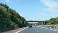 Junction 4 overbridge on the M55 - geograph.org.uk - 4514310.jpg 2,271 × 1,302; 781 KB
-
 Junction of Plumpton Lane and Moss House Lane - geograph.org.uk - 3745033.jpg 4,608 × 3,456; 3.56 MB
-
 Junction of Westby Road and Ballam Road - geograph.org.uk - 2230728.jpg 1,600 × 1,200; 235 KB
-

-
 Kirkham to Blackpool Railway - geograph.org.uk - 2916870.jpg 640 × 480; 178 KB
-
 Kirkham to Blackpool Railway - geograph.org.uk - 2916875.jpg 640 × 480; 167 KB
-
 Lane through Great Plumpton - geograph.org.uk - 2238156.jpg 1,600 × 1,170; 287 KB
-
 Lark Hall - geograph.org.uk - 3748108.jpg 4,608 × 3,456; 2.63 MB
-
 Leaning lampposts by Peel Lane - geograph.org.uk - 3748130.jpg 4,608 × 3,456; 3.22 MB
-

-

-
 Look both ways^ - geograph.org.uk - 2191513.jpg 480 × 640; 105 KB
-
 Lower Ballam - geograph.org.uk - 3748126.jpg 4,608 × 3,456; 3 MB
-
 Lower Ballam - geograph.org.uk - 5717032.jpg 4,482 × 3,025; 7.71 MB
-
 Lower Ballam Bridge - geograph.org.uk - 5716978.jpg 640 × 429; 77 KB
-
 Lytham Road (B5259) - geograph.org.uk - 4252864.jpg 640 × 358; 37 KB
-
 Lytham Road (B5259) - geograph.org.uk - 4252880.jpg 640 × 480; 68 KB
-
 Lytham road approaching level crossing - geograph.org.uk - 4252866.jpg 640 × 480; 105 KB
-
 M55 Motorway - geograph.org.uk - 101307.jpg 640 × 480; 85 KB
-
 M55 sliproad at Junction 4 - geograph.org.uk - 2744377.jpg 640 × 453; 43 KB
-
 Main Drain - geograph.org.uk - 4252857.jpg 640 × 480; 63 KB
-
 Main Drain looking north from Peg's Lane - geograph.org.uk - 1888450.jpg 1,600 × 1,200; 408 KB
-

-
 Main Drain north of Peg's Lane - geograph.org.uk - 1423061.jpg 640 × 480; 71 KB
-
 Main Drain south of Peg's Lane - geograph.org.uk - 1423063.jpg 640 × 480; 58 KB
-
 Maple Farm - geograph.org.uk - 5778700.jpg 4,325 × 2,231; 7.79 MB
-
 Mere Farm - geograph.org.uk - 4252093.jpg 640 × 480; 39 KB
-
 Moss House Farm - geograph.org.uk - 4250659.jpg 640 × 480; 48 KB
-
 Moss House Lane - geograph.org.uk - 2238113.jpg 1,600 × 1,140; 238 KB
-
 Moss House Lane - geograph.org.uk - 2238146.jpg 1,024 × 727; 49 KB
-
 Moss House Lane - geograph.org.uk - 4250657.jpg 640 × 480; 63 KB
-
 Moss House Lane - geograph.org.uk - 4250661.jpg 640 × 480; 88 KB
-
 Moss House Lane - geograph.org.uk - 5717163.jpg 4,515 × 2,705; 7.64 MB
-
 Moss House Lane - geograph.org.uk - 5778854.jpg 3,056 × 4,592; 6.63 MB
-
 Moss Side Lane - geograph.org.uk - 5333148.jpg 4,280 × 2,554; 7.38 MB
-
 Moss Side Railway Station - geograph.org.uk - 4252869.jpg 640 × 480; 60 KB
-
 Moss Side railway station, The Fylde - geograph.org.uk - 3201892.jpg 800 × 600; 145 KB
-
 Neatly-trimmed hedge alongside Little Birks farmland - geograph.org.uk - 3748707.jpg 4,608 × 3,456; 2.81 MB
-
 New build housing off Whitehill Road - geograph.org.uk - 4250649.jpg 640 × 480; 52 KB
-
 New track into farmland - geograph.org.uk - 3748760.jpg 4,608 × 3,456; 2.31 MB
-

-

-
 Overgrown land off Hallam Way - geograph.org.uk - 3216752.jpg 1,500 × 980; 178 KB
-
 Overlooking the M55 - geograph.org.uk - 69200.jpg 640 × 428; 26 KB
-
 Park homes site - geograph.org.uk - 4250653.jpg 640 × 480; 56 KB
-
 Partially erased graffiti - geograph.org.uk - 5473362.jpg 1,280 × 960; 345 KB
-
 Peg's Lane - geograph.org.uk - 3748723.jpg 4,608 × 3,456; 2.72 MB
-
 Peg's Lane - geograph.org.uk - 4252180.jpg 640 × 480; 59 KB
-
 Peg's Lane - geograph.org.uk - 4252856.jpg 640 × 480; 79 KB
-

-
 Pegs Lane - geograph.org.uk - 5717137.jpg 3,056 × 4,592; 7.55 MB
-
 Phone mast off Wild Lane - geograph.org.uk - 4250641.jpg 480 × 640; 40 KB
-
 Pipers Farm - geograph.org.uk - 2229340.jpg 640 × 476; 53 KB
-
 Plumpton Lane - geograph.org.uk - 5714716.jpg 4,592 × 2,792; 7.71 MB
-
 Plumpton Lodge - geograph.org.uk - 4252104.jpg 640 × 480; 73 KB
-
 Pond south of Little Birks Farm - geograph.org.uk - 3748732.jpg 4,608 × 3,456; 6.45 MB
-
 Preston New Road (A583) - geograph.org.uk - 4252098.jpg 640 × 480; 57 KB
-
 Preston New Road (A583) - geograph.org.uk - 4252102.jpg 640 × 393; 45 KB
-
 Preston New Road (A583) - geograph.org.uk - 4252107.jpg 640 × 480; 56 KB
-
 Preston New Road (A583) - geograph.org.uk - 4252110.jpg 640 × 480; 60 KB
-
 Preston New Road (the A683) - geograph.org.uk - 3745068.jpg 4,608 × 3,456; 3.1 MB
-
 Preston New Road - A583 - geograph.org.uk - 2228597.jpg 1,600 × 1,086; 143 KB
-
 Preston New Road - geograph.org.uk - 5474578.jpg 1,280 × 960; 446 KB
-

-
 Preston New Road. (A583) - geograph.org.uk - 4250654.jpg 640 × 480; 64 KB
-
 Private road, Marton - geograph.org.uk - 1882531.jpg 1,600 × 1,200; 382 KB
-
 Railway bridge on the B5260 - geograph.org.uk - 3744557.jpg 4,608 × 3,456; 3.06 MB
-

-
 Railway near Great Plumpton - geograph.org.uk - 6762093.jpg 1,200 × 811; 1.11 MB
-
 Road entering Wrea Green - geograph.org.uk - 2230734.jpg 1,600 × 1,200; 245 KB
-
 Road junction - geograph.org.uk - 1423135.jpg 640 × 461; 57 KB
-
 Road junction at Westby - geograph.org.uk - 5715496.jpg 4,592 × 2,645; 7.69 MB
-
 Road junction, Great Plumpton - geograph.org.uk - 3744586.jpg 4,608 × 3,456; 2.89 MB
-
 Road junction, Westby - geograph.org.uk - 3748089.jpg 4,608 × 3,456; 2.93 MB
-
 Road junction, Westby - geograph.org.uk - 4252124.jpg 640 × 480; 72 KB
-
 Road to Lark Hall - geograph.org.uk - 3748114.jpg 4,608 × 3,456; 2.21 MB
-
 Sheep grazing - geograph.org.uk - 5715484.jpg 4,592 × 2,768; 7.34 MB
-
 St Anne's Catholic Church, Westby Mills - geograph.org.uk - 2916590.jpg 640 × 480; 177 KB
-
 St Anne's Catholic Church, Westby Mills - geograph.org.uk - 2916827.jpg 640 × 480; 159 KB
-

-

-

-

-

-

-
 St Matthew's Church, Higher Ballam - geograph.org.uk - 3748135.jpg 4,608 × 3,456; 6.11 MB
-
 Staining Wood Farm (South) bus stop - geograph.org.uk - 5474586.jpg 1,280 × 960; 337 KB
-
 Station Road, Wrea Green - geograph.org.uk - 2569437.jpg 1,280 × 962; 653 KB
-
 Stone Cross, Wrea Green - geograph.org.uk - 5332536.jpg 4,178 × 3,004; 6.73 MB
-
 Telecoms Mast at Marton - geograph.org.uk - 4514289.jpg 4,074 × 2,776; 2.75 MB
-
 Tents at Maple Farm Nursery - geograph.org.uk - 5474595.jpg 1,280 × 960; 420 KB
-
 Thatched farm building, Westby - geograph.org.uk - 4252128.jpg 640 × 402; 83 KB
-
 The B5259 heading for Wrea Green - geograph.org.uk - 4055722.jpg 640 × 480; 56 KB
-
 The Kirkham to Blackpool South Line at Wrea Green - geograph.org.uk - 3919690.jpg 1,800 × 1,197; 551 KB
-
 The lights are at red - geograph.org.uk - 4055718.jpg 640 × 480; 71 KB
-
 The Outside Inn - geograph.org.uk - 3216751.jpg 1,500 × 1,000; 152 KB
-
 The Preston to Blackpool Railway line. - geograph.org.uk - 5763258.jpg 4,528 × 2,876; 7.67 MB
-
 The Railway at Wrea Green (2) - geograph.org.uk - 2569450.jpg 1,280 × 958; 725 KB
-
 The Railway at Wrea Green - geograph.org.uk - 2569443.jpg 1,280 × 959; 752 KB
-
 The railway bridge on Cartmel Lane - geograph.org.uk - 4752246.jpg 4,359 × 2,901; 7.95 MB
-
 The road into Lower Balham - geograph.org.uk - 5717081.jpg 4,592 × 3,056; 7.64 MB
-
 The track to Moss House Farm - geograph.org.uk - 5778765.jpg 4,592 × 2,727; 7.27 MB


_-_geograph.org.uk_-_4250629.jpg)


_towards_Derby_Hill_-_geograph.org.uk_-_4252089.jpg)


_-_geograph.org.uk_-_4252096.jpg)


_-_geograph.org.uk_-_4252864.jpg)
_-_geograph.org.uk_-_4252880.jpg)


.jpg)


_-_geograph.org.uk_-_4252098.jpg)
_-_geograph.org.uk_-_4252102.jpg)
_-_geograph.org.uk_-_4252107.jpg)
_-_geograph.org.uk_-_4252110.jpg)
_-_geograph.org.uk_-_3745068.jpg)


_-_geograph.org.uk_-_4250654.jpg)


_bus_stop_-_geograph.org.uk_-_5474586.jpg)


_-_geograph.org.uk_-_2569450.jpg)


