Category:West Witton
Jump to navigation
Jump to search
village and civil parish in the Richmondshire district of North Yorkshire, England, UK  | |||||
| Upload media | |||||
| Instance of | |||||
|---|---|---|---|---|---|
| Location | Richmondshire, North Yorkshire, Yorkshire and the Humber, England | ||||
| Population |
| ||||
 | |||||
English: West Witton is a village in the Richmondshire district of North Yorkshire, England. Located in Wensleydale in the Yorkshire Dales it lies on the A684 (the main road between Leyburn and Hawes). The village is the first one on the A684 to lie within the Yorkshire Dales National Park. There is also an East Witton about five miles away in Coverdale.
Subcategories
This category has the following 4 subcategories, out of 4 total.
Media in category "West Witton"
The following 200 files are in this category, out of 318 total.
(previous page) (next page)-
 1845 benchmark on gatepost of South Lodge - geograph.org.uk - 2771459.jpg 1,024 × 683; 336 KB
-
 A Field Corner below Capple Bank - geograph.org.uk - 4476348.jpg 5,184 × 3,456; 5.79 MB
-
 A gap in the trees - geograph.org.uk - 5864338.jpg 4,320 × 3,240; 4.57 MB
-
 A shaded road near West Witton - geograph.org.uk - 5928793.jpg 2,000 × 1,380; 2.96 MB
-
 A shady lane - geograph.org.uk - 5864272.jpg 4,320 × 3,240; 4.88 MB
-
 A View up Wensleydale - geograph.org.uk - 4117036.jpg 4,944 × 2,908; 6.57 MB
-
 A684 at Temple Bank - geograph.org.uk - 3788274.jpg 683 × 1,024; 194 KB
-
 A684 eastbound through West Witton village (geograph 2960760).jpg 640 × 437; 54 KB
-

-

-
 A684 west of Alma Farm looking west - geograph.org.uk - 2960783.jpg 640 × 376; 51 KB
-
 A684, Temple Cross - geograph.org.uk - 5413895.jpg 640 × 480; 118 KB
-
 Across the dale from West Witton - geograph.org.uk - 5864281.jpg 4,319 × 2,841; 2.96 MB
-
 Alma Farm beside A684 - geograph.org.uk - 2762168.jpg 1,024 × 683; 211 KB
-
 An ever winding road - geograph.org.uk - 5928784.jpg 2,000 × 1,333; 2.48 MB
-
 Back Lane - geograph.org.uk - 4972669.jpg 5,184 × 3,888; 5.13 MB
-
 Banchmark on 'Pen Cottage' - geograph.org.uk - 2598660.jpg 683 × 1,024; 242 KB
-
 Barn above West Witton - geograph.org.uk - 2762253.jpg 1,634 × 2,177; 729 KB
-
 Barn and lane at Nossil End - geograph.org.uk - 2762232.jpg 3,264 × 2,448; 1.89 MB
-
 Barn near High Lane - geograph.org.uk - 2762257.jpg 3,264 × 2,448; 1.46 MB
-
 Barn north of High Lane - geograph.org.uk - 2635183.jpg 1,024 × 683; 181 KB
-
 Bay Bolton Avenue - geograph.org.uk - 4476333.jpg 4,867 × 3,174; 6.89 MB
-
 Belvedere and B^B sign - geograph.org.uk - 3338232.jpg 2,048 × 1,536; 1.32 MB
-
 Benchmark dating from 1845 on house 'East View' - geograph.org.uk - 2598611.jpg 683 × 1,024; 312 KB
-
 Benchmark on Alma Farm - geograph.org.uk - 2762144.jpg 1,024 × 683; 309 KB
-
 Benchmark on barn at Penhill Farm - geograph.org.uk - 2634611.jpg 683 × 1,024; 315 KB
-
 Benchmark on barn off High Lane - geograph.org.uk - 4347168.jpg 683 × 1,024; 305 KB
-
 Benchmark on barn on north side of A684 - geograph.org.uk - 2638223.jpg 683 × 1,024; 280 KB
-
 Benchmark on boulder beside High Lane - geograph.org.uk - 3027325.jpg 1,024 × 683; 301 KB
-

-
 Benchmark on boundary wall of Temple Folly - geograph.org.uk - 3787243.jpg 683 × 1,024; 278 KB
-

-

-
 Benchmark on gatepost - geograph.org.uk - 4278365.jpg 1,024 × 683; 314 KB
-

-
 Benchmark on gatepost beside Grassgill Lane - geograph.org.uk - 2667360.jpg 683 × 1,024; 202 KB
-
 Benchmark on gatepost by Watery Lane - geograph.org.uk - 2770198.jpg 683 × 1,024; 227 KB
-
 Benchmark on gatepost near Penhill Farm - geograph.org.uk - 2633858.jpg 683 × 1,024; 272 KB
-
 Benchmark on gatepost of Mesnes Lane (A684) - geograph.org.uk - 2638175.jpg 683 × 1,024; 241 KB
-
 Benchmark on gatepost on Flint Lane - geograph.org.uk - 2634900.jpg 683 × 1,024; 223 KB
-
 Benchmark on gatepost on NW side of Flint Lane - geograph.org.uk - 2635083.jpg 683 × 1,024; 248 KB
-
 Benchmark on gatepost on Patterham Lane - geograph.org.uk - 2602127.jpg 683 × 1,024; 243 KB
-
 Benchmark on gatepost on Scot Gate - geograph.org.uk - 2638062.jpg 683 × 1,024; 296 KB
-
 Benchmark on gatepost on SE side of Flint Lane - geograph.org.uk - 2634945.jpg 683 × 1,024; 266 KB
-
 Benchmark on gatepost on Temple Bank - geograph.org.uk - 3785445.jpg 683 × 1,024; 306 KB
-
 Benchmark on gatepost on west side of track - geograph.org.uk - 2492814.jpg 683 × 1,024; 228 KB
-

-
 Benchmark on gatepost south of Penhill Farm - geograph.org.uk - 2634722.jpg 683 × 1,024; 239 KB
-
 Benchmark on Langthwaite Barn - geograph.org.uk - 2491430.jpg 683 × 1,024; 179 KB
-
 Benchmark on NE side of A684 - geograph.org.uk - 2638254.jpg 683 × 1,024; 191 KB
-
 Benchmark on orphaned gatepost on Patterham Lane - geograph.org.uk - 2603898.jpg 683 × 1,024; 285 KB
-
 Benchmark on roadside wall Middleham High Moor - geograph.org.uk - 2634757.jpg 1,024 × 683; 300 KB
-
 Benchmark on sheepfold gatepost - geograph.org.uk - 2603960.jpg 683 × 1,024; 231 KB
-
 Benchmark on stable at Temple Farm - geograph.org.uk - 3785584.jpg 683 × 1,024; 321 KB
-
 Benchmark on stone in wall of Flint Lane - geograph.org.uk - 2635002.jpg 1,024 × 683; 348 KB
-
 Benchmark on the old School House - geograph.org.uk - 2602004.jpg 683 × 1,024; 264 KB
-
 Benchmark on wall at village entrance - geograph.org.uk - 2604064.jpg 683 × 1,024; 261 KB
-
 Benchmark on wall of Hill House - geograph.org.uk - 2771366.jpg 1,024 × 683; 363 KB
-
 Benchmark on wall of Witton Steeps - geograph.org.uk - 2633306.jpg 1,024 × 683; 278 KB
-
 Benchmark on wall stone of High Lane - geograph.org.uk - 2637202.jpg 1,024 × 683; 287 KB
-
 Benchmark on ^1 Grassmill Cottage - geograph.org.uk - 2638264.jpg 683 × 1,024; 262 KB
-
 Benchmarks on gatepost on Witton Steeps - geograph.org.uk - 2633747.jpg 683 × 1,024; 215 KB
-
 Bend in Scot Gate (A684) - geograph.org.uk - 5413902.jpg 640 × 480; 113 KB
-
 Bend in the A684, Swinithwaite - geograph.org.uk - 5413898.jpg 640 × 480; 118 KB
-
 Beside The Ure - geograph.org.uk - 283637.jpg 640 × 480; 97 KB
-
 Bolton Hall from Lord's Bridge - geograph.org.uk - 6009193.jpg 1,600 × 900; 591 KB
-
 Bolton Hall, from the South - geograph.org.uk - 94409.jpg 640 × 409; 97 KB
-
 Bolton Hall, Wensleydale - geograph.org.uk - 3026889.jpg 2,592 × 1,944; 1.38 MB
-
 Boundary wall near Height of Hazely - geograph.org.uk - 1927175.jpg 2,048 × 1,536; 1.13 MB
-

-
 Bridleway leading towards the River Ure - geograph.org.uk - 4117469.jpg 5,184 × 3,456; 7.02 MB
-
 Bridleway leading up Penhill - geograph.org.uk - 4375503.jpg 5,033 × 3,152; 7.56 MB
-
 Bridleway on Penhill Park - geograph.org.uk - 4375464.jpg 5,184 × 3,456; 7.63 MB
-
 Bridleway through Penhill Park - geograph.org.uk - 4390102.jpg 3,776 × 2,520; 3.87 MB
-
 Bridleway to Penhill. - geograph.org.uk - 4789757.jpg 640 × 340; 56 KB
-
 Cairn near Penhill Beacon - geograph.org.uk - 4390125.jpg 3,776 × 2,520; 4.25 MB
-
 Capplebank Plantation - geograph.org.uk - 6594185.jpg 1,024 × 768; 196 KB
-
 Cattle country - geograph.org.uk - 5864260.jpg 4,320 × 2,772; 2.64 MB
-
 Common Lane, Middleham High Moor - geograph.org.uk - 4390097.jpg 3,776 × 2,520; 3.9 MB
-
 Common Lane, Middleham High Moor - geograph.org.uk - 6594181.jpg 640 × 480; 76 KB
-
 Concrete Track descending towards Swinithwaite - geograph.org.uk - 4116844.jpg 5,184 × 3,456; 6.17 MB
-
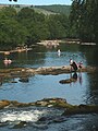 Cooling off at Redmire - geograph.org.uk - 5830719.jpg 720 × 960; 216 KB
-
 Cottages on Main Street, West Witton - geograph.org.uk - 5413917.jpg 640 × 480; 63 KB
-
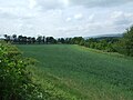 Crop field, Scaw Bottom - geograph.org.uk - 5413930.jpg 640 × 480; 72 KB
-
 Crossing the Ure at Slapestone Wath - geograph.org.uk - 4170851.jpg 800 × 600; 206 KB
-
 Derelict Barn - geograph.org.uk - 3613956.jpg 4,000 × 3,000; 3.82 MB
-
 Descending north off Penhill - geograph.org.uk - 2508011.jpg 640 × 480; 90 KB
-
 Drive to Bolton Hall at South Lodge - geograph.org.uk - 2771484.jpg 683 × 1,024; 250 KB
-
 Drive to Bolton Hall at South Lodge - geograph.org.uk - 3587187.jpg 640 × 481; 135 KB
-

-
 Dry stone wall crossing moorland - geograph.org.uk - 4207190.jpg 1,500 × 957; 1.27 MB
-
 Dry stone wall on south side of High Lane - geograph.org.uk - 2637239.jpg 1,024 × 683; 279 KB
-
 Dry stone walling - geograph.org.uk - 4972683.jpg 5,184 × 3,888; 4.25 MB
-

-
 East of Redmire Force - geograph.org.uk - 6161262.jpg 2,048 × 1,536; 1.14 MB
-

-
 Elizabeth II postbox on Main Street, West Witton - geograph.org.uk - 5415725.jpg 2,136 × 2,848; 1.41 MB
-
 Elizabeth II postbox on Main Street, West Witton - geograph.org.uk - 5415749.jpg 1,898 × 2,841; 1.07 MB
-
 Erosion at Lords Bridge - geograph.org.uk - 6161455.jpg 2,048 × 1,536; 1.04 MB
-
 Escarpment below Flint Lane - geograph.org.uk - 2615494.jpg 480 × 640; 66 KB
-
 Fairy Mushroom Ring - geograph.org.uk - 4727733.jpg 3,456 × 2,592; 3.96 MB
-
 Farm at Low Wanlass - geograph.org.uk - 4347356.jpg 1,024 × 683; 195 KB
-
 Farm building, Temple Farm - geograph.org.uk - 5413890.jpg 640 × 480; 73 KB
-
 Field barn West Witton - geograph.org.uk - 5864279.jpg 4,319 × 2,768; 3.85 MB
-
 Field barn, Swinithwaite - geograph.org.uk - 5864298.jpg 4,320 × 3,240; 4.51 MB
-
 Field entrance off Scot Gate - geograph.org.uk - 5413904.jpg 640 × 480; 71 KB
-
 Field with trees - geograph.org.uk - 4972865.jpg 5,184 × 3,888; 4.64 MB
-
 Flint Lane - geograph.org.uk - 4136748.jpg 4,000 × 3,000; 2.78 MB
-
 Footpath near Redmire Force - geograph.org.uk - 1962541.jpg 640 × 480; 86 KB
-
 Footpath near West Witton - geograph.org.uk - 1924223.jpg 2,048 × 1,536; 1.46 MB
-
 Footpath sign in West Witton - geograph.org.uk - 4545904.jpg 1,024 × 683; 142 KB
-
 Footpath to Kagram - geograph.org.uk - 1997660.jpg 2,304 × 1,704; 1.81 MB
-
 Footpath to Kagram from Grassgill Lane - geograph.org.uk - 2770217.jpg 1,024 × 683; 305 KB
-
 Ford (almost dry today) on High Lane - geograph.org.uk - 2969399.jpg 3,072 × 2,304; 1.1 MB
-
 Former stable beside A684 at Temple Farm - geograph.org.uk - 3785607.jpg 1,024 × 684; 142 KB
-
 Frost on Middleham High Moor - geograph.org.uk - 347112.jpg 600 × 450; 77 KB
-
 Gallop on Middleham High Moor looking East - geograph.org.uk - 4375428.jpg 5,184 × 3,456; 5.11 MB
-
 Gallop on Middleham High Moor looking West - geograph.org.uk - 4375433.jpg 5,184 × 3,456; 4.78 MB
-
 Gallops parallel the road at Middleham High Moor - geograph.org.uk - 2969421.jpg 3,072 × 2,304; 1.42 MB
-
 Gate on the bridleway - geograph.org.uk - 5864261.jpg 3,239 × 4,319; 4.65 MB
-
 Gatepost with 1845 benchmark at Oaktree Farm - geograph.org.uk - 2602036.jpg 683 × 1,024; 281 KB
-
 Gatepost with benchmark on High Lane - geograph.org.uk - 4347144.jpg 683 × 1,024; 318 KB
-
 Gateway beside A684 east of Swinithwaite Hall - geograph.org.uk - 2638071.jpg 1,024 × 683; 210 KB
-
 Gateway beside A684 southwest of Alma Farm - geograph.org.uk - 2771427.jpg 683 × 1,024; 233 KB
-
 Gateway beside path to West Witton - geograph.org.uk - 4347374.jpg 1,024 × 683; 183 KB
-
 Gateway in Wanlass Park - geograph.org.uk - 4347187.jpg 1,024 × 683; 229 KB
-
 Gateway near Penhill Farm - geograph.org.uk - 2633924.jpg 1,024 × 683; 235 KB
-
 Gateway on north side of A684 at Temple Bank - geograph.org.uk - 3785448.jpg 1,024 × 683; 207 KB
-
 Gateway on Witton Steeps at High Lane junction - geograph.org.uk - 2633680.jpg 1,024 × 683; 259 KB
-
 Gateway to field from High Lane - geograph.org.uk - 4347150.jpg 1,024 × 683; 243 KB
-
 Gateways in walls of High Lane - geograph.org.uk - 4278386.jpg 1,024 × 683; 261 KB
-
 Grassgill Lane at Capple Bank Farm - geograph.org.uk - 2771139.jpg 1,024 × 683; 305 KB
-
 Grassgill Lane gateway - geograph.org.uk - 2770169.jpg 1,024 × 683; 232 KB
-

-
 Grazing and woodland, Scot Gate - geograph.org.uk - 5413901.jpg 640 × 480; 86 KB
-
 Grazing near Temple Farm - geograph.org.uk - 5413884.jpg 640 × 480; 51 KB
-
 Grazing off Mesnes Lane - geograph.org.uk - 5413908.jpg 640 × 480; 56 KB
-
 Grazing Temple Cross - geograph.org.uk - 5413893.jpg 640 × 480; 71 KB
-
 Grazing, Middleham High Moor - geograph.org.uk - 6594178.jpg 1,024 × 768; 112 KB
-
 Grazing, Swinithwaite - geograph.org.uk - 5413897.jpg 640 × 480; 70 KB
-
 Groove of old quarry road - geograph.org.uk - 4207206.jpg 1,500 × 932; 1.24 MB
-
 Hawthorn in a buttercup meadow - geograph.org.uk - 4972694.jpg 5,184 × 3,888; 4.65 MB
-
 Heading for Penhill - geograph.org.uk - 6397452.jpg 4,937 × 3,301; 2.41 MB
-
 High Lane - geograph.org.uk - 1032715.jpg 640 × 480; 115 KB
-
 High Lane - geograph.org.uk - 2969364.jpg 3,072 × 2,304; 1.31 MB
-
 High Lane - geograph.org.uk - 3027357.jpg 1,024 × 683; 158 KB
-
 High Lane - geograph.org.uk - 4117000.jpg 5,035 × 3,415; 7.73 MB
-
 High Lane above West Witton - geograph.org.uk - 4553174.jpg 1,024 × 683; 141 KB
-
 High Lane at Gunnery Plain - geograph.org.uk - 2508059.jpg 640 × 480; 73 KB
-
 High Lane below Oswald Pasture - geograph.org.uk - 2969342.jpg 3,072 × 2,304; 1.32 MB
-
 High Lane heading towards Morpeth Gate - geograph.org.uk - 4136768.jpg 4,000 × 3,000; 3.71 MB
-
 Holl Gate (A684) - geograph.org.uk - 5413926.jpg 640 × 480; 87 KB
-
 Horse gallops on beside Common Lane - geograph.org.uk - 6594177.jpg 1,024 × 768; 182 KB
-
 Hot lambs at Swinithwaite - geograph.org.uk - 5830714.jpg 960 × 720; 261 KB
-
 Houses beside the A684 - geograph.org.uk - 2771238.jpg 1,024 × 683; 137 KB
-
 Houses beside the main road through West Witton - geograph.org.uk - 2598698.jpg 1,024 × 683; 165 KB
-
 Houses on A684 at east end of West Witton - geograph.org.uk - 2771296.jpg 1,024 × 683; 162 KB
-
 Houses on south side of A684 - geograph.org.uk - 2771337.jpg 1,024 × 683; 131 KB
-
 Houses on the A684, West Witton - geograph.org.uk - 5413911.jpg 640 × 447; 67 KB
-

-
 Junction of High Lane and Witton Steeps - geograph.org.uk - 2969414.jpg 3,072 × 2,304; 1.4 MB
-
 Lane, Nossill End - geograph.org.uk - 174261.jpg 640 × 480; 75 KB
-
 Langthwaite Lane - geograph.org.uk - 1924256.jpg 2,048 × 1,536; 1.39 MB
-
 Large cairn near Penhill Beacon - geograph.org.uk - 4228775.jpg 1,024 × 683; 173 KB
-
 Line of trees north of Penhill Quarry - geograph.org.uk - 4207216.jpg 1,500 × 786; 1.13 MB
-
 Lone tree at wall corner - geograph.org.uk - 4207242.jpg 1,500 × 965; 1.47 MB
-
 Looking across the A684 outside Oaktree Farm - geograph.org.uk - 2602070.jpg 1,024 × 683; 177 KB
-
 Looking east along High Lane - geograph.org.uk - 4278324.jpg 1,024 × 683; 255 KB
-
 Looking west along High Lane - geograph.org.uk - 4278337.jpg 1,024 × 683; 239 KB
-
 Main Street, West Witton - geograph.org.uk - 5415730.jpg 640 × 480; 65 KB
-
 Manor Farm, Swinithwaite - geograph.org.uk - 5413899.jpg 640 × 480; 69 KB
-
 Mesnes Lane (A684) - geograph.org.uk - 5413909.jpg 640 × 480; 116 KB
-
 Middleham High Moor (28259836847).jpg 2,736 × 3,648; 5.45 MB
-
 Middleham High Moor (43129550511).jpg 3,648 × 2,350; 6.01 MB
-
 Middleham High Moor (43129552721).jpg 3,648 × 1,586; 3.19 MB
-
 Middleham High Moor (43129553731).jpg 3,648 × 1,875; 3.59 MB
-
 Milepost west of Temple Farm - geograph.org.uk - 2508075.jpg 640 × 480; 142 KB
-
 Minor road near Wraykeld Well - geograph.org.uk - 1927191.jpg 2,048 × 1,536; 1.13 MB
-
 Morpeth Gate - geograph.org.uk - 6160984.jpg 2,048 × 1,536; 1.14 MB
-
 Mucky junction - geograph.org.uk - 2762243.jpg 3,264 × 2,448; 1.83 MB
-
 Near Cornlands Wood - geograph.org.uk - 6161259.jpg 2,048 × 1,536; 1.13 MB
-
 Near High Lane - geograph.org.uk - 6160972.jpg 2,048 × 1,536; 1.07 MB
-
 Near Swinithwaite - geograph.org.uk - 5928810.jpg 2,000 × 1,333; 2.33 MB
-
 Near West Witton - geograph.org.uk - 6160961.jpg 2,048 × 1,536; 1.04 MB
-
 Near West Witton - geograph.org.uk - 6161414.jpg 2,048 × 1,536; 1.29 MB
-
 New Wood behind a dry stone wall - geograph.org.uk - 2601006.jpg 1,024 × 683; 253 KB
-
 Nossill Quarry - geograph.org.uk - 6160965.jpg 2,048 × 1,536; 1.25 MB
-
 Novel advertising idea - geograph.org.uk - 4086306.jpg 1,024 × 768; 208 KB
-

-
 Old guide stoop above West Witton - geograph.org.uk - 1032706.jpg 480 × 640; 139 KB
-
 Old quarry ruin, Penhill Park - geograph.org.uk - 2615468.jpg 640 × 480; 99 KB
-
 Old Stables - geograph.org.uk - 283617.jpg 640 × 480; 34 KB
-
 Old stables, Limekiln Hill - geograph.org.uk - 6594175.jpg 1,024 × 768; 177 KB
-
 On Black Scar - geograph.org.uk - 4375744.jpg 5,184 × 3,456; 6.71 MB
-
 On Holl Gate - geograph.org.uk - 5928787.jpg 2,000 × 1,333; 1.95 MB
-
 On Witton Steeps - geograph.org.uk - 6397462.jpg 5,184 × 3,888; 3.09 MB
-
 Ordnance Survey Cut Mark - geograph.org.uk - 3529071.jpg 4,000 × 3,000; 4.61 MB
-
 Ordnance Survey Cut Mark - geograph.org.uk - 3529102.jpg 4,000 × 3,000; 4.21 MB
-
 Ordnance Survey Flush Bracket S8100 - geograph.org.uk - 3529041.jpg 4,000 × 3,000; 3.64 MB
-
 Orphaned gateposts beside Patterham Lane - geograph.org.uk - 2603935.jpg 1,024 × 683; 296 KB


.jpg)


_-_geograph.org.uk_-_2638175.jpg)


_-_geograph.org.uk_-_5413902.jpg)


_on_High_Lane_-_geograph.org.uk_-_2969399.jpg)


_-_geograph.org.uk_-_5413926.jpg)


_and_A684_-_geograph.org.uk_-_2771372.jpg)


_-_geograph.org.uk_-_5413909.jpg)
.jpg)
.jpg)
.jpg)
.jpg)


