Category:West Wickham, Cambridgeshire
Jump to navigation
Jump to search
English: West Wickham is a village and civil parish in South Cambridgeshire, England. At the time of the 2001 census, the parish had a population of 423 people.
village and civil parish in South Cambridgeshire, England, United Kingdom  | |||||
| Upload media | |||||
| Instance of | |||||
|---|---|---|---|---|---|
| Location | South Cambridgeshire, Cambridgeshire, East of England, England | ||||
| Population |
| ||||
 | |||||
Subcategories
This category has only the following subcategory.
Media in category "West Wickham, Cambridgeshire"
The following 150 files are in this category, out of 150 total.
-
 002osd000000002u00097000.jpg 4,000 × 3,076; 5.62 MB
-
 A Cambridgeshire crossroads - geograph.org.uk - 4772736.jpg 1,024 × 683; 775 KB
-
 A converted windmill - geograph.org.uk - 312929.jpg 640 × 480; 102 KB
-
 A green hillside and a drain - geograph.org.uk - 4772836.jpg 1,024 × 732; 974 KB
-
 A Long Black Barn - geograph.org.uk - 2604504.jpg 1,024 × 768; 193 KB
-
 A view from West Wickham churchyard - geograph.org.uk - 4772621.jpg 1,024 × 1,024; 1.68 MB
-
 A weedy field of beet - geograph.org.uk - 5640899.jpg 640 × 480; 126 KB
-
 Access track to Brickyard Cottages - geograph.org.uk - 2562297.jpg 1,600 × 1,200; 855 KB
-
 Agricultural loader and trailer - geograph.org.uk - 4684904.jpg 640 × 480; 93 KB
-
 Black Barn - geograph.org.uk - 2604501.jpg 1,024 × 768; 252 KB
-
 Blue And Yellow - geograph.org.uk - 2604492.jpg 1,024 × 768; 284 KB
-
 Bottle Hall to West Wickham - geograph.org.uk - 4772730.jpg 1,024 × 682; 940 KB
-
 Burton End - geograph.org.uk - 2559710.jpg 1,600 × 1,200; 626 KB
-
 Country Road - geograph.org.uk - 3212981.jpg 1,024 × 768; 194 KB
-
 Crest of the hill - geograph.org.uk - 4772002.jpg 1,024 × 731; 1.01 MB
-
 Crop sprayer - geograph.org.uk - 4685021.jpg 640 × 480; 79 KB
-
 Crop sprayer - geograph.org.uk - 5640904.jpg 640 × 480; 93 KB
-
 Disused Quarry - geograph.org.uk - 3212973.jpg 1,024 × 768; 245 KB
-
 Disused Quarry - geograph.org.uk - 3212978.jpg 1,024 × 768; 212 KB
-
 Ditch from Roman Road - geograph.org.uk - 2572924.jpg 1,600 × 1,200; 763 KB
-
 Down hill to the crossroads - geograph.org.uk - 4772260.jpg 1,024 × 732; 773 KB
-
 Entering Streetly End - geograph.org.uk - 2604507.jpg 1,024 × 768; 271 KB
-
 Farm Buildings - geograph.org.uk - 3466471.jpg 1,600 × 1,000; 627 KB
-
 Farmland near West Wickham - geograph.org.uk - 2562544.jpg 1,600 × 1,200; 914 KB
-
 Football pitch, West Wickham - geograph.org.uk - 2562549.jpg 1,600 × 1,200; 782 KB
-
 Footbridge - geograph.org.uk - 2604518.jpg 1,024 × 768; 279 KB
-
 Footbridge - geograph.org.uk - 2604545.jpg 1,024 × 768; 373 KB
-
 Footbridge - geograph.org.uk - 3212962.jpg 1,024 × 768; 261 KB
-
 Footpath - geograph.org.uk - 2604483.jpg 768 × 1,024; 197 KB
-
 Footpath around West Wickham - geograph.org.uk - 2562538.jpg 1,600 × 1,200; 873 KB
-
 Footpath Field And Forest - geograph.org.uk - 3212968.jpg 1,024 × 768; 296 KB
-
 Footpath from Burton End - geograph.org.uk - 2562289.jpg 1,600 × 1,200; 1.19 MB
-
 Footpath from Skipper's Lane - geograph.org.uk - 2559840.jpg 1,600 × 1,200; 1.16 MB
-
 Footpath from West Wickham - geograph.org.uk - 2562581.jpg 1,600 × 1,200; 833 KB
-
 Footpath Junction - geograph.org.uk - 2604485.jpg 1,024 × 768; 336 KB
-
 Footpath Junction - geograph.org.uk - 2604488.jpg 768 × 1,024; 277 KB
-
 Footpath Junction - geograph.org.uk - 2604525.jpg 1,024 × 768; 235 KB
-
 Footpath Marker Post - geograph.org.uk - 2604528.jpg 768 × 1,024; 145 KB
-
 Footpath Off Country Road - geograph.org.uk - 3213088.jpg 1,024 × 768; 215 KB
-
 Footpath past Hare Wood - geograph.org.uk - 2559754.jpg 1,600 × 1,200; 746 KB
-
 Footpath Sign and Road - geograph.org.uk - 2604467.jpg 1,024 × 768; 379 KB
-
 Footpath through the oil seed rape - geograph.org.uk - 2559735.jpg 1,600 × 1,200; 824 KB
-
 Footpath to Rand's Wood - geograph.org.uk - 2562282.jpg 1,600 × 1,200; 706 KB
-
 Footpath to Skipper's Lane - geograph.org.uk - 2559869.jpg 1,600 × 1,200; 998 KB
-
 Footpath to Streetly End - geograph.org.uk - 2559780.jpg 1,600 × 1,200; 825 KB
-
 Footpath to Streetly End - geograph.org.uk - 2572859.jpg 1,600 × 1,200; 883 KB
-
 Footpath To The Left - geograph.org.uk - 2604530.jpg 1,024 × 768; 278 KB
-
 Footpath to West Wickham - geograph.org.uk - 2562560.jpg 1,600 × 1,200; 980 KB
-
 Footpath to West Wickham - geograph.org.uk - 2562564.jpg 1,600 × 1,200; 905 KB
-
 Footpath to West Wickham - geograph.org.uk - 2562585.jpg 1,600 × 1,200; 836 KB
-
 Footpath to West Wickham - geograph.org.uk - 4071977.jpg 1,600 × 1,200; 924 KB
-
 Footpath to West Wickham - geograph.org.uk - 524247.jpg 640 × 427; 84 KB
-
 Footpath to Weston Woods Farm - geograph.org.uk - 2559855.jpg 1,600 × 1,200; 853 KB
-
 Footpaths from West Wickham - geograph.org.uk - 2562533.jpg 1,600 × 1,200; 881 KB
-
 Former hangar, RAF Wratting Common - geograph.org.uk - 5342981.jpg 640 × 428; 96 KB
-
 Former White Horse - geograph.org.uk - 2604494.jpg 1,024 × 768; 145 KB
-
 Ghostly T2 hangar at ex-RAF Wratting - geograph.org.uk - 4389684.jpg 1,024 × 768; 268 KB
-
 Grassy field - geograph.org.uk - 1458351.jpg 640 × 480; 123 KB
-
 Grassy Footpath - geograph.org.uk - 2604522.jpg 768 × 1,024; 276 KB
-
 Green house at West Wickham - geograph.org.uk - 4048832.jpg 3,422 × 2,336; 2.45 MB
-
 Half Ploughed - geograph.org.uk - 3211532.jpg 1,024 × 768; 281 KB
-
 Hare Wood - geograph.org.uk - 2604515.jpg 1,024 × 768; 220 KB
-
 Harrowing a small field - geograph.org.uk - 4685032.jpg 640 × 480; 116 KB
-
 Hedgerow north of Webb's Road - geograph.org.uk - 5640753.jpg 640 × 480; 113 KB
-
 Highland cottage - geograph.org.uk - 2559731.jpg 1,600 × 1,200; 910 KB
-
 Hill Farm - geograph.org.uk - 2559745.jpg 1,600 × 1,200; 650 KB
-
 Hill Farm, West Wickham - geograph.org.uk - 585125.jpg 640 × 427; 91 KB
-
 Homebrands store - geograph.org.uk - 2559828.jpg 1,600 × 1,200; 590 KB
-
 Horse paddock - geograph.org.uk - 1458400.jpg 640 × 480; 115 KB
-
 In West Wickham churchyard - geograph.org.uk - 4772616.jpg 1,024 × 732; 941 KB
-
 Into Over Wood - geograph.org.uk - 2604542.jpg 769 × 1,024; 367 KB
-
 Jumps training area - geograph.org.uk - 1458506.jpg 640 × 480; 111 KB
-
 Maypole Croft - geograph.org.uk - 2559719.jpg 1,600 × 1,200; 822 KB
-
 Mill Road - geograph.org.uk - 1458372.jpg 640 × 480; 148 KB
-
 Mill Road - geograph.org.uk - 5640914.jpg 640 × 480; 126 KB
-
 Near Bottle Hall - geograph.org.uk - 4772269.jpg 1,024 × 731; 913 KB
-
 Near Streetly End Farm - geograph.org.uk - 3078213.jpg 1,024 × 762; 1.11 MB
-
 Nearing Streetly End - geograph.org.uk - 3078229.jpg 1,024 × 768; 1.2 MB
-
 Nearing West Wickham in December - geograph.org.uk - 4772722.jpg 1,024 × 731; 1.05 MB
-
 Oil seed rape by Streetly Hall - geograph.org.uk - 2572898.jpg 1,600 × 1,200; 579 KB
-
 Old chalk quarry - geograph.org.uk - 5640757.jpg 640 × 480; 132 KB
-
 Old White Horse Pub - geograph.org.uk - 3466532.jpg 1,600 × 1,200; 500 KB
-
 Over the hill to Horseheath - geograph.org.uk - 3078125.jpg 640 × 469; 143 KB
-
 Over Wood - geograph.org.uk - 2604537.jpg 1,024 × 768; 323 KB
-
 Path near Streetly End - geograph.org.uk - 3078116.jpg 1,024 × 768; 1.22 MB
-
 Path through wheat - geograph.org.uk - 3078040.jpg 1,024 × 751; 1.07 MB
-
 Ploughed Field - geograph.org.uk - 2604476.jpg 1,024 × 768; 337 KB
-
 Practice horse jumps - geograph.org.uk - 1458425.jpg 640 × 480; 106 KB
-
 Public footpath - geograph.org.uk - 1458493.jpg 640 × 480; 162 KB
-
 Public footpath to Balsham - geograph.org.uk - 4685009.jpg 640 × 480; 114 KB
-

-
 Rands Wood - geograph.org.uk - 2562272.jpg 1,200 × 1,600; 1.23 MB
-
 Recently cleaned ditch - geograph.org.uk - 5640913.jpg 640 × 480; 108 KB
-
 Ripening wheat at Streetly End - geograph.org.uk - 3078108.jpg 1,024 × 768; 1.3 MB
-
 Road Bend And Farm Entrance - geograph.org.uk - 4763558.jpg 1,024 × 768; 152 KB
-
 Road Junction - geograph.org.uk - 2604499.jpg 1,024 × 768; 227 KB
-
 Road Junction - geograph.org.uk - 2604508.jpg 1,024 × 768; 342 KB
-
 Road Junction - geograph.org.uk - 2604510.jpg 1,024 × 768; 328 KB
-
 Road Junction - geograph.org.uk - 3213038.jpg 1,024 × 768; 189 KB
-
 Road out of West Wickham - geograph.org.uk - 2562575.jpg 1,600 × 1,200; 757 KB
-
 Road Sign - geograph.org.uk - 3213040.jpg 1,024 × 768; 351 KB
-
 Road to Balsham - geograph.org.uk - 1458336.jpg 640 × 480; 136 KB
-
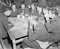 Royal Air Force Bomber Command, 1942-1945. CH10804.jpg 800 × 654; 77 KB
-

-
 Small pond, West Wickham - geograph.org.uk - 2562528.jpg 1,600 × 1,200; 858 KB
-
 Straight Road - geograph.org.uk - 3212987.jpg 1,024 × 768; 194 KB
-
 Streetley End Mill, West Wickham.jpg 640 × 480; 88 KB
-
 Streetly End Farm - geograph.org.uk - 3078189.jpg 1,024 × 778; 1.13 MB
-
 Streetly End, The Old Chequers - geograph.org.uk - 3078135.jpg 1,024 × 767; 1.01 MB
-
 T2 hangar at ex-RAF Wratting - geograph.org.uk - 4389690.jpg 1,024 × 768; 259 KB
-
 T2 hangar at ex-RAF Wratting - geograph.org.uk - 4389698.jpg 1,024 × 768; 317 KB
-
 Tar Coated Wood - geograph.org.uk - 2604503.jpg 1,024 × 768; 345 KB
-
 The former White Horse pub - geograph.org.uk - 4048859.jpg 4,320 × 3,240; 2.93 MB
-
 The Malting House (detail) - geograph.org.uk - 5580409.jpg 1,024 × 768; 181 KB
-
 The Malting House, West Wickham - geograph.org.uk - 5580405.jpg 1,024 × 768; 240 KB
-
 The road to West Wickham - geograph.org.uk - 4772726.jpg 1,024 × 731; 868 KB
-
 Towards the windmill - geograph.org.uk - 4772877.jpg 731 × 1,024; 1.17 MB
-
 Towards West Wratting Park - geograph.org.uk - 4772863.jpg 1,024 × 732; 1.08 MB
-
 Towards West Wratting Windmill - geograph.org.uk - 4772843.jpg 1,024 × 732; 1.07 MB
-
 Track from Yen Hall Farm - geograph.org.uk - 1458389.jpg 640 × 480; 83 KB
-
 Track to Yen Hall Farm - geograph.org.uk - 1458377.jpg 640 × 480; 124 KB
-
 Track to Yen Hall Farm - geograph.org.uk - 4772847.jpg 1,024 × 731; 977 KB
-
 Trig point flush bracket - geograph.org.uk - 2559809.jpg 1,200 × 1,600; 1.11 MB
-
 Trig point in a hedge - geograph.org.uk - 2559797.jpg 1,600 × 1,200; 1.07 MB
-
 Vicarage Cottage, West Wickham - geograph.org.uk - 5580390.jpg 1,024 × 768; 177 KB
-

-
 Warehouse near to West Wickham - geograph.org.uk - 4050367.jpg 4,224 × 3,110; 4.15 MB
-
 Waymarks and wheatfields - geograph.org.uk - 3078100.jpg 1,024 × 768; 1.14 MB
-
 Webb's Road - geograph.org.uk - 4684908.jpg 640 × 480; 124 KB
-
 Webb's Road - geograph.org.uk - 4684980.jpg 640 × 480; 90 KB
-
 Webbs Road, looking towards Streetly End - geograph.org.uk - 3939892.jpg 3,648 × 2,736; 2.14 MB
-
 West from Mill Road - geograph.org.uk - 4772830.jpg 1,024 × 731; 1.02 MB
-
 West north-west from West Wickham - geograph.org.uk - 4772718.jpg 1,024 × 731; 817 KB
-
 West Wickham - geograph.org.uk - 2562555.jpg 1,600 × 1,200; 682 KB
-
 West Wickham - geograph.org.uk - 2562568.jpg 1,600 × 1,200; 786 KB
-
 West Wickham church and a bend in the road - geograph.org.uk - 4772405.jpg 1,024 × 1,024; 1.43 MB
-
 West Wickham High Street - geograph.org.uk - 4772610.jpg 1,024 × 683; 1.06 MB
-
 West Wickham village sign - geograph.org.uk - 5582463.jpg 1,024 × 768; 198 KB
-
 West Wickham, a green house on the corner - geograph.org.uk - 4772412.jpg 1,024 × 683; 910 KB
-
 West Wickham, Cambridgeshire - geograph.org.uk - 54403.jpg 640 × 480; 110 KB
-
 West Wickham, on the edge of the village - geograph.org.uk - 4772697.jpg 1,024 × 1,024; 1.45 MB
-
 West Wickham, St Mary - geograph.org.uk - 4772632.jpg 1,024 × 1,024; 1.17 MB
-
 West Wickham, St Mary - geograph.org.uk - 5254948.jpg 1,600 × 1,081; 548 KB
-
 West Wickham, the corner of High Street - geograph.org.uk - 4772521.jpg 1,024 × 682; 882 KB
-
 West Wickham, winter light and shade - geograph.org.uk - 4772519.jpg 800 × 800; 755 KB
-
 West Wratting Mill - geograph.org.uk - 5640915.jpg 640 × 480; 137 KB
-
 West Wratting Windmill - geograph.org.uk - 4772875.jpg 819 × 1,024; 1.37 MB
-
 Wheatfield and windmill - geograph.org.uk - 3078019.jpg 1,024 × 768; 1.17 MB
-
 White Horse former pub, West Wickham - geograph.org.uk - 2562525.jpg 1,600 × 1,200; 609 KB
-
 Yen Hall Farm - geograph.org.uk - 1458417.jpg 640 × 480; 162 KB


_-_geograph.org.uk_-_5580409.jpg)


