Category:West Peckham
Jump to navigation
Jump to search
village in the United Kingdom | |||||
| Upload media | |||||
| Instance of | |||||
|---|---|---|---|---|---|
| Location | Tonbridge and Malling, Kent, South East England, England | ||||
 | |||||
Subcategories
This category has the following 5 subcategories, out of 5 total.
Media in category "West Peckham"
The following 200 files are in this category, out of 215 total.
(previous page) (next page)-
 A cyclist heads downhill - geograph.org.uk - 4832417.jpg 4,608 × 3,456; 3.55 MB
-

-
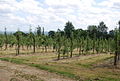
 A field of legumes south of West Peckham - geograph.org.uk - 1359792.jpg 640 × 430; 111 KB
-
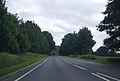
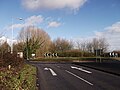 A26 Roundabout - geograph.org.uk - 2780079.jpg 4,288 × 3,216; 6.47 MB
-
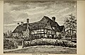 Archaeologia cantiana (1897) (14781691401).jpg 4,016 × 2,612; 2.3 MB
-
 Artichoke Barn - geograph.org.uk - 1292873.jpg 640 × 480; 76 KB
-
 Autumn leaf fall, Hurst Wood - geograph.org.uk - 1570691.jpg 640 × 430; 217 KB
-
 Barn off Stan Lane - geograph.org.uk - 1569712.jpg 640 × 430; 166 KB
-
 Barn, Court Lodge Farm, West Peskham - geograph.org.uk - 1360372.jpg 640 × 462; 99 KB
-
 Beech Farm Cottages, Stan Lane - geograph.org.uk - 1569721.jpg 640 × 430; 161 KB
-
 BIG hedge cutting ^^^ - geograph.org.uk - 1202704.jpg 640 × 481; 120 KB
-
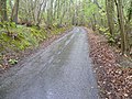
 Bridleway crosses footpath in Hurst Wood - geograph.org.uk - 1202702.jpg 640 × 481; 126 KB
-
 Bridleway crosses Swanton Road - geograph.org.uk - 1202698.jpg 640 × 481; 116 KB
-
 Bridleway off Stan Lane - geograph.org.uk - 1569768.jpg 640 × 430; 208 KB
-
 Bridleway off Swanton Rd - geograph.org.uk - 1569831.jpg 640 × 430; 195 KB
-
 Bridleway off Swanton Rd - geograph.org.uk - 1570639.jpg 640 × 430; 185 KB
-
 Bridleway through Hurst Wood - geograph.org.uk - 1570642.jpg 640 × 430; 211 KB
-
 Bridleway through Hurst Wood - geograph.org.uk - 1570648.jpg 640 × 430; 210 KB
-
 Bridleway through Hurst Wood - geograph.org.uk - 1570650.jpg 640 × 430; 221 KB
-
 Bridleway through Hurst Wood - geograph.org.uk - 1570657.jpg 640 × 430; 213 KB
-
 Bridleway through Hurst Wood - geograph.org.uk - 1570667.jpg 640 × 430; 208 KB
-
 Bridleway through Hurst Wood - geograph.org.uk - 1570696.jpg 640 × 430; 207 KB
-
 Bridleways join in Hurst Wood - geograph.org.uk - 1570677.jpg 640 × 430; 216 KB
-
 Bungalow on Swanton Road - geograph.org.uk - 5228927.jpg 2,252 × 1,658; 1 MB
-
 Buttercups alongside the path to Oxon Hoath - geograph.org.uk - 3508049.jpg 4,000 × 3,000; 4.04 MB
-

-

-
-

-
 Church Rd entering West Peckham - geograph.org.uk - 1569698.jpg 640 × 430; 168 KB
-
 Church Road, West Peckham - geograph.org.uk - 4889456.jpg 3,264 × 2,448; 2.27 MB
-
 Clump of trees by Swanton Road, West Peckham - geograph.org.uk - 5233662.jpg 2,252 × 1,656; 1.55 MB
-
 Coppiced trees by Swanton Rd - geograph.org.uk - 1569811.jpg 640 × 430; 226 KB
-
 Coppiced trees by Swanton Rd - geograph.org.uk - 1569830.jpg 640 × 430; 215 KB
-
 Coppiced trees, Hurst Wood - geograph.org.uk - 1570643.jpg 640 × 430; 195 KB
-
 Coppiced trees, Hurst Wood - geograph.org.uk - 1570662.jpg 640 × 430; 226 KB
-
 Court Lodge Farm, West Peckham (2) - geograph.org.uk - 1360370.jpg 640 × 430; 138 KB
-
 Court Lodge Farm, West Peckham - geograph.org.uk - 1360349.jpg 640 × 430; 132 KB
-
 Cows in Oxon Hoath Park - geograph.org.uk - 3507831.jpg 4,000 × 3,000; 4.39 MB
-

-
 Downderry Lavender Nursery - geograph.org.uk - 1292869.jpg 640 × 480; 95 KB
-
 Driveway towards Hamptons - geograph.org.uk - 4832437.jpg 4,608 × 3,456; 3.61 MB
-
 East Lodge, Matthews Lane - geograph.org.uk - 1359391.jpg 640 × 430; 156 KB
-
 Edge of a field by Stan Lane - geograph.org.uk - 1569757.jpg 640 × 430; 163 KB
-
 Farmhouse, Vines Farm, Matthew's Lane - geograph.org.uk - 1359809.jpg 640 × 430; 164 KB
-
 Field next to Hamptons Road - geograph.org.uk - 4832399.jpg 4,608 × 3,456; 3.32 MB
-
 Field next to Hamptons Road - geograph.org.uk - 4832402.jpg 4,608 × 3,456; 3.36 MB
-
 Footbridge in Sticklands Wood - geograph.org.uk - 1292884.jpg 640 × 480; 152 KB
-
 Footpath south from West Peckham - geograph.org.uk - 1360381.jpg 640 × 430; 145 KB
-
 Footpath to Goose Green Farm - geograph.org.uk - 3508206.jpg 4,000 × 3,000; 4.04 MB
-
 Footpath to Gover Hill - geograph.org.uk - 2977565.jpg 640 × 480; 189 KB
-
 Ford at West Peckham - geograph.org.uk - 3742389.jpg 3,872 × 2,592; 4.88 MB
-

-
 Forest clearance in Hurst Wood - geograph.org.uk - 5234331.jpg 2,304 × 1,728; 887 KB
-
 Forest clearance in Hurst Wood - geograph.org.uk - 5234332.jpg 2,206 × 1,588; 991 KB
-
 Forge Lane, West Peckham - geograph.org.uk - 4889463.jpg 3,264 × 2,448; 2.58 MB
-
 Gate in Oxon Hoath Park - geograph.org.uk - 3508062.jpg 4,000 × 3,000; 4.22 MB
-
 Gover Hill view - geograph.org.uk - 2208483.jpg 1,120 × 757; 268 KB
-
 Gover Hill view - geograph.org.uk - 2208486.jpg 1,133 × 756; 296 KB
-
 Gover Hill view - geograph.org.uk - 2208489.jpg 1,166 × 788; 466 KB
-
 Gover Hill, near West Peckham - geograph.org.uk - 4889485.jpg 3,264 × 2,448; 2.29 MB
-
 Gover Hill, near West Peckham - geograph.org.uk - 5127824.jpg 3,264 × 2,448; 3.96 MB
-
 Gover Pound - geograph.org.uk - 2977549.jpg 640 × 480; 127 KB
-
 Greenhouse domes - geograph.org.uk - 4176675.jpg 640 × 480; 49 KB
-
 Greensand Way, near West Peckham - geograph.org.uk - 219875.jpg 640 × 456; 79 KB
-
 Hamptons Road - geograph.org.uk - 4832421.jpg 4,608 × 3,456; 3.51 MB
-
 Hamptons Road - geograph.org.uk - 4832425.jpg 4,608 × 3,456; 3.53 MB
-
 Hamptons Road near Hadlow - geograph.org.uk - 5187943.jpg 640 × 480; 119 KB
-
 Hamptons Road, near Hadlow - geograph.org.uk - 5070588.jpg 3,264 × 2,448; 1.82 MB
-
 Hamptons Road, near Hadlow - geograph.org.uk - 5070592.jpg 3,264 × 2,448; 2.1 MB
-
 Hamptons Road, near Hadlow - geograph.org.uk - 5070596.jpg 3,264 × 2,448; 2.39 MB
-
 Hamptons, West Peckham - geograph.org.uk - 3389962.jpg 640 × 418; 168 KB
-
 Heading to West Peckham - geograph.org.uk - 1569636.jpg 640 × 430; 171 KB
-

-

-

-
 Horse near Dukes Place, West Peckham - geograph.org.uk - 1569676.jpg 640 × 430; 135 KB
-
 House on Oxon Hoath Estate - geograph.org.uk - 3508054.jpg 4,000 × 3,000; 4.23 MB
-
 House on Swanton Road - geograph.org.uk - 5228948.jpg 2,304 × 1,728; 845 KB
-
 House on Swanton Road - geograph.org.uk - 5233671.jpg 2,304 × 1,728; 1.09 MB
-
 Hurst Cottage, Stan Lane - geograph.org.uk - 1569773.jpg 640 × 430; 183 KB
-
 Hurst Wood - geograph.org.uk - 1570646.jpg 640 × 430; 231 KB
-
 Hurst Wood by Swanton Road - geograph.org.uk - 5234327.jpg 2,304 × 1,728; 863 KB
-
 In Oxon Hoath Park - geograph.org.uk - 3508057.jpg 4,000 × 3,000; 4.15 MB
-

-

-
-
-
-
 Line of trees on the horizon - geograph.org.uk - 1569746.jpg 640 × 430; 148 KB
-
 Lodge on Matthews Lane - geograph.org.uk - 2912736.jpg 4,000 × 3,000; 4.22 MB
-

-
 Looking down the 'tramlines' - geograph.org.uk - 2985152.jpg 640 × 480; 100 KB
-
 Matthew's Lane - geograph.org.uk - 1359821.jpg 640 × 430; 140 KB
-

-
 Matthews Lane, near Hadlow - geograph.org.uk - 4889494.jpg 3,264 × 2,448; 2.89 MB
-
 Matthews Lane, near Hadlow - geograph.org.uk - 4889498.jpg 3,264 × 2,448; 2.86 MB
-
 Mereworth Rd, West Peckham - geograph.org.uk - 1569685.jpg 640 × 430; 184 KB
-
 Mereworth Rd, West Peckham - geograph.org.uk - 1569688.jpg 640 × 430; 171 KB
-
 Mereworth Road - geograph.org.uk - 3826313.jpg 640 × 480; 119 KB
-
 Mereworth Road, near West Peckham - geograph.org.uk - 4889426.jpg 3,264 × 2,448; 2.92 MB
-
 Muddy Wealdway and Greensand Way - geograph.org.uk - 2912720.jpg 4,000 × 3,000; 4.28 MB
-
 Nearly at West Peckham - geograph.org.uk - 1569658.jpg 640 × 430; 196 KB
-

-
 Old tree roots in Mereworth Woods - geograph.org.uk - 2912692.jpg 4,000 × 3,000; 4.11 MB
-
 Old tree roots in Peckham Hurst Road - geograph.org.uk - 2912688.jpg 4,000 × 3,000; 4.19 MB
-

-
 Orchard by the Greensand Way - geograph.org.uk - 1358692.jpg 640 × 430; 156 KB
-
 Orchards by Stan Lane - geograph.org.uk - 1569731.jpg 640 × 430; 156 KB
-
 Oxenhoath Rd and Park Rd junction - geograph.org.uk - 1358673.jpg 640 × 430; 157 KB
-
 Oxenhoath Road - geograph.org.uk - 1737476.jpg 640 × 480; 123 KB
-
 Oxenhoath Road - geograph.org.uk - 2977518.jpg 640 × 480; 186 KB
-
 Oxenhoath Road, near Hadlow - geograph.org.uk - 5070608.jpg 3,264 × 2,448; 2.04 MB
-
 Oxenhoath Road, near Hadlow - geograph.org.uk - 5070611.jpg 2,448 × 2,448; 1.74 MB
-
 Oxon Hoath - geograph.org.uk - 6369090.jpg 4,000 × 3,000; 4.62 MB
-
 Oxon Hoath from the park - geograph.org.uk - 6369096.jpg 4,000 × 3,000; 4.87 MB
-
 Paddock south of Stan Lane - geograph.org.uk - 1569781.jpg 640 × 430; 110 KB
-
 Park Rd, a quiet lane^ - geograph.org.uk - 1358675.jpg 640 × 430; 167 KB
-
 Park Road near Hadlow - geograph.org.uk - 4832410.jpg 4,608 × 3,456; 3.57 MB
-
 Park Road near Hadlow - geograph.org.uk - 4832411.jpg 4,608 × 3,456; 3.35 MB
-
 Park Road, near Hadlow - geograph.org.uk - 5070605.jpg 3,264 × 2,448; 1.77 MB
-
 Path through wild flowers alongside Court Lodge Shaw - geograph.org.uk - 3508224.jpg 4,000 × 3,000; 4.01 MB
-
 Path to Oxon Hoath - geograph.org.uk - 3508047.jpg 4,000 × 3,000; 4.43 MB
-
 Peckham Hurst off Swanton Rd - geograph.org.uk - 1569802.jpg 640 × 430; 223 KB
-
 Peckham Hurst Road - geograph.org.uk - 2793107.jpg 640 × 425; 128 KB
-
 Peckham Hurst Road - geograph.org.uk - 2912700.jpg 4,000 × 3,000; 4.18 MB
-
 Peckham Hurst Road in the rain - geograph.org.uk - 2912706.jpg 4,000 × 3,000; 4.11 MB
-
 Peckham Hurst Road, West Peckham - geograph.org.uk - 5127820.jpg 3,264 × 2,448; 2.15 MB
-
 Peckham Hurst Road, West Peckham - geograph.org.uk - 5127821.jpg 3,264 × 2,448; 2.03 MB
-
 Pillar Box Lane, near Hadlow - geograph.org.uk - 5070607.jpg 3,264 × 2,448; 1.78 MB
-
 Polytunnels , Mereworth Rd, West Peckham - geograph.org.uk - 1569684.jpg 640 × 430; 127 KB
-
 Polytunnels near West Peckham - geograph.org.uk - 1360342.jpg 640 × 430; 115 KB
-
 Privy at Court Lodge Farm, West Peckham - geograph.org.uk - 1306934.jpg 640 × 480; 123 KB
-
 Quiet Lane, Stan Lane - geograph.org.uk - 1569709.jpg 640 × 430; 178 KB
-
 River Bourne (2) - geograph.org.uk - 1358317.jpg 640 × 430; 183 KB
-
 River Bourne (3) - geograph.org.uk - 1358327.jpg 640 × 430; 182 KB
-
 River Bourne - geograph.org.uk - 1358309.jpg 640 × 430; 196 KB
-

-

-

-
 Roundabout, A26 - geograph.org.uk - 4569620.jpg 640 × 498; 70 KB
-

-
 Seven Mile Lane - geograph.org.uk - 2662015.jpg 640 × 430; 55 KB
-
 Seven Mile Lane at the junction of the A26 - geograph.org.uk - 4941854.jpg 2,048 × 1,536; 1.13 MB
-
 Shallow valley in the Greensand Ridge - geograph.org.uk - 1358660.jpg 640 × 430; 123 KB
-
 Single tree seen across the River Bourne - geograph.org.uk - 1358316.jpg 640 × 430; 134 KB
-
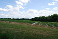 Soft fruit south of Forge Lane - geograph.org.uk - 1359350.jpg 640 × 430; 132 KB
-
 Soft fruit south off Forge Lane (2) - geograph.org.uk - 1359393.jpg 640 × 430; 135 KB
-
 St. Dunstan, West Peckham - geograph.org.uk - 4889441.jpg 3,264 × 2,448; 2.09 MB
-
 Stan Lane - geograph.org.uk - 1569719.jpg 640 × 430; 146 KB
-
 Stan Lane - geograph.org.uk - 1569727.jpg 640 × 430; 202 KB
-
 Stan Lane - geograph.org.uk - 1569760.jpg 640 × 430; 173 KB
-
 Stan Lane - geograph.org.uk - 1569762.jpg 640 × 430; 170 KB
-

-
 Stan Lane, West Peckham - geograph.org.uk - 4829735.jpg 640 × 480; 95 KB
-
 Stan Lane, West Peckham - geograph.org.uk - 4889468.jpg 3,264 × 2,448; 3.91 MB
-
 Stan Lane, West Peckham - geograph.org.uk - 4889474.jpg 3,264 × 2,448; 2.38 MB
-

-
-
 Swanton Rd - geograph.org.uk - 1569796.jpg 640 × 430; 215 KB
-
 Swanton Rd - geograph.org.uk - 1569805.jpg 640 × 430; 225 KB
-
 Swanton Rd - geograph.org.uk - 1569806.jpg 640 × 430; 184 KB
-
 Swanton Rd - geograph.org.uk - 1569826.jpg 640 × 430; 222 KB
-
 Swanton Rd and Stan Lane junction - geograph.org.uk - 1569775.jpg 640 × 430; 189 KB
-
 Swanton Rd and Stan Lane junction - geograph.org.uk - 1569787.jpg 640 × 430; 161 KB
-
 Swanton Rd through Hurst Wood - geograph.org.uk - 1569821.jpg 640 × 430; 195 KB
-
 Swanton Rd through Hurst Wood - geograph.org.uk - 1569823.jpg 640 × 430; 213 KB
-
 Swanton Road, West Peckham - geograph.org.uk - 5127818.jpg 3,264 × 2,448; 2.43 MB
-
 Swanton Road, West Peckham - geograph.org.uk - 5127819.jpg 3,264 × 2,448; 2.23 MB
-

-
 Tent in Hurst Wood - geograph.org.uk - 1570655.jpg 640 × 430; 198 KB
-
 The A228 - geograph.org.uk - 2709464.jpg 640 × 430; 43 KB
-
 The edge of Hurst Wood, Swanton Rd - geograph.org.uk - 1569825.jpg 640 × 430; 228 KB
-
 The Green, West Peckham - geograph.org.uk - 4889435.jpg 3,264 × 2,448; 3.61 MB
-
-

-

-

-
 The Old Post Office, West Peckham - geograph.org.uk - 2794298.jpg 640 × 425; 63 KB
-
 The Swan at West Peckham - geograph.org.uk - 6369080.jpg 3,474 × 2,796; 1.67 MB
-
 The Swan on the Green, West Peckham - geograph.org.uk - 4889450.jpg 3,264 × 2,448; 2.64 MB
-
 The village green at West Peckham - geograph.org.uk - 1304402.jpg 640 × 480; 110 KB
-
 The Wealdway joins the Greensand Way - geograph.org.uk - 1202683.jpg 640 × 481; 118 KB
-
 The Wealdway meest The Greensand Way - geograph.org.uk - 1202658.jpg 640 × 481; 96 KB
-
 Track and Hedgerow - geograph.org.uk - 4310600.jpg 640 × 480; 52 KB
-
 Track into the woods - geograph.org.uk - 3829185.jpg 428 × 640; 179 KB
-
 Track off Matthew's lane to Park Farm - geograph.org.uk - 1359816.jpg 640 × 430; 127 KB
-
 Track to The Hurst, Gover Hill - geograph.org.uk - 5233656.jpg 2,304 × 1,728; 1.36 MB
-
 Tree devoid of leaves, Hurst Wood - geograph.org.uk - 1570672.jpg 430 × 640; 184 KB
-
 Very Muddy Road - geograph.org.uk - 4310604.jpg 640 × 480; 118 KB
-
 View down the Weald Way - geograph.org.uk - 2793088.jpg 640 × 425; 81 KB
-
 View north-west off Gover Hill - geograph.org.uk - 4424966.jpg 1,600 × 1,064; 453 KB
-
 View south-west off Gover Hill - geograph.org.uk - 4423104.jpg 1,600 × 1,064; 294 KB
-
 View south-west off Gover Hill - geograph.org.uk - 4424952.jpg 1,600 × 1,064; 336 KB
-
 View towards Hazel Wood - geograph.org.uk - 3508215.jpg 4,000 × 3,000; 4.01 MB
-
 Vines Farm - geograph.org.uk - 2912760.jpg 4,000 × 3,000; 4.36 MB
-
 Vines Farm, Matthew's Lane - geograph.org.uk - 1359814.jpg 640 × 430; 156 KB
-
 Walkers in Field - geograph.org.uk - 4336342.jpg 640 × 480; 65 KB
-
 Walkers on Wealdway - geograph.org.uk - 4310606.jpg 640 × 480; 78 KB
-
 Waymarker for The Greensand Way - geograph.org.uk - 1359362.jpg 640 × 430; 179 KB


_(14781691401).jpg)


_-_geograph.org.uk_-_1360370.jpg)


_-_geograph.org.uk_-_1358317.jpg)
_-_geograph.org.uk_-_1358327.jpg)


_-_geograph.org.uk_-_1359393.jpg)


_-_geograph.org.uk_-_1359366.jpg)
_-_geograph.org.uk_-_1359377.jpg)


