Category:West Overton
Jump to navigation
Jump to search
village in the United Kingdom  | |||||
| Upload media | |||||
| Instance of | |||||
|---|---|---|---|---|---|
| Location | Wiltshire, South West England, England | ||||
| official website | |||||
 | |||||
Nederlands: West Overton is een dorp (village) en civil parish in de unitary authority Wiltshire, in het Engelse graafschap Wiltshire. De civil parish telt
Subcategories
This category has the following 4 subcategories, out of 4 total.
L
W
- West Overton War Memorial (2 F)
Media in category "West Overton"
The following 200 files are in this category, out of 326 total.
(previous page) (next page)-
 2010 , A4 looking east on Overton Hill - geograph.org.uk - 2079253.jpg 4,538 × 2,164; 2.69 MB
-
 2010 , A4 passing West Overton - geograph.org.uk - 2059232.jpg 800 × 598; 134 KB
-
 2010 , A4 passing West Overton - geograph.org.uk - 2079229.jpg 800 × 659; 84 KB
-
 2010 , Looking east at the top of Overton Hill - geograph.org.uk - 2080267.jpg 4,321 × 1,976; 2.92 MB
-
 41, West Overton - geograph.org.uk - 3389610.jpg 3,392 × 2,402; 1.71 MB
-
 A major crossroad nobody around - geograph.org.uk - 4056991.jpg 4,608 × 3,456; 3.74 MB
-

-
 A View of the Wansdyke - geograph.org.uk - 6002107.jpg 1,600 × 1,200; 725 KB
-
 A4 towards West Kennet - geograph.org.uk - 4880491.jpg 3,264 × 1,840; 1.6 MB
-
 Along the field edge - geograph.org.uk - 4290042.jpg 640 × 480; 165 KB
-
 Approaching Down Barn, West Overton - geograph.org.uk - 3544181.jpg 4,000 × 3,000; 4.11 MB
-
 Avebury Down - geograph.org.uk - 4880560.jpg 3,264 × 1,840; 2.54 MB
-
 Barrow cemetery on Sevenbarrow Hill from the A4 - geograph.org.uk - 4710602.jpg 4,608 × 3,456; 2.99 MB
-
 Barrows on Overton Hill - geograph.org.uk - 4235137.jpg 1,600 × 757; 191 KB
-
 Barrows on Overton Hill - geograph.org.uk - 4235146.jpg 1,600 × 819; 241 KB
-
 Barrows, Overton Hill - geograph.org.uk - 6002145.jpg 1,600 × 1,200; 366 KB
-
 Beech trees, West Woods - geograph.org.uk - 3755470.jpg 4,000 × 3,000; 2.89 MB
-
 Bench Mark, West Overton - geograph.org.uk - 1880769.jpg 480 × 640; 170 KB
-
 Benchmark, Bayardo Farm - geograph.org.uk - 4592737.jpg 640 × 480; 99 KB
-
 Bluebells in Pumphrey Wood - geograph.org.uk - 3508110.jpg 1,600 × 1,200; 602 KB
-
 Bluebells in the West Woods - geograph.org.uk - 2381216.jpg 1,920 × 1,280; 1.78 MB
-
 Bluebells in the West Woods - geograph.org.uk - 2381233.jpg 1,920 × 1,280; 1.86 MB
-
 Bluebells in the West Woods - geograph.org.uk - 2381347.jpg 1,920 × 1,280; 1.79 MB
-
 Bluebells in the West Woods - geograph.org.uk - 3974898.jpg 1,280 × 853; 1.43 MB
-
 Bluebells in the West Woods - geograph.org.uk - 3974906.jpg 1,280 × 853; 1.42 MB
-
 Bridge over the Kennet - geograph.org.uk - 4958436.jpg 640 × 479; 104 KB
-
 Bridge over the River Kennet, West Overton - geograph.org.uk - 3756855.jpg 4,000 × 3,000; 2.81 MB
-
 Bridleway approaching Down Barn - geograph.org.uk - 4711051.jpg 4,608 × 3,456; 3.19 MB
-
 Bridleway leaves the road - geograph.org.uk - 5894235.jpg 4,320 × 3,240; 2.69 MB
-
 Bridleway on Overton Hill - geograph.org.uk - 4985582.jpg 640 × 480; 317 KB
-
 Bridleway through West Woods - geograph.org.uk - 3754305.jpg 4,000 × 3,000; 2.9 MB
-
 Bridleway, West Overton, looking towards The Belt - geograph.org.uk - 3756834.jpg 4,000 × 3,000; 2.86 MB
-
 Bridleways cross (1) - geograph.org.uk - 5894225.jpg 4,168 × 3,127; 3.74 MB
-
 Bridleways cross (2) - geograph.org.uk - 5894226.jpg 4,320 × 3,240; 4.65 MB
-
 Bridleways cross (3) - geograph.org.uk - 5894227.jpg 4,320 × 3,240; 4.03 MB
-
 Bridleways cross (4) - geograph.org.uk - 5894228.jpg 4,320 × 3,240; 3.32 MB
-
 Bridleways cross (5) - geograph.org.uk - 5894230.jpg 4,320 × 3,240; 4.16 MB
-
 Byway - geograph.org.uk - 1912114.jpg 640 × 426; 92 KB
-
 Byway alongside the Wansdyke, West Woods - geograph.org.uk - 3755695.jpg 4,000 × 3,000; 2.9 MB
-
 Byway leaves the road (2) - geograph.org.uk - 5656698.jpg 4,320 × 3,240; 3.45 MB
-
 Byway towards East Kennett - geograph.org.uk - 5489332.jpg 1,024 × 768; 343 KB
-
 Car park for the "Sanctuary" - geograph.org.uk - 4985536.jpg 640 × 480; 257 KB
-
 Car park on The Ridgeway, Overton Hill - geograph.org.uk - 4922036.jpg 2,048 × 1,536; 1.5 MB
-
 Caravan club site - geograph.org.uk - 4592740.jpg 640 × 480; 69 KB
-
 Cereal crop near East Kennett - geograph.org.uk - 6327655.jpg 800 × 600; 105 KB
-
 Church between the barrows - geograph.org.uk - 4691245.jpg 3,264 × 2,448; 3.11 MB
-
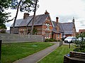
 Church Hill Cottage, Church Hill, West Overton - geograph.org.uk - 5923341.jpg 1,024 × 768; 372 KB
-
 Clumps of beech trees on Overton Down - geograph.org.uk - 4985588.jpg 640 × 480; 317 KB
-
 Concrete Base - geograph.org.uk - 3480167.jpg 1,920 × 1,280; 3.56 MB
-
 Cottage at Lockeridge - geograph.org.uk - 2066989.jpg 640 × 480; 203 KB
-
 Cottage by the churchyard at West Overton - geograph.org.uk - 5469855.jpg 1,024 × 767; 271 KB
-
 Cottage north of the church, West Overton - geograph.org.uk - 5469835.jpg 1,024 × 773; 310 KB
-
 Cottages at West Overton - geograph.org.uk - 5469862.jpg 1,024 × 786; 168 KB
-
 Cows at Lockeridge Dene - geograph.org.uk - 2066990.jpg 640 × 480; 211 KB
-
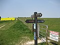 Crossing of the Ridgeways - geograph.org.uk - 422885.jpg 640 × 480; 80 KB
-
 Crossing the Kennet north of Lockeridge - geograph.org.uk - 3389774.jpg 3,561 × 2,681; 1.82 MB
-
 Descending into the Kennett valley - geograph.org.uk - 5669754.jpg 640 × 428; 103 KB
-
 Down Barn - geograph.org.uk - 4596308.jpg 640 × 480; 64 KB
-
 Down Barn Cottage and Down Barn - geograph.org.uk - 4711067.jpg 4,608 × 3,456; 3.28 MB
-
 Downhill on National Cycle Route 45 - geograph.org.uk - 6327669.jpg 800 × 538; 103 KB
-
 Downland near Rockley - geograph.org.uk - 408862.jpg 640 × 480; 132 KB
-
 Downland north of New Town - geograph.org.uk - 1906482.jpg 640 × 480; 119 KB
-
 Dry river - geograph.org.uk - 5895302.jpg 4,320 × 3,240; 4.77 MB
-
 Entering East Kennett from the south - geograph.org.uk - 5669741.jpg 640 × 428; 143 KB
-
 Entrance to Lockeridge - geograph.org.uk - 4589401.jpg 640 × 417; 106 KB
-
 Entrance to West Overton - geograph.org.uk - 4596314.jpg 640 × 480; 105 KB
-
 Farm building - geograph.org.uk - 4596303.jpg 640 × 480; 86 KB
-
 Farm buildings - geograph.org.uk - 2996424.jpg 640 × 480; 137 KB
-
 Farm track heading north from the A4 - geograph.org.uk - 5531796.jpg 640 × 480; 161 KB
-
 Farmland near Down Barn - geograph.org.uk - 3544187.jpg 4,000 × 3,000; 2.78 MB
-
 Farmland south of East Kennett - geograph.org.uk - 5469828.jpg 1,024 × 768; 161 KB
-
 Field corner near West Overton - geograph.org.uk - 3544156.jpg 4,000 × 3,000; 3 MB
-

-
 Fields near Fyfield - geograph.org.uk - 4880456.jpg 3,264 × 1,840; 2.35 MB
-
 Footbridge(^), Withy Bed, West Overton - geograph.org.uk - 6039416.jpg 4,000 × 3,000; 4.95 MB
-
 Footpath and fields near West Overton - geograph.org.uk - 3544166.jpg 4,000 × 3,000; 4.24 MB
-
 Footpath and fields near West Overton - geograph.org.uk - 3544178.jpg 4,000 × 3,000; 3.64 MB
-
 From East Kennet to Overton Down and return (24) (geograph 6554482).jpg 4,320 × 3,240; 2.76 MB
-
 From East Kennet to Overton Down and returns (geograph 6558705).jpg 3,430 × 2,573; 1.58 MB
-
 Fyfield Down - geograph.org.uk - 4711096.jpg 4,608 × 3,456; 3.17 MB
-
 Gallops on Fyfield Down - geograph.org.uk - 3544194.jpg 4,000 × 3,000; 3.85 MB
-
 Gate and field - geograph.org.uk - 2509434.jpg 640 × 480; 129 KB
-
 Green Street, heading across Fyfield Down - geograph.org.uk - 3544241.jpg 4,000 × 3,000; 3.59 MB
-
 Hidden bench mark, West Overton - geograph.org.uk - 1880758.jpg 480 × 640; 123 KB
-

-
 Houses on the edge of Boreham Wood - geograph.org.uk - 2996427.jpg 640 × 480; 165 KB
-
 Inquisitive cattle on Fyfield Down - geograph.org.uk - 3544208.jpg 4,000 × 1,990; 3.69 MB
-
 Into the field - geograph.org.uk - 4290041.jpg 640 × 480; 175 KB
-
 Into the woods - geograph.org.uk - 5660519.jpg 4,320 × 3,240; 4.74 MB
-
 Ivy covered tree beside the byway - geograph.org.uk - 3489089.jpg 1,920 × 1,280; 4.09 MB
-
 Kennet Valley looking north-east - geograph.org.uk - 3905441.jpg 1,600 × 1,200; 354 KB
-
 Kennet Valley looking north-west - geograph.org.uk - 3905445.jpg 1,024 × 768; 192 KB
-
 Kune Kune Pig, West Overton - geograph.org.uk - 1881477.jpg 640 × 480; 148 KB
-
 Lane to Clatford by Broom Copse - geograph.org.uk - 5496858.jpg 1,024 × 768; 283 KB
-
 Late Autumn in Barrow Copse - geograph.org.uk - 2718025.jpg 1,280 × 1,920; 1.73 MB
-
 Lime pollards in Lockeridge - geograph.org.uk - 3389772.jpg 3,648 × 2,736; 1.8 MB
-
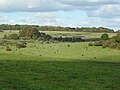
 Livestock on Fyfield Down - geograph.org.uk - 3544196.jpg 4,000 × 3,000; 4.09 MB
-
 Livingstones, Lockeridge - geograph.org.uk - 3756943.jpg 4,000 × 3,000; 2.91 MB
-
 Lockeridge - geograph.org.uk - 3491131.jpg 1,920 × 1,279; 3.36 MB
-
 Lockeridge buildings (1) - geograph.org.uk - 6356882.jpg 4,320 × 3,240; 3.66 MB
-
 Lockeridge buildings (2) - geograph.org.uk - 6357894.jpg 4,320 × 3,240; 2.85 MB
-
 Lockeridge buildings (5) - geograph.org.uk - 6361359.jpg 4,320 × 3,240; 2.88 MB
-
 Lockeridge Dene (1) - geograph.org.uk - 5660544.jpg 4,320 × 3,240; 2.8 MB
-
 Lockeridge Dene (2) - geograph.org.uk - 5660546.jpg 4,320 × 3,240; 4.72 MB
-
 Lockeridge Dene, Lockeridge - geograph.org.uk - 834226.jpg 640 × 480; 166 KB
-
 Lockeridge Dene, Wilts - geograph.org.uk - 2699634.jpg 3,072 × 2,304; 1.78 MB
-
 Lockeridge features (1) - geograph.org.uk - 6356837.jpg 4,320 × 3,240; 4.45 MB
-
 Lockeridge features (2) - geograph.org.uk - 6358693.jpg 4,320 × 3,240; 3.38 MB
-
 Lockeridge houses (12) (geograph 6357878).jpg 4,320 × 3,240; 4.01 MB
-
 Lockeridge houses (13) - geograph.org.uk - 6357880.jpg 4,320 × 3,240; 2.67 MB
-
 Lockeridge houses (14) (geograph 6357881).jpg 4,320 × 3,240; 3.18 MB
-
 Lockeridge houses (17) - geograph.org.uk - 6358681.jpg 4,090 × 3,067; 2.23 MB
-
 Lockeridge houses (18) - geograph.org.uk - 6358689.jpg 4,320 × 3,240; 3.35 MB
-
 Lockeridge houses (2) - geograph.org.uk - 5660557.jpg 4,320 × 3,240; 2.67 MB
-
 Lockeridge houses (4) - geograph.org.uk - 6356840.jpg 4,320 × 3,240; 4.05 MB
-
 Lockeridge houses (5) - geograph.org.uk - 6356845.jpg 4,320 × 3,240; 4.21 MB
-
 Lockeridge houses (6) (geograph 6356864).jpg 4,320 × 3,240; 3.45 MB
-
 Lockeridge houses (8) - geograph.org.uk - 6356866.jpg 4,320 × 3,240; 4.02 MB
-
 Lockeridge housess (geograph 5660549).jpg 4,320 × 3,240; 3.81 MB
-
 Lockeridge housess (geograph 6356835).jpg 4,177 × 3,133; 4.14 MB
-
 Lockeridge housess (geograph 6356865).jpg 4,079 × 3,059; 2.57 MB
-
 Lockeridge housess (geograph 6356872).jpg 4,320 × 3,240; 3.84 MB
-
 Lockeridge housess (geograph 6356875).jpg 4,320 × 3,240; 2.9 MB
-
 Lockeridge housess (geograph 6356879).jpg 4,320 × 3,240; 2.96 MB
-
 Lockeridge housess (geograph 6357888).jpg 4,320 × 3,240; 4.19 MB
-
 Lockeridge housess (geograph 6358665).jpg 4,320 × 3,240; 4.32 MB
-
 Lockeridge, Who'd A Thought it - geograph.org.uk - 3728797.jpg 1,024 × 768; 113 KB
-
 Manor Farm - geograph.org.uk - 4596380.jpg 640 × 480; 113 KB
-
 Marlborough Downs - Monkton Down - geograph.org.uk - 4880582.jpg 3,264 × 1,840; 2.53 MB
-
 Milestone, A4 near Fyfield - geograph.org.uk - 4710591.jpg 4,608 × 3,456; 3.48 MB
-
 Minor road towards Lockeridge - geograph.org.uk - 6327670.jpg 800 × 600; 104 KB
-
 Minor road towards West Overton - geograph.org.uk - 6327661.jpg 800 × 531; 74 KB
-
 National Cycle Route 45 - geograph.org.uk - 6327658.jpg 640 × 480; 76 KB
-

-
 National Trust land at Lockeridge Dene - geograph.org.uk - 1958533.jpg 640 × 439; 121 KB
-
 New Shed - geograph.org.uk - 4596306.jpg 640 × 410; 65 KB
-
 Newly planted - geograph.org.uk - 4290039.jpg 640 × 480; 160 KB
-
 North Farm (1) (geograph 5895303).jpg 4,320 × 3,240; 4.68 MB
-
 North Farm (2) - geograph.org.uk - 5895304.jpg 4,320 × 3,240; 3.25 MB
-
 North Farm - geograph.org.uk - 4596300.jpg 640 × 480; 76 KB
-
 North Farm, by A4, West Overton - geograph.org.uk - 5444902.jpg 1,600 × 1,067; 602 KB
-

-
 Not rotted knot - geograph.org.uk - 5660535.jpg 4,320 × 3,240; 3.11 MB
-
 Now a library - geograph.org.uk - 5897359.jpg 4,320 × 3,240; 4.53 MB
-
 Oilseed rape crop near East Kennett - geograph.org.uk - 6327659.jpg 800 × 600; 130 KB
-

-
 On The Ridgeway - geograph.org.uk - 4902355.jpg 4,608 × 3,072; 3.44 MB
-
 One man and his bike - geograph.org.uk - 3544262.jpg 4,000 × 3,000; 3.69 MB
-
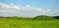
 Overton Hill Early Bronze Age Round Barrows - geograph.org.uk - 4056550.jpg 4,608 × 3,456; 3.84 MB
-
 Parish church (1) - geograph.org.uk - 5894278.jpg 3,240 × 4,320; 2.58 MB
-
 Parish church (2) - geograph.org.uk - 5894279.jpg 4,320 × 3,240; 3.25 MB
-
 Parish church (3) - geograph.org.uk - 5894280.jpg 4,320 × 3,240; 3.71 MB
-
 Part of Overton Hill, Wiltshire - geograph.org.uk - 3414506.jpg 640 × 480; 85 KB
-

-
 Path crossing the gallops - geograph.org.uk - 4770094.jpg 640 × 480; 64 KB
-
 Path leaves the road (1) - geograph.org.uk - 6357885.jpg 3,240 × 4,320; 3.98 MB
-
 Path leaves the road (2) - geograph.org.uk - 6358668.jpg 4,320 × 3,240; 3.14 MB
-
 Path on Overton Down - geograph.org.uk - 4408230.jpg 1,600 × 1,064; 290 KB
-
 Path through the bluebells - geograph.org.uk - 3974901.jpg 1,280 × 853; 1.54 MB
-
 Path through the West Woods - geograph.org.uk - 3480151.jpg 1,280 × 853; 1.85 MB
-
 Path through the West Woods - geograph.org.uk - 3974904.jpg 1,280 × 853; 1.41 MB
-
 Path through West Woods - geograph.org.uk - 265989.jpg 640 × 423; 76 KB
-
 Permissive bridleway near West Overton - geograph.org.uk - 3544162.jpg 4,000 × 3,000; 3.73 MB
-

-
 Play area, Lockeridge - geograph.org.uk - 4589482.jpg 640 × 480; 118 KB
-
 Postbox, West Overton - geograph.org.uk - 1881487.jpg 480 × 640; 123 KB
-
 Poultry farm (1) - geograph.org.uk - 5660524.jpg 4,320 × 3,240; 3.15 MB
-
 Poultry farm (2) - geograph.org.uk - 5660530.jpg 4,320 × 3,240; 4.46 MB
-
 Private access towards the fields - geograph.org.uk - 1958540.jpg 640 × 401; 71 KB
-
 Public bridleway through Puckrudge woods - geograph.org.uk - 3508114.jpg 1,600 × 1,321; 624 KB
-
 Pumping station - geograph.org.uk - 4596315.jpg 640 × 480; 114 KB
-
 Pumping station - geograph.org.uk - 5895294.jpg 4,203 × 3,153; 3.5 MB
-
 Quiet neighbours - geograph.org.uk - 5895307.jpg 4,320 × 3,240; 2.97 MB
-
 Recently planted - geograph.org.uk - 5660518.jpg 4,320 × 3,240; 4.09 MB
-
 Remains of Manor Farm - geograph.org.uk - 4597751.jpg 640 × 480; 122 KB
-
 Ridgeway descending to Overton Hill - geograph.org.uk - 1021283.jpg 640 × 480; 57 KB
-
 Ridgeway on Overton Down - geograph.org.uk - 1021243.jpg 640 × 480; 66 KB
-
 Ridgeway Path - geograph.org.uk - 4880570.jpg 3,264 × 1,840; 2.22 MB
-
 River Kennet (1) - geograph.org.uk - 6358670.jpg 4,320 × 3,240; 5.19 MB
-
 River Kennet (2) - geograph.org.uk - 6358676.jpg 4,320 × 3,240; 4.74 MB
-
 River Kennet (3) - geograph.org.uk - 6358678.jpg 4,320 × 3,240; 5.19 MB
-
 River Kennet at West Overton - geograph.org.uk - 3905397.jpg 1,600 × 1,200; 638 KB
-
 River Kennet valley - geograph.org.uk - 5895295.jpg 4,320 × 3,240; 2.77 MB
-
 River Kennet, West Overton - geograph.org.uk - 1881496.jpg 640 × 480; 147 KB
-
 Road from North Lodge - geograph.org.uk - 4589074.jpg 640 × 471; 91 KB
-
 Road into North Farm yard - geograph.org.uk - 5531799.jpg 640 × 480; 195 KB
-
 Road junction - geograph.org.uk - 4589062.jpg 640 × 480; 70 KB
-
 Road junction - geograph.org.uk - 4589065.jpg 640 × 480; 67 KB
-
 Road junction - geograph.org.uk - 4589436.jpg 640 × 480; 68 KB
-
 Road junction north of Boreham Wood - geograph.org.uk - 3389583.jpg 3,484 × 2,674; 1.24 MB
-
 Road towards Lockeridge - geograph.org.uk - 5669765.jpg 640 × 428; 99 KB
-
 Road towards Lockeridge - geograph.org.uk - 5669772.jpg 640 × 428; 135 KB
-
 Road towards Lockeridge - geograph.org.uk - 5669779.jpg 640 × 428; 150 KB
-
 Sarcen Stones, Fyfield Down - geograph.org.uk - 4902575.jpg 4,475 × 2,983; 1.78 MB
-
 Sarsen stones on Fyfield Down - geograph.org.uk - 3544213.jpg 4,000 × 3,000; 4.24 MB
-
 Sarsen stones on Fyfield Down - geograph.org.uk - 3544234.jpg 4,000 × 3,000; 3.56 MB
-
 Sarsen Stones on the Downs - geograph.org.uk - 4056981.jpg 4,608 × 3,456; 4.07 MB
-
 Sarsen stones, beside Delling Copse - geograph.org.uk - 408882.jpg 640 × 480; 147 KB
-
 Sarsen stones, Fyfield Down - geograph.org.uk - 412186.jpg 640 × 480; 148 KB
-
 Sheep farming - geograph.org.uk - 4596310.jpg 640 × 480; 50 KB


_-_geograph.org.uk_-_5894225.jpg)
_-_geograph.org.uk_-_5894226.jpg)
_-_geograph.org.uk_-_5894227.jpg)
_-_geograph.org.uk_-_5894228.jpg)
_-_geograph.org.uk_-_5894230.jpg)


_-_geograph.org.uk_-_5656698.jpg)


,_Withy_Bed,_West_Overton_-_geograph.org.uk_-_6039416.jpg)


_(geograph_6554482).jpg)
.jpg)


_-_geograph.org.uk_-_6356882.jpg)
_-_geograph.org.uk_-_6357894.jpg)
_-_geograph.org.uk_-_6361359.jpg)
_-_geograph.org.uk_-_5660544.jpg)
_-_geograph.org.uk_-_5660546.jpg)


_-_geograph.org.uk_-_6356837.jpg)
_-_geograph.org.uk_-_6358693.jpg)
_(geograph_6357878).jpg)
_-_geograph.org.uk_-_6357880.jpg)
_(geograph_6357881).jpg)
_-_geograph.org.uk_-_6358681.jpg)
_-_geograph.org.uk_-_6358689.jpg)
_-_geograph.org.uk_-_5660557.jpg)
_-_geograph.org.uk_-_6356840.jpg)
_-_geograph.org.uk_-_6356845.jpg)
_(geograph_6356864).jpg)
_-_geograph.org.uk_-_6356866.jpg)
.jpg)
.jpg)
.jpg)
.jpg)
.jpg)
.jpg)
.jpg)
.jpg)


_(geograph_5895303).jpg)
_-_geograph.org.uk_-_5895304.jpg)


_-_geograph.org.uk_-_5894278.jpg)
_-_geograph.org.uk_-_5894279.jpg)
_-_geograph.org.uk_-_5894280.jpg)


_-_geograph.org.uk_-_6357885.jpg)
_-_geograph.org.uk_-_6358668.jpg)


_-_geograph.org.uk_-_5660524.jpg)
_-_geograph.org.uk_-_5660530.jpg)


_-_geograph.org.uk_-_6358670.jpg)
_-_geograph.org.uk_-_6358676.jpg)
_-_geograph.org.uk_-_6358678.jpg)


