Category:West Ilsley
Jump to navigation
Jump to search
a village located in West Berkshire, United Kingdom  | |||||
| Upload media | |||||
| Instance of | |||||
|---|---|---|---|---|---|
| Location | West Berkshire, Berkshire, South East England, England | ||||
| Population |
| ||||
| official website | |||||
 | |||||
Subcategories
This category has the following 4 subcategories, out of 4 total.
Media in category "West Ilsley"
The following 200 files are in this category, out of 280 total.
(previous page) (next page)-
 2 Furlongs along the Gallop - geograph.org.uk - 5940517.jpg 4,514 × 3,346; 2.46 MB
-

-
 A Mound, Apparently - geograph.org.uk - 5940892.jpg 4,410 × 3,234; 2.03 MB
-
 A Wall to Jump - geograph.org.uk - 2522744.jpg 3,888 × 2,592; 1.7 MB
-
 A34 descends Gore Hill - geograph.org.uk - 2533735.jpg 3,648 × 2,466; 957 KB
-
 A34 northbound - geograph.org.uk - 3341314.jpg 640 × 480; 45 KB
-
 A34 northbound - geograph.org.uk - 5637496.jpg 640 × 428; 77 KB
-
 All-weather gallop on Hodcott Down - geograph.org.uk - 2675811.jpg 2,560 × 1,920; 658 KB
-
 Along the Old Wheat Road - geograph.org.uk - 5940528.jpg 4,733 × 3,387; 2.81 MB
-
 Arable field near West Ilsley - geograph.org.uk - 3340566.jpg 1,500 × 1,000; 208 KB
-
 Arable field near West Ilsley - geograph.org.uk - 3340568.jpg 1,500 × 1,000; 254 KB
-
 Arable field near West Ilsley - geograph.org.uk - 3346764.jpg 1,500 × 1,000; 247 KB
-
 Arable field on Old Down - geograph.org.uk - 3346785.jpg 1,500 × 1,000; 223 KB
-
 Back to the Car park - geograph.org.uk - 5374794.jpg 1,024 × 768; 135 KB
-
 Bales by the path - geograph.org.uk - 4140059.jpg 1,024 × 768; 122 KB
-
 Baling near West Ilsley - geograph.org.uk - 5304260.jpg 1,024 × 683; 303 KB
-

-
 Bend in the Path - geograph.org.uk - 5374989.jpg 1,024 × 768; 327 KB
-
 Berks and Oxon - geograph.org.uk - 2522792.jpg 3,888 × 2,592; 1.51 MB
-
 Between East and West Ilsley - geograph.org.uk - 5940897.jpg 4,819 × 3,198; 2.25 MB
-
 Bluebell copse, Catmore, Berkshire - geograph.org.uk - 4461468.jpg 733 × 800; 332 KB
-
 Bluebells in Park Wood - geograph.org.uk - 2687040.jpg 2,032 × 1,520; 735 KB
-
 Boundary stone - geograph.org.uk - 2603834.jpg 1,873 × 2,397; 828 KB
-
 Bridleway near Catmore - geograph.org.uk - 4280610.jpg 4,000 × 3,000; 3.77 MB
-
 Broomrape and Bridleway - geograph.org.uk - 2536936.jpg 3,572 × 2,420; 2.32 MB
-
 Bury Down - geograph.org.uk - 5300122.jpg 1,024 × 768; 375 KB
-
 Bury Down car park - geograph.org.uk - 5297257.jpg 1,024 × 768; 322 KB
-
 Bury Lane - geograph.org.uk - 2461698.jpg 1,024 × 449; 92 KB
-
 Bury Lane going south - geograph.org.uk - 3528128.jpg 800 × 600; 127 KB
-

-
 Bury Lane, West Ilsley - geograph.org.uk - 6066634.jpg 1,920 × 1,280; 2.04 MB
-
 Bury Lane, West Ilsley - geograph.org.uk - 6066635.jpg 1,920 × 1,280; 1.59 MB
-
 By-way near West Ilsley - geograph.org.uk - 3242152.jpg 1,024 × 652; 129 KB
-
 Byway crossroads - geograph.org.uk - 1591921.jpg 640 × 426; 208 KB
-
 Byway heading to Woolvers Road - geograph.org.uk - 4791679.jpg 640 × 480; 140 KB
-
 Byway to West Ilsley - geograph.org.uk - 5374808.jpg 1,024 × 768; 147 KB
-
 Byway towards East Ilsley - geograph.org.uk - 1591942.jpg 640 × 427; 249 KB
-
 Car park by The Ridgeway, West Ilsley - geograph.org.uk - 6086954.jpg 1,920 × 1,280; 1.19 MB
-
 Catmore Road - geograph.org.uk - 2495348.jpg 3,648 × 2,736; 1.84 MB
-
 Catmore Road - geograph.org.uk - 3683651.jpg 640 × 640; 210 KB
-
 Catmore Road, West Ilsley - geograph.org.uk - 6070169.jpg 1,920 × 1,280; 1.21 MB
-
 Chapel Foundation Stone, West Ilsley - geograph.org.uk - 2536949.jpg 640 × 436; 103 KB
-
 Clart - geograph.org.uk - 6087093.jpg 1,920 × 1,280; 976 KB
-
 Copperage Road beside Knollhill Covert - geograph.org.uk - 3040116.jpg 3,043 × 2,599; 1.29 MB
-
 Copperage Road north of Starveal Farm - geograph.org.uk - 3040115.jpg 3,291 × 2,454; 1.06 MB
-
 Copperage Road passes Knollhill Covert - geograph.org.uk - 3346792.jpg 1,500 × 1,000; 304 KB
-
 Copperage Road passes Knollhill Covert - geograph.org.uk - 3346793.jpg 1,500 × 1,000; 260 KB
-
 Country road near Farnborough (3) - geograph.org.uk - 3640185.jpg 640 × 480; 135 KB
-
 Country road near Farnborough (4) - geograph.org.uk - 3640389.jpg 640 × 480; 158 KB
-
 Country road near West Ilsley (1) - geograph.org.uk - 3639845.jpg 640 × 370; 120 KB
-
 Country road near West Ilsley (2) - geograph.org.uk - 3640395.jpg 640 × 480; 149 KB
-
 Country road near West Ilsley (3) - geograph.org.uk - 3640409.jpg 505 × 640; 197 KB
-
 Couple of Signs - geograph.org.uk - 5374806.jpg 1,024 × 768; 60 KB
-
 Cricket ground and pavilion, West Ilsley - geograph.org.uk - 3010902.jpg 2,560 × 1,920; 1.08 MB
-
 Crop field and research campus - geograph.org.uk - 5300127.jpg 1,024 × 768; 425 KB
-
 Crossing to the gallops - geograph.org.uk - 3528168.jpg 800 × 600; 82 KB
-
 Daffodils on the Down - geograph.org.uk - 5374793.jpg 1,024 × 768; 340 KB
-
 Derby Winner's Seat - geograph.org.uk - 1718911.jpg 1,600 × 1,200; 534 KB
-
 Diamond Light Source - geograph.org.uk - 4130318.jpg 1,024 × 768; 224 KB
-
 Diamond Light Source - geograph.org.uk - 5374680.jpg 2,250 × 685; 213 KB
-
 Diamond Light Source from the Ridgeway - geograph.org.uk - 5300139.jpg 1,024 × 768; 352 KB
-
 Disappearing Point - geograph.org.uk - 5376319.jpg 1,024 × 768; 150 KB
-
 Downland near West Ilsley - geograph.org.uk - 2522767.jpg 3,888 × 2,592; 1.69 MB
-
 Downland Scenery near Hodcott House - geograph.org.uk - 5940954.jpg 4,563 × 3,336; 2.36 MB
-
 Downland view by West Ilsley - geograph.org.uk - 1723501.jpg 640 × 480; 80 KB
-
 Downland, West Ilsley - geograph.org.uk - 631490.jpg 640 × 480; 93 KB
-
 Downland, West Ilsley - geograph.org.uk - 631527.jpg 640 × 480; 116 KB
-
 Downs House on Main Street - geograph.org.uk - 3340560.jpg 1,500 × 995; 225 KB
-
 Downs House, West Ilsley - geograph.org.uk - 2546950.jpg 3,584 × 2,524; 2 MB
-
 Downs House, West Ilsley, Berkshire - geograph.org.uk - 4464298.jpg 769 × 800; 247 KB
-
 Entering West Ilsley - geograph.org.uk - 2203964.jpg 640 × 480; 80 KB
-
 Entrance to field on Catmore Road - geograph.org.uk - 6070548.jpg 1,858 × 1,180; 1.36 MB
-
 Entrance to the gallops - geograph.org.uk - 3346756.jpg 1,500 × 1,000; 121 KB
-
 Except for Access - geograph.org.uk - 5374807.jpg 600 × 800; 102 KB
-
 Farm track off Bury Lane - geograph.org.uk - 2675805.jpg 2,560 × 1,716; 468 KB
-
 Farmland near East Hendred and West Ilsley - geograph.org.uk - 10259.jpg 640 × 480; 290 KB
-
 Farmland near West Ilsley (1) - geograph.org.uk - 3639850.jpg 640 × 421; 121 KB
-
 Farmland near West Ilsley (2) - geograph.org.uk - 3639854.jpg 640 × 421; 129 KB
-
 Farmland near West Ilsley (3) - geograph.org.uk - 3640402.jpg 640 × 480; 142 KB
-
 Farmland off Bury Lane - geograph.org.uk - 2675806.jpg 2,560 × 1,920; 950 KB
-
 Farmland off Bury Lane - geograph.org.uk - 2675807.jpg 2,560 × 1,920; 987 KB
-
 Farmland, Catmore, Berkshire - geograph.org.uk - 4464415.jpg 640 × 415; 63 KB
-
 Farmland, West Ilsley - geograph.org.uk - 5987913.jpg 1,024 × 768; 290 KB
-
 Farmland, West Ilsley - geograph.org.uk - 631486.jpg 640 × 480; 153 KB
-
 Farmland, West Ilsley - geograph.org.uk - 631488.jpg 640 × 480; 156 KB
-
 Farmland, West Ilsley - geograph.org.uk - 631493.jpg 640 × 480; 167 KB
-
 Farmland, West Ilsley, Berkshire - geograph.org.uk - 4462630.jpg 1,024 × 655; 89 KB
-
 Farmland, West Ilsley, Berkshire - geograph.org.uk - 4571361.jpg 1,895 × 2,389; 1.41 MB
-
 Farmland, West Ilsley, Berkshire - geograph.org.uk - 4599495.jpg 2,816 × 1,793; 658 KB
-
 Field by Bury Lane, West Ilsley - geograph.org.uk - 6087084.jpg 1,920 × 1,280; 897 KB
-
 Field by Gore Hill - geograph.org.uk - 5376297.jpg 1,024 × 768; 151 KB
-
 Field entrance on Bury Lane, Harwell - geograph.org.uk - 6086949.jpg 1,920 × 1,280; 1.47 MB
-
 Field of stubble, West Ilsley - geograph.org.uk - 3241123.jpg 800 × 519; 95 KB
-
 Fields and neutron source - geograph.org.uk - 5301501.jpg 1,024 × 768; 291 KB
-
 Fields by Catmore Road - geograph.org.uk - 6070549.jpg 1,920 × 1,280; 1.3 MB
-
 Fields by Catmore Road, West Ilsley - geograph.org.uk - 6070168.jpg 1,920 × 1,280; 1.12 MB
-

-
 Fly Past - geograph.org.uk - 4140062.jpg 1,024 × 768; 125 KB
-
 Folly Down - geograph.org.uk - 2675808.jpg 2,560 × 1,920; 727 KB
-
 Folly Down - geograph.org.uk - 2675810.jpg 2,560 × 1,920; 611 KB
-
 Folly Down - geograph.org.uk - 5304408.jpg 1,024 × 768; 286 KB
-
 Folly Down - geograph.org.uk - 631497.jpg 640 × 480; 132 KB
-
 Footpath to the Right - geograph.org.uk - 5374804.jpg 1,024 × 768; 147 KB
-
 Gallop crosses minor road-with warning sign - geograph.org.uk - 3010890.jpg 2,560 × 1,920; 1,017 KB
-
 Gallops, Sheep Down - geograph.org.uk - 5301599.jpg 1,024 × 768; 398 KB
-
 Gate and White Track - geograph.org.uk - 2522708.jpg 3,684 × 2,129; 1.07 MB
-
 Grim's Ditch near Chilton - geograph.org.uk - 4277963.jpg 1,024 × 576; 124 KB
-
 Harcourt Farm. West Ilsley - geograph.org.uk - 5304286.jpg 1,024 × 768; 254 KB
-
 Harwell research campus - geograph.org.uk - 5300154.jpg 1,024 × 768; 475 KB
-
 Hayloft by Bury Lane, West Ilsley - geograph.org.uk - 6070136.jpg 1,920 × 1,280; 1.09 MB
-
 Hernehill Down - geograph.org.uk - 2953111.jpg 640 × 469; 116 KB
-
 Hernehill Down - geograph.org.uk - 2953128.jpg 640 × 480; 57 KB
-
 Hodcott Hedge - geograph.org.uk - 2603812.jpg 2,504 × 1,905; 863 KB
-
 Hollow tree - geograph.org.uk - 2686836.jpg 2,420 × 1,920; 861 KB
-
 Horses, West Ilsley - geograph.org.uk - 5304388.jpg 1,024 × 768; 498 KB
-
 Into the Cutting - geograph.org.uk - 5374988.jpg 1,024 × 768; 293 KB
-

-

-
 Knapweed Broomrape - geograph.org.uk - 2536920.jpg 2,360 × 3,675; 1.46 MB
-
 Log Pile - geograph.org.uk - 3683648.jpg 640 × 640; 193 KB
-
 Looking across Bury Down - geograph.org.uk - 1316089.jpg 640 × 427; 100 KB
-
 Looking across Bury Down to Didcot - geograph.org.uk - 1316095.jpg 640 × 427; 95 KB
-
 Looking across Knollend Down - geograph.org.uk - 3346782.jpg 1,500 × 1,000; 167 KB
-
 Looking at Harwell - geograph.org.uk - 4132181.jpg 1,024 × 768; 161 KB
-
 Looking at the mast - geograph.org.uk - 5376320.jpg 1,024 × 768; 186 KB
-
 Looking east off the Ridgeway at Bury Down - geograph.org.uk - 2236939.jpg 1,024 × 681; 198 KB
-
 Looking east off the Ridgeway at Bury Down - geograph.org.uk - 2236951.jpg 1,024 × 681; 177 KB
-
 Looking east on the Ridgeway - geograph.org.uk - 3528122.jpg 800 × 600; 100 KB
-
 Looking More Like A River - geograph.org.uk - 3860338.jpg 1,024 × 642; 123 KB
-
 Looking north off the Ridgeway at Bury Down - geograph.org.uk - 2236921.jpg 1,024 × 681; 110 KB
-
 Looking north off the Ridgeway at Bury Down - geograph.org.uk - 2236935.jpg 1,024 × 681; 280 KB
-
 Looking north off the Ridgeway at Bury Down - geograph.org.uk - 2236945.jpg 1,024 × 681; 186 KB
-
 Looking south off the Ridgeway at Bury Down - geograph.org.uk - 2236931.jpg 1,024 × 681; 121 KB
-
 Looking towards Blewburton - geograph.org.uk - 4140057.jpg 1,024 × 768; 138 KB
-

-
 Main Street, West Ilsley - geograph.org.uk - 4425011.jpg 4,320 × 3,240; 4.64 MB
-
 Major Hern's Success - geograph.org.uk - 1718741.jpg 1,024 × 768; 322 KB
-
 Map Board on Bury Down - geograph.org.uk - 5048826.jpg 1,600 × 1,200; 675 KB
-
 Map of the Ridgeway - geograph.org.uk - 4140052.jpg 1,024 × 768; 126 KB
-
 Minor road, West Ilsley - geograph.org.uk - 3242148.jpg 1,024 × 762; 120 KB
-
 Morland Close, West Ilsley - geograph.org.uk - 2538213.jpg 3,508 × 2,368; 1.4 MB
-
 Nearing my Destination - geograph.org.uk - 5374810.jpg 1,024 × 768; 163 KB
-
 New Diamond Buildings - geograph.org.uk - 5376303.jpg 1,024 × 768; 101 KB
-
 New Estate - geograph.org.uk - 4132266.jpg 1,024 × 768; 185 KB
-
 New Estate - geograph.org.uk - 5376306.jpg 1,024 × 768; 97 KB
-

-
 Now we've got a Flood - geograph.org.uk - 3860348.jpg 1,600 × 1,092; 505 KB
-
 Old Chapel and Post Office, West Ilsley - geograph.org.uk - 2537001.jpg 3,292 × 2,472; 1.04 MB
-
 Old Milestone by the A34, south of Chilton (geograph 5622197).jpg 1,050 × 1,693; 319 KB
-
 Old Post Office, West Ilsley - geograph.org.uk - 2536965.jpg 3,084 × 2,736; 1.7 MB
-
 Old Street Byway - geograph.org.uk - 2205349.jpg 640 × 480; 110 KB
-
 Old Wheat Road - geograph.org.uk - 2603842.jpg 2,516 × 1,828; 473 KB
-
 On the Back - geograph.org.uk - 4140054.jpg 1,024 × 768; 155 KB
-

-
 Path on Windmill Down - geograph.org.uk - 3689197.jpg 1,600 × 974; 479 KB
-
 Path over Hodcotte Down - geograph.org.uk - 5374987.jpg 1,024 × 768; 229 KB
-
 Pluto ^ Dido - geograph.org.uk - 4130323.jpg 1,024 × 768; 163 KB
-
 Power station from Bury Down - geograph.org.uk - 4130242.jpg 1,024 × 768; 134 KB
-
 Power Station from the Ridgeway - geograph.org.uk - 4132183.jpg 1,024 × 768; 114 KB
-
 Racehorse gallops, Sheep Down - geograph.org.uk - 5301672.jpg 1,024 × 768; 343 KB
-
 Racehorse path to West Ilsley Stables - geograph.org.uk - 3346753.jpg 1,500 × 1,000; 235 KB
-
 Raingauge on Hodcott Down - geograph.org.uk - 2537091.jpg 3,648 × 2,736; 1.91 MB
-
 Remembrance Sunday parade - geograph.org.uk - 2672119.jpg 567 × 640; 85 KB
-
 Ridgeway and gallops on East Hendred Down - geograph.org.uk - 5301524.jpg 1,024 × 683; 263 KB
-
 Ridgeway Car Park meets Big Bertha - geograph.org.uk - 4114271.jpg 4,608 × 3,456; 1.92 MB
-
 Ridgeway From Bury Down - geograph.org.uk - 4140050.jpg 1,024 × 768; 167 KB
-
 Ridgeway from Bury Down - geograph.org.uk - 5374694.jpg 1,024 × 768; 168 KB
-
 Ridgeway Map - geograph.org.uk - 4130320.jpg 1,024 × 768; 165 KB
-
 Ridgeway on Bury Down - geograph.org.uk - 1001951.jpg 640 × 480; 58 KB
-
 Ridgeway Sign on Bury Down - geograph.org.uk - 4797359.jpg 1,024 × 768; 184 KB
-
 Ridgeway to East Hendred - geograph.org.uk - 4132267.jpg 1,024 × 768; 154 KB
-
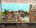 Ridgeway Tunnel Art - geograph.org.uk - 2537921.jpg 3,404 × 2,696; 1.42 MB
-
 Ridgeway Tunnel Art 2 - geograph.org.uk - 2537936.jpg 3,516 × 2,560; 1.26 MB
-
 River Pang crossing West Ilsley Road - geograph.org.uk - 3875137.jpg 640 × 397; 112 KB
-
 River Pang crossing West Ilsley Road - geograph.org.uk - 3875141.jpg 640 × 492; 113 KB
-
 River Pang crossing West Ilsley Road - geograph.org.uk - 3875145.jpg 640 × 480; 104 KB
-
 River Pang crossing West Ilsley Road - geograph.org.uk - 3875155.jpg 640 × 457; 128 KB
-

-
 River Pang flowing from Hodcott - geograph.org.uk - 3875168.jpg 640 × 480; 90 KB
-
 River Pang in West Ilsley - geograph.org.uk - 3860326.jpg 1,600 × 1,216; 544 KB
-
 River Pang in West Ilsley - geograph.org.uk - 3875266.jpg 800 × 600; 189 KB
-
 River Pang seen from Windmill Hill - geograph.org.uk - 3875174.jpg 640 × 485; 90 KB
-
 River Pang Source, Feb. 2014 - geograph.org.uk - 3860251.jpg 1,024 × 728; 260 KB
-
 River Pang springs at East Ilsley - geograph.org.uk - 3875109.jpg 640 × 450; 57 KB
-
 River Pang springs at East Ilsley - geograph.org.uk - 3875117.jpg 640 × 480; 79 KB
-
 River Pang springs at East Ilsley - geograph.org.uk - 3875127.jpg 640 × 480; 72 KB
-
 Road junction and finger post - geograph.org.uk - 6132095.jpg 640 × 569; 128 KB
-
 Road junction in West Ilsley - geograph.org.uk - 1723495.jpg 640 × 480; 134 KB
-
 Road to West Ilsley - geograph.org.uk - 1316069.jpg 640 × 427; 61 KB
-
 Rutherford Fireworks 2 - geograph.org.uk - 4305144.jpg 1,600 × 1,197; 251 KB
-
 Rutherford Fireworks 3 - geograph.org.uk - 4305145.jpg 1,600 × 1,298; 253 KB
-
 Rutherford Fireworks 4 - geograph.org.uk - 4305147.jpg 1,330 × 1,600; 257 KB
-
 Rutherford from Bury Down - geograph.org.uk - 4130235.jpg 1,024 × 768; 168 KB
-
 Rutherford Laboratory - geograph.org.uk - 4130246.jpg 1,024 × 768; 224 KB
-
 Rutherford Laboratory - geograph.org.uk - 4132179.jpg 1,024 × 768; 176 KB
-
 Rutherford Laboratory - geograph.org.uk - 5376301.jpg 1,024 × 768; 99 KB
-
 Scattered in the Grass - geograph.org.uk - 4130237.jpg 600 × 800; 221 KB
-
 Sheep Down - geograph.org.uk - 2522641.jpg 3,888 × 2,592; 1.23 MB
-
 Sheep Down - geograph.org.uk - 5301715.jpg 1,024 × 768; 427 KB
-
 Sheep Down - geograph.org.uk - 5302269.jpg 768 × 768; 279 KB

_-_geograph.org.uk_-_3937777.jpg)


_-_geograph.org.uk_-_3640185.jpg)
_-_geograph.org.uk_-_3640389.jpg)
_-_geograph.org.uk_-_3639845.jpg)
_-_geograph.org.uk_-_3640395.jpg)
_-_geograph.org.uk_-_3640409.jpg)


_-_geograph.org.uk_-_3639850.jpg)
_-_geograph.org.uk_-_3639854.jpg)
_-_geograph.org.uk_-_3640402.jpg)


.jpg)


