Category:West Hills (Box Elder County, Utah)
Jump to navigation
Jump to search
mountain range in Box Elder County, Utah and Oneida County, Idaho in the United States | |||||
| Upload media | |||||
| Instance of | |||||
|---|---|---|---|---|---|
| Location |
| ||||
| Width |
| ||||
| Elevation above sea level |
| ||||
 | |||||
English: Media related to the West Hills (Box Elder County), a 20-mile long (32 km) mountain range located in northeast Box Elder County, Utah, United States, that extends slightly north into Oneida County, Idaho. The range lies on the Idaho-Utah border. The range is connected to the smaller range north, the Samaria Mountains of Idaho. (Utah-Idaho's Cache Valley lies to the east.)
Media in category "West Hills (Box Elder County, Utah)"
The following 3 files are in this category, out of 3 total.
-
 Great Salt Lake map-fr.svg 1,000 × 1,000; 1.98 MB
-
 South along Malad River in Woodruff, Idaho, Jun 17.jpg 2,592 × 1,944; 2.29 MB
-
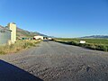 South on west segment of WASHO Road Test, Jun 17.jpg 2,592 × 1,944; 2.31 MB


Categories:
- Mountain ranges of Idaho
- Mountain ranges of Utah
- Landforms of Oneida County, Idaho
- Landforms of Box Elder County, Utah
- Mountain ranges of the Great Basin (USA) in Utah
- Locations along Interstate 80N in Box Elder County, Utah
- Locations along Interstate 84 in Box Elder County, Utah
- Locations along U.S. Route 30S (Idaho–Utah–Wyoming) in Box Elder County, Utah