Category:West Gorton
Jump to navigation
Jump to search
English: West Gorton is an area of Gorton, Manchester and former civil parish, in the Manchester district, in the county of Greater Manchester, England.
area and former civil parish in Manchester, Greater Manchester, England  | |||||
| Upload media | |||||
| Instance of |
| ||||
|---|---|---|---|---|---|
| Location | Gorton, Manchester, Greater Manchester, North West England, England | ||||
 | |||||
Subcategories
This category has only the following subcategory.
S
Media in category "West Gorton"
The following 47 files are in this category, out of 47 total.
-
 A6010 Pottery Lane, West Gorton - geograph.org.uk - 3379379.jpg 640 × 480; 57 KB
-
 Aines Street, West Gorton - geograph.org.uk - 3379633.jpg 640 × 480; 49 KB
-
 Armstrong Works, West Gorton - geograph.org.uk - 3379640.jpg 640 × 480; 73 KB
-
 Belle Vue Street, West Gorton - geograph.org.uk - 3379579.jpg 640 × 480; 61 KB
-
 Bennett Street, West Gorton - geograph.org.uk - 3381488.jpg 640 × 480; 65 KB
-
 Bennett Street, West Gorton - geograph.org.uk - 3381494.jpg 640 × 480; 61 KB
-
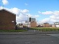
 Brook Business Complex - geograph.org.uk - 3381483.jpg 640 × 480; 67 KB
-
 Brunet Walk - geograph.org.uk - 2860069.jpg 640 × 480; 204 KB
-
 Container Depot, West Gorton - geograph.org.uk - 2806897.jpg 640 × 361; 43 KB
-
 Container Depot, West Gorton - geograph.org.uk - 3306802.jpg 640 × 430; 58 KB
-
 Emmanuel Church, West Gorton, Manchester.jpg 4,864 × 2,736; 3.2 MB
-
 Ex, ICL Tower-West Gorton - geograph.org.uk - 3741927.jpg 480 × 640; 64 KB
-
 Factory for Sale, West Gorton - geograph.org.uk - 3381510.jpg 640 × 480; 81 KB
-
 Fujitsu Building in West Gorton - geograph.org.uk - 1493.jpg 476 × 640; 46 KB
-
 Gorton Lane, West Gorton - geograph.org.uk - 3379567.jpg 640 × 480; 81 KB
-
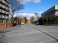
 Gorton Road, West Gorton - geograph.org.uk - 3379372.jpg 640 × 480; 54 KB
-
 Gortonvilla Walk, West Gorton - geograph.org.uk - 3379647.jpg 640 × 480; 57 KB
-
 Kelsall Street, West Gorton - geograph.org.uk - 3379755.jpg 640 × 480; 74 KB
-
 Kniveton Road, West Gorton - geograph.org.uk - 3379784.jpg 640 × 480; 85 KB
-
 Manchester Climbing Centre - geograph.org.uk - 3379811.jpg 640 × 480; 67 KB
-

-
 New Housing at Eastlands - geograph.org.uk - 3472352.jpg 640 × 480; 169 KB
-
 Penfold Walk, West Gorton - geograph.org.uk - 3379675.jpg 480 × 640; 74 KB
-
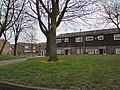
 Play area amongst the trees. - geograph.org.uk - 3379790.jpg 640 × 480; 81 KB
-
 Railway bridge, Bennett Street - geograph.org.uk - 3987299.jpg 640 × 480; 77 KB
-
 Railway Bridge, West Gorton - geograph.org.uk - 3381525.jpg 640 × 480; 64 KB
-
 Railway Bridge, West Gorton - geograph.org.uk - 3381530.jpg 640 × 480; 65 KB
-

-
 Rostron Avenue, Manchester - geograph.org.uk - 3987294.jpg 640 × 480; 55 KB
-
 Skarratt Close - geograph.org.uk - 2860061.jpg 640 × 375; 107 KB
-
 Somerwood Walk, West Gorton - geograph.org.uk - 3379735.jpg 640 × 480; 65 KB
-
 St Benedict's Church - geograph.org.uk - 3705462.jpg 640 × 430; 42 KB
-
 St Benedict's Church, West Gorton - geograph.org.uk - 2806904.jpg 640 × 430; 54 KB
-
 Textile Street, West Gorton - geograph.org.uk - 3379384.jpg 640 × 480; 61 KB
-
 Trowtree Avenue, West Gorton - panoramio.jpg 2,048 × 1,536; 1.28 MB
-

-
 Vaughan Street, West Gorton - geograph.org.uk - 3381501.jpg 640 × 480; 73 KB
-
 Wenlock Court, West Gorton - geograph.org.uk - 3379769.jpg 480 × 640; 75 KB
-
 Wenlock Way, West Gorton - geograph.org.uk - 3379623.jpg 640 × 480; 64 KB
-
 West Gorton - geograph.org.uk - 1339849.jpg 640 × 455; 107 KB
-
 West Gorton from a Manchester Airport-bound train - Saturday 4th April 2009 - panoramio.jpg 3,072 × 2,304; 1.78 MB
-
 West Gorton Working Mens Club - geograph.org.uk - 3379749.jpg 640 × 480; 46 KB
-
 West Gorton Youth Centre - geograph.org.uk - 3379587.jpg 640 × 480; 70 KB
-
 West Gorton, from the railway - geograph.org.uk - 3574223.jpg 1,600 × 790; 251 KB
-
 Wheatley Walk, West Gorton - geograph.org.uk - 3379669.jpg 480 × 640; 70 KB
-
 Wigley Street, West Gorton - geograph.org.uk - 3381478.jpg 640 × 480; 60 KB
-
 Witterage Close, West Gorton - geograph.org.uk - 3379722.jpg 640 × 480; 64 KB


